Anthropoclastite – Rock Formed in 35 Years or Less
New research reveals industrial waste can turn into rock in





New research reveals industrial waste can turn into rock in
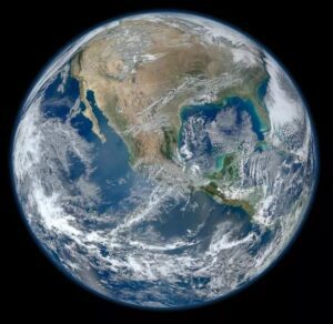
Background The 4.5 billion-year-old Earth is the only known astronomical

Evidence from Earth’s deep past suggests dramatic subduction zones can
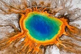
Scientists have discovered a “breathing” magma cap beneath the Yellowstone
Background The 4.5 billion-year-old Earth is the only known astronomical

What would you say about a volunteer who has spent


This year marks the 30th anniversary of the Ice Age
Just a short drive east of Cheney, Washington, lies Fish
We know the story…a world gripped by ice. Some twenty

The Mossback’s Northwest production team met in Thurston County last week to

The Oregon Naturalist Program at Oregon State University is partnering
New research indicates it likely won’t blow today, but one

Traveling east along Lake Roosevelt from the Grand Coulee brings









This 3:50 minute animation, presented by the Crown Point Country Historical Society, illustrates the growth of the Cordilleran Ice Sheet, the damming and back-up of Glacial Lake Missoula, and the progress of an Ice Age Flood through WA and OR after an ice dam collapse.
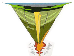
Palagonite Maar Just west of Hood River is a distinctive, short (<500 m) section of stratified orangeish oxidized volcanic tephra and highly fractured lava bombs. This mixture of oxidized volcanic particles ranging down to sub-micrometer sizes mixed with the larger lava bombs is a palagonite tuff. This deposit is the result of a “phreatic” eruption when lava erupted explosively
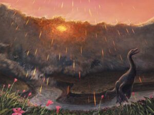
Spring may have been when a roughly seven-mile-wide asteroid struck the Earth, immediately triggering the mass extinction that would wipe out 76 percent of known species. That key piece of timing doesn’t come from dinosaurs, but from the fish that swam in the waters dinosaurs drank from. By studying the

Chris Goodell’s 1-hour video presentation of his Ice Age Flood hydraulic modeling is both enlightening and thought provoking. Chris is a hydraulic modeling professional for Kleinschmidt Group, whose personal interest in the Ice Age Floods phenomenon led him to privately undertake HEC-RAS modeling of a possible Ice Age Flood hydraulic
In September 2021 my wife and I took a trip to see what was new along the Ice Age Floods National Geologic Trail and visit some places we did not make it to in our very first trip in 2004. The IAFI chapter brochures were very helpful in learning what

Check out this 2-Minute Geology expedition with Nick Zentner and Tom Foster exploring the Giant Current Ripples at West Bar and Camas Prairie. Ice age floodwater 650 feet deep – moving at 65 miles per hour – left Giant Current Ripples along the Columbia River at West Bar! The ripples
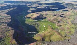
Castle Lake fills a plunge-pool at the base of a 300-ft tall cataract at the opposite (east) end of the Great Cataract Group from Dry Falls, above the east end of Deep Lake. A set of steel ladders put in place during the construction of the Columbia Basin Irrigation Project

Check out this video about the Washington 100, a cool new geotourism website by the Washington Geological Survey featuring 100 places to experience amazing geology in Washington State. Then explore the website itself at wa100.dnr.wa.gov