
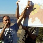
Meet Our New IAFI Membership Manager
Our long time IAFI Membership Manager, Sylvia Thompson and her


Our long time IAFI Membership Manager, Sylvia Thompson and her

We’re sad to report that James “Jim” William Pritchard of Ephrata,

“To see a world in a grain of sand”, the
Our brains are pretty good at physics. For instance, you
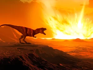
A newly discovered crater suggests a second impact that would

Some 240 million years ago, an enormous supercontinent known as

To date, Earth is the only planet we know of

A 37,000-year-old mammoth butchering site, uncovered in New Mexico, might
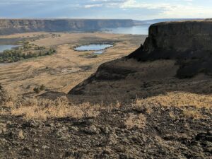

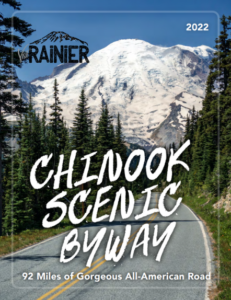
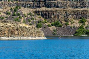
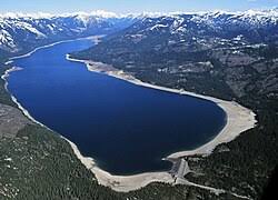
Frenchman Coulee Ice Age Floods National Geologic Trail Frenchman Coulee

Hiking Drumheller Channels Ice Age Floods National Geologic Trail There
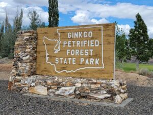
Ginkgo Petrified Forest State Park Interpretive Center Ginkgo Petrified Forest
On Friday,July 8 around 2:45 p.m., British tourist Harry


ICYMI (in case you missed it) — Floodwaters rise more than 1,000 feet as they slam into the Columbia River Gorge from the east. The torrent blasts through the narrows at 60 mph, carrying truck-size boulders and house-size icebergs. Reaching Portland, water loaded with gravel and dirt roils to a

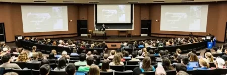
Chris Goodell’s 1-hour video presentation of his Ice Age Flood hydraulic modeling is both enlightening and thought provoking. Chris is a hydraulic modeling professional for Kleinschmidt Group, whose personal interest in the Ice Age Floods phenomenon led him to privately undertake HEC-RAS modeling of a possible Ice Age Flood hydraulic

There’s a Columbian Mammoth hiding out in Coyote Canyon down Kennewick way, and MCBONES Research Center Foundation is working to uncover his/her hiding place. For a small contribution you can tour this hide-and-seek site, or you can volunteer to help uncover the hidden mammoth. Sound interesting? Find out more in
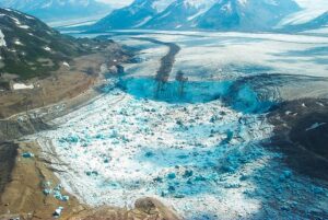
A recent Smithsonian Magazine article gives some interesting insights to present-day Jökulhlaups (glacial outburst floods) that are but minuscule relatives of the cataclysmic Ice Age Floods. Iceberg Lake was on the edge of a western tributary of the Tana Glacier, but in 1999 the lake suddenly vanished. Dammed on its

An ancient flood seems to have stalled the circulation of the oceans, plunging the Northern Hemisphere into a millennium of near-glacial conditions. Thirteen thousand years ago, an ice age was ending, the Earth was warming, the oceans were rising. Then something strange happened – the Northern Hemisphere suddenly became much
In August, Scott David, a postdoctoral researcher and Karin Lehnigk, a 2nd year PhD candidate from the University of Massachusetts visited the scablands for a week to do field studies. Karin was in search of granite erratics. Samples of these were taken to be processed for Beryllium-10 exposure dating, a

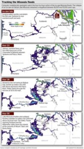
This feature-filled video by Tom Foster and Nick Zentner explores the evidence for Glacial Lake Missoula, and provides a treasure trove of places to visit and sights to see when you plan your field trip to the area.

Bruce Bjornstad is at it again with his awesome Ice Age Floodscapes drone videos, this one from Frenchman Coulee. Watch it below and visit his Ice Age Floodscapes YouTube channel.for many more.