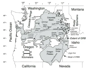
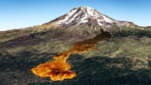
What are LIPs (like the Columbia River Basalt large igneous province)?
We came across an interesting article in IFLScience that pertains


We came across an interesting article in IFLScience that pertains

We normally include a review of our past year’s activities in our January
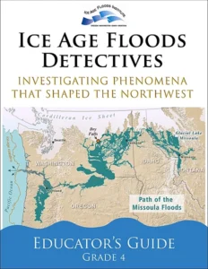
Empowering Teachers to Share the Ice Age Floods Story with Students
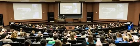
Every student in the Northwest should experience the incredible science
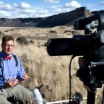
Developing an Ice Age Floods Animation Through Science, Partnership, and

The IAFI Store is having a special Winter Inventory Reduction

“All creatures, objects, places, and elements have a spirit.” Patrick
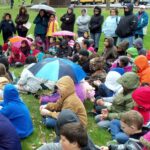
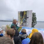
Thousands of K-12 students across the Pacific Northwest are
The east bank of the Columbia River near Malaga, Washington,

The Bowl and Pitcher is a rock formation along the
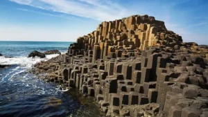
The Giant’s Causeway is a rock formation that is so
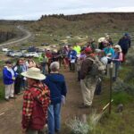
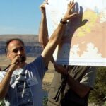
Missoula chapter field trip – tv news coverage Recently the
How bad-faith arguments sow doubt by weaponizing scientific humility Good
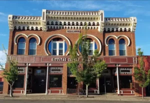
IN THE CITY OF ELLENSBURG… when you want to spend
Strewn among the forests of the Puget Lowland are an


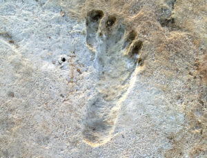
Articles in Science Alert and the New York Times report on a well documented age for many sets of human footprints as old as 23,000 years in the ancient lake shore sands of White Sands, New Mexico. “The footprints were first discovered in 2009 by David Bustos, the park’s resource
National Geographic has published an outstanding article, “Formed by Megafloods, This Place Fooled Scientists for Decades”, about J Harlan Bretz and his outrageous, fantastical theories of a landscape shaped by huge floods. Most Ice Age Floods aficionados are generally aware of the story, but this one is so detailed and
Floods of lava (Columbia River Basalts) and Ice Age Floods of water (Lake Missoula floods and the Bonneville Flood) are world-famous topics among geologists. To have both sets of floods in the same area means the geology of the Inland Northwest is truly Disneyland for Geologists! The program begins in
1918 story in the Wenatchee World that Bill Dietrich (former Columbian reporter and later with The Seattle Times) says in his wonderful 1995 book Northwest Passage — The Great Columbia River , “is probably the single most famous newspaper article in Pacific Northwest history. . . It is generally credited
Washington State Geological Survey is collecting, analyzing, and publicly distributing detailed information about our state’s geology using the best available technology – LIDAR – an acronym for Light Detection And Ranging. The main focus of this new push for LIDAR collection is to map landslides, but there are innumerable additional benefits

An ancient flood seems to have stalled the circulation of the oceans, plunging the Northern Hemisphere into a millennium of near-glacial conditions. Thirteen thousand years ago, an ice age was ending, the Earth was warming, the oceans were rising. Then something strange happened – the Northern Hemisphere suddenly became much

Big feet. Little feet. A heel here. A toe there. A digitally enhanced photo of a footprint found at Calvert Island, British Columbia that researchers dated to 13,000 years old. Credit Duncan McLaren Stamped across the shoreline of Calvert Island, British Columbia, are 13,000-year-old human footprints that archaeologists believe to be
As a city kid in the ‘60s my family occasionally visited my grandparents in the farm country of Washington State’s Waterville plateau. My grandfather and two uncles were wheat farmers near the small town of Withrow, the future site of which had been partly hedged in by the Okanagan lobe