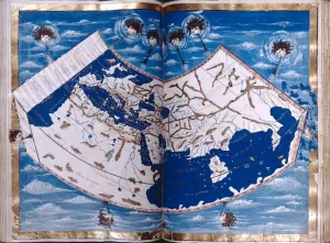
Geographia: An Ancient Blueprint for Mapmaking
Many of history’s major breakthroughs were made by great thinkers


Many of history’s major breakthroughs were made by great thinkers
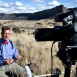
If you have been following Professor Nick Zentner (CWU) on

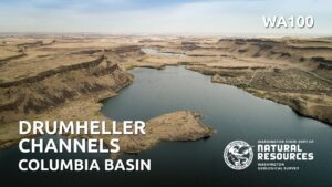
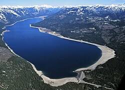
Nestled in the heart of Washington state, the Drumheller Channels

Because of problems with the Zoom broadcast of the Erratics’
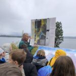
Last week, Friends of the Columbia Gorge completed installation on
In the early days, the IAFI and National Geologic Trail

Non-members of IAFI have been increasingly taking advantage of our
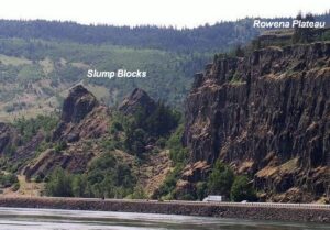
Scenic Rowena Crest and the Tom McCall Preserve area provide

Consuelo Larrabee, a beloved member of the Ice Age Floods
Tualatin, Oregon, lies in its own valley near the head
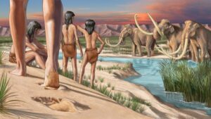
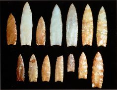
During the last ice age, humans ventured into two vast
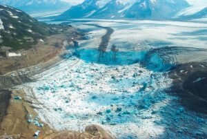
Mendenhall Glacier and other glaciers above Juneau, Alaska, while rapidly
If you’ve visited the Rowena Crest Viewpoint at Tom McCall
The date that humans arrived in South America has been


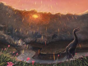
Spring may have been when a roughly seven-mile-wide asteroid struck the Earth, immediately triggering the mass extinction that would wipe out 76 percent of known species. That key piece of timing doesn’t come from dinosaurs, but from the fish that swam in the waters dinosaurs drank from. By studying the
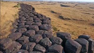
Check out Bruce Bjornstad’s Ice Age Floodscapes YouTube channel. A growing library of surreal aerial video and pics of other-worldly megaflood features.These drone videos and images that can only be achieved and appreiciated from close range in the air give a unique perspective on large landscape features, such as: Gardena Cliffs Rhythmites, Streamlined
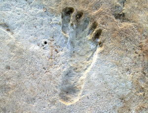
Articles in Science Alert and the New York Times report on a well documented age for many sets of human footprints as old as 23,000 years in the ancient lake shore sands of White Sands, New Mexico. “The footprints were first discovered in 2009 by David Bustos, the park’s resource
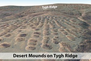
As a city kid in the ‘60s my family occasionally visited my grandparents in the farm country of Washington State’s Waterville plateau. My grandfather and two uncles were wheat farmers near the small town of Withrow, the future site of which had been partly hedged in by the Okanagan lobe

Chris Goodell’s 1-hour video presentation of his Ice Age Flood hydraulic modeling is both enlightening and thought provoking. Chris is a hydraulic modeling professional for Kleinschmidt Group, whose personal interest in the Ice Age Floods phenomenon led him to privately undertake HEC-RAS modeling of a possible Ice Age Flood hydraulic
Richard Waitt kindly shared his recent paper published June 2016 in Quaternary Research, titled “Megafloods and Clovis cache at Wenatchee, WA.” “It covers the reach mainly from Chelan Falls to below West Bar, tries to tell the story of sequential megafloods coming to Wenatchee area by different routes at different
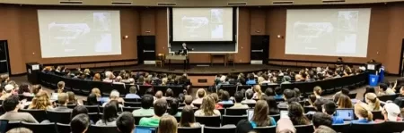
Floods of lava (Columbia River Basalts) and Ice Age Floods of water (Lake Missoula floods and the Bonneville Flood) are world-famous topics among geologists. To have both sets of floods in the same area means the geology of the Inland Northwest is truly Disneyland for Geologists! The program begins in
This 1/2-hour video begins with the Ice Age Floods impact on the Palouse area, then goes on with a fascinating oral and pictorial history of the area. The video was produced by Mortimore Productions for the Whitman County Library with materials and information provided by a bevy of contributors, including