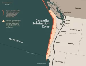
There are 4 Pieces in Our “Big One” Puzzle
The ground beneath our feet could be more complex than


The ground beneath our feet could be more complex than
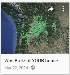
Explore Historical Field Research with Google Maps Did J harlan
National Volunteer Week is an annual celebration established in the
“Scabland” – the Movie, A Google Earth Odyssey “Scabland” is
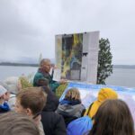
In my “Tales from the Trail” I usually highlight a

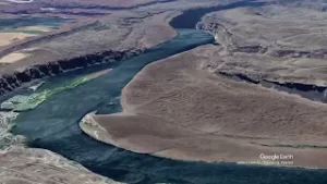
Moses Coulee, a Washington state wonder, has puzzled geologists for

Max Vuletich, a first grader at Jefferson Elementary in Spokane,

Wenatchee, Washington is often called the “Apple Capital of the
An interesting geology tidbit featured today in Nice News: @Jefferies_

I’m an artist using scientific data as an artistic medium
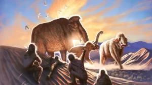
New analysis of a 14,000-year-old woolly mammoth tusk has pieced

Hello from the Trail. Congress created Ice Age Floods National

NEW RESEARCH SUGGESTS SOME EARLY AMERICANS MAY HAVE TRAVELED ON
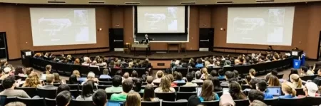
Many of history’s major breakthroughs were made by great thinkers


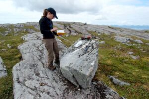
In August, Scott David, a postdoctoral researcher and Karin Lehnigk, a 2nd year PhD candidate from the University of Massachusetts visited the scablands for a week to do field studies. Karin was in search of granite erratics. Samples of these were taken to be processed for Beryllium-10 exposure dating, a

Check out this 2-Minute Geology expedition with Nick Zentner and Tom Foster exploring the Giant Current Ripples at West Bar and Camas Prairie. Ice age floodwater 650 feet deep – moving at 65 miles per hour – left Giant Current Ripples along the Columbia River at West Bar! The ripples

There’s a Columbian Mammoth hiding out in Coyote Canyon down Kennewick way, and MCBONES Research Center Foundation is working to uncover his/her hiding place. For a small contribution you can tour this hide-and-seek site, or you can volunteer to help uncover the hidden mammoth. Sound interesting? Find out more in

This 3:50 minute animation, presented by the Crown Point Country Historical Society, illustrates the growth of the Cordilleran Ice Sheet, the damming and back-up of Glacial Lake Missoula, and the progress of an Ice Age Flood through WA and OR after an ice dam collapse.
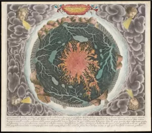
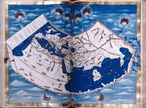
“Beneath Our Feet: Mapping the World Below” plumbs the depths of the question, “What’s beneath our feet?” through maps, images and archaeological artifacts. The exhibition explores nearly 400 years of maps and objects in an attempt to find out why and how humans imagine subterranean landscapes including caves, mines and
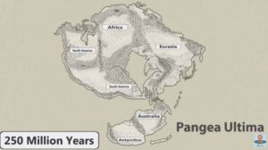
No one can ever say for sure what the future will bring, but this new video has summed up all the science-backed predictions that we can reasonably make about how Earth will change over the next 1 billion years. It’s highly unlikely that anyone will be around to see most
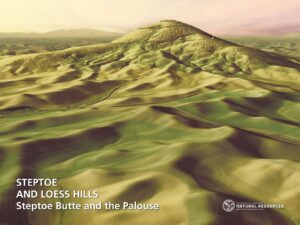
The Washington Geological Survey (WGS) has released 50 high-resolution lidar-derived images of the State’s geology and geomorphology through the Washington State DNR’s Flickr page. The images are available in 16:9 format (7,200 x 4,050 pixels) and 4:3 format (7,200 x 5,400 pixels). Ten of the images are new (see below)
When and how did the first people come to the Americas? The conventional story says that the earliest settlers came via Siberia, crossing the now-defunct Bering land bridge on foot and trekking through Canada when an ice-free corridor opened up between massive ice sheets toward the end of the last