Geologists predict an Undersea volcano off the Oregon coast could erupt this year
Scientists say Axial, an undersea volcano off the coast of


Scientists say Axial, an undersea volcano off the coast of
The boggy landscape of the Bering land bridge may have
The Lake Roosevelt National Recreation Area serves as a striking
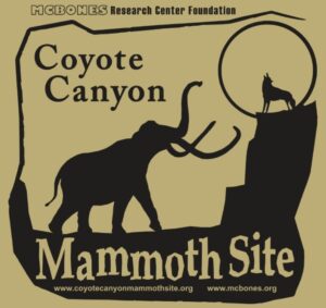
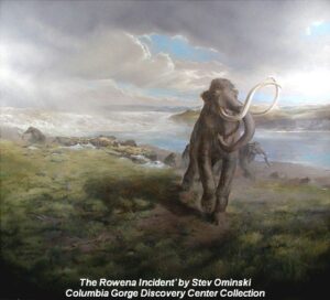
The Coyote Canyon Mammoth Dig is an active paleontological excavation

Two glacial erratics in the Bitterroot Valley, the Lone Rock
It’s generally accepted that a massive Cascadia earthquake occurred along
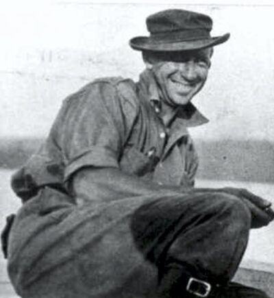
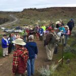
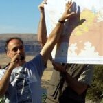
Glenn Cruickshank recently met with Dean Kiefer. who shared a
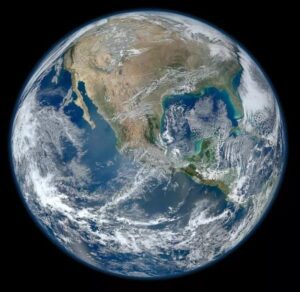
Among the planets in the Solar System, Earth is unique
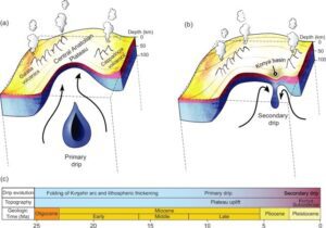
Crinkles and divots in the surface of Earth on Türkiye’s

The Washington Post recently published an article about a scientific
Around 3:30 in the morning on August 6, the first
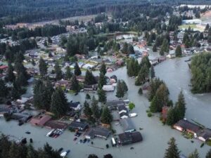
One of Montana’s other floods has been tickling the curiosity

The cliffs at Discovery Park in Seattle offer a glimpse

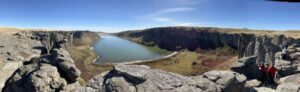
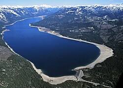
In the approximate center of the state of Washington is


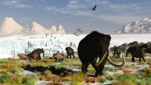
New research reveals the ancient animals survived some 8,000 years later than previously thought Frozen soil samples collected around a decade ago are rewriting our understanding of iconic Ice Age animals like the woolly mammoth. The soil samples were pulled from Canada’s permafrost in the early 2010s, but no work

The Columbia River Gorge is an incredibly popular area to visit, and that’s for good reason, the setting is uniquely spectacular. The Gorge encompasses: Easily accessible ecozones that range through boreal conifer forests, oak woodlands, high desert grasslands and alpine environments in only 40 miles, Dazzling viewpoints and scenery, including

There’s a Columbian Mammoth hiding out in Coyote Canyon down Kennewick way, and MCBONES Research Center Foundation is working to uncover his/her hiding place. For a small contribution you can tour this hide-and-seek site, or you can volunteer to help uncover the hidden mammoth. Sound interesting? Find out more in
Check out this video about the Washington 100, a cool new geotourism website by the Washington Geological Survey featuring 100 places to experience amazing geology in Washington State. Then explore the website itself at wa100.dnr.wa.gov

This feature-filled video by Tom Foster and Nick Zentner explores the evidence for Glacial Lake Missoula, and provides a treasure trove of places to visit and sights to see when you plan your field trip to the area.

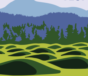
Have you ever thought about the how the weight of the ice-age Cordilleran ice sheet might affect the underlying Earth’s crust. There is strong evidence that the crust was depressed hundreds of feet beneath the ice, and since the crust is relatively thin and rigid over a plastic aesthenosphere, that
Discover how colossal floods transformed the ancient landscape. All over the world, scientists are discovering traces of ancient floods on a scale that dwarfs even the most severe flood disasters of recent times. What triggered these cataclysmic floods, and could they strike again? In the Channeled Scablands of Washington State,

Do you ever hear the Led Zepplin song “Kashmir” in your head when contemplating the Ice Age Floods? “I am a traveler of both time and space. To be where I have been” –Robert Plant, Led Zepplin’s Kashmir My 11-year old daughter and I are on a 5-day, 4-night raft