First Peoples
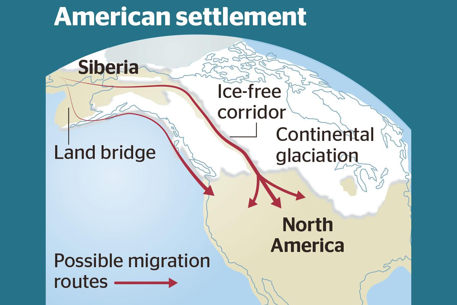
Ice-Free Corridor Human Migration to Americas R e e x a m i n e d Humans In Americas 30,000 years ago??? Analysis of how long erratics have been exposed on ice-free ground in the hypothesized “Late Pleistocene ice-free corridor migration route” suggests that route was not fully open until about 13,800 years ago. The ice sheets “may have been 1,500 to 3,000 feet (455 to 910 m) high in the area where they covered the ice-free corridor,” according to study lead author Jorie Clark, a geologist and archaeologist at Oregon State University. Clark said, “we now have robust evidence that the ice-free corridor was not open and available for the [Late Pleistocene] first peopling of the Americas.” If evidence of humans in the Americas prior to the 30,000 years ago is ultimately found, that evidence does not preclude the possibility of ice-free corridor migration before closure of the corridor.
The Grand Coulee – A Floods Poem
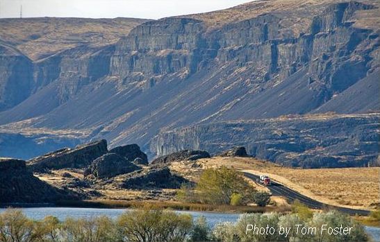
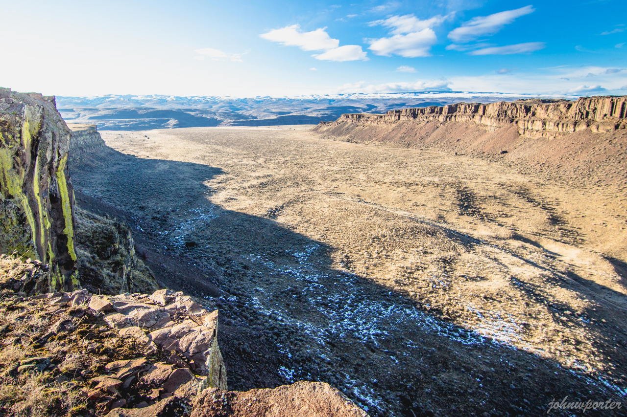
THE GRAND COULEE – A Floods Poem THE GRAND COULEE Older than legends,Younger than mountains,The earth remembersThe Great Inland Sea. And that Sea emptiedIn torrential furyNever imaginedEven in dreams. Down through the canyons,Flood of all riversCarving the couleesTime, time again. Roiled surging waters,Thunder of thunders,Swift toward the oceanReshaping the plain. Gone with the glaciersIs the great Lake Missoula,Gone from remembrance,Like mist in the wind. Yet the story is etchedIn the canyons and couleesLeft for those who imagineTo seek and to find. David Wahl January 4, 2002 Lower Grand Coulee Upper Grand Coulee at Steamboat Rock (left)
Trovants

Geology Can Be Weird – Trovants Trovants Are Stones That Seem to Grow, Move and Reproduce. By: Jennifer Walker-Journey | Jun 21, 2022 | HowStuffWorks/Science/Environmental Science/Earth Science/Geology/Geologic Processes Trovants such as these are found only in Romania and have become such a tourist attraction that they are protected by UNESCO. WIKIMEDIA COMMONS (CC BY SA 3.0)Just when we think we’ve seen it all, Mother Nature throws yet another oddity our way. Welcome to the wondrous world of the geological manifestations known as trovants. These rare bulbous, budging boulders are only found in a small town in Romania called Costesti. So fantastical are these trovants, they’ve found a place in local folklore. Some say they grow, walk and even give birth to baby trovants. Science says they’re probably right. What Are Trovants? Trovants are spherical and slightly irregular-shaped rocks. They can be as small as less than an inch, or a couple of millimeters, in diameter and weigh only a few grams, or they can soar up to 15 feet (4.5 meters) high and weigh several tons. These odd, gravity-defying boulders have baffled observers since the 18th century with many a curious soul suspecting they were dinosaur eggs, plant fossils or even alien pods. Scientists believed trovants to be a type of concretion — a mound of mineral matter (specifically gritstone and conglomerates) embedded within rock layers of limestone, sandstone or shale. They often form from minerals precipitating, or settling, out of water collected around a nucleus of pebble, leaf, shell, bone or fossil. However, in 2008, the International Geological Congress in Oslo claimed trovants were incorrectly classified as concretions because there was no mineral difference between the stones and the sandstone beds on which they sat. There was also no distinct nucleus inside them. Whatever they are, scientists believe that based on their makeup and locale atop the sands, these weird stones are older than man — shaped by earthquakes around 5.3 million years ago, during the Middle Miocene sub-epoch. The surrounding sands also suggest the area was an ancient marine environment, which may explain why bivalve and gastropod fossils can sometimes be found in them. These Rocks Can Grow and Multiply Another oddity about trovants — they secrete cement. This talent makes some people think they may be living creatures and not simply rocks. This cement seepage occurs after a heavy rain shower. When trovants absorb the rain’s minerals, the minerals come in contact with the chemicals already present in the stone, causing a pressure reaction that makes the rocks grow in girth. It’s not something you can see happening. Researchers say the deposition rate for trovants is roughly 1.5 to 2 inches (4 to 5 centimeters) every 1,000 years. This same phenomenon is what causes trovants multiply or “reproduce,” as some might say. When a new growth bauble emerges, likely from water affecting only one side of the rock, and gets big enough, it can break off from the “parent” rock and create baby trovants. Like a Rolling Stone Some people also believe that trovants can “walk,” much like the so-called sailing stones of Death Valley that appear to drift across the flat desert landscape on their own. One researcher allegedly filmed trovants for two weeks and claimed one moved about one-tenth of an inch (2.5 millimeters). While many academics are skeptical about “trovant walking” claims, they don’t deny the possibility that the heating or cooling of the soil could cause movement among the stones. Where Can I See a Trovant? Trovants are almost exclusively found in Romania’s Valcea County at the sand quarry near the Costesti village, along the Gresarea Brook, or in the neighboring Otesani village. To protect these unusual geological specimens, the “Muzeul Trovantilor” or Trovants Museum Natural Reserve, was developed in Valcea County, Romania, in 2004, and is now protected by UNESCO.
Bonneville Flood Video

Shawn Willsey recently put together an overview presentation on the Bonneville flood that he wanted to share with IAFI.
The Day the Dinosaurs Died
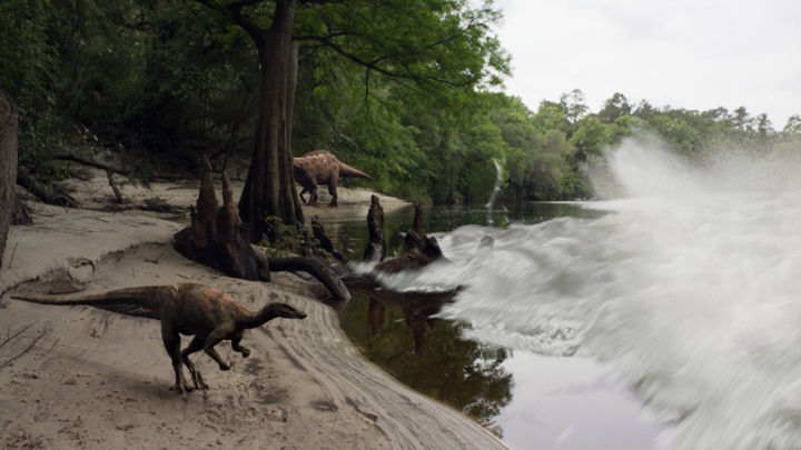
RETROPOLIS – Dave Kindy, Washington Post, May 9, 2022 Discoveries shed new light on the day the dinosaurs died The Thescelosaurus moved stealthily along the seashore. Stretching about 12 feet long and weighing about 500 pounds, the thickly muscled dinosaur was probably looking for food — or trying to avoid becoming a meal. Featuring prominent bony eyebrows and a pointy beak, Thescelosaurus plodded along on two feet with the bulk of its body leaning forward while a long tail stretched backward for balance. Suddenly, the dinosaur lifted its head and looked around, alarmed as the calm was broken by a series of unnerving natural forces. The ground started shaking with intense vibrations while water in the nearby sea sloshed about in response. The sky filled with burning embers, which drifted down and set fire to the lush primordial forest. Thescelosaurus panicked and looked to flee — but it was too late. Everything changed in a heartbeat as a 30-foot-high wave of mud and debris came racing up the seaway from the south, sweeping away life and limb in the process. The dinosaur was caught in the destructive deluge, its leg ripped off at the hip by the devastating surge. That moment — 66 million years ago at the end of the Cretaceous period, when an earth-shattering asteroid ended the reign of the dinosaurs — is frozen in time today through a stunning fossil found last year at the Tanis dig site in North Dakota. This perfectly preserved leg clearly shows the skin, muscle and bones of the three-toed Thescelosaurus. While the details of the death scenario described above are embellished, they’re based on remarkable new findings and accounts by Robert DePalma, lead paleontologist at Tanis. “We’re never going to say with 100 percent certainty that this leg came from an animal that died on that day,” the scientist said. “The thing we can do is determine the likelihood that it died the day the meteor struck. When we look at the preservation of the leg and the skin around the articulated bones, we’re talking on the day of impact or right before. There was no advanced decay.” DePalma and the dinosaur leg will be featured in two episodes of “Nova” on PBS airing back-to-back on Wednesday: “Dinosaur Apocalypse: The New Evidence” and “Dinosaur Apocalypse: The Last Day.” Biologist and natural historian Sir David Attenborough will host the programs, which were produced in conjunction with the BBC. The leg and several other relics discovered at the North Dakota site are the first actual fossils found showing the death and destruction that took place when a 10-mile-long space rock struck the Yucatán Peninsula in the Gulf of Mexico. This impact event 66 million years ago doomed the dinosaurs and led to the mass extinction of 75 percent of animal and plant life on Earth. At the time, the world was a much warmer place. There were no icecaps, and water levels were higher. The North American continent was split in two by the Western Interior Seaway. Tanis is located on what was the edge of that massive river, which became a conduit of carnage after the asteroid struck. The shock waves from nearly 3,000 miles away caused the seaway to erupt with a tsunami of epic proportions. As DePalma pointed out, Thescelosaurus never stood a chance. “You would not want to be there on that day,” he said. “There was a turbulent wall of death heading up the river. In addition, all these glowing spherules are falling out of the sky. They’re like beads of superheated glass reentering the Earth’s atmosphere after being ejected from the crater site at the Yucatán. Then there was all this seismic shaking. It was really hell on earth.” A dinosaur’s loss, though, is a paleontologist’s gain. After Tanis was discovered in 2008, scientists began to realize the fossils there were probably created during that big-impact moment. A series of key discoveries were made, including the dinosaur leg, the embryo of a pterosaur still in its shell, a turtle pierced by a chunk of wood and the well-preserved skin of a triceratops. Many of these fossils are being presented to the public for the first time in the PBS documentaries. Perhaps most telling were the fossilized fish unearthed at the site in 2019, which caught many scientists by surprise. In those petrified remains, researchers found the embedded evidence they needed to substantiate the claim that the animals died when the asteroid struck: the glass spheres, known as ejecta, that came raining down from the sky that fateful day. “Those were fish that died on that day,” DePalma said. “We know that because they had ejecta from the impact in their gills.” Researchers have unearthed countless samples of these glass spheres, all containing the signature chemical components typical of a major impact event. Made up of sand and other earthly materials, the molten glass was ejected into the atmosphere by the explosion caused by the asteroid striking the planet — estimated to be the equivalent of 10 billion atomic bombs. Inside one of those circular fossils is a tiny speck of rock that may be from the killer asteroid itself. DePalma, a postgraduate researcher at the University of Manchester in England and adjunct professor of geosciences at Florida Atlantic University, has headed efforts at Tanis since 2012. He and other scientists on the team have published several major papers describing the discoveries and outlining the scientific methodology used to date the fossils and other evidence. DePalma asserts that what happened then is directly relevant to the world today. “I’ve been asked, ‘Why should we care about this? Dinosaurs have been dead for so long,’ ” he said. “It’s not just for paleo nerds. This directly applies to today. We’re seeing mass die-offs of animals and biomes that are being put through very stressful situations worldwide. By looking through this window into the past, we can apply these lessons to today.” To produce the “Nova” episodes, DePalma worked directly with
Relive Important Archive Articles

A large number of important articles get buried over time as new articles are added to our website, so here’s a chance to review and relive some of our most important articles. We think you might enjoy reviewing these timeless features.
Hydraulic Modeling of a Missoula Flood
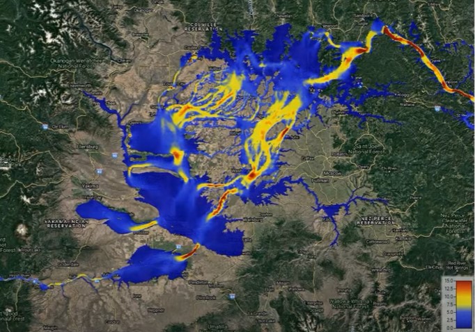
Chris Goodell’s 1-hour video presentation of his Ice Age Flood hydraulic modeling is both enlightening and thought provoking. Chris is a hydraulic modeling professional for Kleinschmidt Group, whose personal interest in the Ice Age Floods phenomenon led him to privately undertake HEC-RAS modeling of a possible Ice Age Flood hydraulic response. His presentation for American Society of Civil Engineers – Environmental & Water Resources Institute – Seattle (ASCE EWRI Seattle) provides interesting insights to the Floods Story even as it recognizes many of the obstacles and shortcomings of what we can know about details of any Ice Age Floods.
Smithsonian Article about the Ice Age Floods
Ice Age Floods Smithsonian Article Devastating Ice Age Floods That Occurred in the Pacific Northwest Fascinate ScientistsThe Scablands were formed by tremendous and rapid change, and may have something to teach us about geological processes on Marsby Riley Black – Science Correspondent – April 19, 2022 for Smithsonian Magazine The Earth seems to change slowly. Continents shift by about half an inch in a year. Sea levels rise by less than a quarter of an inch in the same amount of time. Mountains are constantly being eroded but, to us, seem to stand today just as they did yesterday and the day before. Our planet’s geological history often seems like one of slow, grinding change. But that’s hardly the whole story. Sometimes geological change comes startlingly, violently fast, leaving scars on the Earth’s surface. The Channeled Scablands of the Pacific Northwest, a landscape full of flat-topped plateaus that rise between steep-walled canyons, are among the vastly-altered landscapes that have caused researchers to rethink what they previously presumed. The geologic wounds are dramatic evidence that quick and catastrophic changes have played a significant role in shaping our planet. The Scablands, principally located in southeastern Washington state, bear the signs of an incredible Ice Age event. Between 14,000 and 18,200 years ago, huge glacial lakes on the boundaries of ice sheets burst from their natural dams and rushed over the landscape, scouring the hills and dropping massive stones as they went. Entire hills were washed away as the floodwaters dumped gravel, boulders and sediment in new places, almost like shaking a great geological Etch-a-Sketch. But this is a relatively new understanding, only broadly accepted since the 1970s. It took decades for geologists to construct even an outline of what the Scablands represent, a realization that proved to be a turning point for science. For if intense floods could carve such features once in Earth’s history, surely they could have changed landscapes at other times and in other places—even those as far away as the Martian surface. Geologists only began to pick up on the story of the Scablands a century ago. In the 1920s, naturalist J Harlen Bretz wrote several descriptive papers on the strange basins and odd channels of the area. Those channels had been created by moving water, but the way water had once flowed through the area seemed to make no sense. “The channels run uphill and downhill, they unite and they divide, they head on the back-slopes and cut through the summit,” Bretz wrote, “they could not be more erratically and impossibly designed.” The only reasonable conclusion, Bretz proposed, was that the Scablands were created by massive and short-lived floods. Bretz’s colleagues were not ready for such a conclusion. Ever since geology came into its own as a science in the 19th century, much of the field has been influenced by the concept of uniformitarianism—that the present is the key to the past. In a broad sense, that’s an excellent rule. The Earth is still changing, and many of those alterations—from erosion to volcanic eruptions—also occurred in the past. But some additional stipulations to the older formulation of the idea were unnecessarily taken as truth. One of them was that the Earth is changing at a slow, gradual rate and that quick, catastrophic change was impossible. Bretz’s idea for how the Scablands formed flew in the face of what many geologists accepted. Channels were carved over long periods of time by rivers, other geologists thought, not by sudden floods. To Bretz, the evidence was unmistakable. Among other things, the Scablands contained layers of gravel hundreds of feet high. Slow-moving streams couldn’t have left such vast accumulations. Pieces of gravel are larger and heavier than particles of sand or silt, requiring faster-moving water to pick up the gravel and transport it. Gravel deposits as tall as skyscrapers must have required an incredible amount of fast-flowing water. The pattern was consistent with the underlying geology of the area, as well. The rock beneath the massive flood deposits was relatively friable volcanic rock, easily broken and carved. The fragility of these rock layers allowed the floods to gouge out channels and canyons in a way that harder rocks would have been more resistant to. Yet the fact that Bretz couldn’t identify the source of the floodwaters caused many to dismiss his idea, and it wasn’t until evidence of similar events—such as Ice Age flood beds found in Montana—that other experts began to reconsider what Bretz had proposed. Eventually, by the 1970s, dismissive geologists changed their tune. Something catastrophic truly did transpire to create the Scablands. Not that the behavior or history of such floods are completely understood. “There are loads of outstanding questions and many people are thinking carefully about the Scablands,” says University of Washington geology PhD candidate Kelsay Stanton. Even though experts are confident that vast glacial lakes provided the water for the floods, the precise volumes of the repeated floods are unknown, and the timing of the dozens of outbursts has yet to be determined in detail. “The glacial outburst flooding of the Pacific Northwest is hardly a closed subject,” Stanton says. Part of what’s allowing geologists to keep going back to the Scablands is that the tools available to scientists have changed a great deal since Bretz’s time. “There are lots of geochronology and computer modeling methods now that weren’t available when Bretz and other early researchers were mapping the area,” says University of Massachusetts Amherst geology PhD candidate Karin Lehnigk. These repeated floods affected the ocean, she notes, with the influx of freshwater reducing the saltiness of the northern Pacific for years and altering the way colder, saltier water in deep ocean layers circulated. The floods affected more than the land they ran over, and have acted as models for how our modern glaciers might alter ocean circulation as they melt due to global warming. New, broad scale methodologies can offer some of these insights and these refined techniques have proved to be critical, as no one has ever
April IAFI Newsletter is Published
Our quarterly newsletter was published Friday, April 15 with some good ideas for exploring the Ice Age Floods. However, we’re again finding that several member’s inboxes or internet providers have assigned the email deliveries to Spam folders. If you are an IAFI member and didn’t receive the newsletter please email newsletter@iafi.org after you check your Spam folder. If one or both emails are in Spam please mark them as NOT SPAM to ensure proper delivery in the future from the email addresses we use. Meanwhile, here is a window displaying the online version of the April IAFI Newsletter, ENJOY!
Scholars Trek on the Ice Age Floods Trail

Ice Age Floods Fourth Grade Curriculum Development One of the missions of the Ice Age Floods Institute is to educate young people about the Floods and the influence of the Floods on their lives today. The IAFI Educational Outreach Committee has contracted with the curriculum design firm The Inspired Classroom to produce engaging lesson materials to excite fourth-grade students from across the Northwest about the Ice Age Floods. The curriculum will contain video footage narrated by experts and lesson plans for use by fourth grade teachers in Montana, Idaho, Washington and Oregon. The story, entitled “Scholars Trek on the Ice Age Floods Trail,” will begin with a flyover video of the trail, including Glacial Lake Missoula, the Clark Fork Ice Dam, the Rathdrum Prairie, Spokane Falls, the Channeled Scabland, Lake Lewis, the Columbia River Gorge, Lake Allison, and the deposition of the eroded sediment on the continental shelf at the mouth of the Columbia River. Along the route, students will be introduced to the ways in which the Floods influence society today, including the influence of the Floods on the Spokane Aquifer and on railroad and highway routes across the Pacific Northwest. Funding for the project will come from grants, the IAFI, and from private benefactors. The continued support of IAFI members through membership dues and donations helps fund projects like this. The Education Committee is made up from a sampling of IAFI Board Members and Chapter Presidents from each state: Jim Shelden (Glacial Lake Missoula); Tony Lewis (Coeur du Deluge); Melanie Bell and Consuelo Larrabee (Cheney-Spokane); Gary Kleinknect (Lake Lewis) and Dale Lehman (Puget Lobe.) In the future, the Education Committee plans to work on curriculum materials for middle and high school students. By Dale Lehman, 04/14/2022