




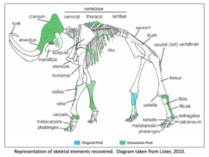
It has been well proven that the Missoula Floods greatly
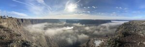
Without aerial views of the Ice Age Flood lands, we
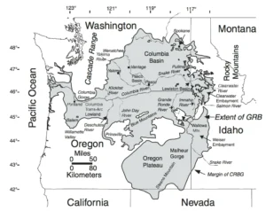
We came across an interesting article in IFLScience that pertains

We normally include a review of our past year’s activities in our January

Empowering Teachers to Share the Ice Age Floods Story with Students

Every student in the Northwest should experience the incredible science

Developing an Ice Age Floods Animation Through Science, Partnership, and

The IAFI Store is having a special Winter Inventory Reduction

“All creatures, objects, places, and elements have a spirit.” Patrick
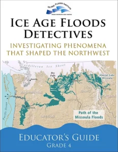
Thousands of K-12 students across the Pacific Northwest are

The east bank of the Columbia River near Malaga, Washington,

The Bowl and Pitcher is a rock formation along the
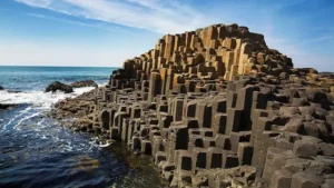
The Giant’s Causeway is a rock formation that is so







Geologists have been investigating a potential cycle in geological events for a long time. A recent analysis on the ages of 89 well-understood geological events from the past 260 million years show a catastrophic 27.5 million year pulse in eight clusters of world-changing geologic events over geologically small timespans. This
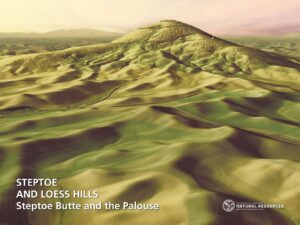
The Washington Geological Survey (WGS) has released 50 high-resolution lidar-derived images of the State’s geology and geomorphology through the Washington State DNR’s Flickr page. The images are available in 16:9 format (7,200 x 4,050 pixels) and 4:3 format (7,200 x 5,400 pixels). Ten of the images are new (see below)
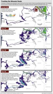
ICYMI (in case you missed it) — Floodwaters rise more than 1,000 feet as they slam into the Columbia River Gorge from the east. The torrent blasts through the narrows at 60 mph, carrying truck-size boulders and house-size icebergs. Reaching Portland, water loaded with gravel and dirt roils to a
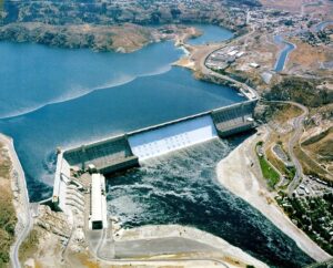
1918 story in the Wenatchee World that Bill Dietrich (former Columbian reporter and later with The Seattle Times) says in his wonderful 1995 book Northwest Passage — The Great Columbia River , “is probably the single most famous newspaper article in Pacific Northwest history. . . It is generally credited

Chris Goodell’s 1-hour video presentation of his Ice Age Flood hydraulic modeling is both enlightening and thought provoking. Chris is a hydraulic modeling professional for Kleinschmidt Group, whose personal interest in the Ice Age Floods phenomenon led him to privately undertake HEC-RAS modeling of a possible Ice Age Flood hydraulic
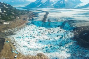
A recent Smithsonian Magazine article gives some interesting insights to present-day Jökulhlaups (glacial outburst floods) that are but minuscule relatives of the cataclysmic Ice Age Floods. Iceberg Lake was on the edge of a western tributary of the Tana Glacier, but in 1999 the lake suddenly vanished. Dammed on its
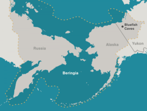
Archaeologists have long debated how and when people entered the Americas. Throughout the 20th century, the mainstream hypothesis was that the Clovis people were the first to pass into Alaska about 13,000 years ago. Stemming from his excavations between 1977 and 1987 at the Bluefish Caves in northwestern Yukon, Jacques
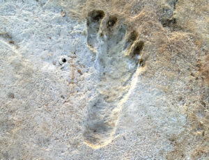
Articles in Science Alert and the New York Times report on a well documented age for many sets of human footprints as old as 23,000 years in the ancient lake shore sands of White Sands, New Mexico. “The footprints were first discovered in 2009 by David Bustos, the park’s resource