
Rowena Crest – Tom McCall Nature Preserve
Overlooking a major chokepoint along the Ice Age Floods path, Rowena Crest lies at nearly 700 feet above the Columbia River at the upstream end of Rowena Plateau, a miles-long promontory that protrudes into the path of the river. This forces the river around the plateau through a relatively narrow section of the Gorge known as the Rowena Gap.
The onrushing Ice Age Floods waters easily flowed over the relatively low relief of Dallesport in The Dalles Basin to the east, but as they entered Rowena Gap they were impeded and diverted northward as they crashed against the Rowena promontory. This created a major chokepoint, a hydraulic dam, in the path of the floods as they made their way through the Columbia River Gorge. The flood waters hitting the Rowena promontory built to nearly 1000 feet and flowed over the Rowena Crest while backing upstream to form temporary Lake Condon in The Dalles basin.
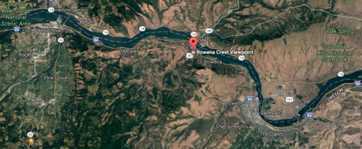
From the vantage of Rowena Crest Viewpoint are several compelling flood-related features. The drive to the viewpoint on old Hwy 30 from either east or west is a spectacular drive through a beautiful section of the Columbia River Gorge. A roundabout parking area at the viewpoint with a safety wall above a sheer cliff provides a great observation point.
It is estimated that each of the 40-120 Ice Age Floods may have taken up to a month to completely flush through the system to the Pacific Ocean, but the duration of the flood waters at any point along the path, like at Lake Lewis, probably lasted less than a couple of weeks.
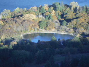
Rowena Kolk Pond
At Columbia River level below and east of the promontory is a Kolk pond formed by relatively stationary whirlpools in the flood waters where they were deflected around the Rowena Crest promontory. Other Kolk ponds can also be seen along the hiking path atop Rowena Crest where they are marked by surrounding groves of oak trees.
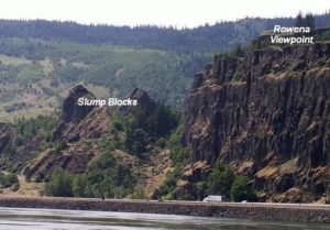
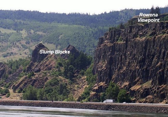
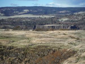
Rowena Slump Blocks
Below the block wall along the cliff edge a number of large tilted fault blocks of layered of Columbia River Basalt are slump blocks that broke off the promontory and slid toward the river as they were undercut by the flood waters coming at them from The Dalles. The relationship of these slump blocks to Rowena Crest are best viewed from the WA side of the River (see image right).
Rowena Mima Mounds
The many rounded mounds that cover the plateau are mima mounds whose origins are not definitively known, but were probably formed by turbulence at the base of the flood waters flowing over the plateau. All, that is, except for the mounds in the middle of the roundabout parking area, which were built by Oregon Dept. of Transportation to mimic those that cover the plateau.