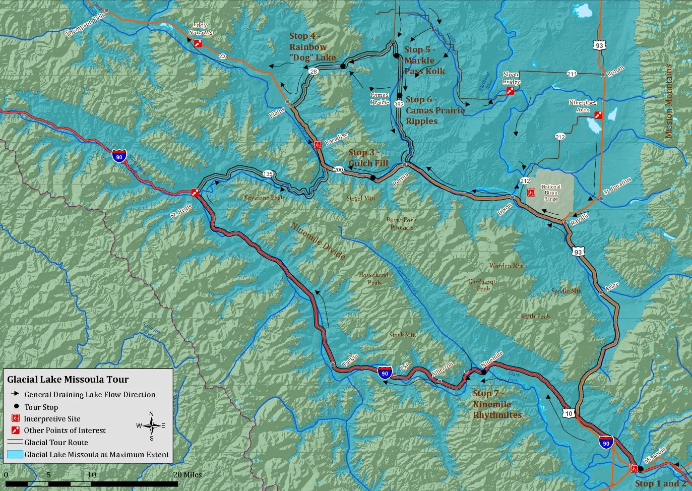
A guide to Ice Age Floods features in Montana is now available that shows a driving route to the major ice age floods features in the region, including some points of interest which have not been listed before. All the map locations are within a day trip of Missoula and can also be easily accessed when traveling west along the Interstate-90 corridor or north to Glacier National Park. A map is included in the brochure that can also be downloaded to a smartphone and used to navigate even in areas with no cell phone coverage. A blue dot will show exactly where you are located on the map if you are within its boundaries.
Photos and a brief explanation of each tour feature include some that have been revised to reflect the most recent research. A bonus feature in the brochure is the exact location of several engraved stone monuments marking the high water point of Lake Missoula – including one up the Bitterroot Valley. The map and directions also include three interpretive sites and exhibits in this area.
The guide is somewhat larger than the previous brochure and is available for free at the Montana Natural History Center and tourist locations in Missoula. Or it can be downloaded HERE and printed as four letter size pages on most printers. More information about flood features in these surrounding river valleys is planned for the future.
Smartphone Avenza Map Download/Use Instructions
To take advantage of the cell phone map feature, the user will need to download the free Avenza Maps app from your app store and also download a special geo-referenced PDF version of the map (instructions below). You should be connected to wi-fi when downloading the map because it’s a large file.
To use the Avenza Map technology that guides you and tracks your location on a smartphone even when you’re not in range of cellphone coverage you’ll need to:
- Install the free Avenza Map app from your App Store and open the app,
- Click this link MissoulaGlacialTourMap_201804 or the map below to download the PDF map to your device (this is a large file and works best when you are connected to wi-fi),
- Click the “+” icon in the Avenza Map app to “Download or Import a map”,
- Select “Import from Device Storage”, then navigate to the storage location (Internal Storage>>Download folder),
- Select and store the map PDF, then select it from your My Maps tab and you’ll be on your way.
The blue dot on the map will show at your location (if you are within the boundaries of the map).
