Do you have a geology question? We might have an answer! Members who want to do a short article, or describe a field trip location of interest, or describe some geologic problem or site, can use the form below to submit a question or write-up to our technical committee.
How Galactic Rhythms Helped Form Earth’s Continental Crust
“To see a world in a grain of sand”, the opening sentence of the poem by William Blake, is an oft-used phrase that also captures some of what geologists do. We observe the composition of mineral grains, smaller than the width of a human hair. Then, we extrapolate the chemical processes they suggest to ponder the construction of our planet itself. Now, we’ve taken that minute attention to new heights, connecting tiny grains to Earth’s place in the galactic environment. Looking out to the universe At an even larger scale, astrophysicists seek to understand the universe and our place in it. They use … Read more…
Kummakivi, Finland’s Balancing Rock, Seems to Defy the Laws of Physics
Our brains are pretty good at physics. For instance, you can watch somebody kick a soccer ball in front of you, and you can run to the spot where you and that soccer ball will intersect, taking into consideration the speed of both you and the ball — so smart! Not only that, we can look at one object balancing on another and tell how sturdy it is without so much as touching it. But sometimes our brains make uneducated mathematical guesses, and one of these is Kummakivi, the balancing rock in Ruokolahti, Finland. If it was up to your … Read more…
Dinosaur-Killing Asteroid May Have Had a Companion
A newly discovered crater suggests a second impact that would have triggered underwater landslides and tsunamis On its own, the dinosaur-killing asteroid had a staggering impact: Wildfires raged across the continents, tsunamis pummeled coastlines and about three-quarters of Earth’s species went extinct. But now, new evidence suggests this massive chunk of rock may have had a partner: Scientists discovered what might be an impact crater off the coast of Guinea that they say dates to 66 million years ago—around the same time as the collision that wiped out the dinosaurs. This second asteroid may have broken off from the dinosaur-killer, known … Read more…
How Has Your Address Moved Over the Past 750 Million Years?
Some 240 million years ago, an enormous supercontinent known as Pangea encompassed nearly all of Earth’s extant land mass, Pangea bore little resemblance to our contemporary planet, but thanks to a recently released interactive map interested parties can now superimpose the political boundaries of today onto the geographic formations of yesteryear—at least dating back to 750 million years ago. Ancient Earth is an interactive Map tool that enables users to home in on a specific location and visualize how it has evolved between the Cryogenian Period and the present. The tool behind this millennia-spanning visualization, is the brainchild of Ian Webster, … Read more…
Continents Were Created on Ancient Earth by Giant Meteorite Impacts
To date, Earth is the only planet we know of that has continents. Exactly how they formed and evolved is unclear, but we do know – because the edges of continents thousands of miles apart match up – that, at one time long ago, Earth’s landmass was concentrated in one big supercontinent. Since that’s not what the planet looks like today, something must have triggered that supercontinent to break apart. Now, we have new evidence to suggest that giant meteorite impacts played a significant role. The smoking gun consists of crystals of the mineral zircon, excavated from a craton in Western Australia, … Read more…
Geology Can Be Weird – Trovants
Trovants Are Stones That Seem to Grow, Move and Reproduce By: Jennifer Walker-Journey | Jun 21, 2022 | HowStuffWorks/Science/Environmental Science/Earth Science/Geology/Geologic Processes Trovants such as these are found only in Romania and have become such a tourist attraction that they are protected by UNESCO. WIKIMEDIA COMMONS (CC BY SA 3.0) Just when we think we’ve seen it all, Mother Nature throws yet another oddity our way. Welcome to the wondrous world of the geological manifestations known as trovants. These rare bulbous, budging boulders are only found in a small town in Romania called Costesti. So fantastical are these trovants, they’ve found a place in local folklore. Some … Read more…
THE GRAND COULEE – A Floods Poem
THE GRAND COULEE Older than legends, Younger than mountains, The earth remembers The Great Inland Sea. And that Sea emptied In torrential fury Never imagined Even in dreams. Down through the canyons, Flood of all rivers Carving the coulees Time, time again. Roiled surging waters, Thunder of thunders, Swift toward the ocean Reshaping the plain. Gone with the glaciers Is the great Lake Missoula, Gone from remembrance, Like mist in the wind. Yet the story is etched In the canyons and coulees Left for those who imagine To seek and to find. David Wahl January 4, 2002 Read more...
First Peoples Ice-Free Corridor Migration to Americas Reexamined
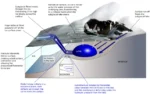
Analysis of how long erratics have been exposed on ice-free ground in the hypothesized “Late Pleistocene ice-free corridor migration route” suggests that route was not fully open until about 13,800 years ago, and the ice sheets “may have been 1,500 to 3,000 feet (455 to 910 m) high in the area where they covered the ice-free corridor,” according to study lead author Jorie Clark, a geologist and archaeologist at Oregon State University. Clark said, “we now have robust evidence that the ice-free corridor was not open and available for the [Late Pleistocene] first peopling of the Americas.” If evidence of … Read more…
Waning Pleistocene Ice Sheet Affected Megaflood Paths and Local Shorelines
Have you ever thought about the how the weight of the ice-age Cordilleran ice sheet might affect the underlying Earth’s crust. There is strong evidence that the crust was depressed hundreds of feet beneath the ice, and since the crust is relatively thin and rigid over a plastic aesthenosphere, that also caused the crust for some distance beyond the ice margins to tilt toward the ice sheet. A new modeling study explored how changes in topography due to the solid Earth’s response to ice sheet loading and unloading might have influenced successive megaflood routes over the Channeled Scablands between 18 … Read more…
Evidence Elsewhere of Ice-Age Floods?
Q – Is there evidence elsewhere in the world of ice age floods. Intuitively, I would think glaciers dammed other rivers, created lakes and then eventually collapsed and releasing the waters of Lake Missoula. A – Your instincts are correct. The rivers with big ice and big gorges pretty much all had outburst floods on them. The St. Lawrence Seaway is a flood path as is the Strait between Denmark and Norway and the English channel at the Dover Straits. The Altai Mountain Floods in Mongolia were very steep and fast much like Lake Missoula. The latitude where the ice … Read more…
Badger Mountain Landslide Potential?
Q – With all the homes being built on and around Badger mountain in the Tri-Cities, is there any danger of landslides, similar to what is happening at Rattlesnake Hills? I’m unfamiliar with the geology there, and I understand that building homes can affect stability, but are there other likely dangers in that area that potential homebuyers/builders should be wary of? A – There have been prehistoric landslides (now stabilized) on Badger Mountain along with the other ridges nearby. These may have occurred following one more of the Ice Age floods >15k years ago. Renewed landsliding is unlikely as long as … Read more…
What are Spokane’s Haystack Basalt Mounds?
Q – Throughout the Spokane area there are what some call ‘haystacks’, basalt mounds that look like haystacks. There are many such on Spokane’s south hill and I’m including a photo of one that’s in lower Lincoln Park. How did these form? Do they indicate the location of a volcanic vent? – John Ludders A1 – The picture is a large chunk of chill zone basalt. The sequence is chill zone, columnar basalt, entablature, capped by chill zone of the next flow. Like the columns, the chill zone is resistant to plucking but is weak and susceptible to hammering and … Read more…
Rounded Boulders in Spokane – Ice Rafted Erratics?
Q – I have noticed places around Spokane where there are large accumulations of similarly-size boulders. They are smooth and generally about a meter in diameter.. The type of stone varies, but none are Columbia Basin basalt. I assume these are ice-rafted erratics. My question is how did so many end up in a few locations and why are they all similarly sized? My guess is that the flood waters ran into a slope and became still enough to drop similarly-sized loads. Is that right? Or is there another explanation? The South Hill Park and Ride has 81 scattered around … Read more…
Height of Dry Falls
Q – Long time resident and have been to dry falls several times. Can you [lease tell me the elevation change between the top of the falls to the lake below ? do you know or can you direct me to the information. A – The height is often cited as 400′ but it appears to be a bit over 500′ based on USGS topographic maps. Read more...
Ice in Puget Valley
Q – My daughter and family live west of Dean Kreger Rd, above Silver Lake, west of Eatonville. I tease her that her yard is gravel held together with a little sand. I believe they are close to the margin of an ice sheet but, I can’t find a map showing the margins. I’ve always been curious when I see different geology features and after watching all of Nick Zentner’s videos I’ve learned enough to be a hazard to myself and society. A – Google Ice in Puget Valley, Vashon ice lobe, Glacial landforms of Puget Valley and you will … Read more…
Any idea what made this formation?
Q – This is in the Utah desert, south of Green River. I keep hearing that it might be clastic dikes? I have sent this pic to the USGS and they are kinda stumped too but plan to send some paleontologists to check it out. A – The clastic dike explanation looks quite probable. As I understand it, when a fluid (typically water) saturated body of sediment is overlain by another thick layer of sediment the weight of the overlying sediment overpressures the fluid in the saturated sediment body, resulting in the fluid forcing its way toward the surface, where … Read more…
Quaternary—What is that???
Ice Age Floods Institute members may have heard the term Quaternary during Chapter presentations and field trips, or may have learned that the Quaternary Period represents the last 2.588 million years (~2.6 million years) of earth history, or that it is divided into the Pleistocene and Holocene Epochs. The Quaternary began with the Pleistocene (~2.6 million years ago) and the strata and landscape features reflect the major climate changes of the last Ice Age (synonymous with the Pleistocene Epoch). But where did the term Quaternary come from? The word suggests the number four as in quadrangle, quadrant, quadruplet, etc. For its … Read more…
Submit a Geology Corner question or short article:
Geology Corner
Ask a question of our technical committee or submit a short geologic article for our website