
Puget Lobe Chapter Field Trips
(Updated 30Jul2022) Fall field trips to be posted soon!
The Puget Lobe Chapter sponsors field trips enable IAFI members and the public to learn about the diverse geology of Washington. The Puget Sound area is remarkable for Cordilleran Continental Ice Sheets that issued forth from British Columbia and abrading and deforming the area between the Cascades and Olympic Mountains from the area to the Pacific Ocean “north” of the Olympics and there called the Juan de Fuca Lobe. “North” is a relative term, as the Last Glacial Maximum (LGM) was a condition of the ice sheet size at any given time. For example, the Double Bluff Glaciation LGM (190 Kya – 130Kya {T2*}) extended to ≅Tenino, while the Puyallup Glaciation (80-59Kya) LGM only extended ≅ Bremerton. The Fraser Glaciation (30Kya – 15Kya {T1 at 11Kya}) LGM terminated just below Olympia. We also had Alpine Glaciation in the Cascade and Olympic Mountains. For example, prior to the Fraser ice sheet flowing into the Puget trough, the alpine glaciers had advanced and receded from the same area (LGM 22Kya). (Note: T2 and T1 are Termination Points)
The Puget Sound area was isolated by the Cascades Range from the large number of ice sheet lobes found in Eastern Washington, Idaho, and Montana, Similarly, we were isolated from the Missoula Floods and the effects of those floods which rampaged down the Columbia River and turned west at Longview – a mere 20-30 miles south of the Puget Lobe LGM. Yes, all the ice lobes in our area were called “Puget Lobe” except where the Puget Lobe couldn’t get past the Olympics. Forced to take a westerly turn towards the Pacific Ocean, that was called the Juan de Fuca Lobe.
The first of our four Spring Field Trips:
1. Building Stone of Seattle, (Completed)
2. Ice Age geology of the Snoqualmie Valley, (Completed)
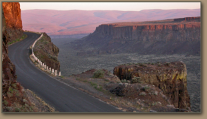
3. June 1-3: Frenchman Springs Coulee and the Ice Age Floods
This trip is Completed.
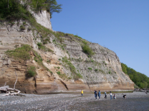
4. June 30: The Advance and Retreat of the Cordilleran Ice Sheet Revealed at Discovery Park
This trip is Completed.