
Ice Age Floods – More Than a Lot of Water – Palouse Falls News
Tremendous floods of water formed the Channeled Scabland of eastern Washington but there is much more to the story than a lot of water. The Palouse Falls Chapter for the last seven months has been looking at the human side of the story.
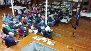
In November 2017, James Paine, Director of the Fort Walla Walla Museum presented a lecture entitled “Flaked Stone Tool Production in Ice Age America”. He did his study in New England at sites that would have been active at the time of the Ice Age Floods here in the northwest. Were humans here at the time of the floods? If so, we got a glimpse of what their lives would have been like.
McGregor’s History Lecture
Then in March of this year, we looked at more current human history. Business manager, historian, and chapter member Alex McGregor talked about the remarkable people who first settled the channeled scablands. They discovered the loess soil fertile and excellent for growing wheat. Where the floods had stripped the soil down to bedrock, they found that sheep could thrive off the barren landscape. As synthetic fibers came into the market, there was less need for wool and the sheep were replaced with cattle. The early settlers came to grips with the unusual challenges of a unique landscape. It is a story of how these remarkable people have progressed in feeding a burgeoning world population while becoming ever finer stewards of the land.
Finally, in May, we took a closer look at how the floods affected the transportation routes of man. To do this, we took a page out of the Ellensburg chapter and hosted our first carpool lecture. We visited several local sites and learned how the natives discovered the easiest routes, not always the straightest, which got them to the places they needed to go. We visited local historical roads which in many ways followed the trails of the natives. The Colville Military Road between Fort Walla Walla and Fort Colville was built in 1859. Shortly after, the Mullan Road between Fort Walla Walla and Fort Benton in Montana was built. The two roads follow the same route between Fort Walla Walla and separate at Cow Creek just west of modern day Benge. Lyons Ferry on the Snake River at the mouth of the Palouse River was put into service in 1860 on the Colville/Mullan Road and continued until 1968 when it was replaced with a bridge. In 1867, the Washtucna Road was built from the Columbia River at Wallula, crossed the Snake River a few miles upriver from it’s mouth and then into Washtucna Coulee to Washtucna, up the east side of the Staircase Rapids, and then east to connect with the Colville/Mullan Road just south of their split. This easier route took days off the Mullan Road route and got eager miners to their field of dreams in the Colville area and the Rocky Mountains quicker. These historic roads are sometimes the same paved roads we traverse today. Other times, they serve as service roads for today’s ranchers. There are still places where the original two-rut wagon roads are still visible.
Not only did these first land travelers find the coulees an easy way to navigate the channeled scablands, but the expansion of the railroad system in the late 1800’s and early 1900’s did too. The SP&S railroad and a branch of the Union Pacific used the gentle slope of Washtucna Coulee while the main line of the Union Pacific used the Snake River Valley, Palouse Canyon, and Cow Creek Coulee and continues this route today.
After our morning excursion, we ended our trip at the home of our member John Hair’s home south of Lyons Ferry. John demonstrated his outdoor G-scale (1-22.5) which is a quarter of a mile long and growing.
by Lloyd Stoess – Palouse Falls Chapter