
Exploring the “Volcanic Legacy Scenic By-Way”
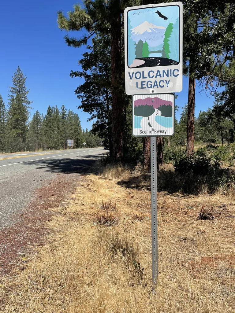
VOLCANIC LEGACY SCENIC BYWAY, Ore. — Quartzite mountains. Pumice plains. Cinder cones. Volcanoes are the geology that shaped the Pacific Northwest — and there’s an easy way to view them on an incredible, scenic road trip. This 500-mile Volcanic Legacy Scenic Byway, which stretches from Crater Lake National Park in southern Oregon to Lassen Volcanic National Park in Northern California some 220 miles to the south, takes one back in time for a living geology lesson.
We drove the route in mid-August, and because much of the route is 4,000 to 8,500 feet in elevation, we had temps in the mid-70s. Including a day at Crater Lake, our trip to and from Lassen Peak, the southernmost volcano in the Cascades, took six days. We barely skimmed the surface of the route’s marvels. or From Seattle, we drove 500 miles to Klamath Falls, Oregon, an ideal staging area to begin the trip. Before going, we ordered an official Volcanic Legacy Scenic Byway Guide (or Oregon and California online), a primer on the must-see attractions along the way. Worth noting: The book is written starting in California; anyone coming from the north has to start at the end and read backward.
Although the byway officially begins at Crater Lake, we first stopped at the Newberry National Volcanic Monument 11 miles south of Bend, next to the 500-foot Lava Butte to the right of Oregon Highway 97. You can’t miss this huge brown basalt cone. The Lava Lands Visitor Center to the south offers shuttle rides to the top for a $3 round-trip. Drop by the center to get a feel for the geologic history of the region and relax on the shaded patio. We then drove a few miles south to the turnoff for the Newberry Caldera, then drove 13 miles to Paulina Lake, which, along with East Lake (5 miles farther), are great for swimming. They were formed about 75,000 years ago.
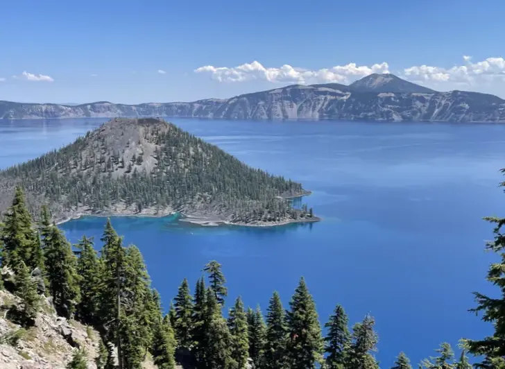
Wizard Island – Crater Lake
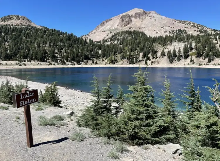
The next day, we drove 54 miles from Klamath Falls to the south entrance to Crater Lake. As you drive on the flats toward the park, you can see a huge gap on the nearby Dutton Ridge that 7,700 years ago would have included the 12,000-foot Mount Mazama. Its eruption created what is now Crater Lake. Crater Lake National Park was its usual stunning self when we visited. So — unfortunately — were the crowds. The park lacks enough food concessions, so the Rim Village Café was packed. We quickly left to drive the 33 miles around the rim to view the country’s deepest lake at 1,943 feet. The park’s main visitor center was closed this summer for renovations and its signature boat tours had been canceled — for lack of workers, I was told. Afternoons are the best time to enter the park to avoid lineups at the entrances.
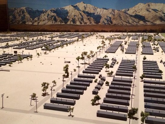
Manzanar Diorama
From Klamath Falls, one can also drive an hour south to the Lava Beds National Monument, a massive collection of lava tube caves, craters, spatter cones, cinder cones and at least 22 caves on the northern side of the Medicine Lake volcano. It is near Tulelake, California, a flat, dry area where 120,000 Japanese American citizens were incarcerated in Manzanar War Relocaton Center for four years during World War II. You can still see the camp buildings from the road.
Roadside construction prevented us from getting there, so we headed south on 97 from Klamath Falls through 50-some miles of range and grassland, crossing two summits at around 5,000 feet and seeing increasingly gorgeous vistas of the 14,179-foot Mount Shasta, the largest stratovolcano in the Cascades and second in size after Mount Rainier. Along the way there’s a fire lookout, a vista point and a short hike through a lava tube known as Pluto’s Cave. (Stratovolcanoes are built from layers — or strata — of the lava, pumice and volcanic ash flowing from volcanic vents. Each eruption forms another layer. Other types of volcanoes en route were cinder cones, steep-sided hills only a few hundred feet tall, and shield volcanoes, large flat formations with multiple vents that covered the earth with lava like a massive shield.)
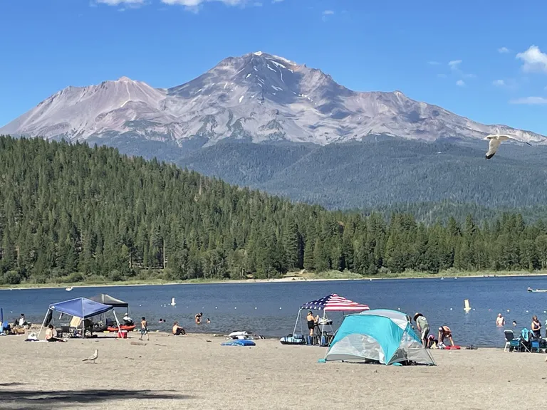
Mt Shasta
The byway takes drivers briefly on Interstate 5 to the cities of Weed and Mount Shasta, which abut a huge cinder cone: Black Butte. Take Exit 738 into downtown Mount Shasta to enjoy its hippie vibe and businesses with names like Gaia Hair Design and Shasta Vortex Adventures. Stop by the Chamber of Commerce building on West Lake Street just off the exit to get instructions on local hikes and ways to drive up the 15-mile scenic Everitt Memorial Highway to a viewpoint of the mountain at 7,858 feet. We elected to cross over the freeway and drive a few miles to Lake Siskiyou Camp Resort, which had a beach with a stunning view of the mountain. We then headed east on the byway on Highway 89, driving 10 miles to McCloud, a historical town on the other side of Shasta, to spend the night.
Continuing south on 89 the next day, we found McArthur-Burney Falls Memorial State Park within an hour. One could walk down a path to the sparkling emerald green and cobalt blue pool, and the spray from the falls lowers the outdoor temperature by some 20 degrees. The rocks over which Burney Creek flows are made of porous basalt, allowing hundreds of springs to seep directly into one cascade. The nearby snack bar and picnic tables under the pines are quite pleasant, as is the adjoining campground and nearby Lake Britton.
Mt Lassen
As we drove south for 51 miles, we could see one charred landscape after another from the Dixie fire of summer 2021. That hellacious blaze, which burned nearly 1,000,000 acres through five counties for more than three months, was the largest single wildfire in California history. Clear-cuts and piles of salvage logs were everywhere.
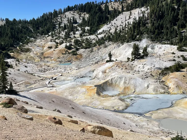
Bumpass Hell – Mt Lassen
At the intersection of Highways 89 and 44 was Old Station, a crossroads with a well-stocked food store (milkshakes, basic first aid, food, camping supplies), visitor center and gas station. There were several interesting hikes in this area (all detailed in the byway guide). We turned east, climbing up the Hat Creek Rim, an escarpment 1,000 feet above the Hat Creek valley floor and an overlook showcasing multiple volcanic peaks and cones.
Fifty-two miles later, we arrived in Susanville, the easternmost point of the byway, with plenty of hotels, restaurants and other services. Its Chamber of Commerce had helpful maps including one for Lake Almanor, a lovely body of water to the west at the southern end of the byway.
Article by Julia Duin, reprinted from The Seattle Times