
ESA Maps a Lava Tube for Moon and Mars Expeditions
With all deference to the book and movie “The Martian”, wouldn’t you, as part of an interplanetary expedition, prefer to be protected from the radiation, micro-meteorites and extreme temperature fluctuations of the Moon or Martian surface? Though some of the hazards depicted in “The Martian” are way over-dramatized (the thin Martian atmosphere wouldn’t sustain the depicted raging storms), there are still hazards aplenty on the surface. So why not site your habitat in a cozy lava tube, protected from many of those surface nasties.
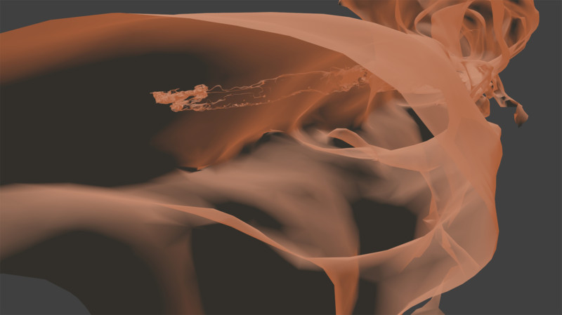
At least that’s some of the reasoning behind a European Space Agency (ESA) effort to map a portion of Spanish lava tube in centimeter-scale detail as part of the ESA’s 2017 Pangaea-X campaign. Some chambers in the 8 km long La Cueva de los Verdes lava tube are large enough to hold residential streets and houses (or a prototype Martian research station/habitat). In less than 3 hours the cave research team mapped the lava tube using the smallest and lightest imaging scanner on the market and a wearable backpack mapper that collects geometric data without a satellite and synchronizes images collected by five cameras and two 3D imaging laser profilers.
While the data is still being analyzed, ESA has released this ghostly fly-thru of a 1.3 km portion of the lava tube. Click the play button and prepare to take a pseudo-trip to Mars.
So, the next time you visit a cave or lava tube, especially a large one, imagine yourself in a spacesuit on the Moon or Mars and realize that you’re actually an inner-space explorer. But don’t be too surprised at the creatures you may run into, they’re just other inner-space explorers too.