
Columbia Gorge Geology Field Trip
“Landslides, eddy bars, hydraulic dams, glacial erratics, kolk ponds, anticlines & synclines, thrust faults, Ohanepecosh to Troutdale formations, lahars, tree casts, petroglyphs, and more”
The central Columbia River Gorge is like a storybook of the past 40-50 million years, and we will open and read from several chapters of that book in a 10 hour bus/walking tour of a 40 mile section of the Gorge between Bonneville Dam and The Dalles. As we turn some of those pages and take a glimpse into the incredible geology and more of the Columbia River Gorge, we will reveal many secrets that are hidden right in plain sight.
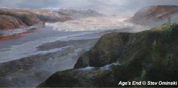
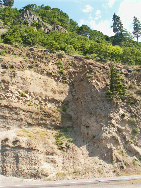
- Massive landslides that dammed the Columbia River in the past, and those that continue to cause problems for OR and WA road crews,
- Gargantuan lava outpourings that flank the present-day Columbia River, built the Cascade mountains, filled lakes, and left ghosts of lava-consumed forests;
- Cataclysmic ice age floods that reshaped the landscape and scoured the Gorge;

- The rapidly changing climatic zones and lush to sparse flora of the Gorge;
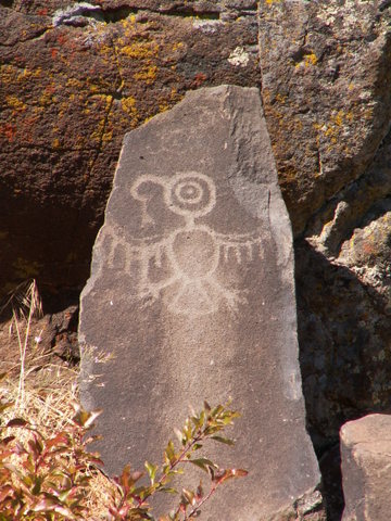
- Native American art that was saved from being covered by the backwaters of The Dalles Dam;
- Maybe even a present-day mini-safari featuring zebra, camels, giraffes, and more.
The field trip will involve some easy to moderate walking and will include a knowledgeable field trip leader, a printed field guide, a delicious box lunch, drinks and snacks, and comfortable bus transportation with continuing en-route commentary. But most important, it will brighten your eyes and enlighten your mind with amazing and delightful discoveries.
To get a sense of the trip, click the map markers below to explore some of the many features along the field trip route (we won’t stop at or see them all) or download the IAFI-CGC Gorge Geology Field Trip Guide.
Click here to view this Central Gorge Geology Field Trip map in a larger interactive map window