
Another High Water Marker Placed in Missoula
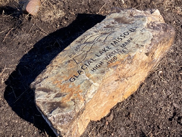
One more engraved rock marking the high water level of Glacial Lake Missoula has been added to four others already set on the mountains along the eastern city limits of Missoula. Several members from the Glacial Lake Missoula Chapter of the Ice Age Floods Institute joined a small crew and equipment from the Missoula Parks and Recreation Department to place the large boulder at an overlook on Mt Dean Stone. Despite record breaking low temperatures and snow the previous week, the weather on October 29th was perfect for this job to be completed.
Mt Dean Stone occupies the area between Pattee Canyon and Miller Creek. The marker is located at the South Hills Spur overlook which can be accessed from the Barmeyer or the Sousa trailheads. The Barmeyer Loop Trail begins at a small parking lot adjacent to 1355 Pattee Canyon Drive, just beyond one of the trailheads for the Mt Sentinel marker at the Gas Works/Gravel pit lot but on the other side of the road. It is a 3.6 mile loop with 898 feet elevation gain. The Sousa Trailhead is located off Spanish Peaks Drive.

This is the second high water marker to be set this year. Besides those in Missoula, the others mark the furthest extent of the floods in the Blackfoot/Clearwater and Bitterroot drainages – one at Lake Como and one in Ovando. More are planned for next year.