Clark Fork Ice Dam
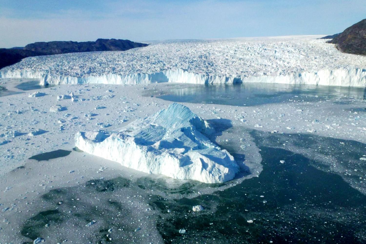
Ice Age Floods National Geologic Trail 12,000 to 17,000 years ago a 4000′ tall ice dam blocked the path of the Clark Fork River creating glacial Lake Missoula. At the end of the last ice age this ice dam failed, releasing more water than is held in modern day Lake Ontario and Lake Erie combined. 600 cubic miles of water rushed through this area and down Lake Pend Oreille destined for the Pacific Ocrean.One of the most intriguing questions about the catastrophic flooding is how the ice dam failed. Various mechanisms for glacial outburst floods have been proposed: Ice erosion by overflow water, subglacial failure by flotation, deformation of ice by water pressure, and erosion of subglacial tunnels by flowing water. One model suggests a self-dumping phenomenon. In this mechanism, floodwaters are released when the lake level reaches nine-tenths the height of the ice. At this depth the ice becomes buoyant, subglacial tunnels form and enlarge, and drainage occurs until hydrostatic pressure is decreased and the ice again seals the lake. The self-emptying model is used to explain the numerous cycles in the rhythmite deposits and to interpret each cycle as a separate flood. Even so, only the total collapse of the ice dam can explain the largest of the catastrophic foods. Sub-glacial tunneling and enlargement due to thermal erosion progressing to collapse have also been proposed, as well as catastrophic failure due to water pressure. All are dependent on the configuration of the ice dam and structure of the ice. Quick Facts Location:Clark Fork, Idaho
Columbia Gorge Discovery Center & Museum

Columbia Gorge Discovery Center & Museum Ice Age Floods National Geologic Trail, Lewis & Clark National Historic Trail, Oregon National Historic Trail The Columbia Gorge Discovery Center & Museum is located on a 54-acre point of land adjacent to the Columbia River and is the interpretive center for the Columbia River Gorge National Scenic Area. This area includes one of the oldest continuously occupied places in North America (over 11,000 years) and parts of the Lewis and Clark and Oregon Trails. On the grounds are walking trails, a pond, scenic overlooks, and historic artifacts. The 48,200 square foot Discovery Center & Museum building contains interactive exhibits about the creation of the gorge; Ice Age animals, including a full-size Columbian mammoth; the Lewis & Clark Corps of Discovery; native peoples of the area; and a life-size exhibit featuring a wagon-raft braving the Columbia River’s current. This is an excellent stop for families with children. Allow several hours for your visit. Modest admission is charged. Site Information Oregon National Historic Trail Quick Facts Location:5000 Discovery Drive, The Dalles, Oregon Significance:Interpretive center for the Columbia River Gorge National Scenic Area MANAGED BY:Columbia Gorge Discovery Center Museum Inside the Columbia Gorge Discovery Center and Museum
Frenchman Coulee
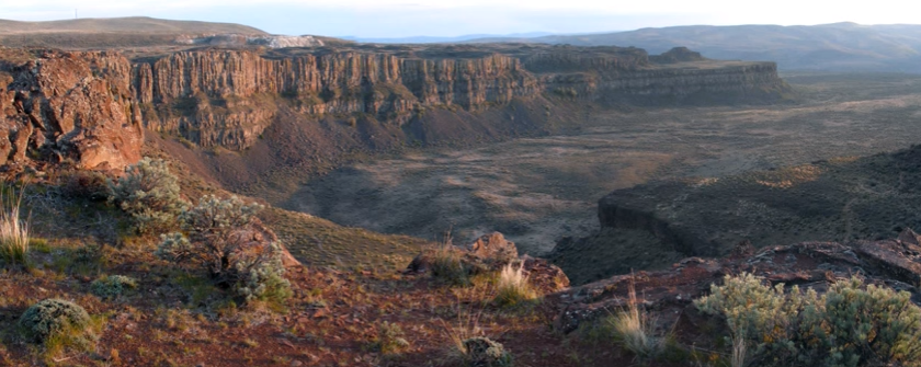
Frenchman Coulee Ice Age Floods National Geologic Trail Frenchman Coulee is a short drive north and west from the Silica Road exit 123 off US-90, along the Old Vantage Road. It is one of the most beautiful features left behind by the great Ice Age Floods. Several of those massive floods, up to 700 ft (213 m) deep, created Frenchman Coulee, its Potholes Coulee neighbor to the north, and scoured the bizarrely eroded surface of Babcock Bench, preferentially eroding weaker rock out of the top of the Grand Ronde Member of Columbia River Basalt. Frenchman Coulee is actually a dual coulee and cataract system, Frenchman Coulee and Echo Basin, separated by a remnant rock blade that sports tall basalt columns attracting rock climbers like bees to flowers. The Feathers is probably the most popular climbing area in the region. Hiking trails, some barely discernible, lead along and atop the rock blade, affording spectacular views of both coulees. Frenchman Coulee also has a waterfall in the eastern section of the Coulee that is accessible by foot. Other hiking and biking trails explore the floor of the coulee and continue over 15 miles north along Babcock Bench, perched high above and adjacent to the Columbia River, past Potholes Coulee and on to Crescent Bar. Quick Facts Location: Old Vantage Highway, Quincy, WA 98848 A primarily destination for hikers, mountain bikers and rock climbers with the fascinating rock formations of the Gorge making for a great challenge
Hiking Drumheller Channels

Hiking Drumheller Channels Ice Age Floods National Geologic Trail There are scads of hiking trails all through Drumheller Channels National Natural Landmark. On a cloudy day in early June we took off on a couple of exploratory hikes that were simply amazing. We first proceeded south from the parking lot at Lower Goose Lake, running through late Spring wildflowers, eventually looking for one of Bruce Bjornstad’s geocaches. We wandered over hills and down into deeper valleys, always surrounded by the towering walls of basalt defining that section of Drumheller Channels. Along the way we found an area of apparent Kolk depressions with odd spires of basalt poking up out of the middle of a central mound. Soon we passed through a reedy area that bounded the southern edge of Lower Goose Lake. We continued on south to the edge of Black Lake where the geocache was supposed to be, but after 20 minutes with 4 of us looking in the area of the GPS coordinates, we finally decided the cache was no longer there and headed back. The hike was easy, very pleasant, and mercifully cool due to the cloudy morning. We then drove north across the O’Sullivan Dam, and back south through Columbia National Wildlife Refuge to the W. McManamon Road entrance to Crab Creek Marsh Unit #3 and the Basalt Columns at Drumheller Trailhead, the kickoff point to go to the top of “Nick’s Columns”. Nick Zentner’s videos about the columns are great, but the blooper where his rock hammer falls down between columns is priceless. We just had to see those columns for ourselves, and we weren’t disappointed. It’s interesting how only the columns along the edge are free standing, while those inboard are packed around with sediment. The little rain the area gets probably washed the sediment out of the spaces between the bordering columns. After walking around for a while we made our way back to the car and drove to the Drumheller Channels National Natural Landmark overlook for a final sweeping viewpoint. The entire area is huge and worth several days of exploring, but it’s also pretty easy to have a great time in just a few hours. This is a place you just have to experience. Quick Facts Location: Adams County, Washington 99371
Dry Falls Kayaking

Dry Falls Kayaking Ice Age Floods National Geologic Trail Most Pacific Northwesterners know how awesomely majestic and stunningly beautiful Dry Falls is, if only from the pictures that seem to show up everywhere. If you haven’t been there in person yet you definitely need to make that trek into central Washington. The drive through the lower Grand Coulee, as awesome as it is, is only the teaser for the view from the Dry Falls Visitor Center. But if you really want to get into the majesty, consider taking a kayak down to Dry Falls Lake or Deep Lake, at the base of those monstrous cataracts. The dirt road to Dry Falls Lake isn’t for the faint of heart, and a good, high clearance SUV is recommended. But paddling the lake near the base of those 400 foot high cliffs is worth the effort. Bordered by reeds and accompanied by waterfowl, an hour-long paddle around the lake is leisurely, relaxing, and totally absorbing. And who knows, you might end up in someone else’s fantastic photo of Dry Falls from the Visitor Center. The road to Deep Lake is paved, so it is a much easier place to get to. And the ramp at the lake makes getting in and out pretty easy… just be careful of the slippery algae on the ramp. Once you’re on the lake an hour’s paddle will take you from an area bordered by rolling hills to a section bounded by high vertical walls. Don’t fall out in this area because there’s nowhere to climb out or beach your boat to climb back in. Still, it’s astoundingly interesting to get up close and see the variety of textures in the basalt walls. Of course, you can also do some great hiking in both areas, though climbing the blade takes quite a bit of effort and confidence, but the view is pretty spectacular. Unfortunately, the way back down isn’t any easier than the way up. Choose your route carefully. Quick Facts Location: Grant County, Washington, United States 99371 MANAGED BY:Washington State ParksWebsite: https://iafi.org/go-do/washington/ Dry Falls is a 3.5-mile-long scalloped precipice with four major alcoves, in central Washington scablands. A Discover Pass is required for vehicle access to state parks for day use. For more information about the Discover Pass and exemptions, please visit the Discover Pass web page.
Ginkgo Petrified Forest

Ginkgo Petrified Forest State Park Interpretive Center Ginkgo Petrified Forest State Park is a registered National Natural Landmark, lyng just north of US-90 at exit 136, and west of the Wanapum Lake portion of the Columbia River at Vantage, WA. Established in 1935, it is home to a rare and vast collection of petrified trees. The park covers 7,124 acres, including an interpretive trail, on which visitors can hike and see protected displays of several of the petrified tree species. The abundance of tree species discovered here make it one of the most diverse collections of petrified trees in North America. The trees are thought to have been carried down the flanks of ancient volcanoes from various ecological zones by floods and lahars., and then deposited and buried in an ancient lakebed. Slowly, cell-by-cell, the tree cells were replaced by dissolved minerals in the groundwater, resulting in exact rock replicas of the trees. The park comprises three primary locations. Drive a couple of miles up the Old Vantage Highway to the Ginkgo “Trailside Museum”, constructed by the Civilian Conservation Corps in the 1930s, and recently updated with a new interpretive exhibit. From here, 1.25 miles of the Trees of Stone Interpretive Trail wind past more than 20 petrified logs protected in their original settings with signage about the petrified wood. Birders look for golden eagles, sage thrashers, Say’s phoebes and many other species. Elk and bighorn sheep also frequent this area. A total of 3 miles of hiking trails are at this site. Perched on a cliff face carved out by Ice Age floods, Ginkgo Petrified Forest Interpretive Center overlooks the Wanapum Lake portion of the beautiful Columbia River. The access road is marked by a small sign on Main St. just north of the small town of Vantage. The interpretive center was constructed by the Civilian Conservation Corps during the Great Depression and was later expanded in 1951.The air-conditioned Center museum features a beautiful collection of more than 30 varieties of petrified wood, videos and park volunteers to inform visitors about the history behind this unique and unusual petrified forest. They can also tell about the powerful Ice Age Floods, responsible for the visually captivating surrounding landscape. Outside the Center, visitors can enjoy the day-use/picnic area, view the scenic river, touch petrified wood and learn more about the Ice Age Floods. Ginkgo Petrified Forest State Park is also home to the Wanapum Recreation Area about 3 miles south of US-90, which features 27,000 feet of freshwater shoreline and hosts a 50 site, full hook-up campground, a day use area with a swim beach, and a boat launch. Quick Facts On the Ice Age Floods National Geologic Trail Location: 4511 Huntzinger Rd, Vantage, WA 98950 99371 MANAGED BY: Washington State Parks A Discover Pass is required for vehicle access to state parks for day use. For more information about the Discover Pass and exemptions, please visit the Discover Pass web page.
Willamette Floodplain National Natural Landmark
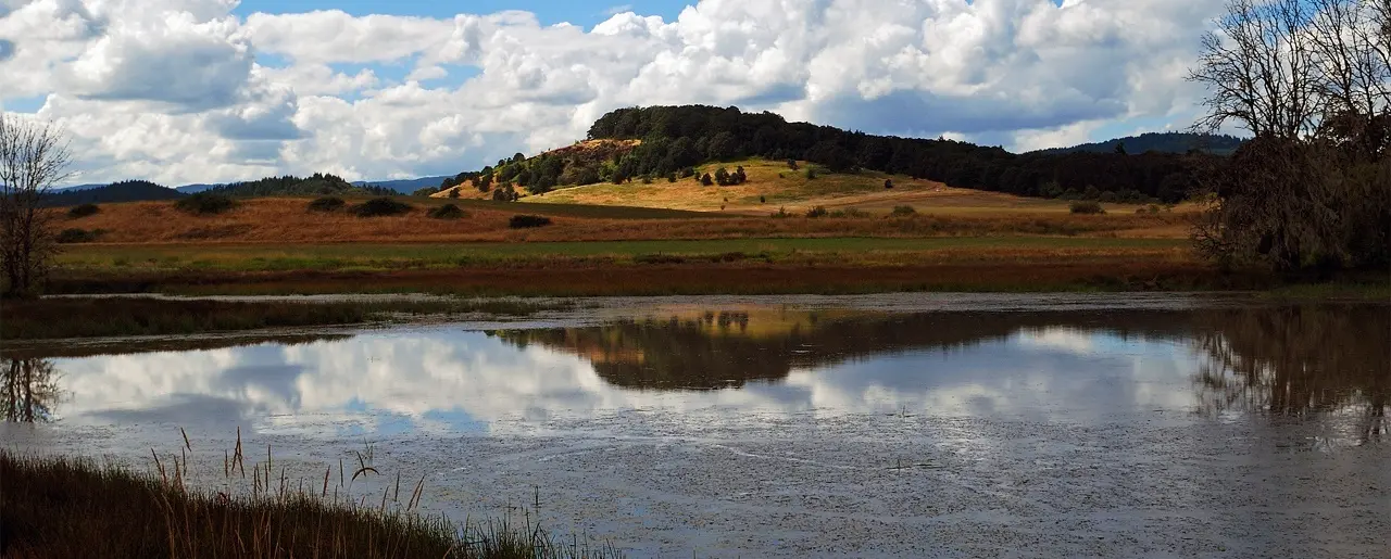
Willamette Floodplain National Natural Landmark Ice Age Floods National Geologic Trail The Willamette Floodplain represents the mix of bottom-land grasslands once common throughout the interior valleys of western Oregon and Washington. It is a large remnant example of largely un-plowed native grassland and ash woodland. The bottom-land grasslands include the largest remnants in the North Pacific Border Region. These grasslands include both the full range of bottom-land communities and the large diversity of endemic species primarily restricted to these habitats. The grassland communities include a fairly complex matrix of tufted hair grass bottom-land prairie (Deschampsia caespitosa valley prairie), sedge-meadow barley bottom-land grassland (Carex unilateralis – Hordeum branchyantherum bottomland grassland), and hawthorn- rose bottom-land shrub-land (Crataegus douglasii – Rosa nutkana bottomland shrub-land), all of which are well represented at the site in areas with pluvial clay or silty clay soils. In the better drained areas, where alluvial silt loams occur, a matrix of tufted hair grass valley prairie and red fescue valley prairie (Danthonia californica – Festuca rubra valley grassland) is found. In the very wet area along Muddy Creek are large and significant examples of Oregon ash bottom-land forests (Fraxinus latifolia/Carex obnupta and Fraxinus latifolia/Symphoricarpos albus). All of these grassland and shrub-land communities have become increasingly rare as most of the bottom-land areas in the interior valleys have been converted to farmland and to pasture. In the bottom-land grassland are found five vascular plant species listed by the U.S. Fish and Wildlife Service as candidate threatened or endangered species. The site also has populations of some threatened and endangered animal species. The area has occurrences of two threatened animals of concern to the U.S. Fish and Wildlife Service. Muddy Creek has populations of the Oregon Chub (Hybopsis crameri), a candidate species endemic to the Willamette and Umpqua River systems. The site has wintering populations of Lewis’ Woodpecker (Melanerpes lewis) and breeding Western Pond Turtles (Clemmys marmorata), both of which are considered threatened in Oregon but more common elsewhere. The site is located on essentially flat topography typical of the floor of the Willamette Valley. It is on the Calapooyia geomorphic surface, characterized by the absence of appreciable local relief. Elevation ranges from about 270 to 290 feet (82 to 88 meters). Gentle swales and ridges, which are most easily distinguished on aerial photographs, provide the only variation. Muddy Creek, a small, turbid, meandering, valley-bottom stream with associated ash forests, flows along the eastern edge of the area. Quick Facts Location:William L. Finley National Wildlife Refuge can be found off of Highway 99W 10 miles south of Corvallis, Oregon. You can also reach the Refuge via Bellfountain Rd. along the west of the Refuge.
Erratic Rock State Natural Site (Bellevue Erratic)

Erratic Rock State Natural Site (Bellevue Erratic) Ice Age Floods National Geologic Trail Six miles west of McMinnville just off of Hwy 18 sits a 90-ton rock, the Bellevue Erratic, that was floated as much as 500 miles in an iceberg by way of the Columbia River during the Ice Age Floods. The largest iceberg erratic found in the Willamette Valley, it’s originally from the Northern Rocky Mountains. When the iceberg in which it was encased melted, the rock was left behind at the 300 foot elevation level. A short uphill hike leads visitors to the Erratic Rock State Natural Site, where they can look out across the vast landscape and imagine the huge amount of water that filled the Willamette Valley during the Ice Age Floods. The Bellevue erratic rests upon a gentle hill 150 ft above the floor of Oregon’s bucolic Willamette Valley. The erratic floated in on an iceberg during a Missoula mega-flood when floodwaters backed up to 400 ft elevation behind the Kalama Gap choke-point, forming temporary Lake Allison. This is akin to Wallula Gap forming terminal Lake Lewis and Lake Condon on the southern/downstream side of the Gap, and the erratics found at ~1200ft asl there. The erratic Bellevue boulder consists of banded argillite, which can be traced back 400 miles or more to the 1.5 BILLION-year-old Belt Supergroup that lay beneath the ice dam for glacial Lake Missoula in northern Idaho! This is the source of pinkish Missoula flood sediments, as well. The discovery that erratic rocks were found at or below the 400 foot elevation in the Willamette Valley indicated that the water inundated this region from Portland down to Eugene up to 400 feet above present day sea level! The Portland region owes its rich agriculture, beautiful geography, and many handsome erratics to a series of massive Ice Age Floods that burst from an ice dam, the last of them about 15,000 years ago with a few smaller Glacial Lake Columbia mega-flood pulses finishing off around 14 kya. Quick Facts Location:Erratic Rock State Natural Site,McMinnville, OR 97128
Tualatin Public Library

Tualatin Public Library Ice Age Floods National Geologic Trail The Tualatin Public Library, located just off Interstate 5 in Tualatin, Oregon, is home to a display of Ice Age Megafauna. The Library features a striking display of an articulated partial mastodon skeleton, which was discovered in Tualatin less than a mile away. In partnership with the Tualatin Historical Society, the Library also has a display of Ice Age fossils including the sacrum of a giant ground sloth, mammoth bones, and bones from other animals; small erratics; and replicas of an ancient bison skull, mastodon tooth, and mastodon tusk. Located adjacent to the Library is Tualatin River Greenway Trail, which features a geologic timeline incorporating the Ice Age Floods, plus erratics, fossil replicas, and interpretive signage. A unique highlight of the Tualatin Public Library is its striking display of an articulated mastodon skeleton, which is mounted in front of an etched-glass image of a mastodon. The mastodon skeleton was unearthed in Tualatin near the Library in 1962 by two Portland State University students. John George grew up in Tualatin and remembered the town marshal telling about some enormous bones that he had seen in the swamp near Nyberg Creek (just south of the current Fred Meyer store parking lot). Along with Ron and George Sund, George spent a a month excavating the bones, recovering nearly half of a skeleton. The bones were originally displayed at Portland State University before being given to then Tualatin City Manager Yvonne Addington in the 1970s. After several years in storage (first in Tualatin, then at the Portland Zoo), the Tualatin Historical Society and community members raised funds to have the bones cleaned and restored, and the skeleton was put on display within the Library. The current display was created as part of the Library’s renovation and expansion in 2008. The skeleton was carbon-dated and determined to have died about 14,000 years ago. Scientists estimate this mastodon was a female who died in her 20s. Tualatin has been named as a partner on the Ice Age Floods National Geologic Trail. In partnership with the Tualatin Historical Society, the Library also currently displays several other Ice Age relics. An interactive display in the Children’s Room offers the Library’s young visitors a hands-on opportunity to learn more about these massive creatures that once roamed in Tualatin. Quick Facts Location:18878 SW Martinazzi Ave, Tualatin, Oregon 97062
Crown Point National Natural Landmark

Crown Point National Natural Landmark Ice Age Floods National Geologic Trail – Historic Columbia River Highway This spectacular viewpoint along the Historic Columbia River Highway 30 was the site of the 1916 dedication of a highway that was, for that time, an innovative European-style road that traced a winding path through the perilous Columbia River Gorge, linking Portland and The Dalles. Vista House opened in 1918 as a glamorous rest stop and observatory for those traveling the new highway. This “comfort station” was a rest stop like no other, featuring marble floors, stained glass windows — and, of course, a stunning view. In the words of The Oregonian, it was “the finishing achievement for the greatest highway in America.” Architect Edgar M. Lazarus designed the building to be functional, beautiful and commemorative; a memorial to the settlers who had traveled the final stretch of the Oregon Trail along the Columbia River. Stone panels inside are carved with the names of settler families. Listed on the National Register of Historic Places in 1974, the building fulfills Lazarus’s vision as a “temple to the natural beauty of the Gorge.” The octagonal building houses a museum, gift shop and interpretive display of historic and geologic points of interest in the Gorge. Additional information about the site’s history can be found at the National Park Service website in their Vista House brochure. The landmark is open daily, weather permitting. It closes when winds reach 50mph or more. The Columbia River Gorge at Crown Point passes from the steeper, more rugged terrain of the western slopes of the Cascade Range to the broad Willamette Valley that stretchs along the western edge of the High Cascades from Oregon into Washington. To the east the spectacular Crown Point section of the Columbia River Gorge was downcut through thick 16 million year old flood basalts by the much older Columbia River as the Cascade Range rose over the past 5 million years. About 16,000 years ago the ice-age Missoula Floods roared repeatedly through the Gorge up to 1000 feed deep, sweeping away millions of years of accumulated rock debris and even tearing out the underlying basalt bedrock to form the steep sided, box-shaped Gorge cross-section we marvel at today. The Crown Point promontory provides a strategic vantage point for observing the beautiful entrance to the wonders of the Columbia River Gorge. Crown Point also marks the beginning of the “Waterfall Corridor” that features eight waterfalls along the historic highway, including Multnomah Falls. This is an excellent place to envision how 500 cubic miles of water might have rushed through the Gorge during the great Missoula Floods an the end of the last ice age. Quick Facts Designation: National Natural Landmark Location: 40700 Crown Point Hwy, Corbett, OR 97019 MANAGED BY: Oregon State Parks IMPORTANT: Hours and weather closures are posted at vistahouse.com, or by calling 503-344-1368. Check Vista House’s weather station before you go. Parking areas are open 6 a.m. to 9 p.m. Please note: the Historic Highway has instituted a reservation system. To travel the Waterfall Corridor timed Use Permits are needed from May 24th through September 5th.