
Oral/Pictorial Video History of the Palouse Area
This 1/2-hour video begins with the Ice Age Floods impact on the Palouse area, then goes on with a fascinating oral and pictorial history of the area. The video was produced by Mortimore Productions for the Whitman County Library with materials and information provided by a bevy of contributors, including several IAFI members. This is a must view if you’re planning to travel to the Palouse Falls Chapter. In this stunning video you’ll learn about the Floods impact, early settlers, mule trains, sheep herders, and so much more that will make the event ever more personal and relevant. Whitman County Library – Ice Age v06 from Mortimore Productions on Vimeo.
Tualatin Ice Age Foundation Established
A Tualatin, Oregon Ice Age Foundation has been established to provide educational and economic opportunities for area residents, students, businesses and visitors. Local interest in ancient ice-age animals started in the 1970s when a Portland State University college student dug up half of a mastodon skeleton in Tualatin, which now is on display at the Tualatin Library along with several other ancient animal bones from such as mammoths, giant sloth, and bison. In 2018 a Foundation board was created to guide the foundation and raise funds for the center. The board includes Portland State University Geology Professor Emeritus Scott Burns as President; Yvonne Addington, Tualatin Historical Society; Linda Moholt, Executive Director of Tualatin Chamber of Commerce; Paul Hennon, retired Tualatin Parks Director; Jerianne Thompson, Tualatin Librarian; and Rick and Sylvia Thompson of the Ice Age Floods Institute, Lower Columbia chapter. Prior to the Foundation being established, an Ice Age Heritage Tourism Plan, funded by Washington County Visitor’s Association, which contained recommendations for further development by an international consultant, Bill Baker, owner of Total Destination Management. Baker recommended a new Ice Age Interpretive Center to house more of the collections and educate residents and visitors. According to Baker, “the Tualatin area was front and center for one of the greatest natural events of the last ice advance: a series of colossal floods that roared down the Columbia Gorge and pooled in the Tualatin and Willamette Valleys between 18,000 and 15,000 years ago. The entire Tualatin area landscape was shaped by those floods.” Baker saw important economic development, jobs and educational opportunities and recommended a new Tualatin Ice Age Foundation to implement opportunities and raise funds for a Tualatin Ice Age Interpretive Center. Portland State University, the University of Oregon and the Ice Age Floods Institute, Lower Columbia chapter have, for several years, been assisting the Tualatin Historical Society in seeking the prehistory of Tualatin. The National Park Service has identified Tualatin as a key Ice Age Floods National Geologic Trail hub. The City has continued their efforts to display their ice age prehistory by the development of the Tualatin River Greeway Trail and Fred Bruning, chief executive for Center Cal shopping centers, donating to the public, a $220,000 bronze statue of the Tualatin Mastodon. To date, many ancient animal bones and huge multi-ton erratics carried here by roaring floods have been found. Private donations of bones continue to be offered as we seek funding for this unusual historical project of building our interpretive center. Tualatin invites you to come see the displays and exhibits we already have at the library, Tualatin Heritage Center, in our parks and walkways and in the future in our Ice Age Interpretitive Center. For more information on Tualatin’s ice age history go to: https://tualatinchamber.com/visitor/ice-age/.
My Visit to the Othello Sand Crane Festival
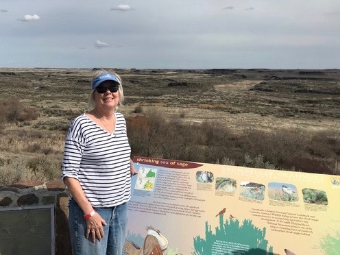
My husband and I attended the 2019 Sandhill Crane Festival in Othello, WA. We went because of my interest in seeing the ice age flood related features, but I also wanted to the the Sandhill Cranes – which we were told accumulate there by the hundreds of thousands. They are large, heron-like birds that like to fuel up in the fields on remnants of corn and alfalfa before heading north for the summer. We were warned to register for events as soon as possible, which we did. Nevertheless, the motels in Othello, a town of 7700, were full, so we stayed in Moses Lake, which is about 15 miles from Othello. The Festival used the high school gymnasium for exhibits and kid’s handicrafts and the classrooms for lectures and presentations. The events are obviously well attended because the parking lots were completely full. My husband was pleasantly surprised to be greeted by the mayor! I enjoyed seeing the familiar faces at the Ice Age Floods Institute exhibit. Our first tour, the evening we arrived, was out to the fields to see the cranes. We had a Fish and Wildlife biologist and an engineer from the Columbia Valley Irrigation Co. Apparently the cranes winter in Central Valley, Calif. and summer in Bristol Bay. They tend to be “right wing” (pun intended). As promised, they were present in the fields in the several thousands. Fortunately, our guides know which fields and sections line roads to take. The cranes make a unique noise, very distinguishable from the honking of geese. There were also hundreds of thousands of snow geese circling like clouds overhead. Unfortunately, the Pothole Lakes were still frozen. The irrigation engineer provided interesting input with regard to the value of the irrigation system, i.e. water provided by the Grand Coulee Dam and a sandy loam soil provided by the ice age floods, The area was obviously rich agriculturally. Our Saturday field trip was with Brent Cunderla, former BLM geologist. He took us through portions of the channeled scab land formations and provided a good overview of the flood story. We listened to his talk prior to the field trip – which provided background on what we were to see. Our Sunday field trip was a hike through the Drumheller channels with Bruce Bjornstad, also a geologist and author of several papers and books on the Ice Age Floods. Drumheller is a state park that includes buttes and cliffs on the columnar basalts. Although I was focused on scab-land geology, the festival had speakers and field trips by many biologists, regional geologists, and and naturalists. If I were to do this again, and I’m tempted, I would attend some of these. All in all, it was a lot of fun. by Lynne Dickman
“Gorge-ous Night Out” in Olympia
For the past four years and more, Gorge people and businesses have provided Oregon and Washington legislators and staff a casual “Gorge-ous Night Out” evening event to remind them and raise their awareness of the Columbia River Gorge. The intent of these matching events in both Salem and Olympia is not to lobby the legislators for anything in particular, but to remind them that we’re here, we’re vibrant, and we’re an economic and cultural force for both states. The IAFI Columbia River Gorge Chapter has been part of most of these events, educating the legislators about the Ice Age Floods story, and citing the economic role that Floods tourism can and does play in both local and state economies. It is somewhat surprising how few of the legislators have even visited some of the spectacular Floods sites throughout the region. So we premiered for them some of the new chapter tourism brochures we plan to release soon, and encouraged them to “get out on the road” for an awe inspiring look at the landscape and people they represent. We even agreed to requests for guided tours of Gorge geology from a couple of legislators and their staff. What better way to entertain and educate them while building a relationship that we can count on when we do need to ask them for their support.
“Hiding in Plain Sight”
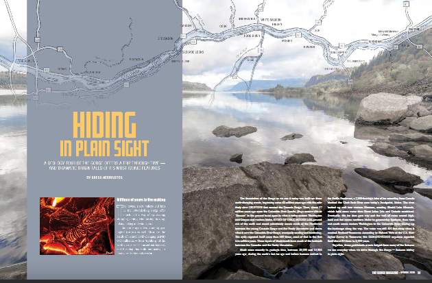
Millions of people who visit and pass through the Gorge each year don’t realize the scope of the cataclysmic stories behind the stunning and tranquil beauty they are surrounded by. The Spring 2019 edition of The Gorge Magazine (page 50) attempts to address that premise with a feature article about the geology of the Columbia River Gorge titled “Hiding in Plain Sight“. The author, Gregg Harrington, who is not a geologist, used a private tour with Lloyd DeKay, president of the Columbia River Gorge Chapter, as well as other local geologists as a basis for much of the article. The article touches on 40 million years of Gorge geology, including the Ice Age Floods, and highlights some of the more interesting geological features of this popular tourist destination. Hopefully, articles like this, along with IAFI field trips, lectures and website, will help many recognize and realize some of the tumultuous story that lies behind the enchanting scenery, and make them “never see the Gorge in the same way again”. The magazine is available online and begins at page 50. We had hoped for an Ice Age Floods Institute website mention, but a planned “For more information” section was not included in the article. Still, the article covers a lot of interesting geology of an extremely popular destination, and an article like this is a significant contribution to our efforts to inform and educate the public about the Ice Age Floods.
New – Lower Columbia Chapter Brochure
The Lower Columbia Chapter of IAFI recently produced the third IAFI chapter-specific “Our Cataclysmic Floodscapes” brochure, a guide to several of the key Ice Age Floods sites in the Portland Basin. This multi-panel brochure includes brief descriptions and map locations for five key sites, The Story of the Great Floods, Interesting Flood Facts, information about the Lower Columbia Chapter, and more. Expanded out the brochure measures 18″x23″, but it is folded to a rack card size for distribution to visitor centers. Click here to view a PDF of the brochure, and for more information about where a brochure can be obtained please contact Rick Thompson, President of the Lower Columbia Chapter (Rick@GigaFlood.com).
2018 Annual IAFI Field Trip – Lower Columbia Chapter
We started our field trip at the Tualatin library where the bones of a number of ice age mega-fauna are on display. Yvonne Addington led us through the displays and explained some of her role in arranging to have the bones in Tualatin where they were found. After the library we took a stroll on the Tualatin River Greenway Trail where we were instructed by several members of the Rivers of Life Youth Tourism Corp. who volunteered to be docents on the trail. We viewed signs, erratic boulders, casts of the mega-fauna and granite insets with maps and timelines. This $3.8 million trail was put in a couple years ago as part of Tualatin’s ice age identity as well as the $230,000 bronze statue of a young mastodon and a stylized image of the boy who dug it up only about a mile from where the bronze is today. Most of the actual skeleton of the mastodon is now on display in the library. After viewing the statue we went to the neighboring town of West Linn. At Fields Bridge Park we walked the nature trail with its three kiosks revealing the story of the ice age floods and the Willamette Meteorite that landed not far from there when the iceberg it was carried in was grounded on the hillside. From Fields Bridge Park we traveled east on Willamette Falls Drive over the gravel bar that the town of Willamette was built on. We then stopped at the I-205 overlook to see Willamette Falls. This Falls is the second largest in the United States by volume after Niagara Falls. Since this has been a fairly dry year it was easy to see the basalt rocks that the river cascades over. After lunch at Tualatin Community Park we took a short drive to the Tualatin Heritage Center; home of the Tualatin History Society. It is here where the molar and tusk from the Tualatin mastodon is housed as well as a collection of ice rafted boulders from the surrounding area. Yvonne Addington, former president of the Tualatin Historical Society, described the display of news articles, photographs and book covers telling the story of the Center and the ice age features. Our next stop, the Tualatin Commons, has a man-made lake with undulating hand-railing representing the wave action of the Ice Age floods and glass drinking fountains representing icebergs in those floods along with several ice rafted boulders; one being an argillite. Partly for fun and partly to see how a community can capitalize on an ice age idea we went to Ibach Park with its symbolic ice age floods play structures. The spongy blue pavement represented the water; some of it including ripples with icebergs. In the sand area children can dig for replica fossils and with the water feature they are able to make their own ice age floods through a collection of ice rafted erratics. We viewed the sign that for the last 20 years has been telling people about the ice age floods, the Willamette Meteorite, the mastodon and the local history. This award-winning park and its structures and signage was years ahead of other areas in adopting the ice age floods theme. Click here to view the full article with many more pictures. Between the towns of Tualatin and Sherwood there is a series of ice age flood channels that funneled the water from the Tualatin Valley into the Willamette Valley. This area is called the Tonquin Scablands. We stopped to view an erosional remnant of two basalt flows separated by a soil horizon and Coffee Lake, a kolk lake, created when two flood channels converged and formed a vortex that removed rock and soil leaving what is now a coffee-colored lake. We then drove along the largest of the 14 Tonquin Flood Channels to an area where we could get out and view that channel both north and south.
Ice Age Features in Shallow Waters
Many of the features left behind by the ice age floods are not apparent to the average visitor to areas where the floods were relatively shallow, such as the Bitterroot River valley south of Missoula, Montana. The Bitterroot Valley has erratics and subtle strandlines in several locations. J.T. Pardee, the Montana geologist who in the early 1900’s identified the source of the water for Bretz’s flood, published a paper and sketches specifically about the Bitterroot valley, where he was living at the time. These features can be used to tell the Ice Age Floods story if put together in a useable format. That is just what happened this summer when Jessica Dufresne, a local elementary school librarian, was selected to develop a curriculum aimed at 4th-8th grades under the National Park Service’s Teacher Ranger Teacher program. The program is aimed at linking to lesser known park units such as the Ice Age Floods National Geographic Trail to underserved student populations and offers professionals the opportunity to learn about the resources and educational materials available through the National Park Service. Dufresne, daughter of Glacial Lake Missoula chapter vice president Lynne Dickman, grew up with geology and always found it interesting. Now she can share that enthusiasm with other teachers and young learners. Other partners in the grant were the Montana Natural History Center and the Bitterroot Cultural Heritage trust. The Glacial Lake Missoula chapter also assisted in locating these features and plans to add them to its field trips and its map and guide.
Uncovering a Columbian Mammoth
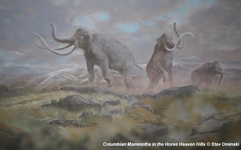
There’s a Columbian Mammoth hiding out in Coyote Canyon down Kennewick way, and MCBONES Research Center Foundation is working to uncover his/her hiding place. For a small contribution you can tour this hide-and-seek site, or you can volunteer to help uncover the hidden mammoth. Sound interesting? Find out more in this short video produced by Mark Harper of “Smart Shoot“, or visit the MCBONES website. The Mid-Columbia Basin Old Natural Education Sciences (MCBONES) Research Center Foundation provides local K-12 teachers and their students, as well as other volunteers, an opportunity to actively participate in laboratory and field-based research in paleontology, geology, paleoecology, and other natural sciences primarily within the Mid-Columbia Region of southeast Washington State.
The Cerutti Mastodon Site – A Bretz Type Controversy of Our Time
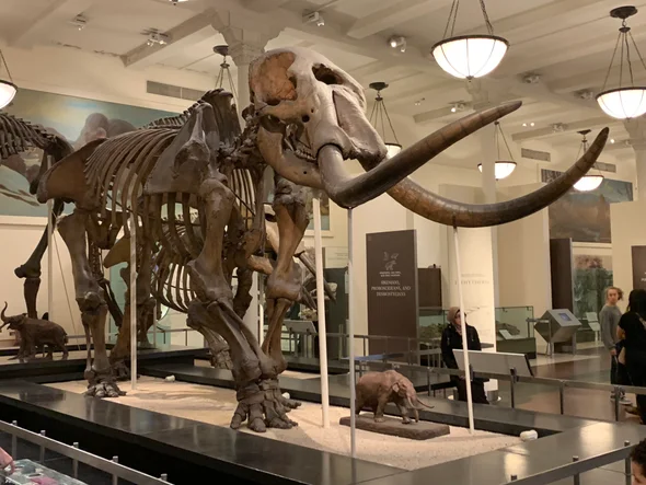
In March, while visiting San Diego, I went to the San Diego Museum of Natural History in Balboa Park and toured the remarkable Cerutti Mastodon Site exhibit. This controversial exhibit of a mastodon site is notable for its claim that the mastodon’s bones were broken by humans 130,000 years ago, making it far older than any other such site in North America. The signs at the beginning of the exhibit read as follows; “The Cerutti Mastodon discovery. A San Diego find reveals the earliest evidence of of human life in North America. In 1992, paleontologists from the San Diego Natural History Museum were surveying a highway construction site to identify and salvage any fossils that might be unearthed. “Field paleontologist Richard Cerutti spotted some bones and tusks. Exploring further, the team discovered that these were bones of a mastodon-an extinct relative of elephants. “But Richard noticed something unusual. The bones were mysteriously broken and the pieces separated. “It took 22 years for scientists to solve the riddle. Once they did, they realized that this local site is evidence of human presence on this continent 130,000 years ago-much earlier than we thought possible. “In 2014, scientists made a new discovery about the age of the Cerutti Mastodon Site. How did this happen? Scientists figured out the age of the mastodon bones using radiometric dating. It’s a way of telling how old a rock or fossil is by measuring its radioactive isotopes. “A radioactive isotope transforms into an isotope of a different element over time. If you know the rate at which the “parent” isotope transforms into its “daughter” isotope, measuring the parent-daughter ratio tells you how old the material is. “Scientists used a method that measures the ratio of the radioactive isotope uranium-234 to its daughter isotope thorium-230. Dramatic improvements in this method have made it a highly accurate means of dating very old materials- up to 500,000 years. In 2014, scientists used this method to date bones at the Cerutti Mastodon Site. “The results were clear. The bones are approximately 130,000 years old.” More than two decades after the Cerutti mastodon’s discovery in southern California in 1993, USGS scientist Dr. James Paces was sent several bones of unknown age. The specimens were important because they came from a site with abundant evidence of processing by ancient humans. Advances in analytical capabilities and the understanding of processes that incorporate natural uranium and its decay products in fossil bone provided archaeologists with a radiometric dating tool that, at least in some cases, could confidently and accurately determine ages for these older materials. After analyzing nearly 100 subsamples from multiple specimens, Dr. Paces determined that the mastodon bones—which were still fresh when someone fractured them using hammerstones and rock anvils—were covered with sediments 131,000 years ago, give or take about 9,000 years. This result indicates that some form of archaic humans arrived in the Americas more than 100,000 years earlier than scientists had thought possible. Following the dating of the bones officials at the Natural History Museum began making plans for a permanent exhibit about the discovery. The exhibit opened in 2017. It is very thorough and includes bones, alleged hammerstones, and anvil rocks from the original mastodon site as well as numerous photos and interpretive panels. When J Harlen Bretz first announced in the 1920’s his theory that the scablands of eastern Washington State had been carved out by a cataclysmic flood he met stiff opposition. What he was proposing was so far out of the mainstream of geological thinking of the time that many scientists couldn’t accept it. Schooled in uniformitarianism they believed that earth’s landforms were all created by slow gradual processes operating over time and that an event of the magnitude Bretz was proposing just wasn’t possible. They tried to come up with alternative explanations for the facts Bretz presented that fit in with their current frame of reference. Yale University geologist Richard Foster Flint famously said of certain flood features in the scablands that they presented “a picture of leisurely streams with normal discharge.” The claim by San Diego’s Natural History Museum that the Cerutti site is 130,000 years old is likewise far outside what many scientists of our time are ready to accept. Other similar sites are much younger. For example Sequim’s famous mastodon site is only 13,800 years old. If the San Diego Natural History Museum is correct it totally rewrites the history books about humans in North America. It places humans in North America during a previous interglacial period. It would establish that humans had long since been in North America during the time of the comparatively recent ice-age floods. Critics of the Natural History Museum, and there are many, point to things like what they consider to be a lack of lithics from the site. Others speculate that the signs of bone breakage observed at the site may have been caused by some other creature besides humans or by modern day construction equipment. But the Natural History Museum counters that none of the critics have provided a satisfactory alternative explanation for the evidence that they’ve presented. Cerutti and his team of researchers and the San Diego Natural History Museum remain unequivocal in their conclusion: The Cerutti Mastodon Site is a 130,000 year old archaeological site. – by Mark Sundquist, Puget Lobe Chapter “Ideas without precedent are generally looked upon with disfavor and men are shocked if their conceptions of an orderly world are challenged.” J Harlen Bretz 1928 “Extraordinary claims require extraordinary evidence – each aspect requires the strongest scrutiny,” Chris Stringer