Palouse Falls State Park

Palouse Falls State Park Ice Age Floods National Geologic Trail The Palouse River runs through a narrow cataract and drops 200 feet to a churning bowl. From there, the current moves swiftly, through a winding gorge of columnar basalt, to its southern end at the mighty Snake River. Carved more than 13,000 years ago, Palouse Falls is among the last active waterfalls on the Ice Age Floods path. This natural wonder was named Washington’s state waterfall in 2014, when the state Legislature passed a bill written by local schoolchildren, who advocated for the designation. Palouse Falls is an artist’s dream, and many a painter or shutterbug has set up an easel or camera and tripod to capture the falls in the changing light. Others make the trip in all four seasons, when the water is high, low or frozen, because they understand that once is not enough when it comes to seeing Washington’s own state waterfall. PARK FEATURES This 94-acre park is known as an ideal picnic and birding spot. The park offers three distinct views of the falls. The lower viewpoint provides a direct view; it is reached by a set of steps from the main day-use area adjacent to the parking lot. The second, at the end of a paved interpretive path, tells the story of the secluded canyon. Both the interpretive path and gravel secondary parking area lead to the third and highest viewpoint, the Fryxell Overlook, offering panoramic views of the falls and Palouse River Canyon. Visitors should be prepared for a remote recreational experience. There is no phone service at the park, and staff and volunteer hosts are not always available. Please follow Leave No Trace principles, and experience this view-shed from the designated, developed areas. Your positive stewardship protects cultural and natural resources. Automated pay station: This park is equipped with an automated pay station for visitors to purchase a one-day or annual Discover Pass and boat launch permit. Parking at Palouse Falls State Park is limited. Expect long waits on weekends and holidays. Trailer and RV parking is not possible during these times; turnarounds do not exist, and RVs or trailers will not be permitted entrance into the park. Nearby Lyons Ferry State Park offers swimming and picnicking. Tips for your visit to Palouse Falls: Visitors are advised to bring drinking water, hand sanitizer and toilet paper Take along plenty of water, the park has no potable water available Be prepared for extreme heat Plan ahead for potential wait times No camping available No overnight parking is allowed No nighttime photography is allowed Quick Facts Location:Washtucna, WA 99371 Phone:(509) 646-3229 MANAGED BY:Washington State Parks A Discover Pass is required for vehicle access to state parks for day use. For more information about the Discover Pass and exemptions, please visit the Discover Pass website.
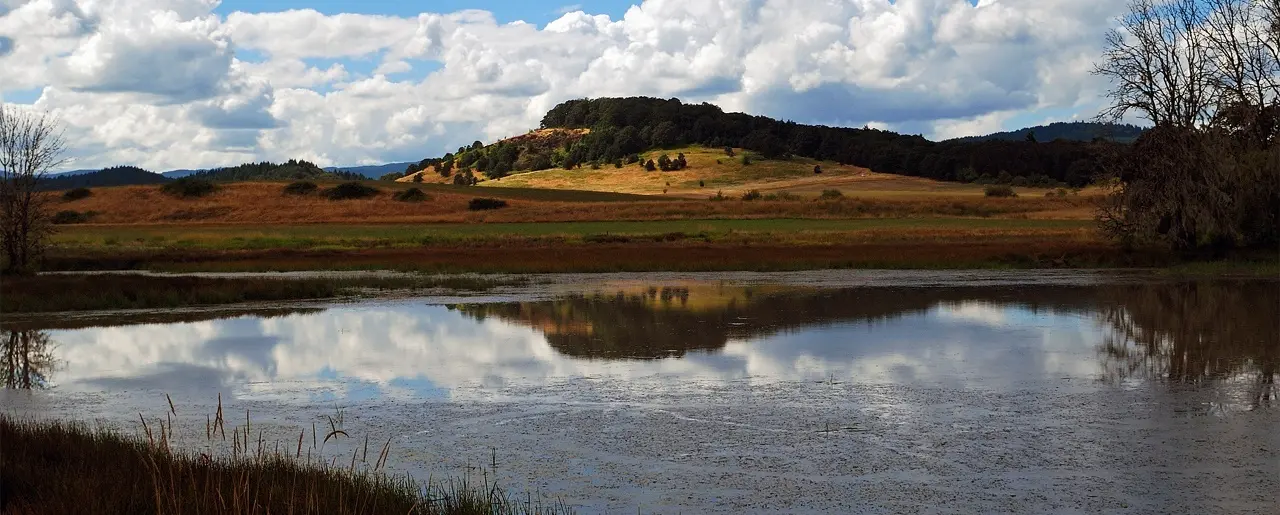
Scooteney Reservoir

Scooteney Reservoir Ice Age Floods National Geologic Trail Situated about nine miles southeast of Othello, west of Highway SR-17, this body of water has a year-round open fishing season. Smallmouth Bass, Largemouth Bass, Walleye, Bluegill sunfish, crappie, and Yellow Perch produce good action throughout the year. The lake has a large population of Lake Whitefish. This lake is popular for ice fishing when conditions allow. The Bureau of Reclamation campground has a developed access area with boat launch, a small dock, and toilets. All around are signs of Ice Age floods and there effects on the landscape. Explore…!!! Quick Facts MANAGED BY:Washington Department of Fish and Wildlife
The Great Gravel Bar of Moses Coulee National Natural Landmark
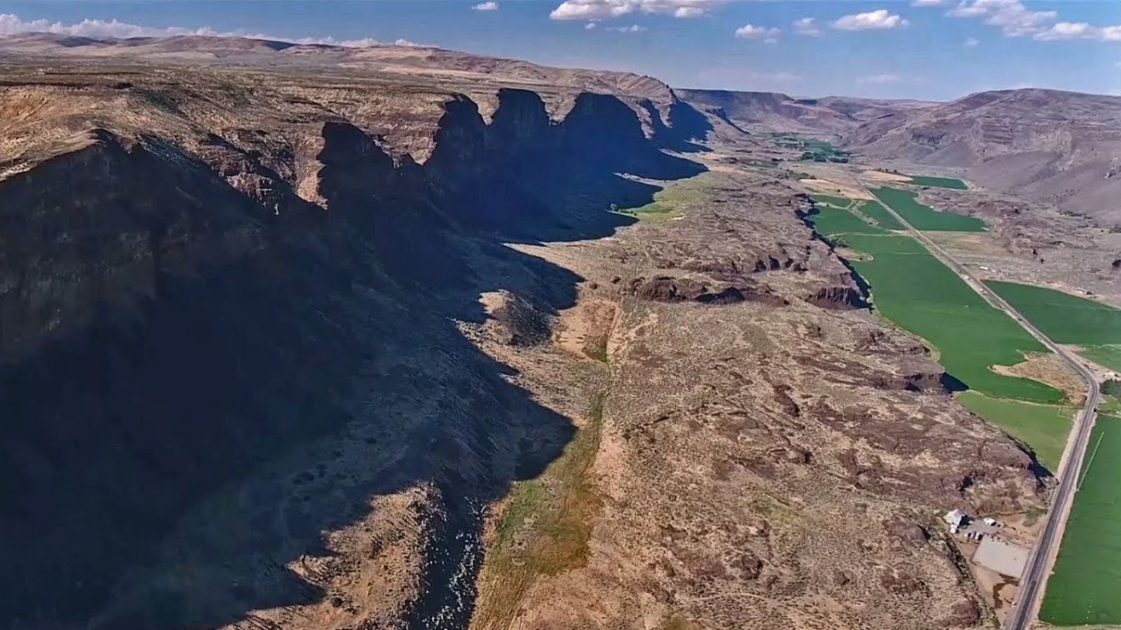
Moses Coulee NNL – Great Gravel Bar Ice Age Floods National Geologic Trail At the time of one of the first floods to be released from Glacial Lake Missoula, the Okanogan Lobe of the continental ice sheet had spread across the Columbia Valley and onto the Columbia Plateau to a position about 24 kilometers (14 miles) north of the site and so had caused the diversion of the glacial Columbia River into the former channel of Moses Coulee. When the outburst flood occurred, violently erosive torrents rushing down the Columbia River drainage were diverted into the Moses Coulee channel, causing in a single flood event the formation of a long, deep coulee second only to the Grand Coulee in size (see Grand Coulee NNL). Powerful eddies in the turbulent waters formed behind protrusions in the coulee walls along the inside of channel meanders (i.e. especially Armour Draw and the draw 1.6 kilometers (1 mile) north of Armour) and further enlarged the embayments behind those protrusions. As the sediment-laden flood currents waned, a 61 meter (200 feet) sheet of gravel was deposited along the coulee floor and a giant teardrop-shaped gravel bar, the so-called “Great Gravel Bar”, formed where flow velocities were lower behind one such prominent bedrock protrusion in the coulee wall. Although many other flood-related bars occur throughout the Channeled Scabland, the Great Gravel Bar is 5.2 kilometers (3.2 miles) long and as much as 74 meters (240 feet) high and so is perhaps the largest of all. It is known as a “pendant” bar because of its teardrop shape and sheltered position in the coulee which is about 180 meters (590 feet) deep and 1.5 kilometers (1 mile) wide at that location. The bar is composed mainly of pebble-cobble gravel and many large boulders occur on its surface. Most boulders are basaltic, derived from erosion of the coulee walls farther upstream, but a few granitic and other non-basaltic boulders probably were ice- rafted from afar on giant bergs caught in the flood before deposition in the coulee. One feature providing convincing evidence for the bar’s constructional formation is an elongate depression about 1 kilometer (0.6 mile) long on the bar’s west side, caused by eddy circulation in the water- filled coulee during deposition of the bar. After the flood the ice sheet advanced another 17 kilometers (10 miles) to its southern-most limit at the head of Moses Coulee. Melt-water streams coursing across the flood gravels in the coulee superimposed an out-wash channel network still visible along the valley floor. Since retreat of the glacier, the site has been little modified even by the intermittent stream now occupying the coulee. Alluvial fans built by tributary streams and talus derived from extensive rockfall now lie along the base of the coulee walls. In addition, patchy deposits of wind-deposited silt and volcanic ash (i.e. primarily from the Glacier Peak and Mazama eruptions 12,000 and 6,600 years ago respectively) cover portion of the bar and coulee floor. Quick Facts Location: The North Entrance to this area is 20 Miles west of Coulee City on State Route 2. Turn south on Moses Coulee Road. Property Privately Owned Stay on public roads, no access allowed at this time.
The Reach Museum
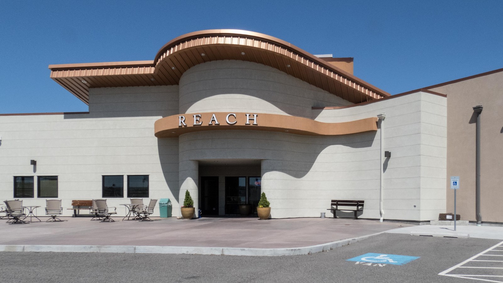
The Reach Museum Ice Age Floods National Geologic Trail, Manhattan Project National Historical Park The REACH Museum shares the natural and human history of the Tri-Cities and the surrounding area. The museum takes its name from Hanford Reach, the longest free flowing (un-dammed), non-tidal section of the Columbia River. The 51mile (82 kilometer) Reach marks the northern and eastern boundary of today’s Hanford Site. Its waters were critical to the site’s plutonium production mission during the Manhattan Project and Cold War. The Hanford Reach’s wild and untamed nature is a direct legacy of the Manhattan Project and the Cold War. Manhattan Project officials removed pre-war agricultural operations and prohibited further development. This formed a large security buffer surrounding the project and inadvertently preserved the shrub steppe ecosystem. When plutonium production stopped, the reduced size of the Hanford Site opened the opportunity for creation of the Hanford Reach National Monument, the US Fish and Wildlife Service’s first national monument. The REACH Museum features rotating and permanent exhibits, including robust presentations on the Manhattan Project, Cold War, indigenous peoples, and cataclysmic ice age floods. An outdoor learning area displays a sampling of the shrub steppe and riparian ecosystems and provides hands-on, interactive activities that are fun while teaching important themes including irrigated agriculture, hops cultivation, local animals, native plants, and land formation. Visit the Reach Museum website for hours of operation and current activities. Continue Your Journey The Hanford Reach National Monument offers hiking at places such as the White Bluffs Overlook, Hanford High School Overlook, and Saddle Mountain, where you may enjoy expansive views of the Hanford Site and the beauty of the shrub steppe ecosystem. Quick Facts Location:Richland, WA MANAGED BY:REACH Museum
Wallula Gap National Natural Landmark
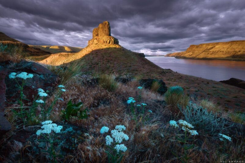
Wallula Gap National Natural Landmark Ice Age Floods National Geologic Trail The Horse Heaven Hills are the southern border of the Central Basin area of the Columbia Basin and the Wallula Gap is the opening through which all of the Columbia and Snake River waters escape the basin. Wallula Gap is the largest, the most spectacular and the most significant of the several large water gaps through basalt anticlines in the Columbia Basin. During the Pliocene and early Pleistocene the thick basalt flows of what is now southern Washington were wrinkled and uplifted into a long northeast-southwest trending anticlinal ridge which we call the Horse Heaven Hills. The uplift of this structure was more rapid than the ability of the ancestral Columbia River to down-cut, thus a great lake, Lake Lewis, was impounded in the Pasco Basin area. The remains of the lake beds formed in this lake are the Ringold Formation. Once Lake Lewis was filled to overflowing, it established an outlet over the lowest saddle in the ridge at the location of Wallula Gap. The Columbia then poured down the steep south flank of the Horse Heaven Hills anticline in cascades and waterfalls which eroded slowly downward and head-ward until the ridge was completely breached, Wallula Gap was formed and the waters of Lake Lewis, along with considerable quantities of the Ringold sediments, drained down the Columbia Gorge into the sea. During the late Pleistocene the greatly increased melt-waters from the ice sheets and Cascade glaciers caused floods, perhaps annually, which also encountered the constriction of Wallula Gap. The gap may have also been dammed by jammed icebergs and ice cakes, causing the temporary and intermittent rebirth of Lake Lewis. This ephemeral lake left bottom deposits called the Touchet Beds. These giant floods filled the basin with a great temporary lake, which rapidly drained out through Wallula Gap. At the height of the Ice Age Floods the water flow through Wallula Gap has been estimated at 166 cubic kilometers (40 cubic miles) per day, a rate nearly twice the combined flow of all the present rivers on earth! This outlet of Wallula Gap, constricted in a relative sense only, (i.e. since it is more than 1.6 kilometers [1 mile] from rim to rim) controlled the discharge from the Pasco Basin and is dramatic and illustrative evidence of the magnitude of these flood waters. Quick Facts Significance:All of the flood waters that cut the channeled scablands of southeastern Washington from the Bonneville and Spokane floods were channeled through Wallula Gap. Designation:National Natural Landmark OPEN TO PUBLIC:No
Yakima Sportsman State Park
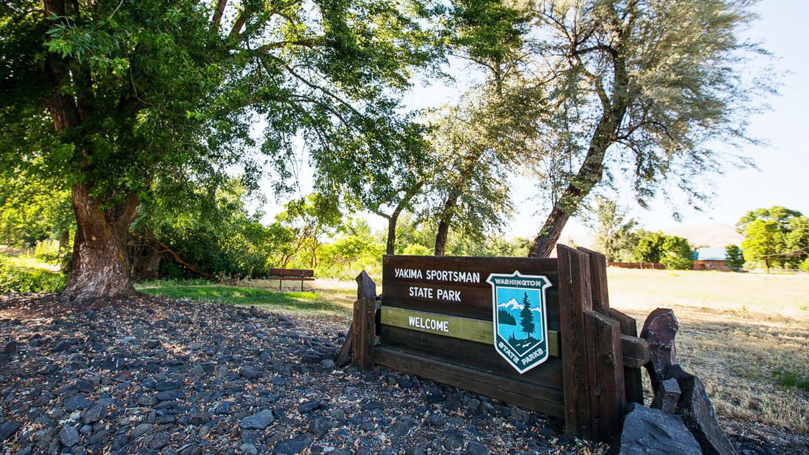
Yakima Sportsman State Park Ice Age Floods National Geologic Trail Yakima Sportsman State Park is, literally, an oasis in the desert. Located near the urban amenities of Yakima in arid eastern Washington, this park attracts local picnickers, out-of-town visitors and road-trippers passing through. Birds flock to Yakima Sportsman, and so do birders, their binoculars and field guides in hand. The Yakima River flood plain sustains a natural wetland of marshes, grasses and ponds, welcoming habitat for 140 bird species. Wood ducks are the stars of the show, but dramatic red-winged blackbirds, herons and hawks make their home near the park’s juvenile fishing pond, which is stocked with rainbow trout and open to young anglers. The gentle trails come alive in season. The trees turn red, orange and yellow in fall, and spring brings a riot of lilies, chokecherry, dogwood and blossoming catalpa trees. Green lawns and tree shade make this a lovely camping or picnic spot in summer. PARK FEATURES Yakima Sportsman State Park is a 266-acre camping park originally created by the Yakima Sportsman’s Association to promote game management and the preservation of natural resources. The park is an irrigated green zone in an otherwise desert area and has a variety of deciduous trees in the camping and picnic areas. More than 130 species of bird make wildlife watching a delight. The campground is a stay-over place for events at the Yakima Sun-Dome and fairgrounds. Discover Pass: A Discover Pass is required for vehicle access to state parks for day use. For more information about the Discover Pass and exemptions, please visit the Discover Pass web page. Quick Facts Location:904 University Parkway Yakima, WA 98901 MANAGED BY:Washington State Parks A Discover Pass is required for vehicle access to state parks for day use. For more information about the Discover Pass and exemptions, please visit the Discover Pass web page.
Willamette Floodplain National Natural Landmark
Willamette Floodplain National Natural Landmark Ice Age Floods National Geologic Trail The Willamette Floodplain represents the mix of bottom-land grasslands once common throughout the interior valleys of western Oregon and Washington. It is a large remnant example of largely un-plowed native grassland and ash woodland. The bottom-land grasslands include the largest remnants in the North Pacific Border Region. These grasslands include both the full range of bottom-land communities and the large diversity of endemic species primarily restricted to these habitats. The grassland communities include a fairly complex matrix of tufted hair grass bottom-land prairie (Deschampsia caespitosa valley prairie), sedge-meadow barley bottom-land grassland (Carex unilateralis – Hordeum branchyantherum bottomland grassland), and hawthorn- rose bottom-land shrub-land (Crataegus douglasii – Rosa nutkana bottomland shrub-land), all of which are well represented at the site in areas with pluvial clay or silty clay soils. In the better drained areas, where alluvial silt loams occur, a matrix of tufted hair grass valley prairie and red fescue valley prairie (Danthonia californica – Festuca rubra valley grassland) is found. In the very wet area along Muddy Creek are large and significant examples of Oregon ash bottom-land forests (Fraxinus latifolia/Carex obnupta and Fraxinus latifolia/Symphoricarpos albus). All of these grassland and shrub-land communities have become increasingly rare as most of the bottom-land areas in the interior valleys have been converted to farmland and to pasture. In the bottom-land grassland are found five vascular plant species listed by the U.S. Fish and Wildlife Service as candidate threatened or endangered species. The site also has populations of some threatened and endangered animal species. The area has occurrences of two threatened animals of concern to the U.S. Fish and Wildlife Service. Muddy Creek has populations of the Oregon Chub (Hybopsis crameri), a candidate species endemic to the Willamette and Umpqua River systems. The site has wintering populations of Lewis’ Woodpecker (Melanerpes lewis) and breeding Western Pond Turtles (Clemmys marmorata), both of which are considered threatened in Oregon but more common elsewhere. The site is located on essentially flat topography typical of the floor of the Willamette Valley. It is on the Calapooyia geomorphic surface, characterized by the absence of appreciable local relief. Elevation ranges from about 270 to 290 feet (82 to 88 meters). Gentle swales and ridges, which are most easily distinguished on aerial photographs, provide the only variation. Muddy Creek, a small, turbid, meandering, valley-bottom stream with associated ash forests, flows along the eastern edge of the area. Quick Facts Location:William L. Finley National Wildlife Refuge can be found off of Highway 99W 10 miles south of Corvallis, Oregon. You can also reach the Refuge via Bellfountain Rd. along the west of the Refuge.
Erratic Rock State Natural Site (Bellevue Erratic)

Erratic Rock State Natural Site (Bellevue Erratic) Ice Age Floods National Geologic Trail Six miles west of McMinnville just off of Hwy 18 sits a 90-ton rock, the Bellevue Erratic, that was floated as much as 500 miles in an iceberg by way of the Columbia River during the Ice Age Floods. The largest iceberg erratic found in the Willamette Valley, it’s originally from the Northern Rocky Mountains. When the iceberg in which it was encased melted, the rock was left behind at the 300 foot elevation level. A short uphill hike leads visitors to the Erratic Rock State Natural Site, where they can look out across the vast landscape and imagine the huge amount of water that filled the Willamette Valley during the Ice Age Floods. The Bellevue erratic rests upon a gentle hill 150 ft above the floor of Oregon’s bucolic Willamette Valley. The erratic floated in on an iceberg during a Missoula mega-flood when floodwaters backed up to 400 ft elevation behind the Kalama Gap choke-point, forming temporary Lake Allison. This is akin to Wallula Gap forming terminal Lake Lewis and Lake Condon on the southern/downstream side of the Gap, and the erratics found at ~1200ft asl there. The erratic Bellevue boulder consists of banded argillite, which can be traced back 400 miles or more to the 1.5 BILLION-year-old Belt Supergroup that lay beneath the ice dam for glacial Lake Missoula in northern Idaho! This is the source of pinkish Missoula flood sediments, as well. The discovery that erratic rocks were found at or below the 400 foot elevation in the Willamette Valley indicated that the water inundated this region from Portland down to Eugene up to 400 feet above present day sea level! The Portland region owes its rich agriculture, beautiful geography, and many handsome erratics to a series of massive Ice Age Floods that burst from an ice dam, the last of them about 15,000 years ago with a few smaller Glacial Lake Columbia mega-flood pulses finishing off around 14 kya. Quick Facts Location:Erratic Rock State Natural Site,McMinnville, OR 97128
Tualatin Public Library

Tualatin Public Library Ice Age Floods National Geologic Trail The Tualatin Public Library, located just off Interstate 5 in Tualatin, Oregon, is home to a display of Ice Age Megafauna. The Library features a striking display of an articulated partial mastodon skeleton, which was discovered in Tualatin less than a mile away. In partnership with the Tualatin Historical Society, the Library also has a display of Ice Age fossils including the sacrum of a giant ground sloth, mammoth bones, and bones from other animals; small erratics; and replicas of an ancient bison skull, mastodon tooth, and mastodon tusk. Located adjacent to the Library is Tualatin River Greenway Trail, which features a geologic timeline incorporating the Ice Age Floods, plus erratics, fossil replicas, and interpretive signage. A unique highlight of the Tualatin Public Library is its striking display of an articulated mastodon skeleton, which is mounted in front of an etched-glass image of a mastodon. The mastodon skeleton was unearthed in Tualatin near the Library in 1962 by two Portland State University students. John George grew up in Tualatin and remembered the town marshal telling about some enormous bones that he had seen in the swamp near Nyberg Creek (just south of the current Fred Meyer store parking lot). Along with Ron and George Sund, George spent a a month excavating the bones, recovering nearly half of a skeleton. The bones were originally displayed at Portland State University before being given to then Tualatin City Manager Yvonne Addington in the 1970s. After several years in storage (first in Tualatin, then at the Portland Zoo), the Tualatin Historical Society and community members raised funds to have the bones cleaned and restored, and the skeleton was put on display within the Library. The current display was created as part of the Library’s renovation and expansion in 2008. The skeleton was carbon-dated and determined to have died about 14,000 years ago. Scientists estimate this mastodon was a female who died in her 20s. Tualatin has been named as a partner on the Ice Age Floods National Geologic Trail. In partnership with the Tualatin Historical Society, the Library also currently displays several other Ice Age relics. An interactive display in the Children’s Room offers the Library’s young visitors a hands-on opportunity to learn more about these massive creatures that once roamed in Tualatin. Quick Facts Location:18878 SW Martinazzi Ave, Tualatin, Oregon 97062
Crown Point National Natural Landmark

Crown Point National Natural Landmark Ice Age Floods National Geologic Trail – Historic Columbia River Highway This spectacular viewpoint along the Historic Columbia River Highway 30 was the site of the 1916 dedication of a highway that was, for that time, an innovative European-style road that traced a winding path through the perilous Columbia River Gorge, linking Portland and The Dalles. Vista House opened in 1918 as a glamorous rest stop and observatory for those traveling the new highway. This “comfort station” was a rest stop like no other, featuring marble floors, stained glass windows — and, of course, a stunning view. In the words of The Oregonian, it was “the finishing achievement for the greatest highway in America.” Architect Edgar M. Lazarus designed the building to be functional, beautiful and commemorative; a memorial to the settlers who had traveled the final stretch of the Oregon Trail along the Columbia River. Stone panels inside are carved with the names of settler families. Listed on the National Register of Historic Places in 1974, the building fulfills Lazarus’s vision as a “temple to the natural beauty of the Gorge.” The octagonal building houses a museum, gift shop and interpretive display of historic and geologic points of interest in the Gorge. Additional information about the site’s history can be found at the National Park Service website in their Vista House brochure. The landmark is open daily, weather permitting. It closes when winds reach 50mph or more. The Columbia River Gorge at Crown Point passes from the steeper, more rugged terrain of the western slopes of the Cascade Range to the broad Willamette Valley that stretchs along the western edge of the High Cascades from Oregon into Washington. To the east the spectacular Crown Point section of the Columbia River Gorge was downcut through thick 16 million year old flood basalts by the much older Columbia River as the Cascade Range rose over the past 5 million years. About 16,000 years ago the ice-age Missoula Floods roared repeatedly through the Gorge up to 1000 feed deep, sweeping away millions of years of accumulated rock debris and even tearing out the underlying basalt bedrock to form the steep sided, box-shaped Gorge cross-section we marvel at today. The Crown Point promontory provides a strategic vantage point for observing the beautiful entrance to the wonders of the Columbia River Gorge. Crown Point also marks the beginning of the “Waterfall Corridor” that features eight waterfalls along the historic highway, including Multnomah Falls. This is an excellent place to envision how 500 cubic miles of water might have rushed through the Gorge during the great Missoula Floods an the end of the last ice age. Quick Facts Designation: National Natural Landmark Location: 40700 Crown Point Hwy, Corbett, OR 97019 MANAGED BY: Oregon State Parks IMPORTANT: Hours and weather closures are posted at vistahouse.com, or by calling 503-344-1368. Check Vista House’s weather station before you go. Parking areas are open 6 a.m. to 9 p.m. Please note: the Historic Highway has instituted a reservation system. To travel the Waterfall Corridor timed Use Permits are needed from May 24th through September 5th.