GO PLACES! DO THINGS!

Along the ICE AGE FLOODS
NATIONAL GEOLOGIC TRAIL


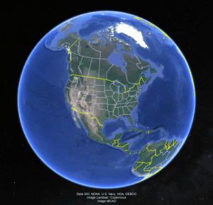
The Ice Age Floods National Geologic Trail covers some 16,000 square miles (41,440 km2) in present day Montana, Idaho, Washington, and Oregon. We have hand picked some of the best of the best places along the Trail and present them here for you enjoy and explore! Check back often, we will be adding new and wonderful destinations for your entire Family to enjoy!

MONTANAIDAHOWASHINGTONOREGON

SOME PLACES TO GO and THINGS TO DO in MONTANA

Eddy Narrows

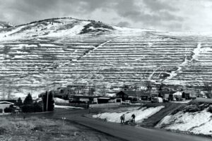
Eddy Narrows Ice Age Floods National Geologic Trail Eddy Narrows is a 10-mile long canyon between Plains and Thompson Fall along the Clark Fork River. Here all of the waters from the northern and eastern arms of Glacial Lake Missoula converged and picked up speed as they were forced through this restricted area. The steep valley walls are bare of talus and soils up to the level estimated to be the highest level of the lake (1000 ft), and there are polished grooves in the bedrock on a bench 340-400 feet above the Clark Fork River that run parallel to it. Since there is no evidence of glaciation in this area, the only explanation is the rapid draining of Glacial Lake Missoula. Using the dimensions of this flume-shaped area of the canyon, which controlled the rate of flow of water surging through it, in 1942 J.T. Pardee was able to calculate maximum speeds approaching 80 mph, emptying Glacial Lake Missoula in as little as three days. There are pullouts along MT-200 at either end of the narrowest part of this section marked for observing big horn sheep with Glacial Lake Missoula signage at the one between mileposts 59 and 60 at: 47.537940, -115.071654  Quick Facts Location:Between Plains and Thompson Falls, MT 

Read More »

Travelers’ Rest State Park

Travelers’ Rest State Park Ice Age Floods National Geologic Trail Located at an historic and contemporary crossroads, Travelers’ Rest State Park and National Historic Landmark is a place where visitors can say with certainty that they are walking in the footsteps of Lewis and Clark. The Park is at the core of a campsite used by the Corps of Discovery from September 9 – 11, 1805 and again from June 30 – July 3, 1806. In the summer of 2002, archaeologists uncovered evidence of the Corps of Discovery’s visit to the area, including a trench latrine tainted with mercury, fire hearths, and lead used in the repair and manufacture of firearms. The discovery makes Travelers’ Rest the only campsite on the Lewis and Clark Trail with physical evidence of the expedition. For centuries Native Americans also used the area as a campsite and trail junction. Salish, Pend d’Oreille and Nez Perce peoples were among those who traditionally occupied the area. Native American storytellers bring their history, culture and society to life as part of the programming at Travelers’ Rest State Park. The Bitterroot River is the primary body of water in this area, now running about 500 feet below the surface of what was once Glacial Lake Missoula, which extended all the way to the area now indicated by a high water marker at Lake Como.  There are few vestiges of the Lake in this area but information and a display are located at the Visitor Center. Travelers’ Rest is an idyllic spot for strolling the park’s trails, and offers a rich bird habitat, with more than 115 species recorded within the park boundaries. Quick Facts Location:Located 1/2 mile west of Lolo on Hwy 12 Significance:Located at the crossroads of culture, this is the only archaeologicaly verified campsite of the Lewis and Clark Expedition, as well as the traditional homeland of the Selis Qlispe people. Designation:National Historic Landmark 

Read More »
SOME PLACES TO GO and THINGS TO DO in IDAHO

Green Monarch Ridge

Green Monarch Ridge Ice Age Floods National Geologic Trail THIS IS WHERE IT ALL BEGAN! The Green Monarch Ridge viewpoint, just south of the Hope Fault, is positioned along the edge of the Purcell Trench Ice Lobe. Here it was responsible for damming the mouth of the Clark Fork drainage basin. This damming effect resulted in the formation of Glacial Lake Missoula, the source of the waters for much of  the PNW Pleistocene Ice Age Floods. The Purcell Trench Ice Lobe originated in Canada and flowed south into Idaho, guided by the structural control of the Purcell Trench. Following the path of least resistance into the basin now occupied by Lake Pend Oreille, it was impeded by the Green Monarch Ridge, located approximately 10 miles south of this viewpoint. Grinding and scraping, the Purcell Trench Ice Lobe backed up behind the Green Monarch Ridge, eventually building an ice plug up to 4,000 feet thick, and scouring out the deepest parts of Lake Pend Oreille. The Purcell Trench Ice Lobe divided into four sub-lobes: one went approximately west (US Highway 2), two went south (US Highway 95 and Lake Pend Oreille) and one went east (SR 200). All four sub-lobes contributed to blocking the Clark Fork drainageQuick Facts MANAGED BY:US Forest Service – Idaho Panhandle National Forest

Read More »

Farragut State Park

Farragut State Park Ice Age Floods National Geologic Trail Farragut State Park is located at the “breakout” of Glacial Lake Missoula floods, where the ice dam in the Clark Fork valley and the 20-mile-long tongue of ice occupying the Lake Pend Oreille basin failed. From there, a torrent of water and ice burst from the south end of the lake. Farragut State Park is located at the “breakout” of Glacial Lake Missoula floods. Failure of the ice dam in the Clark Fork valley fractured and broke apart the 20-mile-long tongue of ice occupying the Lake Pend Oreille basin, and a torrent of water and ice burst from the south end of the lake. That churning slurry of flood waters, ice, boulders and other debris erupted from the south end of Lake Pend Oreille, flowing 2000 ft deep across Farragut State Park. Nearly all of the water escaping from Glacial Lake Missoula passed through this area. Discharge estimates range from 14 to 21 million cubic meters per second! Vic Baker’s definition of a megaflood is one which has a discharge of at least 1mil cubic m/s, so we are possibly looking at ground zero for the worst Pleistocene flood in the world. Farragut State Park includes many geologic features left by glaciation and megafoods.Hoodoo channel, an abandoned outlet of Lake Pend Oreille provided a pathway for late-glacial meltwater and for the last outbursts from Glacial Lake Missoula. The channel is marked with a number of closed depressions, probably the result of melting icebergs. One of the largest of these features have been proposed, including kettles, potholes, and sub-glacial meltwater. Some of that debris was deposited to form the Rathdrum Prairie Outburst Plain, an extensive, heterogeneous mix of flood deposits. Farragut State Park offers unique scenery, history and an abundance of recreational opportunities. Quick Facts Location:13550 E. Hwy 54 Athol, ID 83801 

Read More »

Museum of North Idaho

Museum of North Idaho IceAgeFloods National GeologicTrail “The Museum of North Idaho collects, preserves and interprets the history of the Coeur d’Alene Region. to foster appreciation of the area’s heritage.” In the 1960s, the North Idaho Hoo Hoo Club, an organization of loggers, lumbermen and foresters, first entertained the idea of establishing a museum. They incorporated on May 1, 1968 for a museum focusing on the history of the Coeur d’Alene Region (Kootenai, Benewah and part of Shoshone counties). Through the efforts of volunteers and community support, the Museum opened its doors on the North Idaho College campus on July 28, 1973. In 1979, they remodeled a City-owned building and relocated to its current location. Quick Facts Location: 115 Northwest Blvd, Coeur d’Alene, ID 83814Phone: (208) 664-3448 The Museum is open Tuesday to Saturday from 11 am – 5 pm.

Read More »
SOME PLACES TO GO and THINGS TO DO in WASHINGTON

Journey Through Time: Explore Drumheller Channels

Nestled in the heart of Washington state, the Drumheller Channels offer a unique glimpse into earth’s history, carved by the immense power of Ice Age Floods. This National Natural Landmark is a must-visit for anyone seeking breathtaking landscapes, remarkable geological formations, and a chance to

Read More »

Palouse Falls State Park

Palouse Falls State Park Ice Age Floods National Geologic Trail The Palouse River runs through a narrow cataract and drops 200 feet to a churning bowl. From there, the current moves swiftly, through a winding gorge of columnar basalt, to its southern end at the

Read More »
SOME PLACES TO GO and THINGS TO DO in OREGON

Multnomah Falls and Lodge

Multnomah Falls and Lodge Ice Age Floods National Geologic Trail, Lewis & Clark National Historic Trail Oregon’s tallest waterfall (620 ft.) is just 30 minutes east of Portland and 30 minutes west of Hood River. Offering scenic splendor and a gateway to the Gorge’s Waterfall Corridor,

Read More »

Hat Rock State Park

Hat Rock State Park Ice Age Floods National Geologic Trail, Lewis & Clark National Historic Trail Hat Rock is an erosion remnant warn way by floods from glaciers which melted over ten thousand years ago. Lewis and Clark saw this monument on their expedition and

Read More »

Oregon Museum of Science and Industry

Oregon Museum of Science and Industry Ice Age Floods National Geologic Trail The Oregon Museum of Science and Industry (OMSI) in Portland, Oregon, was founded in 1944. OMSI is one of the nation’s leading science museums and a trusted educational resource for communities throughout Oregon

Read More »
Even MORE PLACES TO GO and THINGS TO DO

Click a STATE for MORE PLACES TO GO and THINGS TO DO

MONTANAIDAHOWASHINGTONOREGON

Share this article:

Like this:

Like Loading…