GO PLACES! DO THINGS!

Along the ICE AGE FLOODS
NATIONAL GEOLOGIC TRAIL


The Ice Age Floods National Geologic Trail covers some 16,000 square miles (41,440 km2) in present day Montana, Idaho, Washington, and Oregon. We have hand picked some of the best of the best places along the Trail and present them here for you enjoy and explore! Check back often, we will be adding new and wonderful destinations for your entire Family to enjoy!

MONTANAIDAHOWASHINGTONOREGON

SOME PLACES TO GO and THINGS TO DO in MONTANA

Glacial Lake Missoula National Natural Landmark

Glacial Lake Missoula National Natural Landmark Ice Age Floods National Geologic Trail Glacial Lake Missoula was the largest of several lakes impounded by the Cordilleran Ice Sheet in the Northern Rocky Mountains during the Quaternary period. The lake was approximately 2,900 square miles in size and contained more than 500 cubic miles of water. It occupied the Mission, Jocko and Little Bitterroot valleys, drained by the Flathead River; and the Missoula, Ninemile and Bitterroot valleys, drained by the Clark Fork River. The lake was formed by an ice dam across the mouth of the Clark Fork River at Lake Pend Oreille, Idaho, a result of successive advances of a lobe of the Cordilleran Ice Sheet. The site is located 12 miles north of Perma, Montana. At least three and possibly more than 100 separate collapses of the ice dam, possibly coincident with periods of ice retreat, caused the lake to drain, producing catastrophic floods across the Columbia Plateau and down the Columbia River Basin. It is estimated that the waters of Glacial Lake Missoula, 1,000 feet deep at Eddy Narrows, were withdrawn at a peak discharge rate of 10 cubic miles per hour. Approximately 550 cubic miles of water passed through those narrows during withdrawal. Evidence of this catastrophic withdrawal can be found in scourings, high eddy deposits of flood debris, flood bars of boulders and course gravel, and successions of giant arcuate ripples or ridges of gravel resting on bedrock surfaces. Ripples appear as ridges 15 to 50 feet high, 100 to 250 feet wide, and from 300 feet to a half-mile long. While the form, structure and arrangement of these features are similar to that of ordinary current ripple marks, they are termed giant flood ripples, due to their large size. The giant flood ripples at this site are unusual due to their being on the down-current side of notches in a ridge separating two basins that were both subsidiary to the main course of Lake Missoula in the Clark Fork Valley. The best examples of giant flood ripples are found in Camas Prairie. Quick Facts Designation:National Natural Landmark OPEN TO PUBLIC:Private Land, closed to the public, but features throughout the area are visible from many vantage points.

Read More »

Montana Natural History Center

Montana Natural History Center Ice Age Floods National Geologic Trail  The mission of the Montana Natural History Center is to promote and cultivate the appreciation, understanding, and stewardship of nature through education. Founded in 1991, MNHC was the brainchild of a group of educators who were involved in various efforts to educate both kids and adults about the natural history of western Montana, and who decided to unite those efforts into one environmental education organization. MNHC provides nature education programming for people of all ages through summer camps, kids’ activities, Visiting Naturalist in the Schools, Master Naturalist certification courses and Field Days, evening programs, Field Notes on Montana Public Radio, museum tours, and more.  We have a variety of exhibits that focus on the flora, fauna, geology, and ecology of our beautiful state. Please stop by and visit! MNHC often partners with the Ice Age Floods Institute to share fields trips and lectures about the Ice Age Floods.   MNHC has exhibits that help visitors explore the Glacial Lake Missoula and Ice Age Floods. Learn more at:Explore Glacial Lake Missoula | Montana Natural History Center (montananaturalist.org) The Glacial Lake Missoula Chapeter of the Ice Age Floods Institue also produced a short movie about Glacial Lake Missoula. You can find a link here. Quick Facts Location:120 Hickory Street, Suite A, Missoula, Montana

Read More »

Glacial Lake Missoula Strandlines

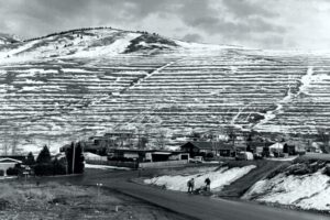
Glacial Lake Missoula Strandlines Ice Age Floods National Geologic Trail Imagine you are standing on the edge of glacial Lake Missoula 15,000 years ago. You can hear lapping waves cutting benches known as “strand-lines” into the shoreline. Today, you can see these huge strand-lines on hills surrounding Missoula, Montana, marking changes in lake level over time. On Mount Sentinel, marked with an “M”, and Mount Jumbo, marked with an “L”, the strand-lines are seen as horizontal lines in the vegetation or highlighted by snow in the winter. Public hiking trails switchback through the strand-lines on Mount Sentinel and Mount Jumbo. Ancient shorelines or strand-lines of Glacial Lake Missoula are visible as perfectly parallel horizontal benches on hillside slopes around Missoula. They are most visible with light snow cover, or in low evening light on the mountains marked with an”M” and an “L” on either side of Hellgate Canyon looking east from the downtown.  These shoreline benches cut by wave action in the lake recorded various lake levels as the ice dam blocking the Clark Fork River far upstream on the Idaho border repeatedly failed and refilled 40 times or more.  It may be that as the ice-age waned each successive ice dam that reformed was smaller and failed under less pressure from a lower lake level than the one before, leaving behind its bench as a record of the successively lower ancient lake shorelines. It’s also possible they record winter still-stands in rising lake levels over time.  Quick Facts Location:The Kim Williams Trail at Van Buren and 5th Street leads from the U Montana campus along the river between the mountains. To reachhigh water markers on the mountains see the Interactive Map or go to GlacialLakeMissoula.org 

Read More »
SOME PLACES TO GO and THINGS TO DO in IDAHO

Farragut State Park

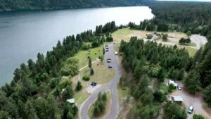
Farragut State Park Ice Age Floods National Geologic Trail Farragut State Park is located at the “breakout” of Glacial Lake Missoula floods, where the ice dam in the Clark Fork valley and the 20-mile-long tongue of ice occupying the Lake Pend Oreille basin failed. From there, a torrent of water and ice burst from the south end of the lake. Farragut State Park is located at the “breakout” of Glacial Lake Missoula floods. Failure of the ice dam in the Clark Fork valley fractured and broke apart the 20-mile-long tongue of ice occupying the Lake Pend Oreille basin, and a torrent of water and ice burst from the south end of the lake. That churning slurry of flood waters, ice, boulders and other debris erupted from the south end of Lake Pend Oreille, flowing 2000 ft deep across Farragut State Park. Nearly all of the water escaping from Glacial Lake Missoula passed through this area. Discharge estimates range from 14 to 21 million cubic meters per second! Vic Baker’s definition of a megaflood is one which has a discharge of at least 1mil cubic m/s, so we are possibly looking at ground zero for the worst Pleistocene flood in the world. Farragut State Park includes many geologic features left by glaciation and megafoods.Hoodoo channel, an abandoned outlet of Lake Pend Oreille provided a pathway for late-glacial meltwater and for the last outbursts from Glacial Lake Missoula. The channel is marked with a number of closed depressions, probably the result of melting icebergs. One of the largest of these features have been proposed, including kettles, potholes, and sub-glacial meltwater. Some of that debris was deposited to form the Rathdrum Prairie Outburst Plain, an extensive, heterogeneous mix of flood deposits. Farragut State Park offers unique scenery, history and an abundance of recreational opportunities. Quick Facts Location:13550 E. Hwy 54 Athol, ID 83801 

Read More »

Glacial Dam at Green Monarch Ridge View Point

Glacial Lobe Dam at Green Monarch Ridge View Point Ice Age Floods National Geologic Trail  As the Purcell Trench ice lobe of the Cordilleran Ice Sheet advanced south from Canada, it was stopped by the Green Monarch Ridge, building an ice dam 4,000 feet (1219 m) tall and nearly 40 miles (64 km) wide that blocked the Clark Fork river, thus filling glacial Lake Missoula. View the Green Monarch Ridge and the Purcell Trench from a large pullout on Idaho State Route 200, about one mile (1.6 km) west of Hope, Idaho and 15 miles (24 km) east of Sandpoint, Idaho. Quick Facts Location: Idaho State Route 200, about one mile west of Hope, Idaho and 15 miles  east of Sandpoint, Idaho.

Read More »

Lake Pend Oreille

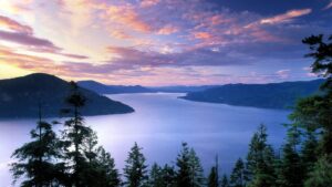
Lake Pend Oreille Ice Age Floods National Geologic Trail  The Purcell Lobe of the Cordilleran Ice Sheet repeatedly formed a 2000′ tall ice dam in this area, which backed up Glacial Lake Missoula and eventually burst catastrophically, releasing Ice Age Floods as often as about every ~10-60 years. Lake Pend Oreille is the largest lake in Idaho. The lake level is 2062 ft above sea level, with the surrounding terrain as high as 6002 ft. With a maximum depth of 1150 ft, this lake is the 5th deepest in the US. The location of the lake is probably related to an old river valley controlled by faults. The Lake Pend Oreille basin was carved by the repeated advances of Pleistocene ice and scoured by Ice Age Floods. With the waning of flood waters, the basin was filled with glacial out-wash and flood deposits. The lake is dammed at the south end by thick glacial and flood deposits that mark the beginning of the “Outburst Deposits”Quick Facts MANAGED BY:US Forest Service

Read More »
SOME PLACES TO GO and THINGS TO DO in WASHINGTON

Grand Coulee – Geology of the Entire 50 miles

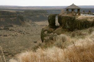
The 50-mile-long Grand Coulee should be on everyone’s bucket list for a “must see” feature.  The immense power of the forces that created the Coulee are apparent to those who read the evidence recorded in its rocks and landforms.  How did the Coulee form? Why

Read More »

Lake Lenore Caves – Lower Grand Coulee

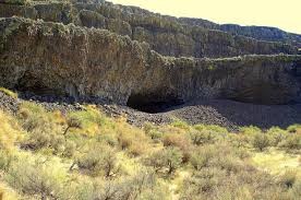
Tucked into the Lenore Canyon are the Lake Lenore Caves. Along with much of the eastern half of the state, Lenore Canyon was formed during the Missoula floods at the end of the last Ice Age, over 13,000 years ago. The glacial flood waters crashed down

Read More »

Fort Spokane Visitor Center

Fort Spokane Visitor Center Ice Age Floods National Geologic Trail “Fort Spokane is one of the cultural jewels of Lake Roosevelt National Recreation Area. For thousands of years, the area was a gathering place for native tribes fishing the rapids of the Spokane River. In

Read More »
SOME PLACES TO GO and THINGS TO DO in OREGON

Museum of Natural History, University of Oregon

Museum of Natural and Cultural History, University of Oregon The museum offers a variety of seasonal and year-round programs for science and culture enthusiasts of every age. Delve into Oregon’s story, from the archaeology of the First Americans to the dynamic cultures of today’s Tribes.

Read More »

Oregon Museum of Science and Industry

Oregon Museum of Science and Industry Ice Age Floods National Geologic Trail The Oregon Museum of Science and Industry (OMSI) in Portland, Oregon, was founded in 1944. OMSI is one of the nation’s leading science museums and a trusted educational resource for communities throughout Oregon

Read More »
Even MORE PLACES TO GO and THINGS TO DO

Click a STATE for MORE PLACES TO GO and THINGS TO DO

MONTANAIDAHOWASHINGTONOREGON

Share this article:

Like this:

Like Loading…