GO PLACES! DO THINGS!

Along the ICE AGE FLOODS
NATIONAL GEOLOGIC TRAIL


The Ice Age Floods National Geologic Trail covers some 16,000 square miles (41,440 km2) in present day Montana, Idaho, Washington, and Oregon. We have hand picked some of the best of the best places along the Trail and present them here for you enjoy and explore! Check back often, we will be adding new and wonderful destinations for your entire Family to enjoy!

MONTANAIDAHOWASHINGTONOREGON

SOME PLACES TO GO and THINGS TO DO in MONTANA

The Paradise Center

The Paradise Center Ice Age Floods National Geologic Trail Paradise Center, formerly the Paradise Elementary School, is a community, visitors, and arts center in the old railroad community of the same name.  Just below the confluence of the muddy Clark Fork and beautiful blue Flathead Rivers, 70 miles northwest of Missoula, the area was repeatedly inundated by Glacial Lake Missoula, leaving many visible features in the area such as gulch fills, kolks, and lake bottom sediment bluffs. It is on the route between the Camas Prairie Ripples and Eddy Narrows.   Inside the school is a unique interactive 3-D topographical or relief map of the entire area covered by Glacial Lake Missoula and an extensive display of information about the Lake as well as other topics of interest to the area.  Outside on the grounds is a playground and an outdoor walking loop with a dozen or so displays of interest such as the former railroad roundhouse.  A model railroad set-up is also found inside the center. This area can easily be reached directly from the St. Regis exit from I-90 by following the Clark Fork River where flood waters turned sharply to the north, carving out the narrow valley along scenic route 135 to the junction with MT-200. Scour marks and displaced boulders are visible from the road, and it is especially lovely when the larch trees turn bright yellow in the fall. This route also takes you past the historic Quinn’s Hot Springs Resort.  ANNOUNCEMENT: The Paradise Center hours are seasonal, generally Wednesday thru Saturday, 11am-3pm in the summer. Check the website at paradisecentermt.org or call 406-826-0500 Quick Facts Location:2 School House Hill Road Paradise, MT 59856 MANAGED BY:The Paradise Center
Read More »

Bison Range

Bison Range The Bison Range was established by President Theodore Roosevelt in 1908 to conserve the American Bison.  Since that time it has been managed as a wildlife refuge and native grassland. Today the management is done by the Confederated Salish and Kootenai Tribes. The range is a small, low-rolling mountain connected to the Mission Mountain Range by a gradually descending spur. Range elevation varies from 2,585 feet (788 m) at headquarters to 4,885 feet (1,489 m) at High Point on Red Sleep Mountain, the highest point on the Range.  Much of the Bison Range was once under prehistoric Glacial Lake Missoula. The upper part of the Range was above water. Red Sleep Mountain scenic drive leads to this high point, which has spectacular views across what was once the lake to the Mission Mountains on the other side.  Other flood features are evident on Buffalo Prairie scenic drive. Old beach lines (strandlines) can be seen on north-facing slopes and some large erratics are located near the old corrals. There is a visitor center near the entrance which has a display and videos of Glacial Lake Missoula as well as information on the tribes of the Flathead Reservation and the abundant wildlife, including birds, bears and antelope.  There is also a gift shop.  Camas Prairie ripples and several other important features of Glacial Lake Missoula are in close proximity to this site, much of them are located on tribal lands.  The entrance is off US 93 and MT 212 N about an hour north of Missoula. Bison Range58355 Bison Range Rd, Moiese, MT (406) 644-2661 bisonrange.org FEES – there is a fee for entrance, including the day use area, except for CSKT tribal members OPEN HOURSWinter Hours (Nov-April)Gate: 8am–6pmVisitors Center: 8am–5pm Red Sleep Drive: closed Buffalo Prairie Drive: 8am-6pm Summer Hours (May-Oct)Gate: 7am–8pmVisitors Center: 8am–7pm Red Sleep Drive: 8am–7pm Buffalo Prairie Drive:8am–8pm  Restrictions: Vehicles over 30 feet long and those owing trailers as well as motorcycles, ATVs, and bicycles are not allowed on either drive.  Visitors must remain inside vehicles at all times except for designated areas      

Read More »

Montana Natural History Center

Montana Natural History Center Ice Age Floods National Geologic Trail  The mission of the Montana Natural History Center is to promote and cultivate the appreciation, understanding, and stewardship of nature through education. Founded in 1991, MNHC was the brainchild of a group of educators who were involved in various efforts to educate both kids and adults about the natural history of western Montana, and who decided to unite those efforts into one environmental education organization. MNHC provides nature education programming for people of all ages through summer camps, kids’ activities, Visiting Naturalist in the Schools, Master Naturalist certification courses and Field Days, evening programs, Field Notes on Montana Public Radio, museum tours, and more.  We have a variety of exhibits that focus on the flora, fauna, geology, and ecology of our beautiful state. Please stop by and visit! MNHC often partners with the Ice Age Floods Institute to share fields trips and lectures about the Ice Age Floods.   MNHC has exhibits that help visitors explore the Glacial Lake Missoula and Ice Age Floods. Learn more at:Explore Glacial Lake Missoula | Montana Natural History Center (montananaturalist.org) The Glacial Lake Missoula Chapeter of the Ice Age Floods Institue also produced a short movie about Glacial Lake Missoula. You can find a link here. Quick Facts Location:120 Hickory Street, Suite A, Missoula, Montana

Read More »
SOME PLACES TO GO and THINGS TO DO in IDAHO

Green Monarch Ridge

Green Monarch Ridge Ice Age Floods National Geologic Trail THIS IS WHERE IT ALL BEGAN! The Green Monarch Ridge viewpoint, just south of the Hope Fault, is positioned along the edge of the Purcell Trench Ice Lobe. Here it was responsible for damming the mouth of the Clark Fork drainage basin. This damming effect resulted in the formation of Glacial Lake Missoula, the source of the waters for much of  the PNW Pleistocene Ice Age Floods. The Purcell Trench Ice Lobe originated in Canada and flowed south into Idaho, guided by the structural control of the Purcell Trench. Following the path of least resistance into the basin now occupied by Lake Pend Oreille, it was impeded by the Green Monarch Ridge, located approximately 10 miles south of this viewpoint. Grinding and scraping, the Purcell Trench Ice Lobe backed up behind the Green Monarch Ridge, eventually building an ice plug up to 4,000 feet thick, and scouring out the deepest parts of Lake Pend Oreille. The Purcell Trench Ice Lobe divided into four sub-lobes: one went approximately west (US Highway 2), two went south (US Highway 95 and Lake Pend Oreille) and one went east (SR 200). All four sub-lobes contributed to blocking the Clark Fork drainageQuick Facts MANAGED BY:US Forest Service – Idaho Panhandle National Forest

Read More »

Glacial Dam at Green Monarch Ridge View Point

Glacial Lobe Dam at Green Monarch Ridge View Point Ice Age Floods National Geologic Trail  As the Purcell Trench ice lobe of the Cordilleran Ice Sheet advanced south from Canada, it was stopped by the Green Monarch Ridge, building an ice dam 4,000 feet (1219 m) tall and nearly 40 miles (64 km) wide that blocked the Clark Fork river, thus filling glacial Lake Missoula. View the Green Monarch Ridge and the Purcell Trench from a large pullout on Idaho State Route 200, about one mile (1.6 km) west of Hope, Idaho and 15 miles (24 km) east of Sandpoint, Idaho. Quick Facts Location: Idaho State Route 200, about one mile west of Hope, Idaho and 15 miles  east of Sandpoint, Idaho.

Read More »
SOME PLACES TO GO and THINGS TO DO in WASHINGTON

The Bretz Journals and Google Earth

If you have been following Professor Nick Zentner (CWU) on YouTube, you may know that one of the treasures he has uncovered with the help of collaborators are the Bretz journals from field research done from 1919 through 1929. After Bretz’s death in 1981, his

Read More »

Palouse Falls State Park

Palouse Falls State Park Ice Age Floods National Geologic Trail The Palouse River runs through a narrow cataract and drops 200 feet to a churning bowl. From there, the current moves swiftly, through a winding gorge of columnar basalt, to its southern end at the

Read More »
SOME PLACES TO GO and THINGS TO DO in OREGON

Crown Point National Natural Landmark

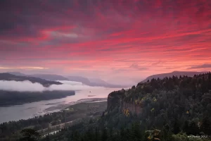
Crown Point National Natural Landmark Ice Age Floods National Geologic Trail – Historic Columbia River Highway This spectacular viewpoint along the Historic Columbia River Highway 30 was the site of the 1916 dedication of a highway that was, for that time, an innovative European-style road

Read More »

Tualatin Public Library

Tualatin Public Library Ice Age Floods National Geologic Trail The Tualatin Public Library, located just off Interstate 5 in Tualatin, Oregon, is home to a display of Ice Age Megafauna. The Library features a striking display of an articulated partial mastodon skeleton, which was discovered

Read More »

Multnomah Falls and Lodge

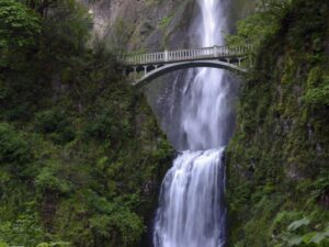
Multnomah Falls and Lodge Ice Age Floods National Geologic Trail, Lewis & Clark National Historic Trail Oregon’s tallest waterfall (620 ft.) is just 30 minutes east of Portland and 30 minutes west of Hood River. Offering scenic splendor and a gateway to the Gorge’s Waterfall Corridor,

Read More »
Even MORE PLACES TO GO and THINGS TO DO

Click a STATE for MORE PLACES TO GO and THINGS TO DO

MONTANAIDAHOWASHINGTONOREGON

Share this article:

Like this:

Like Loading…