GO PLACES! DO THINGS!

Along the ICE AGE FLOODS
NATIONAL GEOLOGIC TRAIL


The Ice Age Floods National Geologic Trail covers some 16,000 square miles (41,440 km2) in present day Montana, Idaho, Washington, and Oregon. We have hand picked some of the best of the best places along the Trail and present them here for you enjoy and explore! Check back often, we will be adding new and wonderful destinations for your entire Family to enjoy!

MONTANAIDAHOWASHINGTONOREGON

SOME PLACES TO GO and THINGS TO DO in MONTANA

Eddy Narrows

Eddy Narrows Ice Age Floods National Geologic Trail Eddy Narrows is a 10-mile long canyon between Plains and Thompson Fall along the Clark Fork River. Here all of the waters from the northern and eastern arms of Glacial Lake Missoula converged and picked up speed as they were forced through this restricted area. The steep valley walls are bare of talus and soils up to the level estimated to be the highest level of the lake (1000 ft), and there are polished grooves in the bedrock on a bench 340-400 feet above the Clark Fork River that run parallel to it. Since there is no evidence of glaciation in this area, the only explanation is the rapid draining of Glacial Lake Missoula. Using the dimensions of this flume-shaped area of the canyon, which controlled the rate of flow of water surging through it, in 1942 J.T. Pardee was able to calculate maximum speeds approaching 80 mph, emptying Glacial Lake Missoula in as little as three days. There are pullouts along MT-200 at either end of the narrowest part of this section marked for observing big horn sheep with Glacial Lake Missoula signage at the one between mileposts 59 and 60 at: 47.537940, -115.071654  Quick Facts Location:Between Plains and Thompson Falls, MT 

Read More »

Bitterroot Valley Glacial Erratics

Two glacial erratics in the Bitterroot Valley, the Lone Rock School erratic and the Rome Lane erratic, were deposited during the last high stand of Lake Missoula about 13,000 years ago. Both these glacial erratics are easy to visit. At the extreme Southern end of the Bitterroot Valley is beautiful Lake Como named after its Italian alpine counter part by Father Ravalli a Jesuit Black Robe tasked with bringing literacy and Jesus to the native Salish people in 1845 via St Mary’s Mission in nearby Stevensville. Lake Como is a beautiful place for lunch and a hike/bike on the trail around lake including a beautiful waterfall a the head of the lake. Several mountain glaciers coalesced here and neighboring drainage to make the largest mass of ice calving into the lake south of the Flathead lobe of the Cordilleran ice sheet at Polson. This mass exited the mountains, floated into and calved into Glacial Lake Missoula. This was the primary iceberg generator for the Bitterroot Valley. As they floated out into the lake and melted they dropped large rocks called erratic onto the lake floor, which is now the surface of the valley. Lone Rock School Erratic The easiest one to find is the Lone Rock School erratic.  From Stevensville, proceed north on the Eastside Highway, county road 269, to the junction with county road 268, turn right.  Follow county road 268 until you reach the Lone Rock School on your left; the erratic is the large boulder in front of the south side of the school, and behind the fence (see map below).   The Lone Rock School erratic is 69” tall, 58” wide, 85” long, and weighs in at about 8.5 metric tons or about 18,700 lbs.  This large erratic is a type of granite called quartz monzonite.  The minerals that make up this rock type are, in order of abundance, plagioclase (calcium and/or sodium rich) feldspar, orthoclase (potassium rich) feldspar, biotite (dark mica), and quartz.  If you look closely you will see that the quartz typically stands out in relief with respect to the other minerals and that its surface has been polished to a smooth finish.  This is the result of dense glacial ice grinding over the surface of the rock. Rome Lane Erratic The Rome Lane erratic measures 47” tall, 117” long, 96” wide, and weighs in at about 13 metric tons or about 28,600 lbs.  The Rome Lane erratic is almost identical to the Lone Rock School erratic; it to is quartz monzonite granite with approximately the same minerals and mineral proportions.  The observation that both erratics are of similar rock type suggests that they came from a similar source region.  There are sources of quartz monzonite granite in both the Sapphire and Bitterroot Mountains, which is the source of these erratics?  Since we know that the erratics were carried to the shores of glacial Lake Missoula by glaciers, we can rule out the Sapphires as a possible source because we know that no glaciers in the Sapphire Mountains ever reached the shores of Lake Missoula.  So, the erratics had to come from the Bitterroot Mountains where the quartz monzonite granite lies anywhere between 5 and 20 miles from the ancient shoreline of Lake Missoula.  That means glaciers carried the erratics for distances of up to 20 miles (32.2 km) before reaching the shores of glacial Lake Missoula.  Which at an average velocity of 5 meters per day (normal for most valley glaciers with the exception of rare bursts in velocity up to 75 meters per day) would take about 18 years.  Which Erratic is Oldest? The quartz grains on the surfaces of the Rome Lane erratic are polished to a smooth shine and stand out in relief above the other minerals, similar to the Lone Rock School erratic.  However, the quartz grains exposed on the top surface of the Rome Lane erratic seem to exhibit higher relief than the quartz grains exposed on any other side of the Rome Lane erratic and/or the top surface of the Lone Rock School erratic.  Why is this?  Rainwater is slightly acidic and acidic fluids can break down some minerals, such as feldspar, and turn them into clay.  Quartz, however, is very resistant to acidic fluids and as a result takes longer to break down or weather.  It is this difference in weathering rates between feldspar and quartz that causes the quartz grains to stand higher than the feldspar grains.  So, based on this relationship we can say that the greater the relief between quartz and feldspar on a rock surface, the longer that surface has been exposed to the elements i.e. rain and wind.  With that in mind, which erratic’s top surface has been exposed longer?  If you answered Lone Rock, you are correct.  As it turns out the Lone Rock School erratic was dug up and moved from its original location, about ¾ of a mile to the south of where it sits today, to commemorate the Lone Rock Schools’ centennial in 1985, in fact upon its excavation portions of the erratic broke off and remain buried.  So what is the top surface of the Lone Rock School erratic today may well not have been the top surface before 1985, and our mineral weathering hypothesis fits the facts. 

Read More »
SOME PLACES TO GO and THINGS TO DO in IDAHO

Farragut State Park

Farragut State Park Ice Age Floods National Geologic Trail Farragut State Park is located at the “breakout” of Glacial Lake Missoula floods, where the ice dam in the Clark Fork valley and the 20-mile-long tongue of ice occupying the Lake Pend Oreille basin failed. From there, a torrent of water and ice burst from the south end of the lake. Farragut State Park is located at the “breakout” of Glacial Lake Missoula floods. Failure of the ice dam in the Clark Fork valley fractured and broke apart the 20-mile-long tongue of ice occupying the Lake Pend Oreille basin, and a torrent of water and ice burst from the south end of the lake. That churning slurry of flood waters, ice, boulders and other debris erupted from the south end of Lake Pend Oreille, flowing 2000 ft deep across Farragut State Park. Nearly all of the water escaping from Glacial Lake Missoula passed through this area. Discharge estimates range from 14 to 21 million cubic meters per second! Vic Baker’s definition of a megaflood is one which has a discharge of at least 1mil cubic m/s, so we are possibly looking at ground zero for the worst Pleistocene flood in the world. Farragut State Park includes many geologic features left by glaciation and megafoods.Hoodoo channel, an abandoned outlet of Lake Pend Oreille provided a pathway for late-glacial meltwater and for the last outbursts from Glacial Lake Missoula. The channel is marked with a number of closed depressions, probably the result of melting icebergs. One of the largest of these features have been proposed, including kettles, potholes, and sub-glacial meltwater. Some of that debris was deposited to form the Rathdrum Prairie Outburst Plain, an extensive, heterogeneous mix of flood deposits. Farragut State Park offers unique scenery, history and an abundance of recreational opportunities. Quick Facts Location:13550 E. Hwy 54 Athol, ID 83801 

Read More »

Must See Floods Features in Northern Idaho

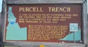
SOME LOCAL NORTHERN IDAHO ICE AGE FLOODS and GLACIAL FEATURES Purcell Trench – This structurally formed valley became the passageway for the Purcell Ice Lobe that divided into five glacial sub-lobes.  The east moving sub-lobe blocked the Clark Fork River forming Glacial Lake Missoula, the source of the Ice Age Flood waters.  Other sub-lobes modified and deepened the basin now occupied by Lake Pend Oreille or helped define several important N-S transportation routes. The Purcell Trench is visible from City Beach in Sandpoint and Schweitzer Mountain Rd.  Hwy 95 follows the Purcell Trench from Sandpoint to beyond Bonners Ferry. Cabinet Gorge – Contact of Pleistocene Ice and Glacial Lake Missoula Water – Although the contact of the Pleistocene Ice and the lapping waters of Glacial Lake Missoula was in flux as the glacier advanced and retreated, the Cabinet Gorge is considered by many to be a likely location of the terminus of the Clark Fork sub-lobe that blocked the drainage of the Clark Fork River.   Evidence of glacial erosion and till deposits indicate glaciation; however, flood deposits on the south side of the river attest to Ice Age flooding.  Cores taken during the construction of the Cabinet Gorge Dam suggest multiple stages and events of ice damming. An AVISTA maintained viewpoint at the Cabinet Gorge Dam with Ice Age Floods signage provides an excellent location to ponder the formation and disintegration of the ice plug blocking the Clark Fork River.  Glacial Striations – Striations can be viewed along Hwy 200 east of Hope and on the south side of Castle Rock east of Clark Fork. Glacial/Flood Related Erratics – Large and small erratics cover the glacial and flood modified landscape.  Large erratics can be seen along Hwy 200 east of Clark Fork, in Sandpoint’s City Beach and in Farragut State Park.  A large pile of erratics excavated from flood deposits are visible on the west-side of Hwy 95 south of the Hoodoo Channel.  A giant ice-rafted flood related erratic weighing over 1,600 tons is located on the east-side of Hwy 41 near Twin Lakes.  Lake Pend Oreille – Cross-section morphology, depth, and sediments – This is where it all started! Lake Pend Oreille is the largest lake in Idaho and the deepest lake in the Pacific Northwest and the 5th deepest in the US. The lake level is 2062 ft above sea level with depths over 1,000 feet and an additional layer of over 1,500 feet of glacial-fluvial deposits going to bedrock, with the surrounding terrain as high as 6002 ft. The glacially modified U-shaped bedrock valley, cut to approximately 600 feet below sea level, was formed by the Pend Oreille glacial sub-lobe. This glacial sub-lobe was up to 4,000+ ft. thick and 30+ miles wide. It was the ice plug responsible for blocking the Clark Fork River. It collapsed catastrophically as often as about every 10-60 years, releasing 40-100 Ice Age Floods.  The location of the lake is probably related to an old river valley controlled by faults. The Lake Pend Oreille basin was carved by the repeated advances of Pleistocene ice and scoured by ice age floods. With the waning of ice age flood waters, the basin was, and continues to be, filled with glacial outwash and flood deposits. The lake is dammed at the south end by thick glacial and flood deposits the mark the beginning of the “Outburst Deposits”. There is a pullout on Hwy 200 approximately one mile west of Hope with signage already established that provides a great view looking south across Lake Pend Oreille to the Green Monarch Mts. Another view of the former ice plug location along Hwy 200 is the mouth of the Clark Fork River at the Clark Fork Drift Yard. Giant Current Dunes or MegaRipple Marks – One of Bretz’ most important pieces of evidence for catastrophic flooding was the “giant current dunes.” These large-scale bedforms appeared as patterns of parallel ridges and swales on many aerial photographs in the flood channels in the scabland of Washington, but had escaped recognition from the ground because of their size. Giant Current Dunes are visible west of Clark Fork near Castle Rock; however, the most prominent and visible Giant Current Dunes are located several miles east of Spirit Lake along Hwy 54 where the highway cuts through the dunes showing their undulating profile. The location of many of the telephone poles on the crest of these dunes accentuates these landforms. The dunes form transverse to the current direction, and form cusps that are convex upstream, with arms that point downstream. Furthermore, the size of the cusps appears to decrease in the direction of lower velocity. Internally, the dunes consist of gravel and pebble foresets. Giant current dunes exhibit an asymmetrical profile with the downstream (lee) slope steeper than the upstream slope. Crests range from 20 to 200m apart and heights range from 1 to 15m (Baker and Nummedal, 1978) and are among the largest measured throughout the Floods area. The Spirit Lake current dunes can also be easily recognized from the air by their characteristic pattern, accentuated by vegetation. This dune field is immediately in the path of the breakout from Lake Pend Oreille, and experienced some of the highest energy flows. Rhythmites – Rhythmites are glaciolacustrine sediments associated with flood events and are useful in attempting to determine the number of Ice Age Floods.  A 112-foot cross-section of rhythmites is located at the junction of East Fork Creek and Lightning Creek approximately 6.5 miles northeast of Clark Fork along Lightning Creek Road (NF-419). Proglacial Deposits – This type of deposit is found associated with most of the drainages on the south side of the Clark Fork Valley and extend from the mouth of the Clark Fork River to nearly Thompson Falls in Montana.  These sediments are glacio-fluvial deposits deposited in contact with the ice and therefore provide evidence of glaciation in the Clark Fork River drainage.  The associated geomorphic features formed by these deposits are referred to as “kame deltas”. The gravel pit associated with Dry Creek (approximately 8 miles west of Clark Fork

Read More »

Green Monarch Ridge

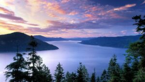
Green Monarch Ridge Ice Age Floods National Geologic Trail THIS IS WHERE IT ALL BEGAN! The Green Monarch Ridge viewpoint, just south of the Hope Fault, is positioned along the edge of the Purcell Trench Ice Lobe. Here it was responsible for damming the mouth of the Clark Fork drainage basin. This damming effect resulted in the formation of Glacial Lake Missoula, the source of the waters for much of  the PNW Pleistocene Ice Age Floods. The Purcell Trench Ice Lobe originated in Canada and flowed south into Idaho, guided by the structural control of the Purcell Trench. Following the path of least resistance into the basin now occupied by Lake Pend Oreille, it was impeded by the Green Monarch Ridge, located approximately 10 miles south of this viewpoint. Grinding and scraping, the Purcell Trench Ice Lobe backed up behind the Green Monarch Ridge, eventually building an ice plug up to 4,000 feet thick, and scouring out the deepest parts of Lake Pend Oreille. The Purcell Trench Ice Lobe divided into four sub-lobes: one went approximately west (US Highway 2), two went south (US Highway 95 and Lake Pend Oreille) and one went east (SR 200). All four sub-lobes contributed to blocking the Clark Fork drainageQuick Facts MANAGED BY:US Forest Service – Idaho Panhandle National Forest

Read More »
SOME PLACES TO GO and THINGS TO DO in WASHINGTON

Palouse Falls State Park

Palouse Falls State Park, dedicated in 1951, is a 94-acre park showcasing the dramatic Palouse Falls and its unique geological history. The park is a popular destination for viewing the falls, which were formed by Ice Age floods and are a key part of the

Read More »

Wenatchee Valley Museum & Cultural Center

Wenatchee Valley Museum & Cultural Center Ice Age Floods National Geologic Trail The Wenatchee Valley Museum and Cultural Center’s mission is to gather, engage, and educate people to celebrate and preserve the history, arts, sciences, and rich diversity of our region. It is a 501(c)(3)

Read More »

Cape Disappointment State Park

Cape Disappointment State Park Ice Age Floods National Geologic Trail, Lewis & Clark National Historic Trail, Lewis and Clark National Historical Park Located in Ilwaco, Washington, Cape Disappointment State Park is a 2,023-acre park located on the Long Beach Peninsula. With the Pacific Ocean to the

Read More »
SOME PLACES TO GO and THINGS TO DO in OREGON

Tualatin Public Library

Tualatin Public Library Ice Age Floods National Geologic Trail The Tualatin Public Library, located just off Interstate 5 in Tualatin, Oregon, is home to a display of Ice Age Megafauna. The Library features a striking display of an articulated partial mastodon skeleton, which was discovered

Read More »

Oregon Museum of Science and Industry

Oregon Museum of Science and Industry Ice Age Floods National Geologic Trail The Oregon Museum of Science and Industry (OMSI) in Portland, Oregon, was founded in 1944. OMSI is one of the nation’s leading science museums and a trusted educational resource for communities throughout Oregon

Read More »
Even MORE PLACES TO GO and THINGS TO DO

Click a STATE for MORE PLACES TO GO and THINGS TO DO

MONTANAIDAHOWASHINGTONOREGON

Share this article:

Like this:

Like Loading…