Athol Library Lecture: Introduction to the Ice Age Floods and the National Geologic Trail
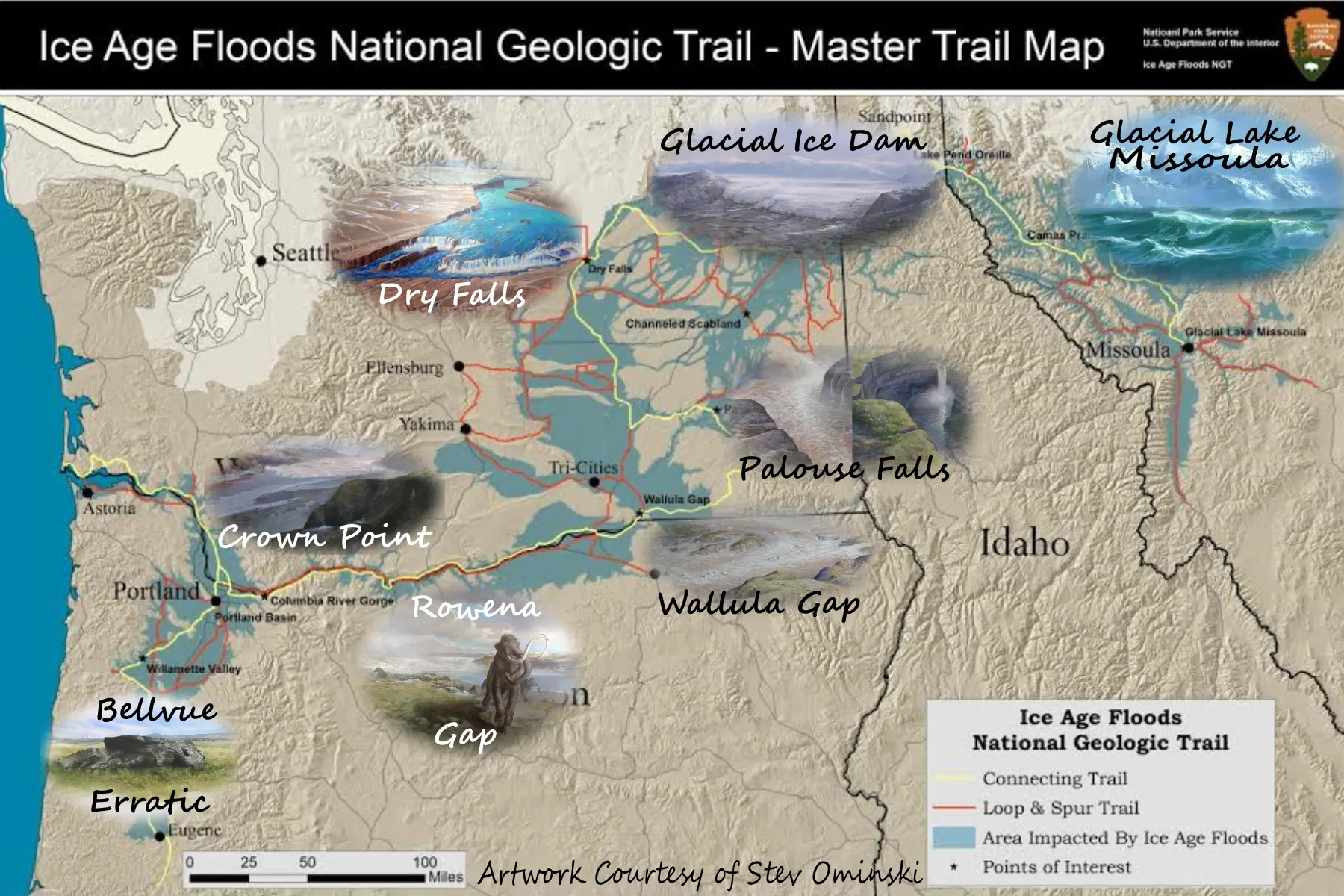
At the end of the last Ice Age an ice dam in northern Idaho created Glacial Lake Missoula stretching 3,000 square miles around Missoula, Montana. The dam burst and released flood waters across Washington, down the Columbia River into Oregon before reaching the Pacific Ocean. The Ice Age Floods forever changed the lives and landscape of the Pacific Northwest. The Ice Age Floods National Geologic Trail is a network of routes, sites, and interpretive centers that follow the pathways of the repeated Ice Age megafloods released from Glacial Lake Missoula between roughly 18,000 and 15,000 years ago. These floods reshaped the Pacific Northwest on a continental scale, carving features such as the Channeled Scablands, Grand Coulee, Dry Falls, Palouse Falls, and the Columbia River Gorge. It spans four states—Montana, Idaho, Washington, and Oregon—and links dozens of geologic landmarks that preserve evidence of these enormous floods. Presented by Don Chadbourne, geologist and board member of the Ice Age Floods Institute (IAFI), Cheney-Spokane Chapter No registration required. Call Librarian Ali Spahn with any questions at 208-683-2979.