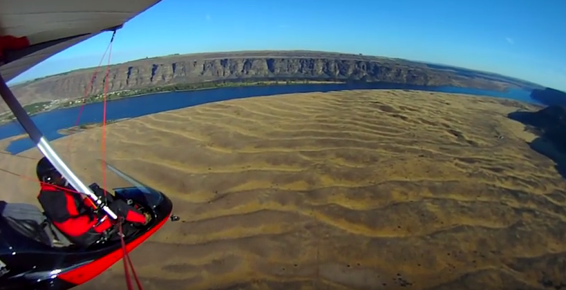
Frenchman Coulee Drone Video
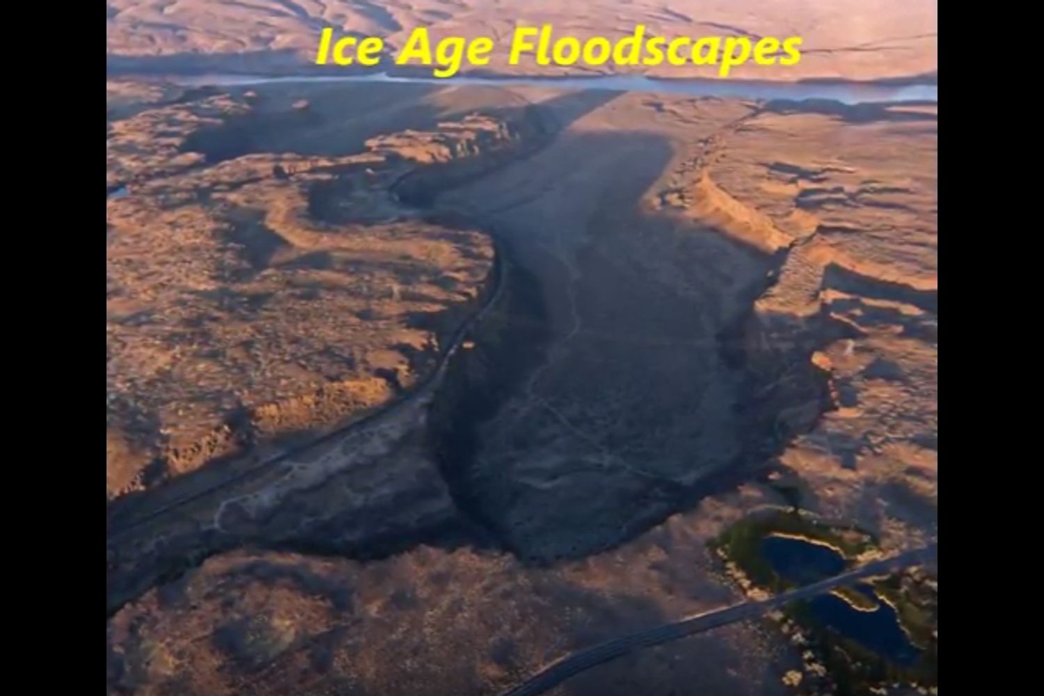
Bruce Bjornstad is at it again with his awesome Ice Age Floodscapes drone videos, this one from Frenchman Coulee. Watch it below and visit his Ice Age Floodscapes YouTube channel.for many more.
Williams Lake Cataract Video
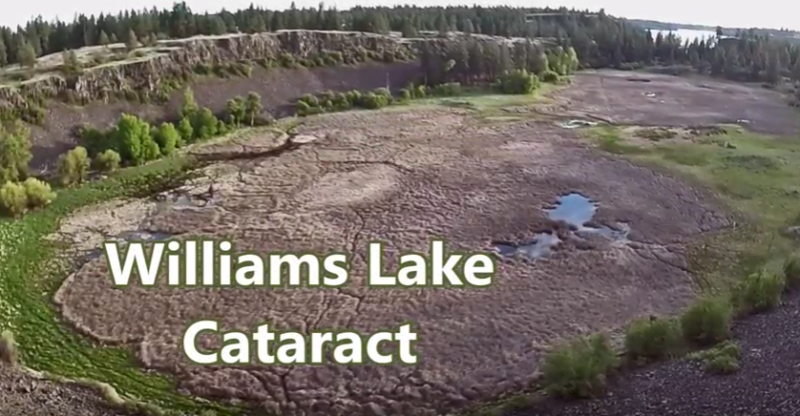
Williams Lake Cataract is an ancient, dry waterfall left behind along the Cheney-Palouse Scabland Tract in eastern Washington after Ice Age flooding recessionally ripped out underlying basalt to produce this massive cataract. Video produced by Bruce Bjornstad, Ice Age Floodscapes
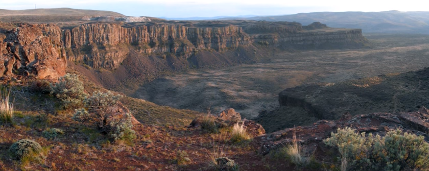
The Great Blade – Bruce Bjornstad Video
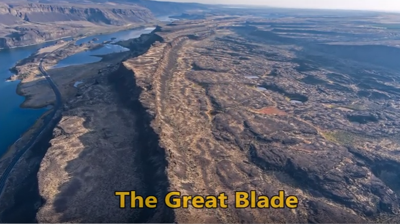
“…there were a few double falls each member of which receded at approximately the same rate, so that the island in mid-channel became very much elongated, like a great blade, as the falls receded and the canyons lengthened.” J Harlen Bretz (1928) A tall, narrow basalt ridge, coined “The Great Blade” by J Harlen Bretz, parallels Lower Grand Coulee east of Lake Lenore. The blade is the product of Ice Age floods that repeatedly rampaged Grand Coulee as recently as 15,000 years ago. Most of the floods appear to have come from sudden outbursts from glacial Lake Missoula. During flooding the coulees on either side of the Great Blade were filled with up to 800 ft turbid water. The largest floods also overtopped the Great Blade, submerging the site under at least another 100 ft of floodwater. On the west side of the blade, where Lake Lenore is located, lies the Lower Grand Coulee, which ultimately migrated 10 miles northward – all the way to Dry Falls. On the east side of the blade is the higher East Lenore Coulee, which migrated a shorter distance (~3 mi) to Dry Coulee. Like a gigantic rib the Great Blade is tallest and narrowest at its south end, widening to the north. The blade extends for almost four miles from where the head of East Lenore Coulee intersects Dry Coulee. In places the blade narrows to as little as 800 ft wide. Video produced by Bruce Bjornstad for Ice Age Floodscapes
Grant’s Getaways – Oregon’s Erratic Rocks
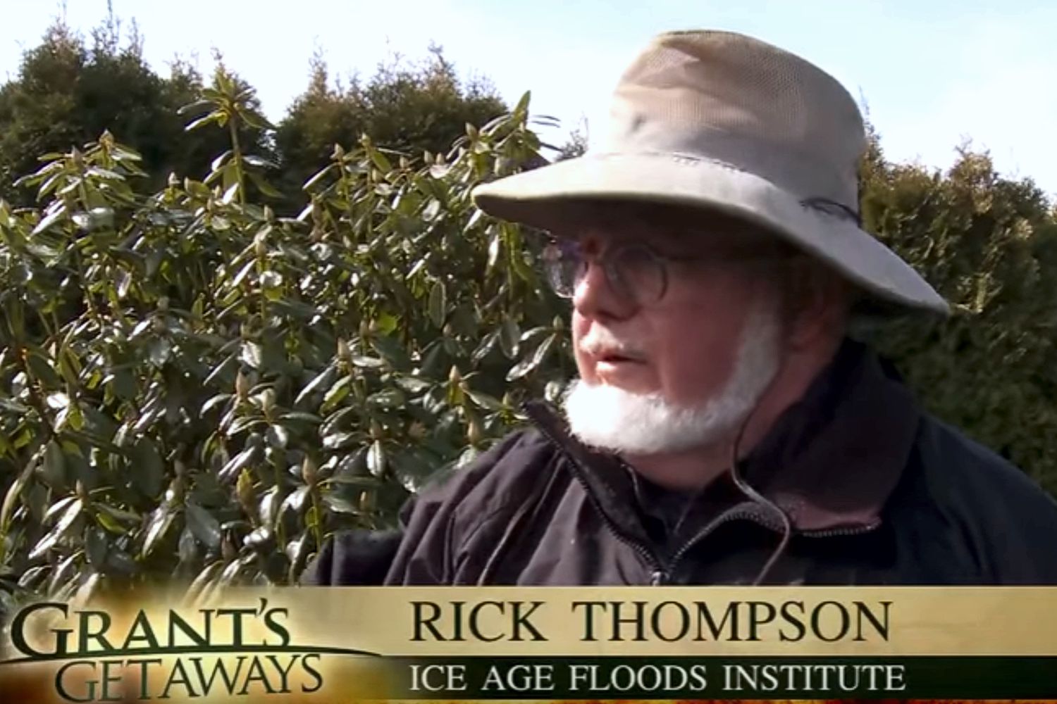
This episode of Grant’s Getaways features Lower Columbia President Rick Thompson and the Floods-borne erratics of the Willamette Valley
Ice Age Floods – Giant Current Ripples
Check out this 2-Minute Geology expedition with Nick Zentner and Tom Foster exploring the Giant Current Ripples at West Bar and Camas Prairie. Ice age floodwater 650 feet deep – moving at 65 miles per hour – left Giant Current Ripples along the Columbia River at West Bar! The ripples at West Bar are 20 feet high, spaced up to 100 yards apart. Giant Current Ripples at Camas Prairie, Montana are also described. The Montana ripples helped Joseph Pardee understand that Glacial Lake Missoula had emptied suddenly. Learn more about Glacial Lake Missoula, Lake Bonneville and the Ice Age Floods at http://hugefloods.com/
Lava + Ice + Water = Floods Geology
Floods of lava (Columbia River Basalts) and Ice Age Floods of water (Lake Missoula floods and the Bonneville Flood) are world-famous topics among geologists. To have both sets of floods in the same area means the geology of the Inland Northwest is truly Disneyland for Geologists! The program begins in Lewiston, Idaho where the floods of lava and water are beautifully on display near the mouth of Hells Canyon. Early on, the Columbia River Basalts – eruptions of fluid lava from deep fissures – are featured. The Missoula Floods from Montana and the Bonneville Flood from Utah – the Ice Age Floods – are surveyed at an introductory level. And finally, the interaction between bedrock and fluid dynamics of the floodwater are highlighted through discussion of Ice Age erosional and depositional landforms. Key locations in the Pacific Northwest are featured, including the Snake River Canyon, Grand Coulee, Dry Falls, the Drumheller Channels, Wallula Gap, and the Columbia River Gorge. Tom Foster and Nick Zentner (Central Washington University) had been hiking together in eastern Washington for years. The result? A series of short videos that showcase geological wonders in the Pacific Northwest. This 16-minute video – Huge Floods in the Pacific Northwest – offers an introductory overview of spectacular geologic events that impacted much of Washington, Oregon, and Idaho. More than a dozen “2 Minute Geology” episodes are now available on Nick’s 2-Minute Geology YouTube channel.
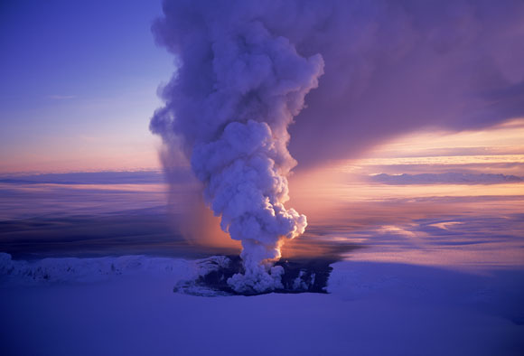
Drone Footage Of Icelandic Lava River
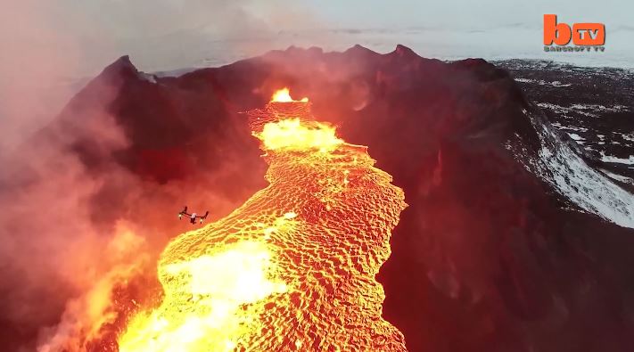
Lake Of Fire: Drone Footage Of Icelandic Lava River 1:46 mins A drone camera flies over a red hot lava lake in freezing cold Iceland and nearly melts in the process. The everchanging rivers of glowing lava shining through the gap between floating pieces of cooled crust are mesmerizing. The stunning footage was captured by US videographer Eric Cheng in February, 2015 and shows smoke and fire burning off the black marbled lava. Videographer / Director: Eric Cheng Producer: Mark Hodge, Chloe Browne Editor: Kyle Waters
Nova – Mystery of the Mega Flood
Monument Valley, the Grand Canyon, Niagara Falls: these ancient wonders show how nature’s forces have shaped the face of our planet on a vast timescale, how great landmarks are the work of millions of years of slow, imperceptible erosion by wind and water. But here, across 16,000 square miles of Washington State, abrupt rips and scars in the landscape defy this explanation. What could have formed these tall canyons and immense dry waterfalls? What could have gouged out these gigantic potholes? Whatever happened, the forces unleashed here created one of the Earth’s most enigmatic landscapes. For more than a century, scientists have been grappling with this geological mystery, descending through thousands of years of Earth’s history in a struggle to uncover, layer by layer, how this landscape was formed. Now the clues point to a sequence of events culminating in a massive natural catastrophe. Explore the features and reasoning that lead to the recognition of the “Missoula (Outburst) Floods” and helped to solve “The Mystery of the Megaflood (Spokane Floods or the Bretz Floods)”
Pillow Basalt and Palagonite – Lava Flowing into Water

Pillow basalt and palagonite are the result of lava flowing into water. We have a striking example in the Columbia River Gorge at the intersection of Hwy 30 and US 197 at the east end of The Dalles. This video gives a good idea of how these basalt pillows form and what they look like.
Ice Age Floods’ Features
This is an amazing compilation of extra ordinary photographs that have been expertly labeled to assist the viewer’s understanding of the evidence supporting the creation of the Channelled Scablands in Eastern Washington State, USA. The photographs are panned and zoomed in and out on providing an overview and close-ups of flood evidence. Music playing in the background helps the viewer focus on the information displayed in an unhurried manner. The viewer can stop the screen at any time to give them more time to study the information displayed in great clarity. For teaching, this methodology is suburb! Much better than a regular film or static photos. YouTube slideshow prepared by Bruce Bjornstad, published Dec 8, 2012