Steamboat Rock
Steamboat Rock lies at the very northern end of the Grand Coulee. At over 1 mile long, ⅔ mile wide, and 800 feet high. The basalt-topped butte standing alone in the middle of the coulee, almost completely surrounded by the waters of Banks Lake is an incredible sight. It was left behind by erosion of both the Ice Age Floods that carved the Grand Coulee, and the Okanogan Lobe of the ice-age continental ice sheet. Because this area is near the thinning outer margin of the Columbia River Basalt extent, it’s easy to see Columbia River Basalt directly overlying older granitic basement from the trails around the base. A steep climb on a well constructed trail leads to the broad top of Steamboat Rock where the views are truly expansive, encompassing a full 360° panorama. It’s also easy to find granitic erratics and glacial till atop the butte that attest to the fact that the Okanagan Lobe overrode Steamboat Rock during the most recent Ice-Age glacial advance. The campgrounds at the State Park are spacious and well laid out. There is easy access to both the trails and to Banks Lake for fishing, boating and swimming. Most of the water in Banks Lake has been pumped up from the Columbia River’s Lake Roosevelt, and impounded by a dam 20 miles south at Coulee City. Banks Lake is a key element in the Columbia Basin Project that supplies water for the verdant agricultural areas to the south in an otherwise quite dry, high desert environment. Some other interesting places to explore in the area include Northrup Canyon, Grand Coulee Dam, and the quixotic Gehrke Windmill Garden just north of Electric City.
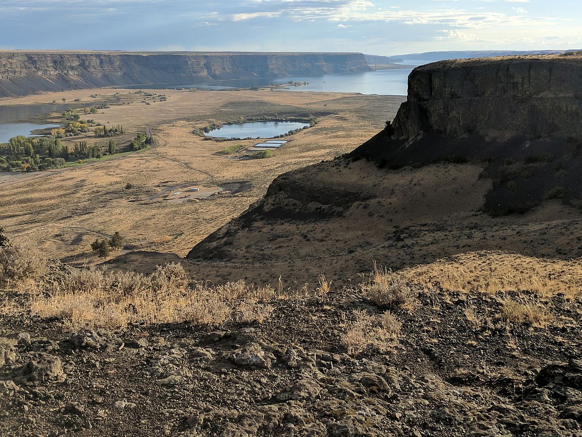
Frenchman Coulee
Frenchman Coulee Ice Age Floods National Geologic Trail Frenchman Coulee is a short drive north and west from the Silica Road exit 123 off US-90, along the Old Vantage Road. It is one of the most beautiful features left behind by the great Ice Age Floods. Several of those massive floods, up to 700 ft (213 m) deep, created Frenchman Coulee, its Potholes Coulee neighbor to the north, and scoured the bizarrely eroded surface of Babcock Bench, preferentially eroding weaker rock out of the top of the Grand Ronde Member of Columbia River Basalt. Frenchman Coulee is actually a dual coulee and cataract system, Frenchman Coulee and Echo Basin, separated by a remnant rock blade that sports tall basalt columns attracting rock climbers like bees to flowers. The Feathers is probably the most popular climbing area in the region. Hiking trails, some barely discernible, lead along and atop the rock blade, affording spectacular views of both coulees. Frenchman Coulee also has a waterfall in the eastern section of the Coulee that is accessible by foot. Other hiking and biking trails explore the floor of the coulee and continue over 15 miles north along Babcock Bench, perched high above and adjacent to the Columbia River, past Potholes Coulee and on to Crescent Bar. Quick Facts Location: Old Vantage Highway, Quincy, WA 98848 A primarily destination for hikers, mountain bikers and rock climbers with the fascinating rock formations of the Gorge making for a great challenge
Hiking Drumheller Channels

Hiking Drumheller Channels Ice Age Floods National Geologic Trail There are scads of hiking trails all through Drumheller Channels National Natural Landmark. On a cloudy day in early June we took off on a couple of exploratory hikes that were simply amazing. We first proceeded south from the parking lot at Lower Goose Lake, running through late Spring wildflowers, eventually looking for one of Bruce Bjornstad’s geocaches. We wandered over hills and down into deeper valleys, always surrounded by the towering walls of basalt defining that section of Drumheller Channels. Along the way we found an area of apparent Kolk depressions with odd spires of basalt poking up out of the middle of a central mound. Soon we passed through a reedy area that bounded the southern edge of Lower Goose Lake. We continued on south to the edge of Black Lake where the geocache was supposed to be, but after 20 minutes with 4 of us looking in the area of the GPS coordinates, we finally decided the cache was no longer there and headed back. The hike was easy, very pleasant, and mercifully cool due to the cloudy morning. We then drove north across the O’Sullivan Dam, and back south through Columbia National Wildlife Refuge to the W. McManamon Road entrance to Crab Creek Marsh Unit #3 and the Basalt Columns at Drumheller Trailhead, the kickoff point to go to the top of “Nick’s Columns”. Nick Zentner’s videos about the columns are great, but the blooper where his rock hammer falls down between columns is priceless. We just had to see those columns for ourselves, and we weren’t disappointed. It’s interesting how only the columns along the edge are free standing, while those inboard are packed around with sediment. The little rain the area gets probably washed the sediment out of the spaces between the bordering columns. After walking around for a while we made our way back to the car and drove to the Drumheller Channels National Natural Landmark overlook for a final sweeping viewpoint. The entire area is huge and worth several days of exploring, but it’s also pretty easy to have a great time in just a few hours. This is a place you just have to experience. Quick Facts Location: Adams County, Washington 99371
Dry Falls Kayaking

Dry Falls Kayaking Ice Age Floods National Geologic Trail Most Pacific Northwesterners know how awesomely majestic and stunningly beautiful Dry Falls is, if only from the pictures that seem to show up everywhere. If you haven’t been there in person yet you definitely need to make that trek into central Washington. The drive through the lower Grand Coulee, as awesome as it is, is only the teaser for the view from the Dry Falls Visitor Center. But if you really want to get into the majesty, consider taking a kayak down to Dry Falls Lake or Deep Lake, at the base of those monstrous cataracts. The dirt road to Dry Falls Lake isn’t for the faint of heart, and a good, high clearance SUV is recommended. But paddling the lake near the base of those 400 foot high cliffs is worth the effort. Bordered by reeds and accompanied by waterfowl, an hour-long paddle around the lake is leisurely, relaxing, and totally absorbing. And who knows, you might end up in someone else’s fantastic photo of Dry Falls from the Visitor Center. The road to Deep Lake is paved, so it is a much easier place to get to. And the ramp at the lake makes getting in and out pretty easy… just be careful of the slippery algae on the ramp. Once you’re on the lake an hour’s paddle will take you from an area bordered by rolling hills to a section bounded by high vertical walls. Don’t fall out in this area because there’s nowhere to climb out or beach your boat to climb back in. Still, it’s astoundingly interesting to get up close and see the variety of textures in the basalt walls. Of course, you can also do some great hiking in both areas, though climbing the blade takes quite a bit of effort and confidence, but the view is pretty spectacular. Unfortunately, the way back down isn’t any easier than the way up. Choose your route carefully. Quick Facts Location: Grant County, Washington, United States 99371 MANAGED BY:Washington State ParksWebsite: https://iafi.org/go-do/washington/ Dry Falls is a 3.5-mile-long scalloped precipice with four major alcoves, in central Washington scablands. A Discover Pass is required for vehicle access to state parks for day use. For more information about the Discover Pass and exemptions, please visit the Discover Pass web page.
Ginkgo Petrified Forest

Ginkgo Petrified Forest State Park Interpretive Center Ginkgo Petrified Forest State Park is a registered National Natural Landmark, lyng just north of US-90 at exit 136, and west of the Wanapum Lake portion of the Columbia River at Vantage, WA. Established in 1935, it is home to a rare and vast collection of petrified trees. The park covers 7,124 acres, including an interpretive trail, on which visitors can hike and see protected displays of several of the petrified tree species. The abundance of tree species discovered here make it one of the most diverse collections of petrified trees in North America. The trees are thought to have been carried down the flanks of ancient volcanoes from various ecological zones by floods and lahars., and then deposited and buried in an ancient lakebed. Slowly, cell-by-cell, the tree cells were replaced by dissolved minerals in the groundwater, resulting in exact rock replicas of the trees. The park comprises three primary locations. Drive a couple of miles up the Old Vantage Highway to the Ginkgo “Trailside Museum”, constructed by the Civilian Conservation Corps in the 1930s, and recently updated with a new interpretive exhibit. From here, 1.25 miles of the Trees of Stone Interpretive Trail wind past more than 20 petrified logs protected in their original settings with signage about the petrified wood. Birders look for golden eagles, sage thrashers, Say’s phoebes and many other species. Elk and bighorn sheep also frequent this area. A total of 3 miles of hiking trails are at this site. Perched on a cliff face carved out by Ice Age floods, Ginkgo Petrified Forest Interpretive Center overlooks the Wanapum Lake portion of the beautiful Columbia River. The access road is marked by a small sign on Main St. just north of the small town of Vantage. The interpretive center was constructed by the Civilian Conservation Corps during the Great Depression and was later expanded in 1951.The air-conditioned Center museum features a beautiful collection of more than 30 varieties of petrified wood, videos and park volunteers to inform visitors about the history behind this unique and unusual petrified forest. They can also tell about the powerful Ice Age Floods, responsible for the visually captivating surrounding landscape. Outside the Center, visitors can enjoy the day-use/picnic area, view the scenic river, touch petrified wood and learn more about the Ice Age Floods. Ginkgo Petrified Forest State Park is also home to the Wanapum Recreation Area about 3 miles south of US-90, which features 27,000 feet of freshwater shoreline and hosts a 50 site, full hook-up campground, a day use area with a swim beach, and a boat launch. Quick Facts On the Ice Age Floods National Geologic Trail Location: 4511 Huntzinger Rd, Vantage, WA 98950 99371 MANAGED BY: Washington State Parks A Discover Pass is required for vehicle access to state parks for day use. For more information about the Discover Pass and exemptions, please visit the Discover Pass web page.
Incredible Glacier Collapse Video

On Friday,July 8 around 2:45 p.m., British tourist Harry Shimmin reached the highest point in his trek along the Jukku pass in the Tian Shan mountains in Kyrgyzstan. He separated from the group to take pictures from the edge of a cliff when he heard deep ice cracking behind him. He turned around to an avalanche of glacial ice and snow rushing toward him and within moments found himself in a blizzard. The avalanche was the second glacier collapse of the week, demonstrating the perils of human-caused climate change amid a blistering hot summer in parts of Europe and Asia. These are glacier ice avalanches, rather than primarily snow, in which a glacier broke off and collapsed under the force gravity. The high density of ice added speed and weight to the avalanche. In the Tian Shan event, glaciologist Peter Neff, of the University of Minnesota, pointed out that there was no apparent snow around the mountain so the avalanche was largely a solid chunk of glacial ice. In high mountain regions with permafrost, warm temperatures not only destabilize the glacier ice but also the density of the ice around it. “It’s very dense, more like a landslide than an avalanche,” he said. “The British trekker is indeed, as he is aware, very lucky to be alive in the case of the Kyrgyzstan event,” added glaciologist Jeff Kargel, a senior scientist at the Planetary Science Institute. “A pretty solid hypothesis is that as temperatures warm [and] climate warms, the amount of melting increases,” Kargel said. “The effects of meltwater on destabilizing ice masses increases, and so the number, the frequency and magnitude of glacier ice avalanches should be increasing … and that does seem qualitatively to be the case.” Daniel Farinotti, a glaciologist at ETH Zurich, agreed. “It is long known that meltwater caused by high temperatures increase the pressure in the glaciers’ subglacial drainage system, which in turn can accelerate glacier motion,” said Farinotti in an email. “This increase in pressure and motion have certainly a role to play in such collapses.” Among the greatest downstream effects from such mountain glacier loss and collapses are on fresh water systems, Neff said. For instance, glaciers in High Mountain Asia play a critical role in funneling freshwater into river basins used for drinking, irrigation and hydropower by nearly 1.5 billion people. From the Washington Post article by Kasha Patel
Grant’s Getaways – Oregon’s Erratic Rocks
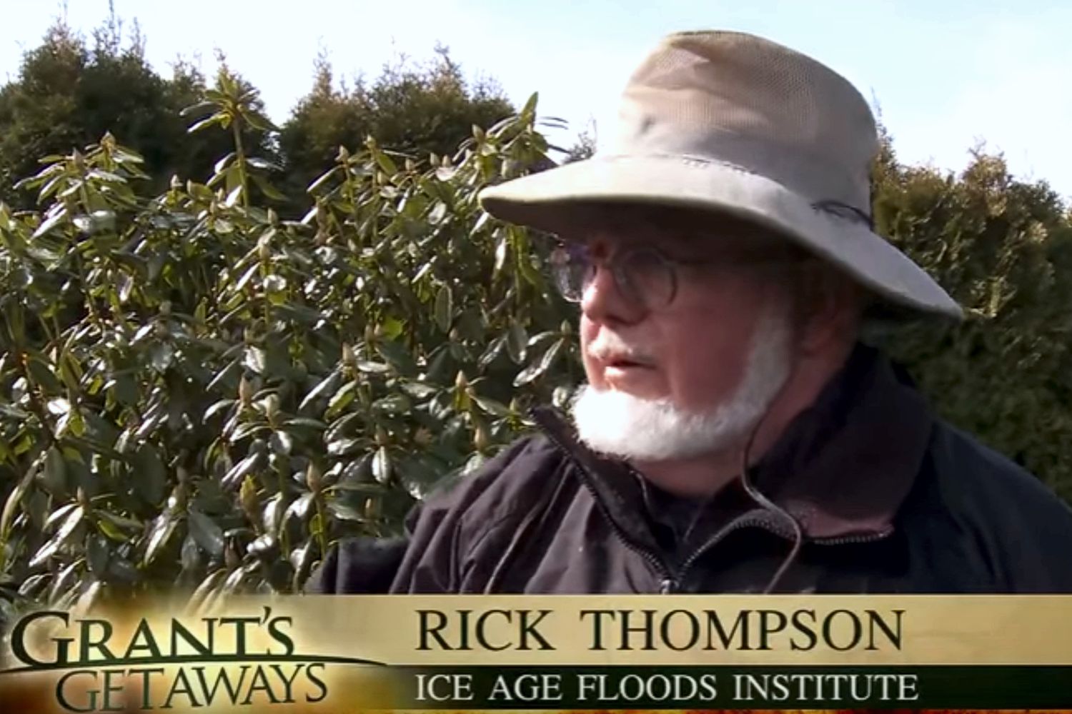
This episode of Grant’s Getaways features Lower Columbia President Rick Thompson and the Floods-borne erratics of the Willamette Valley.
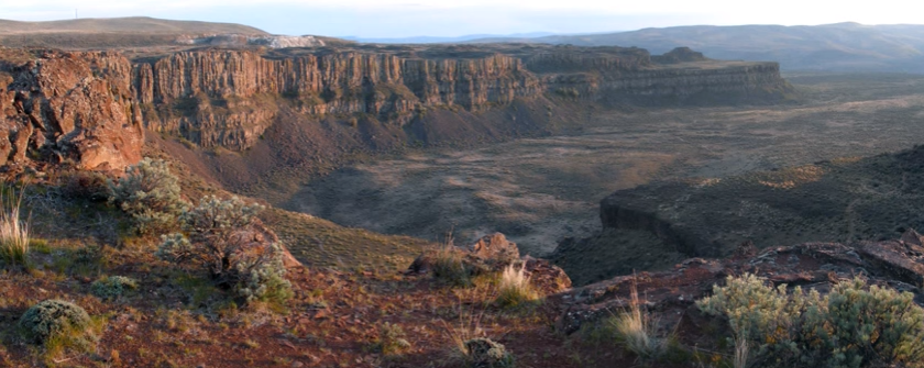
Frenchman Coulee Drone Video
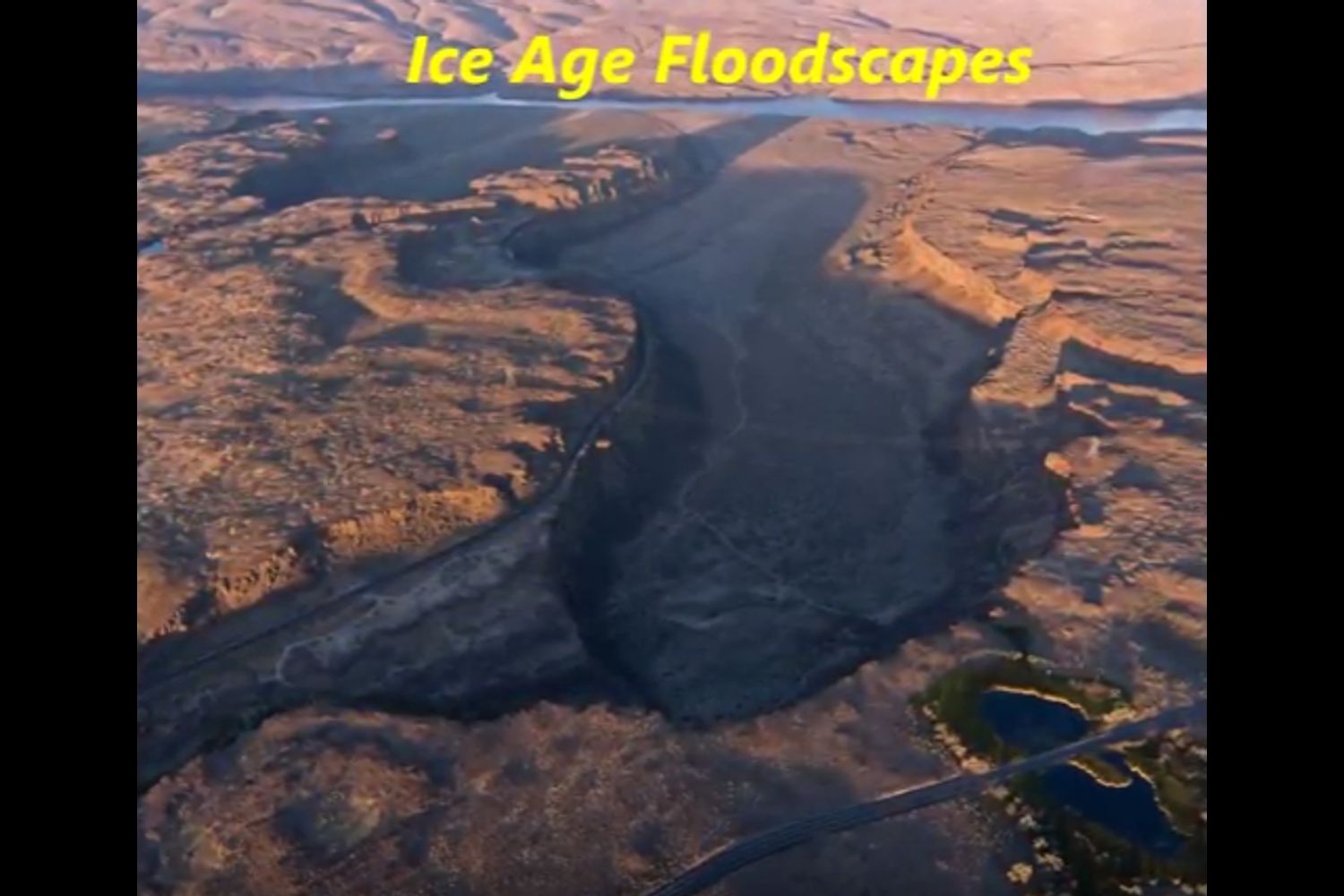
Bruce Bjornstad is at it again with his awesome Ice Age Floodscapes drone videos, this one from Frenchman Coulee. Watch it below and visit his Ice Age Floodscapes YouTube channel.for many more.
WA Geology Releases Stunning Lidar Images
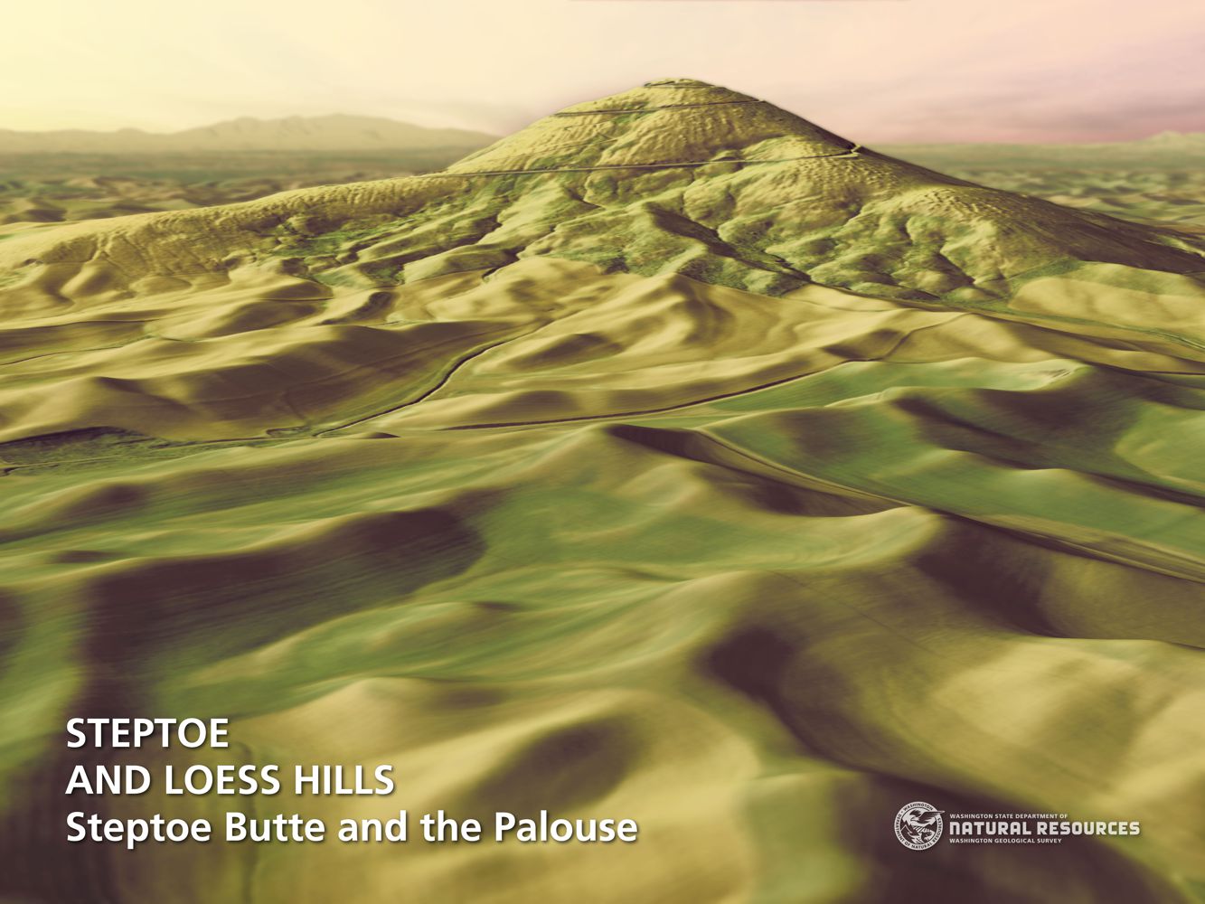
WA Geology Releases Stunning Lidar Images The Washington Geological Survey (WGS) has released 50 high-resolution lidar-derived images of the State’s geology and geomorphology through the Washington State DNR’s Flickr page. The images are available in 16:9 format (7,200 x 4,050 pixels) and 4:3 format (7,200 x 5,400 pixels). Ten of the images are new (see below) and 40 of them were previously available as screen wallpaper (at a lower resolution). Additionally, WGS has released several full-resolution lidar image series that reveal the State’s geology. These images are great for earth science presentations, learning about lidar, and for using as digital wallpaper. They are also large enough to support large-format printing. Click here for the complete Washington State DNR image galleries Mt Adams Lava Flow Outburst Flood Scars West Bar – Giant Ripple Marks Steptoe Butte – Loess Hills Mima Mounds Previous Next
My Hill
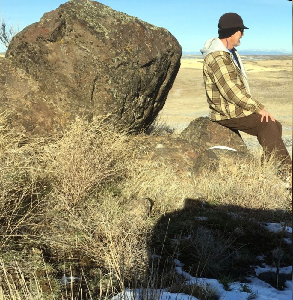
my hill As a city kid in the ‘60s my family occasionally visited my grandparents in the farm country of Washington State’s Waterville plateau. My grandfather and two uncles were wheat farmers near the small town of Withrow, the future site of which had been partly hedged in by the Okanagan lobe of the Cordilleran Ice Sheet many thousands of years ago. Sometimes my father and I would join my uncles on the dusty 15-minute drive “out in the hills” to the sagebrush-surrounded corral, well house and large cement watering trough that served the cattle herd pastured there. Overlooking the corral was a tall hill I would sometimes climb while the trough was refilling. Warned to beware of rattlesnakes, a tiring five- or ten-minute ascent would get me to the top. Astride a large boulder, I would survey the corral far below, the sound of the pump engine distantly laboring. Around me was a panorama of other hills, about whose origins it had never occurred to me to wonder. “My hill” was steep enough that even oblong rocks I tossed down its flank would often bounce and roll clear to the bottom. On occasion, this would elicit salty, muffled hollering from Dad to cease and desist. I’m a half-century older, now, but I wish I had then understood the remarkable history of my hill. How would it have felt at that young age to know that a vast ice sheet had blanketed this terrain some 12,000 years earlier and that the hill I stood on had been its progeny? That, as that glacier began to melt, streams and rivulets had formed on its immense surface? That small sinkholes and other weaknesses in the rotting ice had allowed those waters to sculpt caverns inside the glacier? That those waters carried copious quantities of sediment and rock debris captured as the glacier eroded its way hundreds of miles southward? That my hill, like an embryo within an icy womb, had begun to grow inside one of those expanding interior caverns, ultimately to be deposited on solid ground as a kame, a lasting testament to the retreating glacier? Would I have deduced that the glacier had been at least as thick upon the land as my kame was high above the corral below me? That the erratic boulder on which I sat had been deposited on that kame like a cherry atop a geological sundae? I formed an early affection for the Withrow country because of the many relatives who, not so long ago, had peopled that farmland. It’s strange to contemplate that they are mostly gone from this land now, making it seem somewhat alien to me for their absence. And yet that hill remains, a mute sentinel having witnessed the glacier that birthed it, the quiet passage of the millennia, grandpa’s construction of that watering trough in 1948, and the naive delight of a young city kid climbing its flanks in the 1960s. Dan Jordan – IAFI Wenatchee Erratics Chapter