Outburst Floods GSA Penrose Conference Visits West Bar
The 2023 GSA Outburst Floods Penrose Conference made a field trip stop on Tuesday afternoon, June 6, at Ken Lacy’s (IAFI Wenatchee Valley Erratics Chapter member) home, for a spectacular overview of the West Bar Current Megaripples that can be seen well from that vantage point. The 75 conference attendees were all at the conference by invitation only. They were accompanied by organizers Jim O’Connor, Isaac Larsen, Joel Gobiner, Vic Baker, Richard Waitt, Jerome Lesemann. The purpose of the conference was to review the current outburst floods fieldwork being done, encompassing the range of science conducted both on Earth and elsewhere in the solar system. The timing of the conference coincided with the 100th anniversary of J Harlen Bretz’s first publication on the Channeled Scabland, and took place at Camp Delany, which occupies a spectacular flood-carved setting at the foot of Dry Falls in Grand Coulee, Washington. The conference was meant to review past and present work, as well as help chart the future science on outburst floods through presentations, discussions, and multiple field trips. Everyone who shared Ken’s hospitality were in particularly good humor, as considerable amounts of cookies, popsicles, and bottled water were consumed. There were many comments about how well the meeting was going and how lots of new insights were being discussed. These kind of comments suggest that the meeting was being extremely well received. Ken was also pleased to talk to Justin Radford, along with his USGS Research Geologist… nice to see them in attendance.
Some Ice-Age 1st Peoples in Americas Came From China

The first wave of humans into the Americas during the last ice age may have hailed partly from northern China, according to a DNA study of ancient and modern Indigenous people. The ancient groups may have also migrated to Japan, potentially helping explain similarities in Stone Age artifacts in the Americas, China and Japan, according to the study, published Tuesday (May 9) in the journal Cell Reports. There are two leading models as to how people first migrated to the Americas. The older idea suggests that ancient Siberians made this journey when the Bering Land Bridge — the landmass that once connected Asia with North America — was relatively free of ice. More recent evidence argues that multiple waves of humans journeyed to the Americas from various parts of Eurasia, perhaps on watercraft along the Pacific coasts of Asia, the Bering Land Bridge and North America. To shed light on the origins of Indigenous Americans, scientists examined DNA from mitochondria, the powerhouses of the cell. Mitochondria possess their own genes, which are passed down from the mother. The new findings suggest that the ancestors and closest relatives entered the Americas through at least two migrations. Both diasporas apparently occurred when the land bridge from Asia to the Americas was obstructed by ice, so the researchers suggest that ice age people may have traveled via the Pacific coast instead. The first migration likely happened between 19,500 and 26,000 years ago, during the Last Glacial Maximum, the coldest part of the last ice age, the researchers said. Back then, ice sheets covered much of the planet, and living in northern China would have likely proven difficult for humans. The scientists estimated the second event apparently occurred between 19,000 and 11,500 years ago, when the ice sheets began melting. Prior work suggested this climate shift likely helped support the rapid growth seen in human populations during this era, which may have helped drive their spread into other regions. In all, the new study “matches well with what we know about the archaeological record of Japan, and lends weight to current models of how humans came to populate the Americas,” Loren Davis, an archaeologist at Oregon State University in Corvallis who did not take part in this research, told Live Science in an email. This discovery may help explain some archeological similarities that prior work controversially suggested at times existed between Stone Age peoples in China, Japan and the Americas. Specifically, researchers had argued the three regions possessed similarities in how they crafted “stemmed projectile points” for arrowheads and spears. However, while the new study is exciting, it’s just “another piece of the puzzle,” on how and when ice age humans first populated the Americas, Davis said. For instance, the researchers stressed that while these new findings suggest this single northern Chinese lineage may have contributed to Indigenous American ancestry, “it does not represent the whole history of all Native Americans,” Li said. “Investigating other lineages showing genetic connections between Asia and the Americas will help obtain the whole picture of the history of Native Americans.” For more details read the whole article by Charles Q. Choi at Live Science
How do we know how old Earth is?
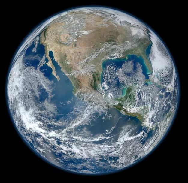
By measuring radioactive elements in rocks from Earth and other parts of the solar system, scientists can develop a timeline of our planet’s early years. Earth is roughly 4.54 billion years old. In that time, it has seen continents form and disappear, ice caps expand and retreat, and life evolve from single-celled organisms into blue whales. But how do we know Earth’s age? We start by looking inside it. “When you’re an Earth scientist who looks at a rock, it’s not just a rock; it’s like that rock has a story that you can try to decipher,” said Becky Flowers, a geologist at the University of Colorado Boulder. When minerals form out of magma or lava, they often contain traces of radioactive material, such as uranium. Over time, those radioactive elements decay, meaning they spew radiation, eventually transforming them into new, more stable elements that remain trapped inside the mineral. Take radioactive uranium-238, a common form of uranium. Its atoms will release energy until they eventually turn into lead. That process occurs at a fixed rate known as a half-life, which corresponds to the amount of time it takes for half of the atoms to decay. The half-life of uranium-238 is more than 4 billion years, meaning it takes more than 4 billion years for half of the uranium-238 in a sample to become lead. This makes it perfect for dating objects that are very, very old. By knowing these half-lives, we can calculate how old a rock is based on the ratio of the “parent” radioactive element and the “daughter” stable element — a method called radiometric dating. The mineral zircon is commonly used for radiometric dating because it contains a relatively large amount of uranium, Flowers said. Uranium-lead dating is just one type of radiometric dating. Other types use different elements; for example, radiocarbon dating, one of the most common methods, uses a radioactive isotope of carbon that has a half-life of thousands of years and is useful for dating organic matter. Using these methods, geologists have found minerals on Earth that date as far back as 4.4 billion years, meaning the planet has been around at least that long. But if scientists say Earth is more than 4.5 billion years old, where did those extra 100 million years or so come from? Earth, as mentioned, has changed a lot over billions of years, especially through processes such as plate tectonics, which shift the crust, birthing new land out of magma and subducting old land back underground. As a result, rocks from the very beginning of the planet’s history are hard to find; they’ve long since eroded or melted back into raw material. But scientists can use radiometric dating to determine the age of rocks from other parts of the solar system, too. Some meteorites contain materials that are more than 4.56 billion years old, and rocks from the moon and Mars have also been dated to around 4.5 billion years ago. Those dates are pretty close to the time scientists think the solar system started to take shape out of the cloud of gas and dust surrounding the newborn sun. And by knowing all of these relative ages, we can start to piece together a timeline of how Earth, the moon, Mars and all of the other little rocks floating around in nearby space started to form. Yet the transition from primordial dust cloud to planet Earth didn’t happen all at once but rather over millions of years, Rebecca Fischer, an Earth and planetary scientist at Harvard University, told Live Science. That means our understanding of Earth’s age will always be less about a specific year when the planet formed and more about a general sense of the era when our home planet started to take shape. By Ethan Freedman (lifes-little-mysteries ) reprinted from LiveScience.com
Ice Age Floods National Geologic Trail – April 2023 Update
Spring is coming and the trail is starting to wake from its long winter break. Our National Park Service Interpretive Rangers are already out and about with our Mobile Visitor Center. Our team has made lots of contacts at various trade show events around Spokane, WA, and Washington State Parks joined NPS at the Othello Sandhill Crane Festival. Our thanks to Ranger’s Abby, Emilee and David for sharing the Missoula Floods story with over 500 visitors to the Scablands. From April 27th through May 25th the Mobile VC will be traveling to sites around Lake Roosevelt NRA on Thursdays. You can find the Ice Age Floods NGT and Lake Roosevelt NRA Mobile Visitor Center’s schedule and locations on our Ice Age Floods NGT calendar. Our Junior Ranger Program test is showing success and has already run out of booklets! Tualatin Library, one of the National Trail’s official partners, has been promoting and sharing our Junior Ranger activity booklet “Megaflood Adventure”. Young explorers can turn in completed booklets for Ice Age Floods NGT Junior Park Ranger badges. National Pak Service is exploring this program and hopes to bring more Junior Rangers into the Missoula Floods community. Out on the Trail: Now is a great time to explore the Willamette Valley searching for signs of great Missoula Floods and watching the valley spring to life. You might explore Erratic Rock State Natural Site near McMinnville, Oregon. There you will find ~90-ton chunk of Precambrian argillite sitting ~150 feet off the valley floor and some 500 miles from where this sort of rock originates. How did that happen? You can use the Trail’s NPS App to find out how and to explore more amazing landscapes changed by the Missoula Floods. Some of them are perhaps in your part of the world! I am looking forward to joining Institute members at the IAFI Rock-Out Jubilee in just a couple of months. I’ll see you there or out on Ice Age Floods National Geologic Trail this summer. Have fun and safe travels.
Puget Sound Area has a Glacial Story to Tell

Although the Seattle region was not impacted by the large floods from Glacial Lake Missoula, Glacial Lake Columbia, or other glacial lakes east of the Cascades, the Puget Sound region has its own glacial story to tell. It’s interesting that J Harlen Bretz, who first imagined that a massive flood produced the Floods features in the Columbia Plateau, also did his PhD on “Glaciation of the Puget Sound Region”. The Puget Lobe of the Cordilleran Ice Sheet advanced and retreated over the Puget Lowland at least seven times during the Quaternary Ice Age. In the process, it left behind rocks, sediments, and other geologic clues that tell the intriguing story of ice, proglacial lakes, and flooding across the landscape near Seattle. Snoqualmie Falls, near North Bend, WA east of Seattle is a popular tourist destination. At the falls, the Snoqualmie River plunges 82m over a wall of volcanic rock. Few tourists, however, understand the role that the Puget Lobe of the Cordilleran Ice Sheet played in the formation of the falls. Prior to glaciation, Snoqualmie Falls did not exist, instead, the river flowed in an incised channel east of the current falls. As the Puget lobe advanced into the Puget Lowland about 18,700 years ago, the glacier’s eastern margin blocked drainage from rivers flowing out of the Cascades, including the Snoqualmie River. A large glacial lake known as Glacial Lake Snoqualmie formed over North Bend and over the Snoqualmie Valley. Tokul Creek, one of the tributaries, formed a thick underwater delta in the lake as its sediments poured into Glacial Lake Snoqualmie. When the Puget Lobe retreated, Glacial Lake Snoqualmie drained to the west and the Snoqualmie river attempted to follow its original channel. However, the original course of the river was blocked by the delta deposits from Tokul Creek and the river was forced to flow over a narrow band of rocks from an eroded volcano further to the south. Snoqualmie Falls flows over this volcanic rock today, but since the last glacial maximum, cataract recession has rapidly eroded the rocks back to a 200m wide band of andesite and volcanic breccia. Behind the thin volcanics is a thick layer of soft alluvium. At the current rate of recession, the Snoqualmie River will erode through the volcanic rock in about 7,200 years. When that happens, the river will hit the alluvium and the falls will quickly devolve into a series of rapids. You might want to hurry to see the falls before they disappear! Other glacial lakes were formed at the southern margin of the Puget Lobe near modern day Seattle. As the Puget Lobe advanced south, it dammed rivers and streams that were flowing north. In places, the bluffs surrounding modern Puget Sound hold a record of the advancing glacier and the pro-glacial lakes backed up by the ice front. One good place to view these sediments is from the beach at Discovery Park in Seattle. A layer cake of sedimentary units records the pre-glacial river system, the advance of the ice, the damming of the proglacial lakes, and the retreat of the ice sheet to the north. At the base of the cliffs the Olympia Formation records the pre-glacial environment of north-flowing rivers and streams. The Lawton Clay layer indicates the formation of proglacial lakes. The Esperance sand represents a period of glacial retreat. The glacier that repeatedly covered the Puget Lowland left behind multiple geologic clues for us to interpret. The Puget Lobe of IAFI welcomes members from other chapters to join us as we explore the glacial history of the Puget Lowland.
White Bluffs at Hanford Reach

Appearing much different than the nearly ubiquitous Columbia River basalt cliffs and boulders of central Washington, the White Bluffs area features a series of 50-170 m tall buff-colored bluffs and badlands underlain by those basalts. These are outcropping layers of the Ringold Formation comprising most of a 600-ft high escarpment exposed along the north and east banks of the Columbia River in south-central Washington. These ancient river and lakebed sediments were laid down by the Columbia and Snake River systems 8.5 to 3.4 million years ago. However, a section of the White Bluffs are a much younger stack of slackwater rhythmite deposits that filled a paleochannel eroded into the Ringold Formation, These late Ice Age rhythmites are only 17,550-12,500 years old. They were laid down as each of the 40 or more Ice Age Floods backed up behind the narrow constriction at Wallula Gap, submerging the entire White Bluffs area under temporary Lake Lewis. Up to about a dozen rhythmites, composed mostly of sand from as many floods, occur within the channel fill. At the top of most rhythmites is a layer of wind-blown sand suggesting a period of dryness separated each flood. Sediment thicknesses and sedimentary structures in each of the beds give a sense of the tremendous sediment load and the relatively calm conditions of the ponded flood waters. Learn more from Nick Zentner’s 2-Minute Geology video – The White Bluffs at Hanford Reach The White Bluffs are located along the east side of the Columbia River, across from the former towns of Hanford and Whitebluffs, on the Hanford Reach National Monument where the atomic age was born. The bluffs have been exposed by the Columbia River down cutting and moving laterally against the deep silts and sands and old soil horizons that make up the bluffs. These towering white bluffs, massive sand dunes, and the last free flowing nontidal section of the Columbia River all help make the Hanford Reach one of the most dramatic natural areas in the state. Take a Hike on the White Bluffs Rhythmites Trail, Lat, Long: 46.642855, -119.403263
Lake Lenore Caves – Lower Grand Coulee
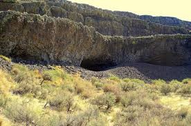
Tucked into the Lenore Canyon are the Lake Lenore Caves. Along with much of the eastern half of the state, Lenore Canyon was formed during the Missoula floods at the end of the last Ice Age, over 13,000 years ago. The glacial flood waters crashed down the canyon, carving through the basalt that makes up the sheer rock walls, creating coulees, ridges, cliffs, plateaus, rock slides, caves and a series of lakes. The caves themselves are shallow, created during the Great Missoula flood as water pulled chunks of basalt from the walls of the coulee. Post-flood weathering created talus slopes that furnished easy access and temporary overnight camps and storage for at least 5,000 years for hunters and gatherers from villages located elsewhere in the Grand Coulee and along the Columbia River and its tributaries. It is still used today for certain Native American religious ceremonies. It is easy to see why the caves were chosen as a cozy place to stay, as the depth provided plenty of shelter from the elements, while not going so deep that light couldn’t reach the back corners. It is often quite warm and breezy outside, but in the caves it is cool and calm. A well-marked 1.2-mile out-and-back trail leads from the parking area to some of the caves. It is generally considered an easy route that takes an average of 31 min to complete. This is a popular trail for hiking and walking, but you can still enjoy some solitude during quieter times of day. The best times to visit this trail are March through November. Dogs are welcome, but must be on a leash. The coulee walls in this area are made up of Grande Ronde Basalt flows overlain by the Frenchman Springs and Roza members of the Wanapum Basalt. The lower (colonnade) and upper (entablature) cooling units of individual flows are visible in the coulee walls. Flow unit contacts are sometimes complex to interpret. Some flows pinch out against older flows, some are perhaps due to flows covering an irregular topographic surface on the underlying flow, some may be filling of shallow valleys, and some multiple layers may be pulses of lava from the fluid interior pushing out over the partially formed entablature of a previous lava pulse.
McBones – Ice Age Floods Mammoth Dig

The Tri-Cities area, home to the Lake Lewis Chapter of IAFI, is inching its way into spring and it’s time to say goodbye to winter. And for some of us, it’s time to begin the 2023 dig season at Coyote Canyon, the resting place of a 17,500-year-old Columbian mammoth. Coyote Canyon is just a few miles southwest of Kennewick in the Horse Heaven Hills. Last month we cleaned up the winter erosion and set up the field equipment so work can begin in earnest in April. Several bones, yet to be identified, were partially exposed last fall and hopes are high for exposing and removing them this summer. This elephant relative was deposited on the west side of Coyote Canyon during one of the earlier Ice Age floods and is buried by possibly six layers of floods sediment. Numerous erratic rocks have been found among the bones. Just before the pandemic temporarily paused work at the site, a local high school girl was assigned the task of identifying rock types of a cluster of small erratics buried near the animal’s left shoulder blade. She then identified outcrops of the same types of rocks in northern Idaho, at or near the ice dam. Finally, she documented her work with a poster and presented it at the 2019 GSA conference in Portland, Oregon. With digging comes tourism. As usual, public tour lists have filled for spring and summer-fall tour reservations will open on June first. To sign up for a tour the public can visit our new website, www.mcbones.weebly.com. School and private group tours are also available. At the time of this writing, we have scheduled six public tours, 30 elementary class tours and 13 group tours, including one for vision impaired and one for non-English speakers. All of our presentations emphasize the importance of the Ice Age floods to the mammoth story at Coyote Canyon.
Geology Experts Find Evidence of Dual Mass Extinctions 260 Million Years Ago

Long before dinosaurs, Earth was dominated by animals that were in many ways even more incredible. Carnivores such as Titanophoneus, or “titanic murderer,” stalked enormous armored reptiles the size of buffalo. Many of these animals died out in a mass extinction during the Capitanian Age approximately 260 million years ago. Now an international team of researchers says evidence suggests this mass extinction was not a single event but two, separated by nearly 3 million years. Both were caused by the same culprit: massive volcanic eruptions. By studying uranium isotope profiles of marine samples collected in the South China Sea, scientists identified two “pulses” in which the oceans became deprived of life-giving oxygen. In a study published in the journal Earth and Planetary Science Letters, researchers say their analysis provides evidence that the oxygen-deprived oceans precipitated two mass extinctions around 259 million and 262 million years ago during the Middle Permian Period. Looming climate disaster By studying these ancient extinctions, researchers can better predict how modern-day global warming could affect the ocean’s food chain. “We are studying the biocrisis in the Permian Period, but similar warming is happening today because of human events,” said Thomas Algeo, a study co-author and University of Cincinnati professor of geosciences. “Humans are mimicking the effects of volcanic eruptions as a consequence of the release of carbon into the atmosphere.” The study was led by researcher Huyue Song at the China University of Geosciences, a former postdoctoral researcher at UC. “Today, we are facing several global change issues, including global warming, ocean hypoxia, seawater acidification and biodiversity decline, which are similar to the environmental changes during the Middle Permian biological crisis interval,” Song said. Scientists have identified the five biggest mass extinctions, including the most cataclysmic of all 252 million years ago called “the great dying” that wiped out 90% of ocean life and 70% of land animals. This disaster, too, was caused by massive volcanic activity that turned the seas into dead zones, said Algeo. “The Capitanian extinctions are not among the Big Five, but they are significant,” Algeo said. How do volcanic eruptions lead to extinctions? Algeo said massive eruptions create a brief period of cooling from ash in the upper atmosphere reflecting sunlight, followed by much longer periods of global warming. The release of massive volumes of greenhouse gases warmed the oceans. The warm surface water did not allow dissolved oxygen to reach lower depths, eventually destroying the food chain. “The ocean is teetering on the edge of anoxia,” he said of this absence of oxygen. “Dissolved oxygen has to be taken up by the surface layer and supplied to the deep ocean. But warmer water is lower density. When you increase the density differential, you prevent any overturn and there’s no way to get dissolved oxygen into the deeper layers.” One way researchers identify these massive volcanic eruptions is by looking for mercury in the sedimentary layers. “Mercury has been shown to be a useful proxy for volcanic eruptions,” Algeo said. “Large volcanic eruptions spew mercury into the atmosphere that gets carried around Earth and deposited in marine sediments.” Scientists say the volcanic eruptions that caused the great dying originated in Siberia. The eruptions that caused the twin mass extinctions in the Permian took place in southwest China in a place known as the Emeishan Large Igneous Province. Algeo said he would like to see if any terrestrial evidence supports the conclusions derived from their study of ancient oceans. He is optimistic that geology will unlock more mysteries about prehistoric life on Earth. “Over the last 40 years we’ve made tremendous strides in understanding the Earth’s past,” Algeo said. “It’s partly because we have all these new tools we can apply. And we have many more people working in this field than we had a generation ago.” Researcher Song said the dual disasters in the Permian show the devastating effects that global warming can have. “We must pay attention to these environmental issues and prevent the sixth mass extinction,” he said. Reprinted from Phys.org, article by Michael Miller, University of Cincinnati
How did humans first reach the Americas?
During the last ice age, which route was taken by the first humans to reach the Americas, and did they travel by foot, boat or both? Humans first arrived in North America at least 15,500 years ago. Exactly how they got there, however, constitutes one of the longest-standing debates in archaeology. For decades, scientists assumed that people first arrived in the Americas by walking south from the now-flooded land bridge in the Bering Strait that once connected Russia to Alaska when sea levels were lower during the last ice age. But recent evidence suggests that these people were not the first to set foot on the continent. According to the now-dominant “coastal route theory,” that distinction belongs to humans who boated down the Pacific coast several millennia earlier. A 2023 study(opens in new tab), for instance, found that coastal conditions were favorable during two time windows: from 24,500 to 22,000 years ago, and from 16,400 to 14,800 years ago. And while the science is far from settled, the evidence increasingly points to the first Americans arriving by sea or land along the coast. “The pendulum is swinging in support of the coastal corridor being the route taken by the first Americans,” Michael Waters(opens in new tab), director of the Center for the Study of the First Americans at Texas A&M University, told Live Science in an email. “But we still need the smoking gun: an early site along the coast.” Until 20 years ago, the best available archaeological evidence(opens in new tab) suggested that humans first arrived in North America about 13,000 years ago. The rise of the Clovis people — whose 13,400-year-old remains were discovered in Clovis, New Mexico, in the early 1900s — coincided perfectly with the formation of an ice-free corridor along the Rocky Mountains. Scientists assumed that these humans crossed the Bering Land Bridge into what is now Alaska, and then turned south to march onward to New Mexico through that convenient corridor. This remains the prevailing theory as to how the Clovis people made it to the Americas. “It seems very likely that people did arrive from northeast Asia via the ice free corridor once this route was open and viable,” Todd Braje, chair of anthropology at San Diego State University, told Live Science in an email. But recent excavations suggest that the Clovis were not the first Americans. A 2011 paper in the journal Science presented evidence of tools crafted by humans in Texas from up to 15,500 years ago, and a 2021 paper in Science described 23,000-year-old footprints in New Mexico. (However, the footprint date is disputed by a 2022 study in the journal Quaternary Research, which posits that the plant seeds the original team used to radiocarbon-date the footprint layer are problematic.) These “pre-Clovis people” would have had to migrate to America long before the ice-free corridor opened up. “The earliest the inland corridor was open is 14,300 years ago,” Waters said. “It is impossible to have people in Texas and Idaho at 16,000 years ago, and Florida at 14,600 years ago, come through the corridor. They must have come a different way.” How the pre-Clovis people got to America without an inland corridor to take them south from the Bering Strait remains an open question. “With the breaking of the Clovis barrier in the 1990s, we know people were in the Americas prior to at least 14,000 years ago, but when people first arrived and by what route or routes remains unknown,” Braje said. “There are now lively debates on the topic but the bottom line is that no one knows definitely.” The prevailing theory is that the pre-Clovis people arrived by watercraft. “The route taken by the initial migrants was almost certainly along the coast,” said Matthew Des Lauriers(opens in new tab), director of the Applied Archaeology Program at California State University, San Bernardino. Des Lauriers described the pre-Clovis as sophisticated maritime hunter-gatherers, who would have cast off south from the Bering Land Bridge and subsisted on fish and game as they voyaged down the Pacific coast. Ultimately, Des Lauriers said, these intrepid seafarers parted ways. Some pre-Clovis people followed rivers inland, while others continued south as far as Chile. “The ocean would always have provided resources for skilled fishermen and hunters,” Des Lauriers told Live Science in an email. “The most likely scenario is one of coastal fisher-hunter-gatherers moving along the North Pacific Coast.” Recent work from geologists has lent support to the theory that the Clovis people arrived via an inland corridor, while the pre-Clovis people took a coastal route. Beryllium-10 dating of glacial boulders(opens in new tab) along the ice-free corridor suggests that the corridor opened about 13,800 years ago. And studies suggest that a strip of unglaciated land should have existed along the Pacific coast of Alaska and British Columbia 16,000 years ago — prime real estate for a coastal corridor. As the field of ancient genetics has blossomed, multiple studies(opens in new tab) have provided additional evidence that the first Americans arrived between 15,000 and 17,000 years ago. “It is gratifying to see the archaeological and genetic evidence converging to tell the same story,” Waters said. “Finally, we have a much better understanding of the chronology of the opening of the two corridors, and the evidence now supports a coastal migration route.” Nonetheless, physical evidence for both corridors is still lacking. Significant archaeological, genetic and geologic legwork will be necessary before we can firmly point to the lives and times of the first Americans and begin to describe, with confidence, how they arrived in America. “There are very few sites along the Pacific Coast that are pre-Clovis in age, and much work needs to be accomplished to find potential early coastal sites,” Braje said. “We have no definitive answers about when and how people first arrived in the Americas.” Reproduced from an article by Joshua A. Krisch, published in Live Science More on archaeological research into early human migration into the Americas: The Fertile Shore