Celebrating the Life and Legacy of Dr. Gary Ford (1943 – 2026)

Members and the Board of Directors of the Ice Age Floods Institute (IAFI) remember fondly our long-time leader, mentor, and friend, Dr. Gary Ford, and deeply mourn his passing. Gary left us peacefully at his home on June 4, 2026 after living a full life of service, curiosity, and dedication. Born in Illinois on May 20, 1943, Gary lived it with an infectious curiosity in a journey defined by service and a profound connection to the earth. After serving in the United States Air Force, he channeled his love for the environment into a Ph.D. in Soil Conservation at Montana State University. He went on to spend a meaningful career protecting America’s most iconic landscapes as a park ranger in Yellowstone National Park and later with the U.S. Forest Service. When Gary “retired,” he brought his leadership and wealth of knowledge to the Ice Age Floods Institute, first as President of the Cheney-Spokane Chapter (2009–2012), then taking the helm as Institute President from 2012 to 2026. Gary tirelessly shared and fully believed that the grand, cataclysmic geological history of the Pacific Northwest belonged to everyone. As a leader, Gary was defined by his extraordinary openness, thoughtfulness, and exceptional people management skills. He possessed a rare ability to harness a diverse Board of Directors, skillfully guiding a wide range of perspectives and building bridges toward a unified, shared vision. He was always eager to welcome new members, champion fresh ideas, support grassroots chapters, and spark a shared sense of wonder in anyone who would listen. His leadership wasn’t rigid or about titles; it was about fostering an open, collaborative community united by curiosity. Gary’s quiet strength, warmth, and gentle spirit left an indelible mark on his family, colleagues, and the landscape he spent his life protecting. Beyond his geological pursuits, Gary was a devoted family man who loved sharing adventures, laughter, and a good story. He is survived by his beloved wife, Barbara Ford; his daughter and son-in-law, Flavia and Matt Hildebrant; his grandsons, Aspen and Dylan Bergland; his sister, Luann Ford; and his cousin, Anna Belle Alshire. He famously passed his love of Star Wars down to his grandsons and was always ready with a perfectly timed Yoda quote to put life into perspective: “Luminous beings are we, not this crude matter.” In keeping with Gary’s wishes, no formal celebration of life will be held. Instead, his family will scatter his ashes in a place that held a special, enduring meaning to him.
Rehoming Wenatchee Valley Erratics Chapter
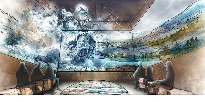
Our Wenatchee Valley Erratics Chapter home for many years at Wenatchee Valley Museum and Cultural Center is now officially closed as of May 18th for a huge renovation project. With that news, now begins the relocation of our chapter’s Education Dept. (i.e., Chapter Headquarters) to the Wells House. We will have our Presentation Area, Internet and Equipment ready in July in time for our August presentation, which is sure to be a reward for our patient Chapter members. The Wells House will provide a historic setting and venue although quaint. The Wenatchee Valley Museum & Cultural Center has long been a place where the history, culture, and creativity of our region come alive. Yet today’s visitors need more than the museum’s current facilities can provide—easier access, more engaging spaces, and opportunities to connect across generations and cultures. The “Branch Out” campaign is Wenatchee Valley Museum & Cultural Center’s answer to that need. By reimagining our campus with connected buildings, welcoming gathering areas, and interactive exhibits, we will create a destination that reflects the energy of our growing community and ensures these stories are preserved, shared, and celebrated for decades to come. Take a virtual fly-through of the new museum design. Relive the joy of the project groundbreaking event. Support the Museum & Cultural Center’s Branch Out building fund campaign. Donations will be matched until June 30th by the Wiedner Group. The Wells House has a long and varied history in Wenatchee. From its construction in 1909, it had been used as family residences, junior college girl’s dorms, administration offices, early classrooms and student activities. It was rescued from demolition and placed on the National Register of Historic Places in 1973, before being deeded to the Museum with the goal of preserving and maintaining it so that it can be used and enjoyed by the public, raise awareness of our valley’s history, and be an architectural asset that contributes to a sense of place and pride within our community.
Malaga Landslide: Ice Age Catastrophe Along the Columbia River
The east bank of the Columbia River near Malaga, Washington, is home to one of the largest and most visually striking landslides in the Pacific Northwest: the Malaga Slide. Covering an estimated 45 square miles, this massive slope failure poured weakened basalt and sediment into the Columbia River valley at the close of the last Ice Age. Today, it remains easily visible from State Route 28, making it an accessible outdoor classroom for geology enthusiasts and tour participants. The geologic story of the Malaga Slide is a tale of both slow preparation and sudden catastrophe. Layers of basalt from the Columbia River Basalt Group were fractured and weathered over millions of years. Interspersed with weaker sedimentary layers, these formations became prone to failure. Add in groundwater saturation, the erosive power of repeated Ice Age Floods, and over-steepened valley walls, and the stage was set for a massive collapse. Scientists believe the main phase of the Malaga Slide occurred approximately 15,000–13,000 years ago, during the final stages of the Missoula Floods. While the collapse itself was sudden, the landslide likely continued to adjust and move over time, creating the hummocky terrain and displaced boulders still visible today. One of the most intriguing aspects of the Malaga Slide is its interaction with the Columbia River. Some geologists have hypothesized that the massive slide may have temporarily blocked or partially dammed the river. This could have caused short-term ponding upstream, potentially extending back toward Peshastin. Evidence of this interaction remains visible today as enormous boulders and slide debris in the river channel. Travelers heading south from Wenatchee on State Route 28 are treated to a dramatic view of the slide, with scarred slopes and scattered boulders lining the west side of the river. This visibility makes the Malaga Slide an outstanding site for guided geology tours offered by the Wenatchee Valley Erratics Chapter of the Ice Age Floods Institute. Participants learn about Ice Age Flood processes, landslide mechanics, and the long-term evolution of the Columbia River valley. Learn more about Wenatchee-area geology tours: https://wverratics.org or contact@wverratics.org Article by Jeff Becklund, Wenatchee Valley Erratics Chapter President
Volunteers Help Shape the IAFI!

We’re reaching out to ask for your help. As we work toward our mission of promoting public awareness and education about the Ice Age Floods, our chapters have been facing a significant challenge: a shortage of active member volunteers willing to step into leadership roles or assist with essential chapter functions. Many of our current leaders are in their 70s and 80s, and the demands of their roles are becoming challenging. While our dedicated leaders works to maintain our organization’s momentum, we need support to ensure our continued growth and success. Your involvement will be crucial in helping to: Organize events: Assist with planning field trips, chapter functions, and speaker series. Provide administrative support: Help with recordkeeping, website updates, and newsletter contributions. Engage with the community: Connect with local schools and media outlets to spread awareness about our mission. Contribute fresh perspectives: Share your ideas and expertise to help us adapt to a changing world. Here are some ways you can get involved: Volunteer for events: Help plan and execute field trips, workshops, and conferences. Join a committee: Contribute to our leadership team and help make important decisions. Share your expertise: Offer your skills in areas like marketing, communications, or technology. By becoming more involved, you can: Strengthen your chapter: Contribute your time and skills to make your local chapter more vibrant and effective. Share your knowledge: Bring new ideas and contemporary skills to our organization. Support the organization: Help IAFI achieve its goals and become the foremost provider of Ice Age Floods information. No matter your level of experience or commitment, we welcome your participation. Whether you can volunteer a few hours a month or are interested in taking on a leadership role, your involvement will make a significant difference. The involvement of many will lighten the load on the few, and also bring a much-needed infusion of energy and fresh perspectives. We believe that by working together, we can strengthen our organization and better serve our mission of promoting public awareness and education about the Ice Age Floods. Your participation is essential. To get involved, please contact your local chapter through the IAFI.org website
Unearthing the Secrets of Spokane Valley: A Recap of the IAFI June Jamboree
This year’s IAFI June Jamboree delved into the fascinating geological history of Spokane Valley, contrasting it with the iconic Grand Coulee and Dry Falls, explored during last year’s Jubilee. Challenging the Landscape: Unlike the open spaces of Dry Falls, Spokane Valley presented a unique challenge – showcasing evidence of Ice Age Floods within an urban environment. Our chapter tackled this brilliantly, organizing hikes and car caravans departing from convenient public parks and commercial areas. Evening Explorations: The program’s highlights included captivating lectures. Professor Emeritus Dean Kiefer shed light on J Harlen Bretz’s Spokane associates, while renowned naturalist Jack Nesbit brought the story of the first Columbian Mammoth discovered near Latah Creek in the 1800s to life. Celebrating Success: The Jamboree culminated in a relaxed gathering at Mirabeau Meadows. Registrants, leaders, and participants exchanged insights and experiences, with a resounding appreciation for the chapter’s efforts. Comparisons were drawn, highlighting how our Spokane Valley exploration continued the excellence of the Puget Lobe’s outing at Dry Falls last year. A Delicious Finale: The grand finale was a catered Longhorn Barbecue overflowing with delicious food. Everyone left satisfied, with many even taking home doggie bags to savor the flavors afterward. Check out more images from the event in this Google Photo Album. Meet the Masterminds: Linda & Mike McCollum: This dynamic professor emerita and a research geologist duo co-led tours and car caravans, sharing their latest research on the Spokane area’s Ice Age Floods, and shaping the Jamboree’s theme. Michael Hamilton: A gifted geologist, Michael led hikes and the bus trip, encouraging questions and offering honest answers. Don Chadbourne & Chris Sheeran: Don, the chapter treasurer, managed logistics with expertise, while Chris, our media and registration guru, ensured a smooth experience. Melanie Bell Gibbs: A past president and national board member, Melanie oversaw participant check-in and badge distribution. Dick Jensen: Dick handled bus transportation and provided crucial support throughout the Jamboree. Jim Fox: The chapter vice president secured speakers and offered his assistance wherever needed. We also owe a great deal to the participant volunteers who proved invaluable in assisting us in all our efforts. Through the combined efforts of many the IAFI June Jamboree was a resounding success, fostering exploration, education, and a deeper appreciation for the Spokane Valley’s unique geological heritage. Being present with so much information and conversation among such extensive expertise was to witness the scientific process in action. Meeting people from other chapters was particularly nice, putting faces with names we know. We all learned a lot.
Scabland – The Movie, A Google Earth Odyssey

“Scabland” – the Movie, A Google Earth Odyssey “Scabland” is a media complement to CWU Professor Nick Zentner’s 2023-2024 A-Z YouTube geology series that re-treads the ice age floods and the work of Professor J Harlen Bretz and others. In this short animation, viewers virtually fly to a selection of locations visited by geologist Dr J Harlen Bretz, with quotes from his original field notes, geolocated in Google Earth and animated with Google Earth Studio. To see more of these locations, visit https://www.geology.cwu.edu/facstaff/nick/gBRETZ/ This video was done as an experiment/prototype by the authors, Glenn Cruickshank and Eric Larson, to showcase Google Earth, virtual special effects techniques, some of the spectacular landforms caused by the floods, the impacts of ice and water during the Last Glacial Maximum and the field locations of J Harlen Bretz. Eric Larson in Billings MT runs Shashin Studio, a VFX video production company (contact@shashin.studio). Google Earth Glenn is a retired photojournalist and consultant in Liberty Lake WA. Credits: Glenn Cruickshank Eric Larson Two Steps From Hell Made with Google Earth and Google Earth Studio. Thanks to The Families of J Harlen Bretz and Thomas Large, Nick Zentner, Glenn Cruickshank, Bruce Bjornstad, The Ice Age Floods Institute, and many others.
Visit Wenatchee, Washington – Explore Ice Age Flood Features

Wenatchee, Washington is often called the “Apple Capital of the World” or the “Buckle of the Power Belt of the Pacific Northwest”. Today the Wenatchee vicinity is known for the fruit industry, wineries, power generation, tourism and outdoor recreation. When you visit and look around the Wenatchee Valley, even today, much of the landscape was formed by Ice Age Flooding. Visit the Wenatchee Valley area to explore some of the interesting Ice Age Flood features found there. Toward the end of the Pleistocene Ice Ages (17,000-12,000 years ago) much of the landscape in the Wenatchee area was changed substantially by catastrophic ice-age flooding. These flood(s), almost 1,000 feet deep, initiated out of glacial Lake Missoula in Montana, and some of the largest came through the Wenatchee area along the Columbia River drainage. Prior to the Okanogan Ice Lobe blocking the Columbia River valley north of Wenatchee, the early Missoula flood(s) could follow the present day path of the Columbia River around the “Big Bend” area of north-central Washington into the Wenatchee area and further south. Take a drive north of Wenatchee on highways US 97 or US 97A to see evidence of this flooding. As the Okanogan Ice Lobe advanced south it eventually blocked the Columbia River drainage north of Wenatchee. The water backed up by that Okanogan Lobe ice dam formed glacial Lake Columbia and forced subsequent ice-age floods to be funneled southward along the east edge of the ice lobe into Moses and Grand Coulees, and farther east through the Channeled Scablands of eastern Washington. When the Okanagan ice eventually retreated, one last flood from glacial Lake Columbia again followed the Columbia drainage through Wenatchee. Massive boulders (some 40 feet in diameter) and erratics (rocks foreign to the area) were transported at the base of the flood waters and embedded in huge icebergs floating on the floodwaters. They were deposited along the hillsides throughout the Wenatchee area as the floods waned and the icebergs became stuck and melted. Those erratics prompted our Ice Age Floods Institute chapter name “The Wenatchee Valley Erratics”. The two main erratic rock types in this area, granite and gneiss, are much different from the Eocene Chumstick Sandstone bedrock. The gneiss erratics transported a relatively short distance from outcrops just north of Wenatchee are often 10 feet in diameter. The nearest granite outcrops occur some 15 miles upstream in the Entiat area, so the granite erratics tend to be smaller, less than 3 feet in diameter. Some of the best locations to see these erratics are just south of the Old Wenatchee Bridge (first bridge over the Columbia River finished in 1908) along the Apple Capital Loop Trail near Patriot Plumbing & Heating, the Department of Social & Health Services and near the old train at Mission Street Park in south Wenatchee. An enormous crescent-pendant Pangborn Bar topped with huge current ripples was deposited in east Wenatchee where the Columbia River drainage takes a right (easterly) turn. The bar elevation is 500 feet above the Columbia River today. On the surface of Pangborn Bar are giant current ripples with crests up to twenty feet tall and ripples spaced some 300 feet apart. Travel up Grant Road, 4th Street in East Wenatchee and then out onto Batterman Road northwest of Rock Island to travel across the entire Pangborn Bar from west to east. The giant current ripples are best observed on 2nd or 4th Streets, where these roads go up and over the current ripples east of Nile Avenue in East Wenatchee, Washington. Just about a mile northeast of Pangborn Memorial Airport is a very significant archaeological site, the East Wenatchee Clovis Site (Richey Clovis Cache), discovered in 1987 and excavated until the site was closed and covered in 2004. This site lies on top of one of these current ripples. Pristine Clovis spear points as well as other archaeological specimens (about 11,000 years old) were discovered and some are now on display at the Wenatchee Valley Museum and Cultural Center in Wenatchee. Article from Brent Cunderla, April 2024
Recording of Erratics’ October 10 program, “Reading the Okanogan Lobe Glacial Landscape”

Because of problems with the Zoom broadcast of the Erratics’ October 10th program, Ralph Dawes graciously recorded for us his talk, “Glaciated landscapes that formed beneath the Okanogan Lobe of the Cordilleran Ice Sheet,” so that we could all enjoy it. Or re-enjoy it. He talks through the slide show, with all the illustrations showing up clear and supportive. The video software lets you view the slides full size, or the slides plus a table of contents at the side, if you click in the right places.You can watch at 1.5x speed by clicking on the gear icon lower right, if you want to hurry along to topics of interest (that appear in the side bar). You can also pause the video to study individual figures. The recording is hosted on a server Wenatchee Valley College provides for faculty to store teaching videos that are retained for the foreseeable future. The video is set to be open to anybody, no password needed. https://wvc.hosted.panopto.com/Panopto/Pages/Viewer.aspx?id=5105f23e-e869-4909-b7b8-b0b10002f143 Here is also a link to the YouTube version: https://youtu.be/1A2hkmxTDdo
Wenatchee Valley Erratics Leadership Changes Are Coming
Major changes are looming for the Wenatchee Valley Erratics Chapter. The chapter president (Brent Cunderla), treasurer (Dan Smith) and publicity person (Susan Freiberg) are all planning to step down in June, 2024. These critical positions don’t involve a lot of time or work, but they are essential.to the health of the chapter. All three are willing to help guide replacements, so if you are interested to learn more about the positions please email the chapter at Wenatchee@iafi.org.
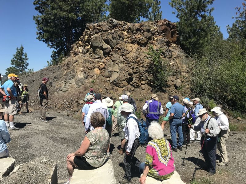
Outburst Floods GSA Penrose Conference Visits West Bar
The 2023 GSA Outburst Floods Penrose Conference made a field trip stop on Tuesday afternoon, June 6, at Ken Lacy’s (IAFI Wenatchee Valley Erratics Chapter member) home, for a spectacular overview of the West Bar Current Megaripples that can be seen well from that vantage point. The 75 conference attendees were all at the conference by invitation only. They were accompanied by organizers Jim O’Connor, Isaac Larsen, Joel Gobiner, Vic Baker, Richard Waitt, Jerome Lesemann. The purpose of the conference was to review the current outburst floods fieldwork being done, encompassing the range of science conducted both on Earth and elsewhere in the solar system. The timing of the conference coincided with the 100th anniversary of J Harlen Bretz’s first publication on the Channeled Scabland, and took place at Camp Delany, which occupies a spectacular flood-carved setting at the foot of Dry Falls in Grand Coulee, Washington. The conference was meant to review past and present work, as well as help chart the future science on outburst floods through presentations, discussions, and multiple field trips. Everyone who shared Ken’s hospitality were in particularly good humor, as considerable amounts of cookies, popsicles, and bottled water were consumed. There were many comments about how well the meeting was going and how lots of new insights were being discussed. These kind of comments suggest that the meeting was being extremely well received. Ken was also pleased to talk to Justin Radford, along with his USGS Research Geologist… nice to see them in attendance.