Grand Coulee Field Trip
Grand Coulee Field TripExploring the Ice Age Floods and Geology of the Grand Coulee AreaGrand Coulee Field TripExploring the Ice Age Floods and Geology of the Grand Coulee AreaGrand Coulee Field TripExploring the Ice Age Floods and Geology of the Grand Coulee AreaGrand Coulee Field TripExploring the Ice Age Floods and Geology of the Grand Coulee AreaGrand Coulee Field TripExploring the Ice Age Floods and Geology of the Grand Coulee AreaGrand Coulee Field TripExploring the Ice Age Floods and Geology of the Grand Coulee Area Click here to download, complete and print a Liability Waiver required of all attendees The Grand Coulee system is a geologic wonderland created by the ice-age interplay of geology, ice and massive floods. In a 2+ day (Sept 19-20 +) car-caravan field trip we will explore many of the unique features leading to and resulting from that interplay. Prepare to have your minds blown. Click Here for the field trip guide. Since this is our first Grand Coulee field trip, please bring a copy to help keep us on track.Please note: the sequence of days and route directions may be changed to adjust for scheduling issues. Dry Falls Plunge Pool – Ominski Grand Coulee at Steamboat Rock Dry Falls Lake Dry Falls Channeled Scabland – Bjornstad Field Trips Upper Grand Coulee Field Trip Car Caravan Lake Lenore & Great Blade – Bjornstad Northrup Cnyn Flood Deposits Million Dollar Mile, Upper Grand Coulee Ranger David McWalter Monster Rock – Ephrata Fan Grand Coulee Dam Steamboat Rock Sunset Local Lodging Information There are multiple quality lodging options available in the area, from campgrounds, motel and hotel rooms to fully furnished cabins with kitchens. Book lodging reservations using links below. Sun Lakes – Dry Falls Camping/Cabin options Lodging on site at Sun Lakes – Dry Falls State Park Sun Lakes – Dry Falls State Park: standard tent & RV campsites can be reserved through WA.Parks.gov. Availability may be limited. Campsite fees: Standard $20-$30, Partial utility $30-$40, Full-utility $35-$45 Sun Lakes Park Resort: adjacent to the state park, standard tent & RV campsites and fully furnished cabins with kitchens (maps). Other Local Lodging options Local inn & hotel lodging options Best Western Rama Inn: Motel rooms in Ephrata (26 minute drive to Sun Lakes State Park) Soap Lake Spa and Resort: Motel rooms in Soap Lake (23 minute drive to Sun Lakes State Park) Masters Inn: Motel rooms in Soap Lake (23 minute drive to Sun Lakes State Park) BW Rama Inn Soap Lake Resort BW Rama Inn Lobby Soap Lake Resort Cabin BW Rama Inn Room Soap Lake Resort Room BW Rama Inn Breakfast Soap Lake Resort Restaurant BW Rama Inn Pool Soap Lake Resort Jacuzzi BW Rama Inn Sauna Blue Lake Resort: Cabins (four minute drive from Sun Lakes State Park) Sun Village Resort: Cabins, RV sites (four minute drive from Sun Lakes State Park) Banks Lake Lodge: Basic motel rooms, cabins, RV sites (six minute drive from Sun Lakes State Park) Ala Cozy Motel: Basic motel in Coulee City (six minute drive from Sun Lakes State Park) Local Dining Information Dining options range from excellent restaurants to local pubs and burger joints. Here are a number of simple to hearty dining options: Sun Lakes Park Resort (adjacent to the State park): Duke’s Diner: takeout window serveing breakfast sandwiches, coffee, espresso, burgers, sandwiches, hotdogs, shakes and smoothies. Multiple restaurants in Coulee City (six minute drive from the State Park) Multiple restaurants in Soap Lake (spectacular 23 minute drive from Sun Lakes State Park) Multiple restaurants in Ephrata (spectacular 26 minute drive from Sun Lakes State Park) Multiple restaurants in Grand Coulee (spectacular 37 minute drive from Sun Lakes State Park)
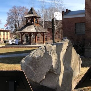
Lyle Cherry Orchard Trail Geology Recording
The Lyle Cherry Orchard Trail is a moderately strenuous trail being developed in the Columbia Gorge by Friends of the Columbia Gorge. They envisioned having a number of interpretive stations along the trail to inform and educate trail users. A station could focus on a single topic, such as the geology, plants, animals, indigenous and cultural history of the area. But they found that the cost of interpretive signs would be prohibitive, would be expensive to maintain and might not last long. So they started brainstorming for better ways to realize thier vision. The came up with a plan to place trailside posts, resembling basalt columns, with a QR code the user could scan with their smartphone that would connect to an informative recording about that location. Friends hopes to have the trail work and information stations finished by 2024. Then everyone will be able to experience the beauty along the Lyle Cherry Orchard Trail with a deeper understanding of their surrounding through the recordings. Renee Tkach, a Friends coordinator of the project, contacted Lloyd DeKay, president of the IAFI Columbia Gorge Chapter, about doing a recording for the first station about the geology of the area. They took a very windy hike together on the still somewhat challenging trail to the first station, where they talked about the focus of a recording and took a number of photos to document the views. At home Lloyd developed a script that everyone reviewed and agreed upon. Then began a few frustrating hours of recording and editing to produce a 4:30 minute recording. Since the original plan was for a 3:00-3:30 minute recording, Friends will now review the recording and decide if it’s OK or needs to be shorter and where to cut back. This method may also be an easier, economical and useful way to provide information at other floods sites throughout the region. Significant advantages include the relatively low cost and long life of the information station, and ability to provide both video and audio clips for a number of features on a webpage linked to the QR code, and the ability to modify and update the presentations as new or updated information becomes available.
Outburst Floods GSA Penrose Conference Visits West Bar
The 2023 GSA Outburst Floods Penrose Conference made a field trip stop on Tuesday afternoon, June 6, at Ken Lacy’s (IAFI Wenatchee Valley Erratics Chapter member) home, for a spectacular overview of the West Bar Current Megaripples that can be seen well from that vantage point. The 75 conference attendees were all at the conference by invitation only. They were accompanied by organizers Jim O’Connor, Isaac Larsen, Joel Gobiner, Vic Baker, Richard Waitt, Jerome Lesemann. The purpose of the conference was to review the current outburst floods fieldwork being done, encompassing the range of science conducted both on Earth and elsewhere in the solar system. The timing of the conference coincided with the 100th anniversary of J Harlen Bretz’s first publication on the Channeled Scabland, and took place at Camp Delany, which occupies a spectacular flood-carved setting at the foot of Dry Falls in Grand Coulee, Washington. The conference was meant to review past and present work, as well as help chart the future science on outburst floods through presentations, discussions, and multiple field trips. Everyone who shared Ken’s hospitality were in particularly good humor, as considerable amounts of cookies, popsicles, and bottled water were consumed. There were many comments about how well the meeting was going and how lots of new insights were being discussed. These kind of comments suggest that the meeting was being extremely well received. Ken was also pleased to talk to Justin Radford, along with his USGS Research Geologist… nice to see them in attendance.
Sea levels from the Maximum of the Last Ice Age to the Present Day

The Wenatchee Valley Erratics’ next program will be on Tuesday, June 13 at 7:00 PM at the Wenatchee Valley Museum and Cultural Center, 127 South Mission St., Wenatchee. Erratics’ member Kirk Laird will talk about “Sea levels from the Maximum of the Last Ice Age to the Present Day.” His presentation will focus on information directly available from NOAA’s Tides and Currents Office, and from NOAA’s Office of Satellite Altimetry. The 400 foot change in sea level over the last 22,000 years is directly attributable to the melting of continental and montane glaciers. With degrees in both Geology and in Oceanography, Kirk has observed earth science issues his entire life. And for the last 25 years, he has paid very close attention to the status of the oceans, in particular. This is a hybrid meeting. You can attend in-person at the Museum. Or you can participate via a Zoom link: https://us02web.zoom.us/j/84520197937 Please sign in at 7:00 PM, June 13! The program is free and open to the public.
Erratic in the Bitterroot
An 8 ton erratic left behind by Glacial Lake Missoula in the Bitterroot Valley on the property of a local rancher was relocated to serve as the focal point of an outdoor kiosk exhibit at the Ravalli County Museum at the former County Courthouse, 205 Bedford Street in Hamilton. Unlike their counterparts at other location along the National Geologic Trail, erratics in this part of the Ice Age Floods did not come from Canada nor did they travel as far, but the action of the floodwaters and iceberg rafts is equally evident despite more shallow waters. There are similar erratics found elsewhere in Bitterroot, on the campus of the University of Montana, and at the Bison Range. The outdoor display tells the same story as other locations on the Ice Age Floods National Geologic Trail but also includes information on two other National Park Service trails that pass through this area – the Nez Perce and the Lewis and Clark National Historic Trails. The museum has other indoor exhibits of historical interest and about Glacial Lake Missoula.
Little Money Creek Gulch Fill
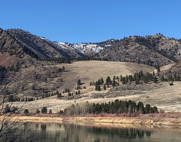
Mounds of soil, sand, gravel, and other coarse materials covered with light vegetation can be seen in the side gulches all along the Flathead River where tributaries drained into what was Glacial Lake Missoula. They were deposited by currents eddying into the slower water in these gulches and also by the drop in velocity of the streams carrying deposits from higher elevations on the far side of the river along the path of the escaping floodwaters. The flow of floodwaters through this narrow valley was estimated by J.T. Pardee at between 8 and 10 cubic miles per hours – more than the combined flow of all modern rivers in the world. Similar gulch fill can be seen in many locations along this beautiful stretch of the river, which today generally flows smoothly and looks completely flat. There are numerous pull-outs along MT 200 between Perma and Paradise; the view pictured here is at mile marker 91.
Puget Sound Area has a Glacial Story to Tell

Although the Seattle region was not impacted by the large floods from Glacial Lake Missoula, Glacial Lake Columbia, or other glacial lakes east of the Cascades, the Puget Sound region has its own glacial story to tell. It’s interesting that J Harlen Bretz, who first imagined that a massive flood produced the Floods features in the Columbia Plateau, also did his PhD on “Glaciation of the Puget Sound Region”. The Puget Lobe of the Cordilleran Ice Sheet advanced and retreated over the Puget Lowland at least seven times during the Quaternary Ice Age. In the process, it left behind rocks, sediments, and other geologic clues that tell the intriguing story of ice, proglacial lakes, and flooding across the landscape near Seattle. Snoqualmie Falls, near North Bend, WA east of Seattle is a popular tourist destination. At the falls, the Snoqualmie River plunges 82m over a wall of volcanic rock. Few tourists, however, understand the role that the Puget Lobe of the Cordilleran Ice Sheet played in the formation of the falls. Prior to glaciation, Snoqualmie Falls did not exist, instead, the river flowed in an incised channel east of the current falls. As the Puget lobe advanced into the Puget Lowland about 18,700 years ago, the glacier’s eastern margin blocked drainage from rivers flowing out of the Cascades, including the Snoqualmie River. A large glacial lake known as Glacial Lake Snoqualmie formed over North Bend and over the Snoqualmie Valley. Tokul Creek, one of the tributaries, formed a thick underwater delta in the lake as its sediments poured into Glacial Lake Snoqualmie. When the Puget Lobe retreated, Glacial Lake Snoqualmie drained to the west and the Snoqualmie river attempted to follow its original channel. However, the original course of the river was blocked by the delta deposits from Tokul Creek and the river was forced to flow over a narrow band of rocks from an eroded volcano further to the south. Snoqualmie Falls flows over this volcanic rock today, but since the last glacial maximum, cataract recession has rapidly eroded the rocks back to a 200m wide band of andesite and volcanic breccia. Behind the thin volcanics is a thick layer of soft alluvium. At the current rate of recession, the Snoqualmie River will erode through the volcanic rock in about 7,200 years. When that happens, the river will hit the alluvium and the falls will quickly devolve into a series of rapids. You might want to hurry to see the falls before they disappear! Other glacial lakes were formed at the southern margin of the Puget Lobe near modern day Seattle. As the Puget Lobe advanced south, it dammed rivers and streams that were flowing north. In places, the bluffs surrounding modern Puget Sound hold a record of the advancing glacier and the pro-glacial lakes backed up by the ice front. One good place to view these sediments is from the beach at Discovery Park in Seattle. A layer cake of sedimentary units records the pre-glacial river system, the advance of the ice, the damming of the proglacial lakes, and the retreat of the ice sheet to the north. At the base of the cliffs the Olympia Formation records the pre-glacial environment of north-flowing rivers and streams. The Lawton Clay layer indicates the formation of proglacial lakes. The Esperance sand represents a period of glacial retreat. The glacier that repeatedly covered the Puget Lowland left behind multiple geologic clues for us to interpret. The Puget Lobe of IAFI welcomes members from other chapters to join us as we explore the glacial history of the Puget Lowland.
McBones – Ice Age Floods Mammoth Dig

The Tri-Cities area, home to the Lake Lewis Chapter of IAFI, is inching its way into spring and it’s time to say goodbye to winter. And for some of us, it’s time to begin the 2023 dig season at Coyote Canyon, the resting place of a 17,500-year-old Columbian mammoth. Coyote Canyon is just a few miles southwest of Kennewick in the Horse Heaven Hills. Last month we cleaned up the winter erosion and set up the field equipment so work can begin in earnest in April. Several bones, yet to be identified, were partially exposed last fall and hopes are high for exposing and removing them this summer. This elephant relative was deposited on the west side of Coyote Canyon during one of the earlier Ice Age floods and is buried by possibly six layers of floods sediment. Numerous erratic rocks have been found among the bones. Just before the pandemic temporarily paused work at the site, a local high school girl was assigned the task of identifying rock types of a cluster of small erratics buried near the animal’s left shoulder blade. She then identified outcrops of the same types of rocks in northern Idaho, at or near the ice dam. Finally, she documented her work with a poster and presented it at the 2019 GSA conference in Portland, Oregon. With digging comes tourism. As usual, public tour lists have filled for spring and summer-fall tour reservations will open on June first. To sign up for a tour the public can visit our new website, www.mcbones.weebly.com. School and private group tours are also available. At the time of this writing, we have scheduled six public tours, 30 elementary class tours and 13 group tours, including one for vision impaired and one for non-English speakers. All of our presentations emphasize the importance of the Ice Age floods to the mammoth story at Coyote Canyon.
Grand Coulee – Geology of the Entire 50 miles

The 50-mile-long Grand Coulee should be on everyone’s bucket list for a “must see” feature. The immense power of the forces that created the Coulee are apparent to those who read the evidence recorded in its rocks and landforms. How did the Coulee form? Why did it form here? What do features like Steamboat Rock, Northrup Canyon, Dry Falls, and the Ephrata Fan tell us about the geological forces that created the Grand Coulee? This presentation will be made May 1, 2023 beginning at 7:00 pm, via Zoom _ https://us02web.zoom.us/j/82985244730 Dr Gene Kiver is professor Emeritus of Geology, Eastern Washington University. He studied alpine glaciation in the Rocky Mountains before moving to Washington State and discovering that J Harlen Bretz had correctly interpreted the bizarre landforms of the Channeled Scabland. Gene taught geology at Eastern Washington University for 34 years. He co-authored “On the Trail of Ice Age Floods” with Bruce Bjornstad that describes the flood history of the northern flood routes of the Missoula Floods. In addition, he authored/co-authored the book “Washington Rocks” and several other books. One item in particular is “Tour Guide Interstate 90 East Tour: Seattle to Spokane” (2007). A CD narration of the people and places as defined by the title. Of the 51 tracks, Dr. Kiver narrates 4 on the Geology of I-90. The Chapter webmaster has ordered it and will update this post after listening to the recording. I bring this up as many of our lectures are about or by people who explored or are exploring the geography of the Ice Age Floods. Look on Amazon under “Eugene Kiver” for this and other books.
Othello Sandhill Crane Festival -March 24-26, 2023

The Othello Sandhill Crane Festival announced the 2023 theme as “Silver Anniversary, Celebrating Our Annual Visitors.” The 25 th annual festival will be held March 24-26, 2023 in Othello Washington. We are excited to be celebrating our 25th year! The festival celebration of the spring migration of the Sandhill cranes offers a variety of events for the whole family to enjoy and learn. The festival will be in the same locations as last year. The lectures will be held at the Othello Nazarene Church, 835 S 10 th Ave, Othello, WA. The Church is next door to McFarland Middle School where we will have the children’s art projects, the vendors, the photo booth, the Rotary breakfast, and the art contest. We will be utilizing both facilities. Food trucks will be available for lunches. Online registration opens on February 6, 2023. Visit the Othello Sandhill Crane Festival website for more information on the events at Website: othellosandhillcranefestival.org. Follow us for updates on Facebook: www.facebook.com/Othello-Sandhill-Crane-Festival Cathy Nowak will be one of the featured speakers on Saturday, March 25, at 7:30pm. Cathy will be speaking about Sandhill Crane nests and how experience matters, with both words and photos. Dr. Kaeli Swift will be the other featured speaker on Friday, March 24, at 7:30 pm. This lecture will require masks. Swift will explore commonly asked questions about crows, how crows have co-evolved with people, and what crows and other corvids can teach us about the nature of intelligence. Saturday, March 25, the lectures will cover cranes, birds, Ice Age Floods, the Drumheller Channel, and much more. We are planning tours by bus, bike, boat, car and self-directed, crane viewing tours will be back. Some tours will be set up over two weekends. The Children Activities Committee will have fun activities for kids such as binoculars made of toilet paper rolls to use for “birding” in the gym by finding pictures of various birds, origami folded crane mobiles, mask making and many other activities. We will again have the free photo booth to take your picture with a digitized Sandhill crane in the background to take home as a memento.