Bretz and His Floods Story – National Geographic
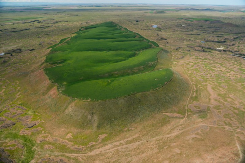
National Geographic has published an outstanding article, “Formed by Megafloods, This Place Fooled Scientists for Decades”, about J Harlan Bretz and his outrageous, fantastical theories of a landscape shaped by huge floods. Most Ice Age Floods aficionados are generally aware of the story, but this one is so detailed and well written it’s worth reading for the story-telling value alone. Please see: This National Geographic site:
Earth in the Next Billion Years
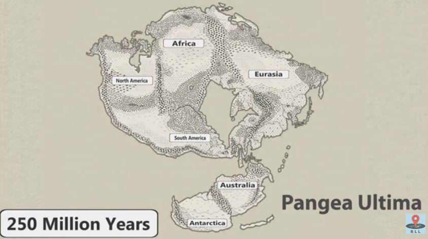
No one can ever say for sure what the future will bring, but this new video has summed up all the science-backed predictions that we can reasonably make about how Earth will change over the next 1 billion years. It’s highly unlikely that anyone will be around to see most of these changes come to pass, so consider this an exclusive front-row seat to a world where supercontinents reign supreme, Mount Everest is no longer the tallest mountain on our planet, Earth enters another glacial period regardless of current global warming trends. and then the Sun becomes a lot hotter. Just another reason we should be glad we live at the time we do. Reposted from Science Alert and RealLifeLore
Beryllium-10 dating of late Pleistocene megafloods and Cordilleran Ice Sheet retreat
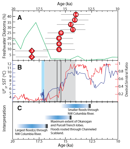
Balbas et. al. use cosmogenic beryllium-10 dating methods to further constrain the timing of ice sheet retreat, as well as the potential pathways for megafloods from both Lake Missoula and Lake Columbia. Read this fascinating Geology article summarizing their findings. Balbas2017 – Missoula Flood Chronology In summary, our new chronological information suggests the following: (1) Blockage of the Clark Fork river by the Purcell Trench lobe by ca. 18.2 ka, resulting in Missoula floods following the Columbia River valley. (2) Blockage of the Columbia River valley by the Okanogan lobe before 15.4 ± 1.4 ka, which shunted Missoula flood water south across the Channeled Scablands. (3) The final Missoula floods at ca. 14.7 ± 1.2 ka, signaling retreat of the Purcell Trench lobe from the Clark Fork valley, yet these floods entered a glacial Lake Columbia still impounded by the Okanogan lobe. (4) Down-Columbia floods at ca. 14 ka from breakouts of glacial Lake Columbia, signaling the retreat and final damming of the Columbia Valley by the Okanogan lobe
Washington’s Ice Age Floods – ESRI Story Map
The Washington Geological Survey (formerly the Division of Geology and Earth Resources) has just released an ESRI story map about the Ice Age Floods in Washington. The story map: “tells the story of cataclysmic outburst floods that shaped the landscape of the Pacific Northwest during the last ice age. With imagery, maps and video, this story map follows the devastating deluge of the Missoula floods as it tore across the landscape, from its origins in western Montana to its terminus at the Pacific Ocean. Sites along the Ice Age Floods National Geologic Trail are featured, with an emphasis on flood features in Washington State.” Entitled Washington’s Ice Age Floods, it is best viewed on a desktop or laptop computer. Mobile devices will not show all of the content. It is navigated by scrolling your mouse through the slides. There are a few animated sections that may take a second or two to load. [weaver_iframe src=’https://wadnr.maps.arcgis.com/apps/Cascade/index.html?appid=84ea4016ce124bd9a546c5cbc58f9e29′ height=600 percent=100]
WA-DNR Website Features Phenomenal LIDAR Images
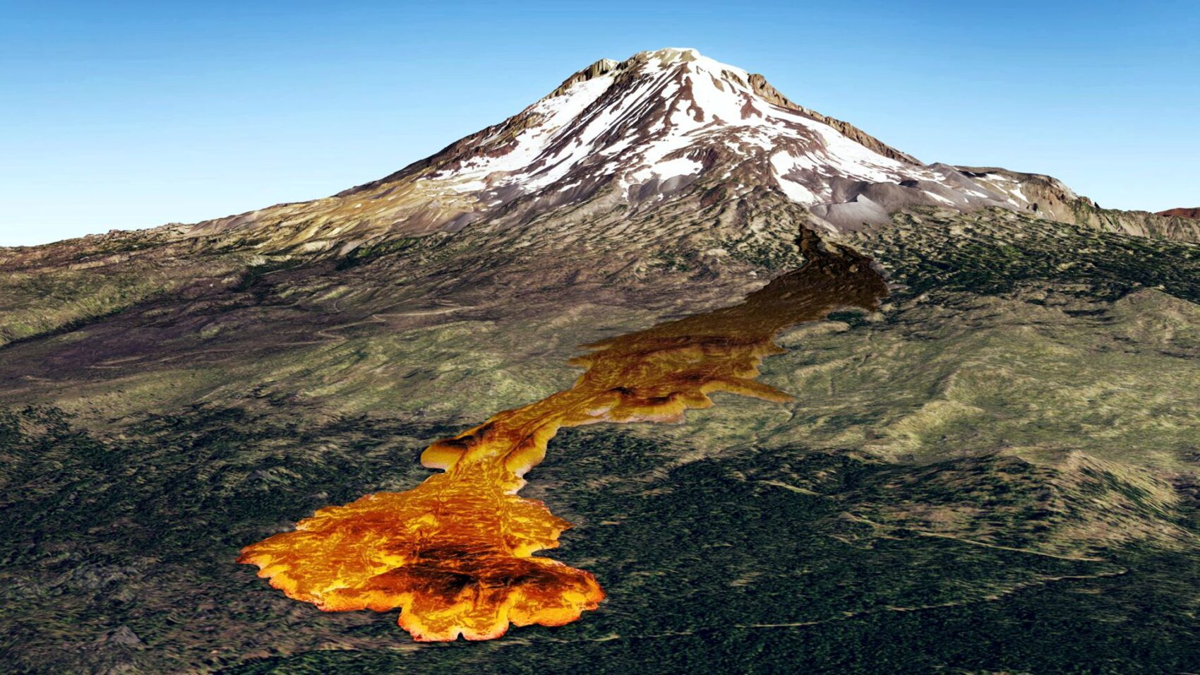
Washington State Geological Survey is collecting, analyzing, and publicly distributing detailed information about our state’s geology using the best available technology – LIDAR – an acronym for Light Detection And Ranging. The main focus of this new push for LIDAR collection is to map landslides, but there are innumerable additional benefits and applications of this data both inside and outside of the field of geology. A number of amazingly beautiful and revealing images are featured on the WA-DNR Flickr website, along with a trove of information about the technology and it’s applications. LIDAR is a surveying method that measures very precise distance to a target by illuminating that target with a pulsed laser light and measuring the reflected pulses with a sensor. Differences in laser return times and wavelengths can then be used to make digital representations of the target. LIDAR is expensive, but it can easily remove vegetation/grass/trees as it uses an emitting source and interferometry criteria to find the “last echo return” that is assumed as the ground, even in very dense scenarios (forests, corn fields, etc). LIDAR uses ultraviolet, visible, or near infrared light to image objects. It can target a wide range of materials, including non-metallic objects, rocks, rain, chemical compounds, aerosols, clouds and even single molecules. LIDAR is widely used for many different applications. Some (but by no means all) of those uses include: Geology and Hazards, Forestry, Graphics, Navigation, Meteorology and Fir,e Land-use planning, Archaeology and Agriculture. In geology, bare earth models allow closer study of geomorphology, which is the study of the origin of the topography of the earth. Floods, faults, landslides, erosion, and glaciers leave their mark on the landscape, and while these marks can be hidden by dense vegetation, they can’t hide from LIDAR. LIDAR can be used in the field of archaeology to find things hidden by the forest canopy. Large features that would be indistinguishable on the ground are readily apparent in a LIDAR survey, leading archaeologists to sites they might not have otherwise found. For example, intensity returns can be used to detect features just below the surface that affect plant growth.
Ice Age Flood Animation
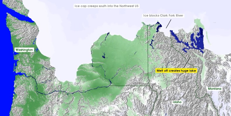
This 3:50 minute animation, presented by the Crown Point Country Historical Society, illustrates the growth of the Cordilleran Ice Sheet, the damming and back-up of Glacial Lake Missoula, and the progress of an Ice Age Flood through WA and OR after an ice dam collapse.
Williams Lake Cataract Video
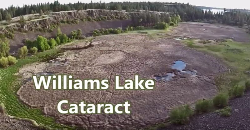
Williams Lake Cataract is an ancient, dry waterfall left behind along the Cheney-Palouse Scabland Tract in eastern Washington after Ice Age flooding recessionally ripped out underlying basalt to produce this massive cataract. Video produced by Bruce Bjornstad, Ice Age Floodscapes
The Great Blade – Bruce Bjornstad Video
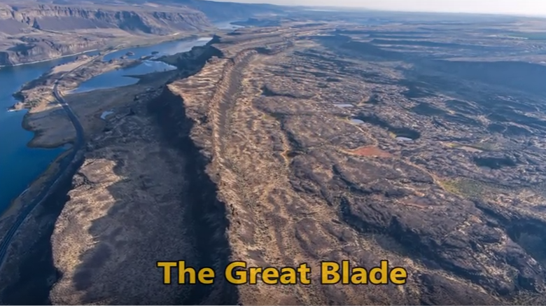
“…there were a few double falls each member of which receded at approximately the same rate, so that the island in mid-channel became very much elongated, like a great blade, as the falls receded and the canyons lengthened.” J Harlen Bretz (1928) A tall, narrow basalt ridge, coined “The Great Blade” by J Harlen Bretz, parallels Lower Grand Coulee east of Lake Lenore. The blade is the product of Ice Age floods that repeatedly rampaged Grand Coulee as recently as 15,000 years ago. Most of the floods appear to have come from sudden outbursts from glacial Lake Missoula. During flooding the coulees on either side of the Great Blade were filled with up to 800 ft turbid water. The largest floods also overtopped the Great Blade, submerging the site under at least another 100 ft of floodwater. On the west side of the blade, where Lake Lenore is located, lies the Lower Grand Coulee, which ultimately migrated 10 miles northward – all the way to Dry Falls. On the east side of the blade is the higher East Lenore Coulee, which migrated a shorter distance (~3 mi) to Dry Coulee. Like a gigantic rib the Great Blade is tallest and narrowest at its south end, widening to the north. The blade extends for almost four miles from where the head of East Lenore Coulee intersects Dry Coulee. In places the blade narrows to as little as 800 ft wide. Video produced by Bruce Bjornstad for Ice Age Floodscapes
Did humans witness any megafloods?
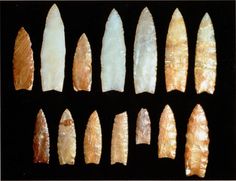
Richard Waitt kindly shared his recent paper published June 2016 in Quaternary Research, titled “Megafloods and Clovis cache at Wenatchee, WA.” “It covers the reach mainly from Chelan Falls to below West Bar, tries to tell the story of sequential megafloods coming to Wenatchee area by different routes at different times, and tries to work in the story of early Homo sapiens in the region, especially as contemplated from the 1988-1990 excavations of the East Wenatchee Clovis cache,” said Waitt in an email to the Wenatchee Valley Erratics. His easy-to-read and immensely interesting paper covers both the geological and the archaeological stories for the Wenatchee area. Did humans witness megafloods? Read the paper Megafloods and Clovis cache at Wenatchee, Washington to find out!
Grant’s Getaways – Oregon’s Erratic Rocks
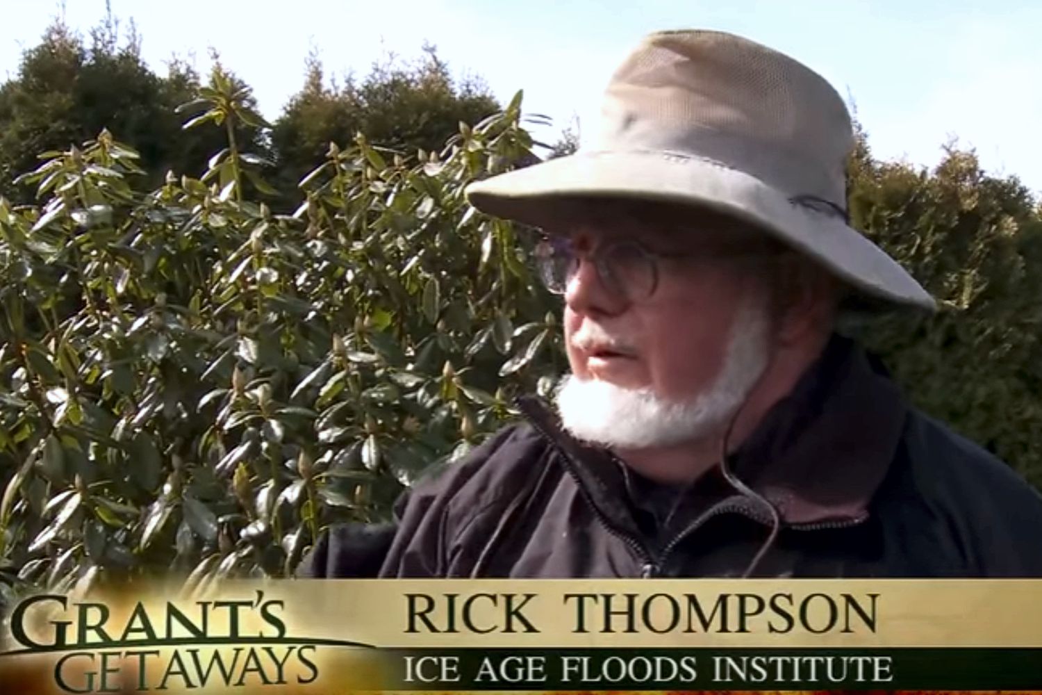
This episode of Grant’s Getaways features Lower Columbia President Rick Thompson and the Floods-borne erratics of the Willamette Valley
