Description

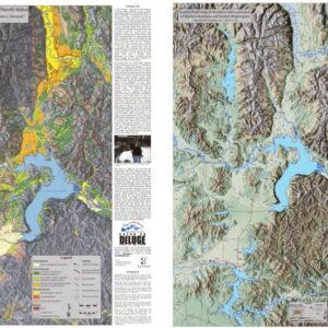
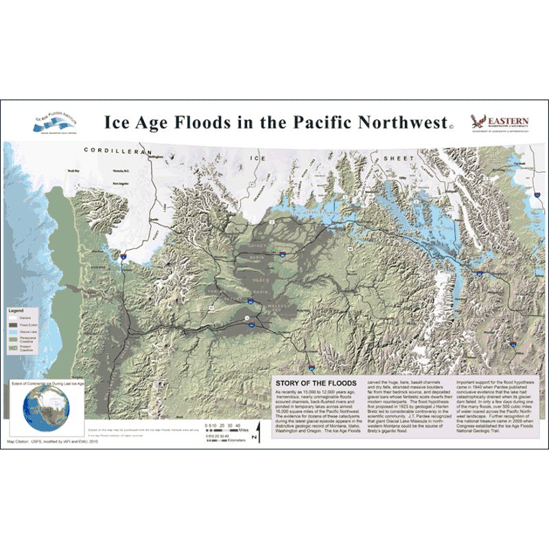
This beautiful full color map of the Missoula Floods has been updated by IAFI. This new map shows the locations of the glaciers during the last glacial cycle, Glacial Lake Missoula and Glacial Lake Columbia, the area inundated during the mega-floods of the Ice Age, and the location of the greatly reduced sea level during the glacial maximum. We have added considerable details of topography, roads, and numerous towns and cities. Details of topography, roads, and numerous towns and cities are also shown for reference.
THE IAFI MAP IS AVAILABLE THREE FORMATS:
- 11″ x 17″ – $12.00
- 11″ x 17″ laminated – $14.00
- 24″ x 36″ – $20.00
The laminated map can be used for place-mats, stored in your car or RV to have when you travel, or even put in your pack! All of the maps are shipped in a sturdy cardboard tube.