
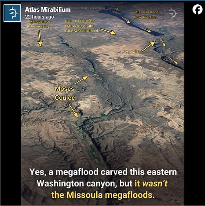
 Yes, a megaflood carved this eastern Washington canyon—but not the Missoula megafloods.
From the air, it looks like a massive scar slicing across the farmland of north central Washington—sheer basalt walls framing a broad, empty valley that looks like the remnant of a vanished super river. Up close, the scale is even more staggering. At a mile (1.6 km) wide with cliffs rising up to 1,000 feet (305 m) above the canyon floor, it’s obvious the tiny stream flowing here today could never have carved a landscape like this.
This is Moses Coulee, a rugged, nearly 40-mile-long gorge stretching from the Waterville Plateau west of Coulee City to the Columbia River southeast of Wenatchee.
For decades, people assumed the Missoula Floods carved it—after all, those massive outburst floods carved much of the nearby Channeled Scablands. But the evidence didn’t quite fit. There are no feeder channels or flood paths connecting Moses Coulee to the well-known Missoula flood routes. For a canyon this massive, that missing link was impossible to ignore. Instead, scientists uncovered something far more surprising: Moses Coulee may have been carved by *subglacial* megafloods—explosive floods that erupted from *under* the Okanogan lobe of the Cordilleran Ice Sheet.
North of here, beneath thousands of feet of ice, meltwater pooled, pressurized, and searched for any escape route. When it finally broke loose, it didn’t just flow—it detonated. Researchers have mapped a vast web of deep, interwoven channels stretching from the Omak area down to the Withrow Moraine at the head of Moses Coulee. The main “trunk” channels are enormous—650 to 1,600 feet (200 to 500 m) wide and 65 to 100 feet (20 to 30 m) deep, not even counting the thick layers of sediment that later filled parts of them. Many are lined with boulders the size of cars, dumped by water racing through high pressure tunnels beneath thousands of feet of ice. On the Waterville Plateau, the channels actually climb uphill and cross multiple ridgelines. Only unimaginably powerful, high-pressure floods could bulldoze their way *up* and over topographic divides. As the flow exited the toe of the glacier at the Withrow Moraine, the giant subglacial channels gave way to smaller surface channels—some carving classic scabland terrain, others filled with outwash—that all converge at one dramatic destination: the head of Moses Coulee.
This hidden network reveals just how extraordinary these ancient subglacial floods were—erupting in total darkness, scouring miles of bedrock, and reshaping an entire region from beneath the ice.
Reprinted from Atlas Mirabilium article. Source: pubs.geoscienceworld.org/gsa/geology/article/52/7/502/637038/Okanogan-lobe-tunnel-channels-and-subglacial