GO PLACES! DO THINGS!

Along the ICE AGE FLOODS
NATIONAL GEOLOGIC TRAIL


The Ice Age Floods National Geologic Trail covers some 16,000 square miles (41,440 km2) in present day Montana, Idaho, Washington, and Oregon. We have hand picked some of the best of the best places along the Trail and present them here for you enjoy and explore! Check back often, we will be adding new and wonderful destinations for your entire Family to enjoy!

MONTANAIDAHOWASHINGTONOREGON

SOME PLACES TO GO and THINGS TO DO in MONTANA

Glacial Lake Missoula National Natural Landmark

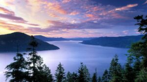
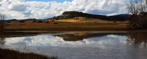
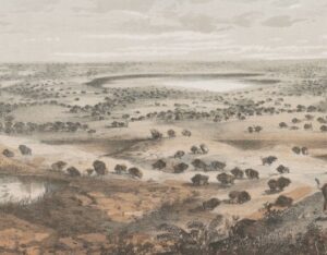
Glacial Lake Missoula National Natural Landmark Ice Age Floods National Geologic Trail Glacial Lake Missoula was the largest of several lakes impounded by the Cordilleran Ice Sheet in the Northern Rocky Mountains during the Quaternary period. The lake was approximately 2,900 square miles in size and contained more than 500 cubic miles of water. It occupied the Mission, Jocko and Little Bitterroot valleys, drained by the Flathead River; and the Missoula, Ninemile and Bitterroot valleys, drained by the Clark Fork River. The lake was formed by an ice dam across the mouth of the Clark Fork River at Lake Pend Oreille, Idaho, a result of successive advances of a lobe of the Cordilleran Ice Sheet. The site is located 12 miles north of Perma, Montana. At least three and possibly more than 100 separate collapses of the ice dam, possibly coincident with periods of ice retreat, caused the lake to drain, producing catastrophic floods across the Columbia Plateau and down the Columbia River Basin. It is estimated that the waters of Glacial Lake Missoula, 1,000 feet deep at Eddy Narrows, were withdrawn at a peak discharge rate of 10 cubic miles per hour. Approximately 550 cubic miles of water passed through those narrows during withdrawal. Evidence of this catastrophic withdrawal can be found in scourings, high eddy deposits of flood debris, flood bars of boulders and course gravel, and successions of giant arcuate ripples or ridges of gravel resting on bedrock surfaces. Ripples appear as ridges 15 to 50 feet high, 100 to 250 feet wide, and from 300 feet to a half-mile long. While the form, structure and arrangement of these features are similar to that of ordinary current ripple marks, they are termed giant flood ripples, due to their large size. The giant flood ripples at this site are unusual due to their being on the down-current side of notches in a ridge separating two basins that were both subsidiary to the main course of Lake Missoula in the Clark Fork Valley. The best examples of giant flood ripples are found in Camas Prairie. Quick Facts Designation:National Natural Landmark OPEN TO PUBLIC:Private Land, closed to the public, but features throughout the area are visible from many vantage points.
Read More »

Eddy Narrows

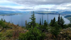
Eddy Narrows Ice Age Floods National Geologic Trail Eddy Narrows is a 10-mile long canyon between Plains and Thompson Fall along the Clark Fork River. Here all of the waters from the northern and eastern arms of Glacial Lake Missoula converged and picked up speed as they were forced through this restricted area. The steep valley walls are bare of talus and soils up to the level estimated to be the highest level of the lake (1000 ft), and there are polished grooves in the bedrock on a bench 340-400 feet above the Clark Fork River that run parallel to it. Since there is no evidence of glaciation in this area, the only explanation is the rapid draining of Glacial Lake Missoula. Using the dimensions of this flume-shaped area of the canyon, which controlled the rate of flow of water surging through it, in 1942 J.T. Pardee was able to calculate maximum speeds approaching 80 mph, emptying Glacial Lake Missoula in as little as three days. There are pullouts along MT-200 at either end of the narrowest part of this section marked for observing big horn sheep with Glacial Lake Missoula signage at the one between mileposts 59 and 60 at: 47.537940, -115.071654  Quick Facts Location:Between Plains and Thompson Falls, MT 

Read More »
SOME PLACES TO GO and THINGS TO DO in IDAHO

Glacial Dam at Green Monarch Ridge View Point

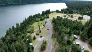
Glacial Lobe Dam at Green Monarch Ridge View Point Ice Age Floods National Geologic Trail  As the Purcell Trench ice lobe of the Cordilleran Ice Sheet advanced south from Canada, it was stopped by the Green Monarch Ridge, building an ice dam 4,000 feet (1219 m) tall and nearly 40 miles (64 km) wide that blocked the Clark Fork river, thus filling glacial Lake Missoula. View the Green Monarch Ridge and the Purcell Trench from a large pullout on Idaho State Route 200, about one mile (1.6 km) west of Hope, Idaho and 15 miles (24 km) east of Sandpoint, Idaho. Quick Facts Location: Idaho State Route 200, about one mile west of Hope, Idaho and 15 miles  east of Sandpoint, Idaho.

Read More »

Museum of North Idaho

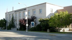
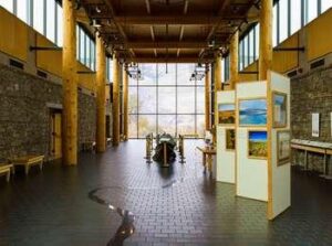
Museum of North Idaho IceAgeFloods National GeologicTrail “The Museum of North Idaho collects, preserves and interprets the history of the Coeur d’Alene Region. to foster appreciation of the area’s heritage.” In the 1960s, the North Idaho Hoo Hoo Club, an organization of loggers, lumbermen and foresters, first entertained the idea of establishing a museum. They incorporated on May 1, 1968 for a museum focusing on the history of the Coeur d’Alene Region (Kootenai, Benewah and part of Shoshone counties). Through the efforts of volunteers and community support, the Museum opened its doors on the North Idaho College campus on July 28, 1973. In 1979, they remodeled a City-owned building and relocated to its current location. Quick Facts Location: 115 Northwest Blvd, Coeur d’Alene, ID 83814Phone: (208) 664-3448 The Museum is open Tuesday to Saturday from 11 am – 5 pm.

Read More »

Celebration Park – Home of Melon Gravel

17,000 years ago, a massive Ice Age lake – now called Lake Bonneville – filled a large portion of present-day Utah. As temperatures changed, the influx of ice melt caused the lake level to rise. In addition, the Bear River, once a tributary of the Snake, was diverted by volcanic activity back into Lake Bonneville. These factors ultimately led to the breaching of a sedimentary rock dam at Red Rocks Pass, Idaho. There was only one ice-age Bonneville Flood because Lake Bonneville broke through a rock dam, unlike the Missoula Floods whose glacial ice dam repeatedly dammed Glacial Lake Missoula, then broke and rebuilt.  1,100 cubic miles of Lake Bonneville water rushed through the Snake River Canyon, and it took only six weeks for Lake Bonneville to empty the equivalent volume of modern-day Lake Michigan. The Great Salt Lake we know today is a remnant of Lake Bonneville, but at one tenth the size, it is a mere puddle compared to what the lake used to be.  The power of this catastrophic flood widened canyons as the force of the water pulled huge chunks of basalt off the cliffs and tumbled them around, smoothing their jagged edges along the way. As the canyon width narrowed, the force and velocity of the flood increased. Wherever the canyons widened, the flood lost force and velocity, the waters slowed and began dropping its bedload – in this case, giant tumbled basalt boulders instead of your typical river gravel.  These flood-rounded boulders, named melon gravel due to their distinct shape, are scattered over vast areas of land. The rocks’ unique outlines and smooth surfaces caught the eye of Native American tribes in the area, who have used them as canvases for petroglyphs for thousands of years. Visitors can see the medium sized flood deposits just outside the visitor center, or hike upriver to see gigantic melon gravel the size of heavy-duty trucks.  Celebration Park is located in the Snake River Canyon, approximately 23 miles south of Nampa, Idaho. It is home to an enormous melon gravel field deposited by the Bonneville Flood. 

Read More »
SOME PLACES TO GO and THINGS TO DO in WASHINGTON

Palouse Falls State Park

Palouse Falls State Park, dedicated in 1951, is a 94-acre park showcasing the dramatic Palouse Falls and its unique geological history. The park is a popular destination for viewing the falls, which were formed by Ice Age floods and are a key part of the

Read More »

Grand Coulee – Geology of the Entire 50 miles

The 50-mile-long Grand Coulee should be on everyone’s bucket list for a “must see” feature.  The immense power of the forces that created the Coulee are apparent to those who read the evidence recorded in its rocks and landforms.  How did the Coulee form? Why

Read More »
SOME PLACES TO GO and THINGS TO DO in OREGON

Tualatin Ice Age Walking Trail

Tualatin Ice Age Walking Trail Ice Age Floods National Geologic Trail The Tualatin Ice Age Trail is a self-guided tour of sites representing the ancient history of our area. Along the trail, you’ll discover evidence of centuries-old ice, rock and bone, including the sites where a mastodon

Read More »

Tualatin Public Library

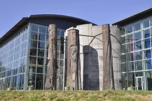
Tualatin Public Library Ice Age Floods National Geologic Trail The Tualatin Public Library, located just off Interstate 5 in Tualatin, Oregon, is home to a display of Ice Age Megafauna. The Library features a striking display of an articulated partial mastodon skeleton, which was discovered

Read More »
Even MORE PLACES TO GO and THINGS TO DO

Click a STATE for MORE PLACES TO GO and THINGS TO DO

MONTANAIDAHOWASHINGTONOREGON

Share this article:

Like this:

Like Loading…