GO PLACES! DO THINGS!

Along the ICE AGE FLOODS
NATIONAL GEOLOGIC TRAIL


The Ice Age Floods National Geologic Trail covers some 16,000 square miles (41,440 km2) in present day Montana, Idaho, Washington, and Oregon. We have hand picked some of the best of the best places along the Trail and present them here for you enjoy and explore! Check back often, we will be adding new and wonderful destinations for your entire Family to enjoy!

MONTANAIDAHOWASHINGTONOREGON

SOME PLACES TO GO and THINGS TO DO in MONTANA

The Paradise Center

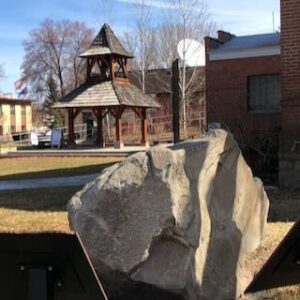
The Paradise Center Ice Age Floods National Geologic Trail Paradise Center, formerly the Paradise Elementary School, is a community, visitors, and arts center in the old railroad community of the same name.  Just below the confluence of the muddy Clark Fork and beautiful blue Flathead Rivers, 70 miles northwest of Missoula, the area was repeatedly inundated by Glacial Lake Missoula, leaving many visible features in the area such as gulch fills, kolks, and lake bottom sediment bluffs. It is on the route between the Camas Prairie Ripples and Eddy Narrows.   Inside the school is a unique interactive 3-D topographical or relief map of the entire area covered by Glacial Lake Missoula and an extensive display of information about the Lake as well as other topics of interest to the area.  Outside on the grounds is a playground and an outdoor walking loop with a dozen or so displays of interest such as the former railroad roundhouse.  A model railroad set-up is also found inside the center. This area can easily be reached directly from the St. Regis exit from I-90 by following the Clark Fork River where flood waters turned sharply to the north, carving out the narrow valley along scenic route 135 to the junction with MT-200. Scour marks and displaced boulders are visible from the road, and it is especially lovely when the larch trees turn bright yellow in the fall. This route also takes you past the historic Quinn’s Hot Springs Resort.  ANNOUNCEMENT: The Paradise Center hours are seasonal, generally Wednesday thru Saturday, 11am-3pm in the summer. Check the website at paradisecentermt.org or call 406-826-0500 Quick Facts Location:2 School House Hill Road Paradise, MT 59856 MANAGED BY:The Paradise Center

Read More »

Travelers’ Rest State Park

Travelers’ Rest State Park Ice Age Floods National Geologic Trail Located at an historic and contemporary crossroads, Travelers’ Rest State Park and National Historic Landmark is a place where visitors can say with certainty that they are walking in the footsteps of Lewis and Clark. The Park is at the core of a campsite used by the Corps of Discovery from September 9 – 11, 1805 and again from June 30 – July 3, 1806. In the summer of 2002, archaeologists uncovered evidence of the Corps of Discovery’s visit to the area, including a trench latrine tainted with mercury, fire hearths, and lead used in the repair and manufacture of firearms. The discovery makes Travelers’ Rest the only campsite on the Lewis and Clark Trail with physical evidence of the expedition. For centuries Native Americans also used the area as a campsite and trail junction. Salish, Pend d’Oreille and Nez Perce peoples were among those who traditionally occupied the area. Native American storytellers bring their history, culture and society to life as part of the programming at Travelers’ Rest State Park. The Bitterroot River is the primary body of water in this area, now running about 500 feet below the surface of what was once Glacial Lake Missoula, which extended all the way to the area now indicated by a high water marker at Lake Como.  There are few vestiges of the Lake in this area but information and a display are located at the Visitor Center. Travelers’ Rest is an idyllic spot for strolling the park’s trails, and offers a rich bird habitat, with more than 115 species recorded within the park boundaries. Quick Facts Location:Located 1/2 mile west of Lolo on Hwy 12 Significance:Located at the crossroads of culture, this is the only archaeologicaly verified campsite of the Lewis and Clark Expedition, as well as the traditional homeland of the Selis Qlispe people. Designation:National Historic Landmark 

Read More »

Bison Range

Bison Range The Bison Range was established by President Theodore Roosevelt in 1908 to conserve the American Bison.  Since that time it has been managed as a wildlife refuge and native grassland. Today the management is done by the Confederated Salish and Kootenai Tribes. The range is a small, low-rolling mountain connected to the Mission Mountain Range by a gradually descending spur. Range elevation varies from 2,585 feet (788 m) at headquarters to 4,885 feet (1,489 m) at High Point on Red Sleep Mountain, the highest point on the Range.  Much of the Bison Range was once under prehistoric Glacial Lake Missoula. The upper part of the Range was above water. Red Sleep Mountain scenic drive leads to this high point, which has spectacular views across what was once the lake to the Mission Mountains on the other side.  Other flood features are evident on Buffalo Prairie scenic drive. Old beach lines (strandlines) can be seen on north-facing slopes and some large erratics are located near the old corrals. There is a visitor center near the entrance which has a display and videos of Glacial Lake Missoula as well as information on the tribes of the Flathead Reservation and the abundant wildlife, including birds, bears and antelope.  There is also a gift shop.  Camas Prairie ripples and several other important features of Glacial Lake Missoula are in close proximity to this site, much of them are located on tribal lands.  The entrance is off US 93 and MT 212 N about an hour north of Missoula. Bison Range58355 Bison Range Rd, Moiese, MT (406) 644-2661 bisonrange.org FEES – there is a fee for entrance, including the day use area, except for CSKT tribal members OPEN HOURSWinter Hours (Nov-April)Gate: 8am–6pmVisitors Center: 8am–5pm Red Sleep Drive: closed Buffalo Prairie Drive: 8am-6pm Summer Hours (May-Oct)Gate: 7am–8pmVisitors Center: 8am–7pm Red Sleep Drive: 8am–7pm Buffalo Prairie Drive:8am–8pm  Restrictions: Vehicles over 30 feet long and those owing trailers as well as motorcycles, ATVs, and bicycles are not allowed on either drive.  Visitors must remain inside vehicles at all times except for designated areas      

Read More »
SOME PLACES TO GO and THINGS TO DO in IDAHO

Celebration Park – Home of Melon Gravel

17,000 years ago, a massive Ice Age lake – now called Lake Bonneville – filled a large portion of present-day Utah. As temperatures changed, the influx of ice melt caused the lake level to rise. In addition, the Bear River, once a tributary of the Snake, was diverted by volcanic activity back into Lake Bonneville. These factors ultimately led to the breaching of a sedimentary rock dam at Red Rocks Pass, Idaho. There was only one ice-age Bonneville Flood because Lake Bonneville broke through a rock dam, unlike the Missoula Floods whose glacial ice dam repeatedly dammed Glacial Lake Missoula, then broke and rebuilt.  1,100 cubic miles of Lake Bonneville water rushed through the Snake River Canyon, and it took only six weeks for Lake Bonneville to empty the equivalent volume of modern-day Lake Michigan. The Great Salt Lake we know today is a remnant of Lake Bonneville, but at one tenth the size, it is a mere puddle compared to what the lake used to be.  The power of this catastrophic flood widened canyons as the force of the water pulled huge chunks of basalt off the cliffs and tumbled them around, smoothing their jagged edges along the way. As the canyon width narrowed, the force and velocity of the flood increased. Wherever the canyons widened, the flood lost force and velocity, the waters slowed and began dropping its bedload – in this case, giant tumbled basalt boulders instead of your typical river gravel.  These flood-rounded boulders, named melon gravel due to their distinct shape, are scattered over vast areas of land. The rocks’ unique outlines and smooth surfaces caught the eye of Native American tribes in the area, who have used them as canvases for petroglyphs for thousands of years. Visitors can see the medium sized flood deposits just outside the visitor center, or hike upriver to see gigantic melon gravel the size of heavy-duty trucks.  Celebration Park is located in the Snake River Canyon, approximately 23 miles south of Nampa, Idaho. It is home to an enormous melon gravel field deposited by the Bonneville Flood. 

Read More »

Lake Pend Oreille

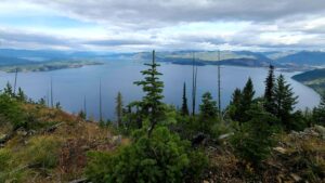
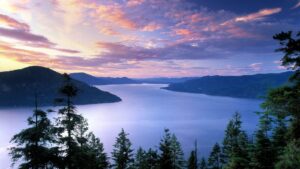
Lake Pend Oreille Ice Age Floods National Geologic Trail  The Purcell Lobe of the Cordilleran Ice Sheet repeatedly formed a 2000′ tall ice dam in this area, which backed up Glacial Lake Missoula and eventually burst catastrophically, releasing Ice Age Floods as often as about every ~10-60 years. Lake Pend Oreille is the largest lake in Idaho. The lake level is 2062 ft above sea level, with the surrounding terrain as high as 6002 ft. With a maximum depth of 1150 ft, this lake is the 5th deepest in the US. The location of the lake is probably related to an old river valley controlled by faults. The Lake Pend Oreille basin was carved by the repeated advances of Pleistocene ice and scoured by Ice Age Floods. With the waning of flood waters, the basin was filled with glacial out-wash and flood deposits. The lake is dammed at the south end by thick glacial and flood deposits that mark the beginning of the “Outburst Deposits”Quick Facts MANAGED BY:US Forest Service

Read More »

Glacial Dam at Green Monarch Ridge View Point

Glacial Lobe Dam at Green Monarch Ridge View Point Ice Age Floods National Geologic Trail  As the Purcell Trench ice lobe of the Cordilleran Ice Sheet advanced south from Canada, it was stopped by the Green Monarch Ridge, building an ice dam 4,000 feet (1219 m) tall and nearly 40 miles (64 km) wide that blocked the Clark Fork river, thus filling glacial Lake Missoula. View the Green Monarch Ridge and the Purcell Trench from a large pullout on Idaho State Route 200, about one mile (1.6 km) west of Hope, Idaho and 15 miles (24 km) east of Sandpoint, Idaho. Quick Facts Location: Idaho State Route 200, about one mile west of Hope, Idaho and 15 miles  east of Sandpoint, Idaho.

Read More »
SOME PLACES TO GO and THINGS TO DO in WASHINGTON

Wenatchee Valley Museum & Cultural Center

Wenatchee Valley Museum & Cultural Center Ice Age Floods National Geologic Trail The Wenatchee Valley Museum and Cultural Center’s mission is to gather, engage, and educate people to celebrate and preserve the history, arts, sciences, and rich diversity of our region. It is a 501(c)(3)

Read More »

Postmortem on the southern Cordilleran Ice Sheet

(21Feb2024) On 18 March 2924 at 7:00pm the Puget Lobe Chapter io the IAFI will have Dr Ralph A Haugerud give his presentation “the Postmortem on the Southern Cordilleran Ice sheet.  Death of an ice sheet can have many causes, as shown by retreat of

Read More »

Drumheller Channels National Natural Landmark

Drumheller Channels National Natural Landmark Ice Age Floods National Geologic Trail The Drumheller Channels are unique because no single channel or major cataracts were formed. The Drumheller Channels are the most spectacular example in the Columbia Plateau of basalt “butte-and-basin” channeled scablands. This is an

Read More »
SOME PLACES TO GO and THINGS TO DO in OREGON

Columbia Gorge Discovery Center & Museum

Columbia Gorge Discovery Center & Museum Ice Age Floods National Geologic Trail, Lewis & Clark National Historic Trail, Oregon National Historic Trail The Columbia Gorge Discovery Center & Museum is located on a 54-acre point of land adjacent to the Columbia River and is the

Read More »

Oregon Museum of Science and Industry

Oregon Museum of Science and Industry Ice Age Floods National Geologic Trail The Oregon Museum of Science and Industry (OMSI) in Portland, Oregon, was founded in 1944. OMSI is one of the nation’s leading science museums and a trusted educational resource for communities throughout Oregon

Read More »

Crown Point National Natural Landmark

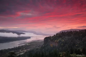
Crown Point National Natural Landmark Ice Age Floods National Geologic Trail – Historic Columbia River Highway This spectacular viewpoint along the Historic Columbia River Highway 30 was the site of the 1916 dedication of a highway that was, for that time, an innovative European-style road

Read More »
Even MORE PLACES TO GO and THINGS TO DO

Click a STATE for MORE PLACES TO GO and THINGS TO DO

MONTANAIDAHOWASHINGTONOREGON

Share this article:

Like this:

Like Loading…