GO PLACES! DO THINGS!

Along the ICE AGE FLOODS
NATIONAL GEOLOGIC TRAIL


The Ice Age Floods National Geologic Trail covers some 16,000 square miles (41,440 km2) in present day Montana, Idaho, Washington, and Oregon. We have hand picked some of the best of the best places along the Trail and present them here for you enjoy and explore! Check back often, we will be adding new and wonderful destinations for your entire Family to enjoy!

MONTANAIDAHOWASHINGTONOREGON

SOME PLACES TO GO and THINGS TO DO in MONTANA

Glacial Lake Missoula National Natural Landmark

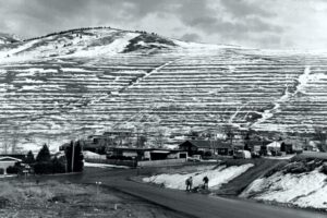
Glacial Lake Missoula National Natural Landmark Ice Age Floods National Geologic Trail Glacial Lake Missoula was the largest of several lakes impounded by the Cordilleran Ice Sheet in the Northern Rocky Mountains during the Quaternary period. The lake was approximately 2,900 square miles in size and contained more than 500 cubic miles of water. It occupied the Mission, Jocko and Little Bitterroot valleys, drained by the Flathead River; and the Missoula, Ninemile and Bitterroot valleys, drained by the Clark Fork River. The lake was formed by an ice dam across the mouth of the Clark Fork River at Lake Pend Oreille, Idaho, a result of successive advances of a lobe of the Cordilleran Ice Sheet. The site is located 12 miles north of Perma, Montana. At least three and possibly more than 100 separate collapses of the ice dam, possibly coincident with periods of ice retreat, caused the lake to drain, producing catastrophic floods across the Columbia Plateau and down the Columbia River Basin. It is estimated that the waters of Glacial Lake Missoula, 1,000 feet deep at Eddy Narrows, were withdrawn at a peak discharge rate of 10 cubic miles per hour. Approximately 550 cubic miles of water passed through those narrows during withdrawal. Evidence of this catastrophic withdrawal can be found in scourings, high eddy deposits of flood debris, flood bars of boulders and course gravel, and successions of giant arcuate ripples or ridges of gravel resting on bedrock surfaces. Ripples appear as ridges 15 to 50 feet high, 100 to 250 feet wide, and from 300 feet to a half-mile long. While the form, structure and arrangement of these features are similar to that of ordinary current ripple marks, they are termed giant flood ripples, due to their large size. The giant flood ripples at this site are unusual due to their being on the down-current side of notches in a ridge separating two basins that were both subsidiary to the main course of Lake Missoula in the Clark Fork Valley. The best examples of giant flood ripples are found in Camas Prairie. Quick Facts Designation:National Natural Landmark OPEN TO PUBLIC:Private Land, closed to the public, but features throughout the area are visible from many vantage points.

Read More »

Eddy Narrows

Eddy Narrows Ice Age Floods National Geologic Trail Eddy Narrows is a 10-mile long canyon between Plains and Thompson Fall along the Clark Fork River. Here all of the waters from the northern and eastern arms of Glacial Lake Missoula converged and picked up speed as they were forced through this restricted area. The steep valley walls are bare of talus and soils up to the level estimated to be the highest level of the lake (1000 ft), and there are polished grooves in the bedrock on a bench 340-400 feet above the Clark Fork River that run parallel to it. Since there is no evidence of glaciation in this area, the only explanation is the rapid draining of Glacial Lake Missoula. Using the dimensions of this flume-shaped area of the canyon, which controlled the rate of flow of water surging through it, in 1942 J.T. Pardee was able to calculate maximum speeds approaching 80 mph, emptying Glacial Lake Missoula in as little as three days. There are pullouts along MT-200 at either end of the narrowest part of this section marked for observing big horn sheep with Glacial Lake Missoula signage at the one between mileposts 59 and 60 at: 47.537940, -115.071654  Quick Facts Location:Between Plains and Thompson Falls, MT 

Read More »

The Paradise Center

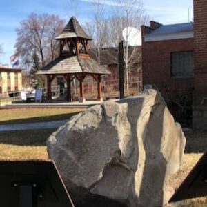
The Paradise Center Ice Age Floods National Geologic Trail Paradise Center, formerly the Paradise Elementary School, is a community, visitors, and arts center in the old railroad community of the same name.  Just below the confluence of the muddy Clark Fork and beautiful blue Flathead Rivers, 70 miles northwest of Missoula, the area was repeatedly inundated by Glacial Lake Missoula, leaving many visible features in the area such as gulch fills, kolks, and lake bottom sediment bluffs. It is on the route between the Camas Prairie Ripples and Eddy Narrows.   Inside the school is a unique interactive 3-D topographical or relief map of the entire area covered by Glacial Lake Missoula and an extensive display of information about the Lake as well as other topics of interest to the area.  Outside on the grounds is a playground and an outdoor walking loop with a dozen or so displays of interest such as the former railroad roundhouse.  A model railroad set-up is also found inside the center. This area can easily be reached directly from the St. Regis exit from I-90 by following the Clark Fork River where flood waters turned sharply to the north, carving out the narrow valley along scenic route 135 to the junction with MT-200. Scour marks and displaced boulders are visible from the road, and it is especially lovely when the larch trees turn bright yellow in the fall. This route also takes you past the historic Quinn’s Hot Springs Resort.  ANNOUNCEMENT: The Paradise Center hours are seasonal, generally Wednesday thru Saturday, 11am-3pm in the summer. Check the website at paradisecentermt.org or call 406-826-0500 Quick Facts Location:2 School House Hill Road Paradise, MT 59856 MANAGED BY:The Paradise Center

Read More »
SOME PLACES TO GO and THINGS TO DO in IDAHO

Museum of North Idaho

Museum of North Idaho IceAgeFloods National GeologicTrail “The Museum of North Idaho collects, preserves and interprets the history of the Coeur d’Alene Region. to foster appreciation of the area’s heritage.” In the 1960s, the North Idaho Hoo Hoo Club, an organization of loggers, lumbermen and foresters, first entertained the idea of establishing a museum. They incorporated on May 1, 1968 for a museum focusing on the history of the Coeur d’Alene Region (Kootenai, Benewah and part of Shoshone counties). Through the efforts of volunteers and community support, the Museum opened its doors on the North Idaho College campus on July 28, 1973. In 1979, they remodeled a City-owned building and relocated to its current location. Quick Facts Location: 115 Northwest Blvd, Coeur d’Alene, ID 83814Phone: (208) 664-3448 The Museum is open Tuesday to Saturday from 11 am – 5 pm.

Read More »

Must See Floods Features in Northern Idaho

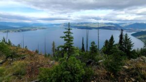
SOME LOCAL NORTHERN IDAHO ICE AGE FLOODS and GLACIAL FEATURES Purcell Trench – This structurally formed valley became the passageway for the Purcell Ice Lobe that divided into five glacial sub-lobes.  The east moving sub-lobe blocked the Clark Fork River forming Glacial Lake Missoula, the source of the Ice Age Flood waters.  Other sub-lobes modified and deepened the basin now occupied by Lake Pend Oreille or helped define several important N-S transportation routes. The Purcell Trench is visible from City Beach in Sandpoint and Schweitzer Mountain Rd.  Hwy 95 follows the Purcell Trench from Sandpoint to beyond Bonners Ferry. Cabinet Gorge – Contact of Pleistocene Ice and Glacial Lake Missoula Water – Although the contact of the Pleistocene Ice and the lapping waters of Glacial Lake Missoula was in flux as the glacier advanced and retreated, the Cabinet Gorge is considered by many to be a likely location of the terminus of the Clark Fork sub-lobe that blocked the drainage of the Clark Fork River.   Evidence of glacial erosion and till deposits indicate glaciation; however, flood deposits on the south side of the river attest to Ice Age flooding.  Cores taken during the construction of the Cabinet Gorge Dam suggest multiple stages and events of ice damming. An AVISTA maintained viewpoint at the Cabinet Gorge Dam with Ice Age Floods signage provides an excellent location to ponder the formation and disintegration of the ice plug blocking the Clark Fork River.  Glacial Striations – Striations can be viewed along Hwy 200 east of Hope and on the south side of Castle Rock east of Clark Fork. Glacial/Flood Related Erratics – Large and small erratics cover the glacial and flood modified landscape.  Large erratics can be seen along Hwy 200 east of Clark Fork, in Sandpoint’s City Beach and in Farragut State Park.  A large pile of erratics excavated from flood deposits are visible on the west-side of Hwy 95 south of the Hoodoo Channel.  A giant ice-rafted flood related erratic weighing over 1,600 tons is located on the east-side of Hwy 41 near Twin Lakes.  Lake Pend Oreille – Cross-section morphology, depth, and sediments – This is where it all started! Lake Pend Oreille is the largest lake in Idaho and the deepest lake in the Pacific Northwest and the 5th deepest in the US. The lake level is 2062 ft above sea level with depths over 1,000 feet and an additional layer of over 1,500 feet of glacial-fluvial deposits going to bedrock, with the surrounding terrain as high as 6002 ft. The glacially modified U-shaped bedrock valley, cut to approximately 600 feet below sea level, was formed by the Pend Oreille glacial sub-lobe. This glacial sub-lobe was up to 4,000+ ft. thick and 30+ miles wide. It was the ice plug responsible for blocking the Clark Fork River. It collapsed catastrophically as often as about every 10-60 years, releasing 40-100 Ice Age Floods.  The location of the lake is probably related to an old river valley controlled by faults. The Lake Pend Oreille basin was carved by the repeated advances of Pleistocene ice and scoured by ice age floods. With the waning of ice age flood waters, the basin was, and continues to be, filled with glacial outwash and flood deposits. The lake is dammed at the south end by thick glacial and flood deposits the mark the beginning of the “Outburst Deposits”. There is a pullout on Hwy 200 approximately one mile west of Hope with signage already established that provides a great view looking south across Lake Pend Oreille to the Green Monarch Mts. Another view of the former ice plug location along Hwy 200 is the mouth of the Clark Fork River at the Clark Fork Drift Yard. Giant Current Dunes or MegaRipple Marks – One of Bretz’ most important pieces of evidence for catastrophic flooding was the “giant current dunes.” These large-scale bedforms appeared as patterns of parallel ridges and swales on many aerial photographs in the flood channels in the scabland of Washington, but had escaped recognition from the ground because of their size. Giant Current Dunes are visible west of Clark Fork near Castle Rock; however, the most prominent and visible Giant Current Dunes are located several miles east of Spirit Lake along Hwy 54 where the highway cuts through the dunes showing their undulating profile. The location of many of the telephone poles on the crest of these dunes accentuates these landforms. The dunes form transverse to the current direction, and form cusps that are convex upstream, with arms that point downstream. Furthermore, the size of the cusps appears to decrease in the direction of lower velocity. Internally, the dunes consist of gravel and pebble foresets. Giant current dunes exhibit an asymmetrical profile with the downstream (lee) slope steeper than the upstream slope. Crests range from 20 to 200m apart and heights range from 1 to 15m (Baker and Nummedal, 1978) and are among the largest measured throughout the Floods area. The Spirit Lake current dunes can also be easily recognized from the air by their characteristic pattern, accentuated by vegetation. This dune field is immediately in the path of the breakout from Lake Pend Oreille, and experienced some of the highest energy flows. Rhythmites – Rhythmites are glaciolacustrine sediments associated with flood events and are useful in attempting to determine the number of Ice Age Floods.  A 112-foot cross-section of rhythmites is located at the junction of East Fork Creek and Lightning Creek approximately 6.5 miles northeast of Clark Fork along Lightning Creek Road (NF-419). Proglacial Deposits – This type of deposit is found associated with most of the drainages on the south side of the Clark Fork Valley and extend from the mouth of the Clark Fork River to nearly Thompson Falls in Montana.  These sediments are glacio-fluvial deposits deposited in contact with the ice and therefore provide evidence of glaciation in the Clark Fork River drainage.  The associated geomorphic features formed by these deposits are referred to as “kame deltas”. The gravel pit associated with Dry Creek (approximately 8 miles west of Clark Fork

Read More »
SOME PLACES TO GO and THINGS TO DO in WASHINGTON

Journey Through Time: Explore Drumheller Channels

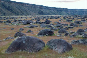
Nestled in the heart of Washington state, the Drumheller Channels offer a unique glimpse into earth’s history, carved by the immense power of Ice Age Floods. This National Natural Landmark is a must-visit for anyone seeking breathtaking landscapes, remarkable geological formations, and a chance to

Read More »

Dry Falls Kayaking

Dry Falls Kayaking Ice Age Floods National Geologic Trail Most Pacific Northwesterners know how awesomely majestic and stunningly beautiful Dry Falls is, if only from the pictures that seem to show up everywhere. If you haven’t been there in person yet you definitely need to

Read More »

The Reach Museum

The Reach Museum Ice Age Floods National Geologic Trail, Manhattan Project National Historical Park The REACH Museum shares the natural and human history of the Tri-Cities and the surrounding area. The museum takes its name from Hanford Reach, the longest free flowing (un-dammed), non-tidal section

Read More »
SOME PLACES TO GO and THINGS TO DO in OREGON

Oregon Museum of Science and Industry

Oregon Museum of Science and Industry Ice Age Floods National Geologic Trail The Oregon Museum of Science and Industry (OMSI) in Portland, Oregon, was founded in 1944. OMSI is one of the nation’s leading science museums and a trusted educational resource for communities throughout Oregon

Read More »

Columbia Gorge Discovery Center & Museum

Columbia Gorge Discovery Center & Museum Ice Age Floods National Geologic Trail, Lewis & Clark National Historic Trail, Oregon National Historic Trail The Columbia Gorge Discovery Center & Museum is located on a 54-acre point of land adjacent to the Columbia River and is the

Read More »

Tualatin Ice Age Walking Trail

Tualatin Ice Age Walking Trail Ice Age Floods National Geologic Trail The Tualatin Ice Age Trail is a self-guided tour of sites representing the ancient history of our area. Along the trail, you’ll discover evidence of centuries-old ice, rock and bone, including the sites where a mastodon

Read More »
Even MORE PLACES TO GO and THINGS TO DO

Click a STATE for MORE PLACES TO GO and THINGS TO DO

MONTANAIDAHOWASHINGTONOREGON

Share this article:

Like this:

Like Loading…