GO PLACES! DO THINGS!

Along the ICE AGE FLOODS
NATIONAL GEOLOGIC TRAIL


The Ice Age Floods National Geologic Trail covers some 16,000 square miles (41,440 km2) in present day Montana, Idaho, Washington, and Oregon. We have hand picked some of the best of the best places along the Trail and present them here for you enjoy and explore! Check back often, we will be adding new and wonderful destinations for your entire Family to enjoy!

MONTANAIDAHOWASHINGTONOREGON

SOME PLACES TO GO and THINGS TO DO in MONTANA

Erratic in the Bitterroot

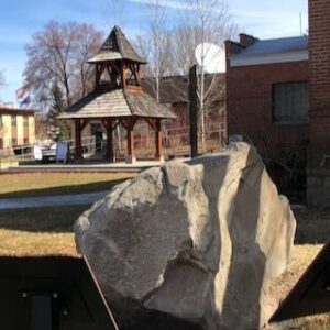
An 8 ton erratic left behind by Glacial Lake Missoula in the Bitterroot Valley on the property of a local rancher was relocated to serve as the focal point of an outdoor kiosk exhibit at the Ravalli County Museum at the former County Courthouse, 205 Bedford Street in Hamilton.  Unlike their counterparts at other location along the National Geologic Trail, erratics in this part of the Ice Age Floods did not come from Canada nor did they travel as far, but the action of the floodwaters and iceberg rafts is equally evident despite more shallow waters. There are similar erratics found elsewhere in Bitterroot, on the campus of the University of Montana, and at the Bison Range. The outdoor display tells the same story as other locations on the Ice Age Floods National Geologic Trail but also includes information on two other National Park Service trails that pass through this area – the Nez Perce and the Lewis and Clark National Historic Trails.  The museum has other indoor exhibits of historical interest and about Glacial Lake Missoula.    

Read More »

Glacial Lake Missoula National Natural Landmark

Glacial Lake Missoula National Natural Landmark Ice Age Floods National Geologic Trail Glacial Lake Missoula was the largest of several lakes impounded by the Cordilleran Ice Sheet in the Northern Rocky Mountains during the Quaternary period. The lake was approximately 2,900 square miles in size and contained more than 500 cubic miles of water. It occupied the Mission, Jocko and Little Bitterroot valleys, drained by the Flathead River; and the Missoula, Ninemile and Bitterroot valleys, drained by the Clark Fork River. The lake was formed by an ice dam across the mouth of the Clark Fork River at Lake Pend Oreille, Idaho, a result of successive advances of a lobe of the Cordilleran Ice Sheet. The site is located 12 miles north of Perma, Montana. At least three and possibly more than 100 separate collapses of the ice dam, possibly coincident with periods of ice retreat, caused the lake to drain, producing catastrophic floods across the Columbia Plateau and down the Columbia River Basin. It is estimated that the waters of Glacial Lake Missoula, 1,000 feet deep at Eddy Narrows, were withdrawn at a peak discharge rate of 10 cubic miles per hour. Approximately 550 cubic miles of water passed through those narrows during withdrawal. Evidence of this catastrophic withdrawal can be found in scourings, high eddy deposits of flood debris, flood bars of boulders and course gravel, and successions of giant arcuate ripples or ridges of gravel resting on bedrock surfaces. Ripples appear as ridges 15 to 50 feet high, 100 to 250 feet wide, and from 300 feet to a half-mile long. While the form, structure and arrangement of these features are similar to that of ordinary current ripple marks, they are termed giant flood ripples, due to their large size. The giant flood ripples at this site are unusual due to their being on the down-current side of notches in a ridge separating two basins that were both subsidiary to the main course of Lake Missoula in the Clark Fork Valley. The best examples of giant flood ripples are found in Camas Prairie. Quick Facts Designation:National Natural Landmark OPEN TO PUBLIC:Private Land, closed to the public, but features throughout the area are visible from many vantage points.

Read More »

Camas Prairie Ripples

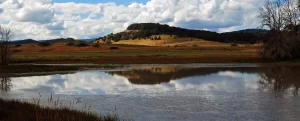
Camas Prairie Ripples The Camas Prairie Ripples, located 12 miles north of Perma, Montana, appear as prominent ridges 15 to 50 feet high, 100 to 250 feet wide, and from 300 feet to a half-mile long – the largest ripples on earth. While the form, structure and arrangement of these features are similar to that of ordinary current ripple marks, they are termed giant flood ripples, due to their large size. Most ripples that are formed by rivers today are only inches high and are mostly made up of sand-sized particles. Many of the Camas Prairie ripples are composed of boulder-sized geologic debris, and since the size of ripples is related to the strength of a river’s currents, these ripples were created by currents so powerful they are difficult to comprehend. The best examples of giant flood ripples are found in Camas Prairie. The Camas Prairie Ripples were formed by strong currents associated with as many as 40 to 100 emptyings of Glacial Lake Missoula over 4,000 years beginning some 17,000 years ago. Glacial Lake Missoula was formed by a massive lobe of the Pleistocene Cordilleran ice sheet that blocked the mouth of the Clark Fork River at Lake Pend Oreille, Idaho, a result of successive advances of the Cordilleran Ice Sheet during the Ice Age, when mammoths, saber-toothed cats, and giant ground sloths still roamed the landscape. It was the largest of several lakes impounded by the Cordilleran Ice Sheet in the Northern Rocky Mountains during the Quaternary period. The lake that formed behind the ice dam expanded until it was 3,000 square miles, held 500 cubic miles of water, and was 2,000 feet deep – as big as Lakes Erie and Ontario combined. It occupied the Mission, Jocko and Little Bitterroot valleys, drained by the Flathead River; and the Missoula, Ninemile and Bitterroot valleys, drained by the Clark Fork River. When the ice dam eventually collapsed Glacial Lake Missoula emptied catastrophically to the west on across the Columbia Plateau and down the Columbia River Basin, its waters moving at maximum speeds of 80 miles per hour to the Pacific Ocean. The flood waters ran with the force equal to 60 Amazon Rivers and moved car-sized boulders up to 500 miles, embedded in icebergs from the failed ice dam. It occupied the Mission, Jocko and Little Bitterroot valleys, drained by the Flathead River; and the Missoula, Ninemile and Bitterroot valleys, drained by the Clark Fork River. It is estimated that the catastrophic flood waters of Glacial Lake Missoula, 1,000 feet deep at Eddy Narrows, drained at a peak discharge rate of 10 cubic miles per hour. Approximately 380 cubic miles of water passed through those narrows, during withdrawal. Evidence of this catastrophic withdrawal can be found in scourings, high eddy deposits of flood debris, flood bars of boulders and course gravel, and successions of giant arcuate ripples or ridges of gravel resting on bedrock surfaces. The giant flood ripples at this site are unusual due to their being on the down-current side of notches in a ridge separating two basins that were both subsidiary to the main course of Lake Missoula in the Clark Fork Valley. Flathead Land Trust’s largest conservation easement protects 3,867 acres of the Camas Prairie near Hot Springs. The rolling grasslands of the Camaroot Ranch were first homesteaded in 1910, the year the Flathead Indian Reservation was first open to land acquisition. The Cross family’s ownership began in 1920 when Sid Cross’s grandparents, John and Anna Lauraman, first acquired 160 acres. They and other relatives continued to acquire surrounding land over the next several decades. At one time the ranch totaled almost 6,000 acres. Parts of three homesteads still remain on the property including a 2-story house and old barn that was built in the 1920s where Anna Lauraman grew up. The ranch was used for grazing cows and horses, and raising some crops such as alfalfa and wheat. The Cross family sold the property to the Confederated Salish and Kootenai Tribe in 2015. The conservation easement on this unique property preserves open space, agricultural land, and the giant ripples as silent monuments of Montana’s prehistoric and chaotic past. The locale includes a mixture of private, public and landtrust lands throughout the Camas Prairie area.

Read More »
SOME PLACES TO GO and THINGS TO DO in IDAHO

Celebration Park – Home of Melon Gravel

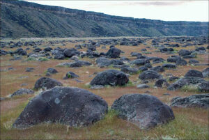
17,000 years ago, a massive Ice Age lake – now called Lake Bonneville – filled a large portion of present-day Utah. As temperatures changed, the influx of ice melt caused the lake level to rise. In addition, the Bear River, once a tributary of the Snake, was diverted by volcanic activity back into Lake Bonneville. These factors ultimately led to the breaching of a sedimentary rock dam at Red Rocks Pass, Idaho. There was only one ice-age Bonneville Flood because Lake Bonneville broke through a rock dam, unlike the Missoula Floods whose glacial ice dam repeatedly dammed Glacial Lake Missoula, then broke and rebuilt.  1,100 cubic miles of Lake Bonneville water rushed through the Snake River Canyon, and it took only six weeks for Lake Bonneville to empty the equivalent volume of modern-day Lake Michigan. The Great Salt Lake we know today is a remnant of Lake Bonneville, but at one tenth the size, it is a mere puddle compared to what the lake used to be.  The power of this catastrophic flood widened canyons as the force of the water pulled huge chunks of basalt off the cliffs and tumbled them around, smoothing their jagged edges along the way. As the canyon width narrowed, the force and velocity of the flood increased. Wherever the canyons widened, the flood lost force and velocity, the waters slowed and began dropping its bedload – in this case, giant tumbled basalt boulders instead of your typical river gravel.  These flood-rounded boulders, named melon gravel due to their distinct shape, are scattered over vast areas of land. The rocks’ unique outlines and smooth surfaces caught the eye of Native American tribes in the area, who have used them as canvases for petroglyphs for thousands of years. Visitors can see the medium sized flood deposits just outside the visitor center, or hike upriver to see gigantic melon gravel the size of heavy-duty trucks.  Celebration Park is located in the Snake River Canyon, approximately 23 miles south of Nampa, Idaho. It is home to an enormous melon gravel field deposited by the Bonneville Flood. 

Read More »

Green Monarch Ridge

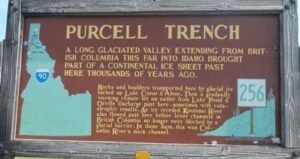
Green Monarch Ridge Ice Age Floods National Geologic Trail THIS IS WHERE IT ALL BEGAN! The Green Monarch Ridge viewpoint, just south of the Hope Fault, is positioned along the edge of the Purcell Trench Ice Lobe. Here it was responsible for damming the mouth of the Clark Fork drainage basin. This damming effect resulted in the formation of Glacial Lake Missoula, the source of the waters for much of  the PNW Pleistocene Ice Age Floods. The Purcell Trench Ice Lobe originated in Canada and flowed south into Idaho, guided by the structural control of the Purcell Trench. Following the path of least resistance into the basin now occupied by Lake Pend Oreille, it was impeded by the Green Monarch Ridge, located approximately 10 miles south of this viewpoint. Grinding and scraping, the Purcell Trench Ice Lobe backed up behind the Green Monarch Ridge, eventually building an ice plug up to 4,000 feet thick, and scouring out the deepest parts of Lake Pend Oreille. The Purcell Trench Ice Lobe divided into four sub-lobes: one went approximately west (US Highway 2), two went south (US Highway 95 and Lake Pend Oreille) and one went east (SR 200). All four sub-lobes contributed to blocking the Clark Fork drainageQuick Facts MANAGED BY:US Forest Service – Idaho Panhandle National Forest

Read More »
SOME PLACES TO GO and THINGS TO DO in WASHINGTON

Hiking Drumheller Channels

Hiking Drumheller Channels Ice Age Floods National Geologic Trail There are scads of hiking trails all through Drumheller Channels National Natural Landmark. On a cloudy day in early June we took off on a couple of exploratory hikes that were simply amazing. We first proceeded

Read More »

Fort Spokane Visitor Center

Fort Spokane Visitor Center Ice Age Floods National Geologic Trail “Fort Spokane is one of the cultural jewels of Lake Roosevelt National Recreation Area. For thousands of years, the area was a gathering place for native tribes fishing the rapids of the Spokane River. In

Read More »

Journey Through Time: Explore Drumheller Channels

Nestled in the heart of Washington state, the Drumheller Channels offer a unique glimpse into earth’s history, carved by the immense power of Ice Age Floods. This National Natural Landmark is a must-visit for anyone seeking breathtaking landscapes, remarkable geological formations, and a chance to

Read More »
SOME PLACES TO GO and THINGS TO DO in OREGON

Hat Rock State Park

Hat Rock State Park Ice Age Floods National Geologic Trail, Lewis & Clark National Historic Trail Hat Rock is an erosion remnant warn way by floods from glaciers which melted over ten thousand years ago. Lewis and Clark saw this monument on their expedition and

Read More »

Oregon Museum of Science and Industry

Oregon Museum of Science and Industry Ice Age Floods National Geologic Trail The Oregon Museum of Science and Industry (OMSI) in Portland, Oregon, was founded in 1944. OMSI is one of the nation’s leading science museums and a trusted educational resource for communities throughout Oregon

Read More »

Columbia Gorge Discovery Center & Museum

Columbia Gorge Discovery Center & Museum Ice Age Floods National Geologic Trail, Lewis & Clark National Historic Trail, Oregon National Historic Trail The Columbia Gorge Discovery Center & Museum is located on a 54-acre point of land adjacent to the Columbia River and is the

Read More »
Even MORE PLACES TO GO and THINGS TO DO

Click a STATE for MORE PLACES TO GO and THINGS TO DO

MONTANAIDAHOWASHINGTONOREGON

Share this article:

Like this:

Like Loading…