GO PLACES! DO THINGS!

Along the ICE AGE FLOODS
NATIONAL GEOLOGIC TRAIL


The Ice Age Floods National Geologic Trail covers some 16,000 square miles (41,440 km2) in present day Montana, Idaho, Washington, and Oregon. We have hand picked some of the best of the best places along the Trail and present them here for you enjoy and explore! Check back often, we will be adding new and wonderful destinations for your entire Family to enjoy!

MONTANAIDAHOWASHINGTONOREGON

SOME PLACES TO GO and THINGS TO DO in MONTANA

Montana Natural History Center

Montana Natural History Center Ice Age Floods National Geologic Trail  The mission of the Montana Natural History Center is to promote and cultivate the appreciation, understanding, and stewardship of nature through education. Founded in 1991, MNHC was the brainchild of a group of educators who were involved in various efforts to educate both kids and adults about the natural history of western Montana, and who decided to unite those efforts into one environmental education organization. MNHC provides nature education programming for people of all ages through summer camps, kids’ activities, Visiting Naturalist in the Schools, Master Naturalist certification courses and Field Days, evening programs, Field Notes on Montana Public Radio, museum tours, and more.  We have a variety of exhibits that focus on the flora, fauna, geology, and ecology of our beautiful state. Please stop by and visit! MNHC often partners with the Ice Age Floods Institute to share fields trips and lectures about the Ice Age Floods.   MNHC has exhibits that help visitors explore the Glacial Lake Missoula and Ice Age Floods. Learn more at:Explore Glacial Lake Missoula | Montana Natural History Center (montananaturalist.org) The Glacial Lake Missoula Chapeter of the Ice Age Floods Institue also produced a short movie about Glacial Lake Missoula. You can find a link here. Quick Facts Location:120 Hickory Street, Suite A, Missoula, Montana

Read More »

Camas Prairie Ripples

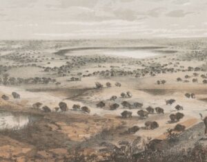
Camas Prairie Ripples The Camas Prairie Ripples, located 12 miles north of Perma, Montana, appear as prominent ridges 15 to 50 feet high, 100 to 250 feet wide, and from 300 feet to a half-mile long – the largest ripples on earth. While the form, structure and arrangement of these features are similar to that of ordinary current ripple marks, they are termed giant flood ripples, due to their large size. Most ripples that are formed by rivers today are only inches high and are mostly made up of sand-sized particles. Many of the Camas Prairie ripples are composed of boulder-sized geologic debris, and since the size of ripples is related to the strength of a river’s currents, these ripples were created by currents so powerful they are difficult to comprehend. The best examples of giant flood ripples are found in Camas Prairie. The Camas Prairie Ripples were formed by strong currents associated with as many as 40 to 100 emptyings of Glacial Lake Missoula over 4,000 years beginning some 17,000 years ago. Glacial Lake Missoula was formed by a massive lobe of the Pleistocene Cordilleran ice sheet that blocked the mouth of the Clark Fork River at Lake Pend Oreille, Idaho, a result of successive advances of the Cordilleran Ice Sheet during the Ice Age, when mammoths, saber-toothed cats, and giant ground sloths still roamed the landscape. It was the largest of several lakes impounded by the Cordilleran Ice Sheet in the Northern Rocky Mountains during the Quaternary period. The lake that formed behind the ice dam expanded until it was 3,000 square miles, held 500 cubic miles of water, and was 2,000 feet deep – as big as Lakes Erie and Ontario combined. It occupied the Mission, Jocko and Little Bitterroot valleys, drained by the Flathead River; and the Missoula, Ninemile and Bitterroot valleys, drained by the Clark Fork River. When the ice dam eventually collapsed Glacial Lake Missoula emptied catastrophically to the west on across the Columbia Plateau and down the Columbia River Basin, its waters moving at maximum speeds of 80 miles per hour to the Pacific Ocean. The flood waters ran with the force equal to 60 Amazon Rivers and moved car-sized boulders up to 500 miles, embedded in icebergs from the failed ice dam. It occupied the Mission, Jocko and Little Bitterroot valleys, drained by the Flathead River; and the Missoula, Ninemile and Bitterroot valleys, drained by the Clark Fork River. It is estimated that the catastrophic flood waters of Glacial Lake Missoula, 1,000 feet deep at Eddy Narrows, drained at a peak discharge rate of 10 cubic miles per hour. Approximately 380 cubic miles of water passed through those narrows, during withdrawal. Evidence of this catastrophic withdrawal can be found in scourings, high eddy deposits of flood debris, flood bars of boulders and course gravel, and successions of giant arcuate ripples or ridges of gravel resting on bedrock surfaces. The giant flood ripples at this site are unusual due to their being on the down-current side of notches in a ridge separating two basins that were both subsidiary to the main course of Lake Missoula in the Clark Fork Valley. Flathead Land Trust’s largest conservation easement protects 3,867 acres of the Camas Prairie near Hot Springs. The rolling grasslands of the Camaroot Ranch were first homesteaded in 1910, the year the Flathead Indian Reservation was first open to land acquisition. The Cross family’s ownership began in 1920 when Sid Cross’s grandparents, John and Anna Lauraman, first acquired 160 acres. They and other relatives continued to acquire surrounding land over the next several decades. At one time the ranch totaled almost 6,000 acres. Parts of three homesteads still remain on the property including a 2-story house and old barn that was built in the 1920s where Anna Lauraman grew up. The ranch was used for grazing cows and horses, and raising some crops such as alfalfa and wheat. The Cross family sold the property to the Confederated Salish and Kootenai Tribe in 2015. The conservation easement on this unique property preserves open space, agricultural land, and the giant ripples as silent monuments of Montana’s prehistoric and chaotic past. The locale includes a mixture of private, public and landtrust lands throughout the Camas Prairie area.

Read More »

Glacial Lake Missoula National Natural Landmark

Glacial Lake Missoula National Natural Landmark Ice Age Floods National Geologic Trail Glacial Lake Missoula was the largest of several lakes impounded by the Cordilleran Ice Sheet in the Northern Rocky Mountains during the Quaternary period. The lake was approximately 2,900 square miles in size and contained more than 500 cubic miles of water. It occupied the Mission, Jocko and Little Bitterroot valleys, drained by the Flathead River; and the Missoula, Ninemile and Bitterroot valleys, drained by the Clark Fork River. The lake was formed by an ice dam across the mouth of the Clark Fork River at Lake Pend Oreille, Idaho, a result of successive advances of a lobe of the Cordilleran Ice Sheet. The site is located 12 miles north of Perma, Montana. At least three and possibly more than 100 separate collapses of the ice dam, possibly coincident with periods of ice retreat, caused the lake to drain, producing catastrophic floods across the Columbia Plateau and down the Columbia River Basin. It is estimated that the waters of Glacial Lake Missoula, 1,000 feet deep at Eddy Narrows, were withdrawn at a peak discharge rate of 10 cubic miles per hour. Approximately 550 cubic miles of water passed through those narrows during withdrawal. Evidence of this catastrophic withdrawal can be found in scourings, high eddy deposits of flood debris, flood bars of boulders and course gravel, and successions of giant arcuate ripples or ridges of gravel resting on bedrock surfaces. Ripples appear as ridges 15 to 50 feet high, 100 to 250 feet wide, and from 300 feet to a half-mile long. While the form, structure and arrangement of these features are similar to that of ordinary current ripple marks, they are termed giant flood ripples, due to their large size. The giant flood ripples at this site are unusual due to their being on the down-current side of notches in a ridge separating two basins that were both subsidiary to the main course of Lake Missoula in the Clark Fork Valley. The best examples of giant flood ripples are found in Camas Prairie. Quick Facts Designation:National Natural Landmark OPEN TO PUBLIC:Private Land, closed to the public, but features throughout the area are visible from many vantage points.

Read More »
SOME PLACES TO GO and THINGS TO DO in IDAHO

Lake Pend Oreille

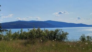
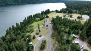
Lake Pend Oreille Ice Age Floods National Geologic Trail  The Purcell Lobe of the Cordilleran Ice Sheet repeatedly formed a 2000′ tall ice dam in this area, which backed up Glacial Lake Missoula and eventually burst catastrophically, releasing Ice Age Floods as often as about every ~10-60 years. Lake Pend Oreille is the largest lake in Idaho. The lake level is 2062 ft above sea level, with the surrounding terrain as high as 6002 ft. With a maximum depth of 1150 ft, this lake is the 5th deepest in the US. The location of the lake is probably related to an old river valley controlled by faults. The Lake Pend Oreille basin was carved by the repeated advances of Pleistocene ice and scoured by Ice Age Floods. With the waning of flood waters, the basin was filled with glacial out-wash and flood deposits. The lake is dammed at the south end by thick glacial and flood deposits that mark the beginning of the “Outburst Deposits”Quick Facts MANAGED BY:US Forest Service

Read More »

Glacial Dam at Green Monarch Ridge View Point

Glacial Lobe Dam at Green Monarch Ridge View Point Ice Age Floods National Geologic Trail  As the Purcell Trench ice lobe of the Cordilleran Ice Sheet advanced south from Canada, it was stopped by the Green Monarch Ridge, building an ice dam 4,000 feet (1219 m) tall and nearly 40 miles (64 km) wide that blocked the Clark Fork river, thus filling glacial Lake Missoula. View the Green Monarch Ridge and the Purcell Trench from a large pullout on Idaho State Route 200, about one mile (1.6 km) west of Hope, Idaho and 15 miles (24 km) east of Sandpoint, Idaho. Quick Facts Location: Idaho State Route 200, about one mile west of Hope, Idaho and 15 miles  east of Sandpoint, Idaho.

Read More »

Clark Fork Ice Dam

Ice Age Floods National Geologic Trail 12,000 to 17,000 years ago a 4000′ tall ice dam blocked the path of the Clark Fork River creating glacial Lake Missoula. At the end of the last ice age this ice dam failed, releasing more water than is held in modern day Lake Ontario and Lake Erie combined. 600 cubic miles of water rushed through this area and down Lake Pend Oreille destined for the Pacific Ocrean.One of the most intriguing questions about the catastrophic flooding is how the ice dam failed. Various mechanisms for glacial outburst floods have been proposed: Ice erosion by overflow water, subglacial failure by flotation, deformation of ice by water pressure, and erosion of subglacial tunnels by flowing water. One model suggests a self-dumping phenomenon. In this mechanism, floodwaters are released when the lake level reaches nine-tenths the height of the ice. At this depth the ice becomes buoyant, subglacial tunnels form and enlarge, and drainage occurs until hydrostatic pressure is decreased and the ice again seals the lake. The self-emptying model is used to explain the numerous cycles in the rhythmite deposits and to interpret each cycle as a separate flood. Even so, only the total collapse of the ice dam can explain the largest of the catastrophic foods. Sub-glacial tunneling and enlargement due to thermal erosion progressing to collapse have also been proposed, as well as catastrophic failure due to water pressure. All are dependent on the configuration of the ice dam and structure of the ice. Quick Facts Location:Clark Fork, Idaho

Read More »
SOME PLACES TO GO and THINGS TO DO in WASHINGTON

Ginkgo Petrified Forest

Ginkgo Petrified Forest State Park Interpretive Center Ginkgo Petrified Forest State Park is a registered National Natural Landmark, lyng just north of US-90 at exit 136, and west of the Wanapum Lake portion of the Columbia River at Vantage, WA. Established in 1935, it is

Read More »

Cape Disappointment State Park

Cape Disappointment State Park Ice Age Floods National Geologic Trail, Lewis & Clark National Historic Trail, Lewis and Clark National Historical Park Located in Ilwaco, Washington, Cape Disappointment State Park is a 2,023-acre park located on the Long Beach Peninsula. With the Pacific Ocean to the

Read More »

White Bluffs at Hanford Reach

Appearing much different than the nearly ubiquitous Columbia River basalt cliffs and boulders of central Washington, the White Bluffs area features a series of 50-170 m tall buff-colored bluffs and badlands underlain by those basalts. These are outcropping layers of the Ringold Formation comprising most

Read More »
SOME PLACES TO GO and THINGS TO DO in OREGON

Willamette Floodplain National Natural Landmark

Willamette Floodplain National Natural Landmark Ice Age Floods National Geologic Trail The Willamette Floodplain represents the mix of bottom-land grasslands once common throughout the interior valleys of western Oregon and Washington. It is a large remnant example of largely un-plowed native grassland and ash woodland.

Read More »

Columbia Gorge Discovery Center & Museum

Columbia Gorge Discovery Center & Museum Ice Age Floods National Geologic Trail, Lewis & Clark National Historic Trail, Oregon National Historic Trail The Columbia Gorge Discovery Center & Museum is located on a 54-acre point of land adjacent to the Columbia River and is the

Read More »

Tualatin Ice Age Walking Trail

Tualatin Ice Age Walking Trail Ice Age Floods National Geologic Trail The Tualatin Ice Age Trail is a self-guided tour of sites representing the ancient history of our area. Along the trail, you’ll discover evidence of centuries-old ice, rock and bone, including the sites where a mastodon

Read More »
Even MORE PLACES TO GO and THINGS TO DO

Click a STATE for MORE PLACES TO GO and THINGS TO DO

MONTANAIDAHOWASHINGTONOREGON

Share this article:

Like this:

Like Loading…