GO PLACES! DO THINGS!

Along the ICE AGE FLOODS
NATIONAL GEOLOGIC TRAIL


The Ice Age Floods National Geologic Trail covers some 16,000 square miles (41,440 km2) in present day Montana, Idaho, Washington, and Oregon. We have hand picked some of the best of the best places along the Trail and present them here for you enjoy and explore! Check back often, we will be adding new and wonderful destinations for your entire Family to enjoy!

MONTANAIDAHOWASHINGTONOREGON

SOME PLACES TO GO and THINGS TO DO in MONTANA

Glacial Lake Missoula Strandlines

Glacial Lake Missoula Strandlines Ice Age Floods National Geologic Trail Imagine you are standing on the edge of glacial Lake Missoula 15,000 years ago. You can hear lapping waves cutting benches known as “strand-lines” into the shoreline. Today, you can see these huge strand-lines on hills surrounding Missoula, Montana, marking changes in lake level over time. On Mount Sentinel, marked with an “M”, and Mount Jumbo, marked with an “L”, the strand-lines are seen as horizontal lines in the vegetation or highlighted by snow in the winter. Public hiking trails switchback through the strand-lines on Mount Sentinel and Mount Jumbo. Ancient shorelines or strand-lines of Glacial Lake Missoula are visible as perfectly parallel horizontal benches on hillside slopes around Missoula. They are most visible with light snow cover, or in low evening light on the mountains marked with an”M” and an “L” on either side of Hellgate Canyon looking east from the downtown.  These shoreline benches cut by wave action in the lake recorded various lake levels as the ice dam blocking the Clark Fork River far upstream on the Idaho border repeatedly failed and refilled 40 times or more.  It may be that as the ice-age waned each successive ice dam that reformed was smaller and failed under less pressure from a lower lake level than the one before, leaving behind its bench as a record of the successively lower ancient lake shorelines. It’s also possible they record winter still-stands in rising lake levels over time.  Quick Facts Location:The Kim Williams Trail at Van Buren and 5th Street leads from the U Montana campus along the river between the mountains. To reachhigh water markers on the mountains see the Interactive Map or go to GlacialLakeMissoula.org 

Read More »

Bison Range

Bison Range The Bison Range was established by President Theodore Roosevelt in 1908 to conserve the American Bison.  Since that time it has been managed as a wildlife refuge and native grassland. Today the management is done by the Confederated Salish and Kootenai Tribes. The range is a small, low-rolling mountain connected to the Mission Mountain Range by a gradually descending spur. Range elevation varies from 2,585 feet (788 m) at headquarters to 4,885 feet (1,489 m) at High Point on Red Sleep Mountain, the highest point on the Range.  Much of the Bison Range was once under prehistoric Glacial Lake Missoula. The upper part of the Range was above water. Red Sleep Mountain scenic drive leads to this high point, which has spectacular views across what was once the lake to the Mission Mountains on the other side.  Other flood features are evident on Buffalo Prairie scenic drive. Old beach lines (strandlines) can be seen on north-facing slopes and some large erratics are located near the old corrals. There is a visitor center near the entrance which has a display and videos of Glacial Lake Missoula as well as information on the tribes of the Flathead Reservation and the abundant wildlife, including birds, bears and antelope.  There is also a gift shop.  Camas Prairie ripples and several other important features of Glacial Lake Missoula are in close proximity to this site, much of them are located on tribal lands.  The entrance is off US 93 and MT 212 N about an hour north of Missoula. Bison Range58355 Bison Range Rd, Moiese, MT (406) 644-2661 bisonrange.org FEES – there is a fee for entrance, including the day use area, except for CSKT tribal members OPEN HOURSWinter Hours (Nov-April)Gate: 8am–6pmVisitors Center: 8am–5pm Red Sleep Drive: closed Buffalo Prairie Drive: 8am-6pm Summer Hours (May-Oct)Gate: 7am–8pmVisitors Center: 8am–7pm Red Sleep Drive: 8am–7pm Buffalo Prairie Drive:8am–8pm  Restrictions: Vehicles over 30 feet long and those owing trailers as well as motorcycles, ATVs, and bicycles are not allowed on either drive.  Visitors must remain inside vehicles at all times except for designated areas      

Read More »

Eddy Narrows

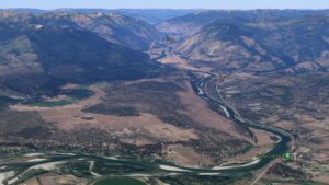
Eddy Narrows Ice Age Floods National Geologic Trail Eddy Narrows is a 10-mile long canyon between Plains and Thompson Fall along the Clark Fork River. Here all of the waters from the northern and eastern arms of Glacial Lake Missoula converged and picked up speed as they were forced through this restricted area. The steep valley walls are bare of talus and soils up to the level estimated to be the highest level of the lake (1000 ft), and there are polished grooves in the bedrock on a bench 340-400 feet above the Clark Fork River that run parallel to it. Since there is no evidence of glaciation in this area, the only explanation is the rapid draining of Glacial Lake Missoula. Using the dimensions of this flume-shaped area of the canyon, which controlled the rate of flow of water surging through it, in 1942 J.T. Pardee was able to calculate maximum speeds approaching 80 mph, emptying Glacial Lake Missoula in as little as three days. There are pullouts along MT-200 at either end of the narrowest part of this section marked for observing big horn sheep with Glacial Lake Missoula signage at the one between mileposts 59 and 60 at: 47.537940, -115.071654  Quick Facts Location:Between Plains and Thompson Falls, MT 
Read More »
SOME PLACES TO GO and THINGS TO DO in IDAHO

Celebration Park – Home of Melon Gravel

17,000 years ago, a massive Ice Age lake – now called Lake Bonneville – filled a large portion of present-day Utah. As temperatures changed, the influx of ice melt caused the lake level to rise. In addition, the Bear River, once a tributary of the Snake, was diverted by volcanic activity back into Lake Bonneville. These factors ultimately led to the breaching of a sedimentary rock dam at Red Rocks Pass, Idaho. There was only one ice-age Bonneville Flood because Lake Bonneville broke through a rock dam, unlike the Missoula Floods whose glacial ice dam repeatedly dammed Glacial Lake Missoula, then broke and rebuilt.  1,100 cubic miles of Lake Bonneville water rushed through the Snake River Canyon, and it took only six weeks for Lake Bonneville to empty the equivalent volume of modern-day Lake Michigan. The Great Salt Lake we know today is a remnant of Lake Bonneville, but at one tenth the size, it is a mere puddle compared to what the lake used to be.  The power of this catastrophic flood widened canyons as the force of the water pulled huge chunks of basalt off the cliffs and tumbled them around, smoothing their jagged edges along the way. As the canyon width narrowed, the force and velocity of the flood increased. Wherever the canyons widened, the flood lost force and velocity, the waters slowed and began dropping its bedload – in this case, giant tumbled basalt boulders instead of your typical river gravel.  These flood-rounded boulders, named melon gravel due to their distinct shape, are scattered over vast areas of land. The rocks’ unique outlines and smooth surfaces caught the eye of Native American tribes in the area, who have used them as canvases for petroglyphs for thousands of years. Visitors can see the medium sized flood deposits just outside the visitor center, or hike upriver to see gigantic melon gravel the size of heavy-duty trucks.  Celebration Park is located in the Snake River Canyon, approximately 23 miles south of Nampa, Idaho. It is home to an enormous melon gravel field deposited by the Bonneville Flood. 

Read More »

Museum of North Idaho

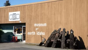
Museum of North Idaho IceAgeFloods National GeologicTrail “The Museum of North Idaho collects, preserves and interprets the history of the Coeur d’Alene Region. to foster appreciation of the area’s heritage.” In the 1960s, the North Idaho Hoo Hoo Club, an organization of loggers, lumbermen and foresters, first entertained the idea of establishing a museum. They incorporated on May 1, 1968 for a museum focusing on the history of the Coeur d’Alene Region (Kootenai, Benewah and part of Shoshone counties). Through the efforts of volunteers and community support, the Museum opened its doors on the North Idaho College campus on July 28, 1973. In 1979, they remodeled a City-owned building and relocated to its current location. Quick Facts Location: 115 Northwest Blvd, Coeur d’Alene, ID 83814Phone: (208) 664-3448 The Museum is open Tuesday to Saturday from 11 am – 5 pm.

Read More »

Must See Floods Features in Northern Idaho

SOME LOCAL NORTHERN IDAHO ICE AGE FLOODS and GLACIAL FEATURES Purcell Trench – This structurally formed valley became the passageway for the Purcell Ice Lobe that divided into five glacial sub-lobes.  The east moving sub-lobe blocked the Clark Fork River forming Glacial Lake Missoula, the source of the Ice Age Flood waters.  Other sub-lobes modified and deepened the basin now occupied by Lake Pend Oreille or helped define several important N-S transportation routes. The Purcell Trench is visible from City Beach in Sandpoint and Schweitzer Mountain Rd.  Hwy 95 follows the Purcell Trench from Sandpoint to beyond Bonners Ferry. Cabinet Gorge – Contact of Pleistocene Ice and Glacial Lake Missoula Water – Although the contact of the Pleistocene Ice and the lapping waters of Glacial Lake Missoula was in flux as the glacier advanced and retreated, the Cabinet Gorge is considered by many to be a likely location of the terminus of the Clark Fork sub-lobe that blocked the drainage of the Clark Fork River.   Evidence of glacial erosion and till deposits indicate glaciation; however, flood deposits on the south side of the river attest to Ice Age flooding.  Cores taken during the construction of the Cabinet Gorge Dam suggest multiple stages and events of ice damming. An AVISTA maintained viewpoint at the Cabinet Gorge Dam with Ice Age Floods signage provides an excellent location to ponder the formation and disintegration of the ice plug blocking the Clark Fork River.  Glacial Striations – Striations can be viewed along Hwy 200 east of Hope and on the south side of Castle Rock east of Clark Fork. Glacial/Flood Related Erratics – Large and small erratics cover the glacial and flood modified landscape.  Large erratics can be seen along Hwy 200 east of Clark Fork, in Sandpoint’s City Beach and in Farragut State Park.  A large pile of erratics excavated from flood deposits are visible on the west-side of Hwy 95 south of the Hoodoo Channel.  A giant ice-rafted flood related erratic weighing over 1,600 tons is located on the east-side of Hwy 41 near Twin Lakes.  Lake Pend Oreille – Cross-section morphology, depth, and sediments – This is where it all started! Lake Pend Oreille is the largest lake in Idaho and the deepest lake in the Pacific Northwest and the 5th deepest in the US. The lake level is 2062 ft above sea level with depths over 1,000 feet and an additional layer of over 1,500 feet of glacial-fluvial deposits going to bedrock, with the surrounding terrain as high as 6002 ft. The glacially modified U-shaped bedrock valley, cut to approximately 600 feet below sea level, was formed by the Pend Oreille glacial sub-lobe. This glacial sub-lobe was up to 4,000+ ft. thick and 30+ miles wide. It was the ice plug responsible for blocking the Clark Fork River. It collapsed catastrophically as often as about every 10-60 years, releasing 40-100 Ice Age Floods.  The location of the lake is probably related to an old river valley controlled by faults. The Lake Pend Oreille basin was carved by the repeated advances of Pleistocene ice and scoured by ice age floods. With the waning of ice age flood waters, the basin was, and continues to be, filled with glacial outwash and flood deposits. The lake is dammed at the south end by thick glacial and flood deposits the mark the beginning of the “Outburst Deposits”. There is a pullout on Hwy 200 approximately one mile west of Hope with signage already established that provides a great view looking south across Lake Pend Oreille to the Green Monarch Mts. Another view of the former ice plug location along Hwy 200 is the mouth of the Clark Fork River at the Clark Fork Drift Yard. Giant Current Dunes or MegaRipple Marks – One of Bretz’ most important pieces of evidence for catastrophic flooding was the “giant current dunes.” These large-scale bedforms appeared as patterns of parallel ridges and swales on many aerial photographs in the flood channels in the scabland of Washington, but had escaped recognition from the ground because of their size. Giant Current Dunes are visible west of Clark Fork near Castle Rock; however, the most prominent and visible Giant Current Dunes are located several miles east of Spirit Lake along Hwy 54 where the highway cuts through the dunes showing their undulating profile. The location of many of the telephone poles on the crest of these dunes accentuates these landforms. The dunes form transverse to the current direction, and form cusps that are convex upstream, with arms that point downstream. Furthermore, the size of the cusps appears to decrease in the direction of lower velocity. Internally, the dunes consist of gravel and pebble foresets. Giant current dunes exhibit an asymmetrical profile with the downstream (lee) slope steeper than the upstream slope. Crests range from 20 to 200m apart and heights range from 1 to 15m (Baker and Nummedal, 1978) and are among the largest measured throughout the Floods area. The Spirit Lake current dunes can also be easily recognized from the air by their characteristic pattern, accentuated by vegetation. This dune field is immediately in the path of the breakout from Lake Pend Oreille, and experienced some of the highest energy flows. Rhythmites – Rhythmites are glaciolacustrine sediments associated with flood events and are useful in attempting to determine the number of Ice Age Floods.  A 112-foot cross-section of rhythmites is located at the junction of East Fork Creek and Lightning Creek approximately 6.5 miles northeast of Clark Fork along Lightning Creek Road (NF-419). Proglacial Deposits – This type of deposit is found associated with most of the drainages on the south side of the Clark Fork Valley and extend from the mouth of the Clark Fork River to nearly Thompson Falls in Montana.  These sediments are glacio-fluvial deposits deposited in contact with the ice and therefore provide evidence of glaciation in the Clark Fork River drainage.  The associated geomorphic features formed by these deposits are referred to as “kame deltas”. The gravel pit associated with Dry Creek (approximately 8 miles west of Clark Fork

Read More »
SOME PLACES TO GO and THINGS TO DO in WASHINGTON

Wallula Gap National Natural Landmark

Wallula Gap National Natural Landmark Ice Age Floods National Geologic Trail The Horse Heaven Hills are the southern border of the Central Basin area of the Columbia Basin and the Wallula Gap is the opening through which all of the Columbia and Snake River waters

Read More »

Grand Coulee Dam Visitor Center

Grand Coulee Dam Visitor Center Ice Age Floods National Geologic Trail | Columbia Basin Project The Columbia Basin Project, which includes Grand Coulee Dam as its main feature, is the Bureau of Reclamation’s largest multipurpose project. Grand Coulee Dam includes three major hydroelectric power generating plants

Read More »

Lewis and Clark Interpretive Center

Lewis and Clark Interpretive Center Ice Age Floods National Geologic Trail, Lewis & Clark National Historic Trail English fur trader John Meares was mistaken as he stood on the northern shore of the mouth of the Columbia River in July 1788. He was in search

Read More »
SOME PLACES TO GO and THINGS TO DO in OREGON

Hat Rock State Park

Hat Rock State Park Ice Age Floods National Geologic Trail, Lewis & Clark National Historic Trail Hat Rock is an erosion remnant warn way by floods from glaciers which melted over ten thousand years ago. Lewis and Clark saw this monument on their expedition and

Read More »

Columbia Gorge Discovery Center & Museum

Columbia Gorge Discovery Center & Museum Ice Age Floods National Geologic Trail, Lewis & Clark National Historic Trail, Oregon National Historic Trail The Columbia Gorge Discovery Center & Museum is located on a 54-acre point of land adjacent to the Columbia River and is the

Read More »
Even MORE PLACES TO GO and THINGS TO DO

Click a STATE for MORE PLACES TO GO and THINGS TO DO

MONTANAIDAHOWASHINGTONOREGON

Share this article:

Like this:

Like Loading…