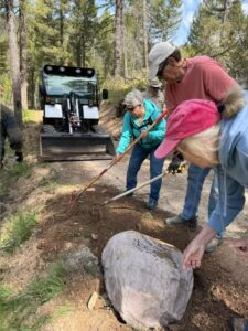
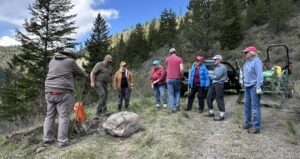
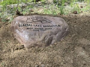
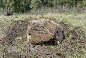
 Members of the Glacial Lake Missoula Chapter recently placed two more rock markers on recreation trails located on Missoula hillsides. Both rocks were placed at 4200 feet elevation, the highest fill level of the Lake. The inscription contains IAFI’s name and logo, Glacial Lake Missoula, and the high-water elevation of 4200 feet.
The rocks (known as #6 and #7) continue the “Route of the Rocks” project of previously placed rocks throughout the Missoula area. Most of the rocks are situated at 4200 feet. Missoula’s elevation is about 3200 feet, so trail users can imagine the valley completely submerged with only the highest surrounding hill tops sticking out.
Number 6 is located on the Miller Trail which begins at the Little Park Creek Trailhead and parking lot, accessed via upper Miller Creek Road. Hiking distance is approximately 1.5 miles.
Number 7 sits at 4200 feet on Marshall Mountain, a former ski area but now a park, in East Missoula. From the parking lot take the Easy Up Trail .6 mile to the rock.
The rocks are either argillite or quartzite from the Belt Formation. An interactive trail map of the Missoula area can be found at https://missoulamaps-cityofmissoula.hub.arcgis.com/datasets/missoula-trails