One of Montana’s other floods has been tickling the curiosity of some of our members.. This grew into a desire to plan a trip over to the upper Missouri River to see the channels from the diversion damming and outburst of Glacial Lake Great Falls. Thus, a reconnaissance was planned for 4 people. As the word got out everyone wanted to go and we wound with 14 souls on a loosely planned ‘let’s go over and see what we can find’ trip.
The map below portrays Lake Great Falls when the Keewatin lobe of the Laurentide Continental Ice pushed the Missouri River out of its banks, pushing it south to the ice margin until the ice sealed off on the Bears Paw Mountains, then rapidly snaked off a sub lobe that sealed off on the Highwood Mountains.

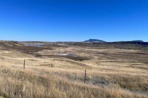
The lake began to fill to about 600 feet deep over Great Falls. It burst catastrophically at least once, creating the mile wide 500-foot deep Shonkin Sag (AKA Big Sag). This history appears to be a little more complicated than that as we turned up places where the last flood cut previous flood gravels.

MBMG Special Publication 122: Geology of Montana, vol. 1: Geologic History by IAFI member DR Larry Smith is an excellent read for the details.
This is a flood channel in soft rock (Cretaceous shale and sands). The lakes along the flood channels are endorheic (allows no outflow to other, external bodies of water or groundwater) so equilibrate by evaporation and are salty like the sea. The presence of these is a major clue the swale or drainage they are in is a flood channel.
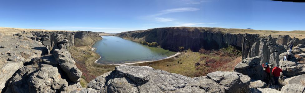
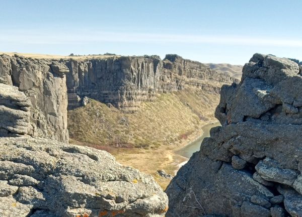
This is a flood channel in Shonkinite, a peculiar, dark igneous rock that would be basalt if it were not greatly enriched in potassium. Importantly it forms the columnar jointing common in basalt making it subject to plucking and the formation of retreat cataracts and geometry like the Washinton scablands. Note the column size. These are 5 to 10 feet in diameter and weigh many tens of tons but still the high surface area makes them subject to plucking if you have enough water moving quickly.
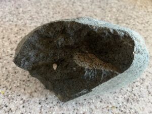
We extracted a piece of Shonkinite gravel with blebs of white felspathoid syenite (like feldspar but having a different structure and much lower silica content) exsolving from Shonkinite magma like oil from water in salad dressing
We stayed at Fort Benton, the historic steamship terminus on the Missouri river. Much of this is on private land and the landowner graciously allowed access to our group after being forced to close it due to trash and bad behavior. Lynne Dickman was the persistent silver tongued devil that made this happen.
In all this was a very interesting reconnaissance of one of the other Montana floods.
Article by Jim Shelden, President, Glacial Lake Missoula Chapter of Ice Age Floods Institute