
- This event has passed.
Mapping the Glacial Legacy of the Pacific Northwest
The Wenatchee Valley Erratics Chapter of the Ice Age Floods Institute will meet Tuesday, August 13 at 7:00 PM, at the Wenatchee Valley Museum and Cultural Center, 127 S. Mission, Wenatchee. Or via Zoom link https://us02web.zoom.us/j/84520197937
Our speaker is Daniel Coe, graphics editor for the Washington Geological Survey in Olympia; and an editor for the North American Cartographic Information Society’s Atlas of Design. He will talk about “Mapping the Glacial Legacy of the Pacific Northwest.”
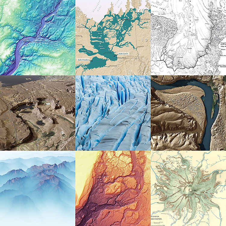
Glaciers have shaped much of the Pacific Northwest’s landscape over the past 15,000 years. The Cordilleran ice sheet, repeated ice age floods, and expansive alpine glaciation have left their distinctive fingerprints on the topography of our region. Geologists and cartographers have been mapping and interpreting glacial landforms since the late 19th century. In the past decade, the Washington Geological Survey has created new maps that build upon this rich cartographic history by fusing older datasets and techniques with modern insights and technology, such as lidar.
Using both historical and modern maps, this presentation will be a visual journey through the Pacific Northwest’s glacial past and present.
You can see Daniel’s work at dancoecarto.com
The program is free and open to the public.