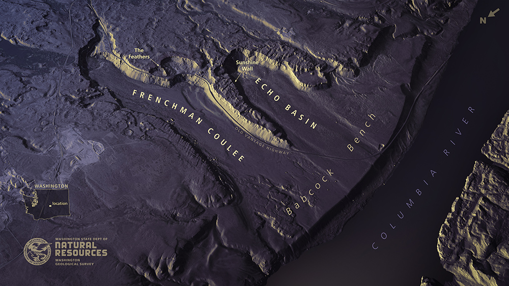
In celebration of GIS Day, Nov. 16, 2021, the Washington Geological Survey is releasing ten new lidar images featuring geologic landforms from around the State. This exciting batch of images includes ice age floodscapes, volcanoes, earthquake-induced landslides, and winding rivers. Use the links below the images to view and download high-resolution versions of each one. You can find these and other lidar images and maps on the Washington State Geology website and Washington DNR’s Flickr page