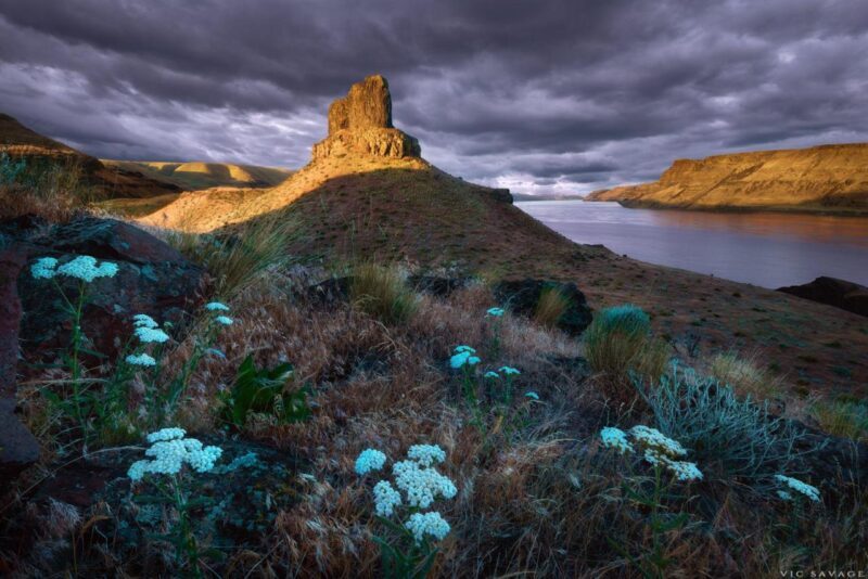
Palouse Falls State Park

Palouse Falls State Park Ice Age Floods National Geologic Trail The Palouse River runs through a narrow cataract and drops 200 feet to a churning bowl. From there, the current moves swiftly, through a winding gorge of columnar basalt, to its southern end at the mighty Snake River. Carved more than 13,000 years ago, Palouse Falls is among the last active waterfalls on the Ice Age Floods path. This natural wonder was named Washington’s state waterfall in 2014, when the state Legislature passed a bill written by local schoolchildren, who advocated for the designation. Palouse Falls is an artist’s dream, and many a painter or shutterbug has set up an easel or camera and tripod to capture the falls in the changing light. Others make the trip in all four seasons, when the water is high, low or frozen, because they understand that once is not enough when it comes to seeing Washington’s own state waterfall. PARK FEATURES This 94-acre park is known as an ideal picnic and birding spot. The park offers three distinct views of the falls. The lower viewpoint provides a direct view; it is reached by a set of steps from the main day-use area adjacent to the parking lot. The second, at the end of a paved interpretive path, tells the story of the secluded canyon. Both the interpretive path and gravel secondary parking area lead to the third and highest viewpoint, the Fryxell Overlook, offering panoramic views of the falls and Palouse River Canyon. Visitors should be prepared for a remote recreational experience. There is no phone service at the park, and staff and volunteer hosts are not always available. Please follow Leave No Trace principles, and experience this view-shed from the designated, developed areas. Your positive stewardship protects cultural and natural resources. Automated pay station: This park is equipped with an automated pay station for visitors to purchase a one-day or annual Discover Pass and boat launch permit. Parking at Palouse Falls State Park is limited. Expect long waits on weekends and holidays. Trailer and RV parking is not possible during these times; turnarounds do not exist, and RVs or trailers will not be permitted entrance into the park. Nearby Lyons Ferry State Park offers swimming and picnicking. Tips for your visit to Palouse Falls: Visitors are advised to bring drinking water, hand sanitizer and toilet paper Take along plenty of water, the park has no potable water available Be prepared for extreme heat Plan ahead for potential wait times No camping available No overnight parking is allowed No nighttime photography is allowed Quick Facts Location:Washtucna, WA 99371 Phone:(509) 646-3229 MANAGED BY:Washington State Parks A Discover Pass is required for vehicle access to state parks for day use. For more information about the Discover Pass and exemptions, please visit the Discover Pass website.
Scooteney Reservoir

Scooteney Reservoir Ice Age Floods National Geologic Trail Situated about nine miles southeast of Othello, west of Highway SR-17, this body of water has a year-round open fishing season. Smallmouth Bass, Largemouth Bass, Walleye, Bluegill sunfish, crappie, and Yellow Perch produce good action throughout the year. The lake has a large population of Lake Whitefish. This lake is popular for ice fishing when conditions allow. The Bureau of Reclamation campground has a developed access area with boat launch, a small dock, and toilets. All around are signs of Ice Age floods and there effects on the landscape. Explore…!!! Quick Facts MANAGED BY:Washington Department of Fish and Wildlife
The Great Gravel Bar of Moses Coulee National Natural Landmark
Moses Coulee NNL – Great Gravel Bar Ice Age Floods National Geologic Trail At the time of one of the first floods to be released from Glacial Lake Missoula, the Okanogan Lobe of the continental ice sheet had spread across the Columbia Valley and onto the Columbia Plateau to a position about 24 kilometers (14 miles) north of the site and so had caused the diversion of the glacial Columbia River into the former channel of Moses Coulee. When the outburst flood occurred, violently erosive torrents rushing down the Columbia River drainage were diverted into the Moses Coulee channel, causing in a single flood event the formation of a long, deep coulee second only to the Grand Coulee in size (see Grand Coulee NNL). Powerful eddies in the turbulent waters formed behind protrusions in the coulee walls along the inside of channel meanders (i.e. especially Armour Draw and the draw 1.6 kilometers (1 mile) north of Armour) and further enlarged the embayments behind those protrusions. As the sediment-laden flood currents waned, a 61 meter (200 feet) sheet of gravel was deposited along the coulee floor and a giant teardrop-shaped gravel bar, the so-called “Great Gravel Bar”, formed where flow velocities were lower behind one such prominent bedrock protrusion in the coulee wall. Although many other flood-related bars occur throughout the Channeled Scabland, the Great Gravel Bar is 5.2 kilometers (3.2 miles) long and as much as 74 meters (240 feet) high and so is perhaps the largest of all. It is known as a “pendant” bar because of its teardrop shape and sheltered position in the coulee which is about 180 meters (590 feet) deep and 1.5 kilometers (1 mile) wide at that location. The bar is composed mainly of pebble-cobble gravel and many large boulders occur on its surface. Most boulders are basaltic, derived from erosion of the coulee walls farther upstream, but a few granitic and other non-basaltic boulders probably were ice- rafted from afar on giant bergs caught in the flood before deposition in the coulee. One feature providing convincing evidence for the bar’s constructional formation is an elongate depression about 1 kilometer (0.6 mile) long on the bar’s west side, caused by eddy circulation in the water- filled coulee during deposition of the bar. After the flood the ice sheet advanced another 17 kilometers (10 miles) to its southern-most limit at the head of Moses Coulee. Melt-water streams coursing across the flood gravels in the coulee superimposed an out-wash channel network still visible along the valley floor. Since retreat of the glacier, the site has been little modified even by the intermittent stream now occupying the coulee. Alluvial fans built by tributary streams and talus derived from extensive rockfall now lie along the base of the coulee walls. In addition, patchy deposits of wind-deposited silt and volcanic ash (i.e. primarily from the Glacier Peak and Mazama eruptions 12,000 and 6,600 years ago respectively) cover portion of the bar and coulee floor. Quick Facts Location: The North Entrance to this area is 20 Miles west of Coulee City on State Route 2. Turn south on Moses Coulee Road. Property Privately Owned Stay on public roads, no access allowed at this time.
The Reach Museum
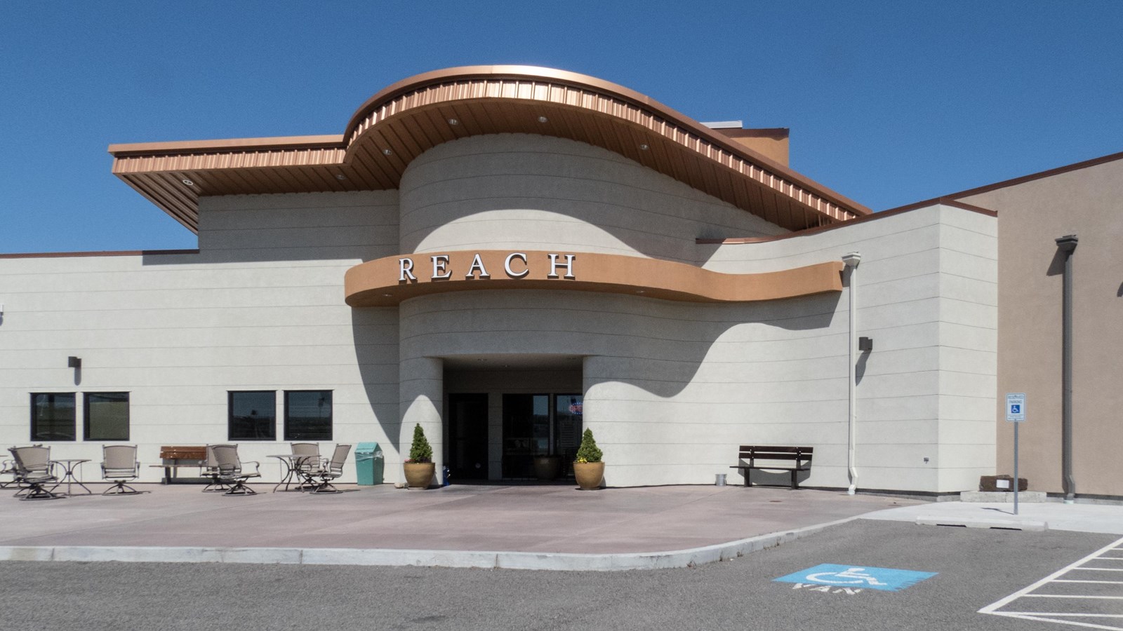
The Reach Museum Ice Age Floods National Geologic Trail, Manhattan Project National Historical Park The REACH Museum shares the natural and human history of the Tri-Cities and the surrounding area. The museum takes its name from Hanford Reach, the longest free flowing (un-dammed), non-tidal section of the Columbia River. The 51mile (82 kilometer) Reach marks the northern and eastern boundary of today’s Hanford Site. Its waters were critical to the site’s plutonium production mission during the Manhattan Project and Cold War. The Hanford Reach’s wild and untamed nature is a direct legacy of the Manhattan Project and the Cold War. Manhattan Project officials removed pre-war agricultural operations and prohibited further development. This formed a large security buffer surrounding the project and inadvertently preserved the shrub steppe ecosystem. When plutonium production stopped, the reduced size of the Hanford Site opened the opportunity for creation of the Hanford Reach National Monument, the US Fish and Wildlife Service’s first national monument. The REACH Museum features rotating and permanent exhibits, including robust presentations on the Manhattan Project, Cold War, indigenous peoples, and cataclysmic ice age floods. An outdoor learning area displays a sampling of the shrub steppe and riparian ecosystems and provides hands-on, interactive activities that are fun while teaching important themes including irrigated agriculture, hops cultivation, local animals, native plants, and land formation. Visit the Reach Museum website for hours of operation and current activities. Continue Your Journey The Hanford Reach National Monument offers hiking at places such as the White Bluffs Overlook, Hanford High School Overlook, and Saddle Mountain, where you may enjoy expansive views of the Hanford Site and the beauty of the shrub steppe ecosystem. Quick Facts Location:Richland, WA MANAGED BY:REACH Museum
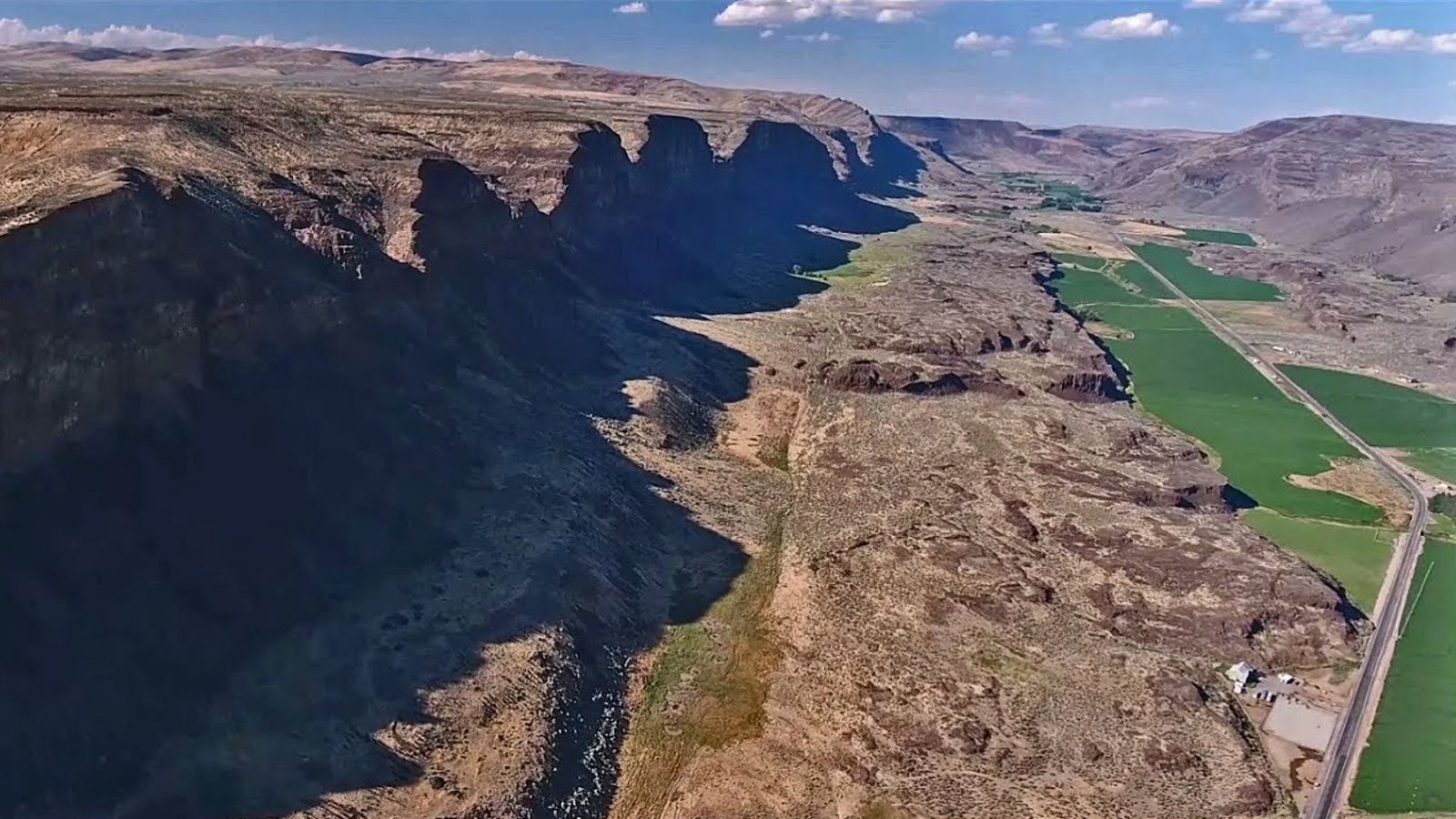
Wallula Gap National Natural Landmark
Wallula Gap National Natural Landmark Ice Age Floods National Geologic Trail The Horse Heaven Hills are the southern border of the Central Basin area of the Columbia Basin and the Wallula Gap is the opening through which all of the Columbia and Snake River waters escape the basin. Wallula Gap is the largest, the most spectacular and the most significant of the several large water gaps through basalt anticlines in the Columbia Basin. During the Pliocene and early Pleistocene the thick basalt flows of what is now southern Washington were wrinkled and uplifted into a long northeast-southwest trending anticlinal ridge which we call the Horse Heaven Hills. The uplift of this structure was more rapid than the ability of the ancestral Columbia River to down-cut, thus a great lake, Lake Lewis, was impounded in the Pasco Basin area. The remains of the lake beds formed in this lake are the Ringold Formation. Once Lake Lewis was filled to overflowing, it established an outlet over the lowest saddle in the ridge at the location of Wallula Gap. The Columbia then poured down the steep south flank of the Horse Heaven Hills anticline in cascades and waterfalls which eroded slowly downward and head-ward until the ridge was completely breached, Wallula Gap was formed and the waters of Lake Lewis, along with considerable quantities of the Ringold sediments, drained down the Columbia Gorge into the sea. During the late Pleistocene the greatly increased melt-waters from the ice sheets and Cascade glaciers caused floods, perhaps annually, which also encountered the constriction of Wallula Gap. The gap may have also been dammed by jammed icebergs and ice cakes, causing the temporary and intermittent rebirth of Lake Lewis. This ephemeral lake left bottom deposits called the Touchet Beds. These giant floods filled the basin with a great temporary lake, which rapidly drained out through Wallula Gap. At the height of the Ice Age Floods the water flow through Wallula Gap has been estimated at 166 cubic kilometers (40 cubic miles) per day, a rate nearly twice the combined flow of all the present rivers on earth! This outlet of Wallula Gap, constricted in a relative sense only, (i.e. since it is more than 1.6 kilometers [1 mile] from rim to rim) controlled the discharge from the Pasco Basin and is dramatic and illustrative evidence of the magnitude of these flood waters. Quick Facts Significance:All of the flood waters that cut the channeled scablands of southeastern Washington from the Bonneville and Spokane floods were channeled through Wallula Gap. Designation:National Natural Landmark OPEN TO PUBLIC:No
Yakima Sportsman State Park
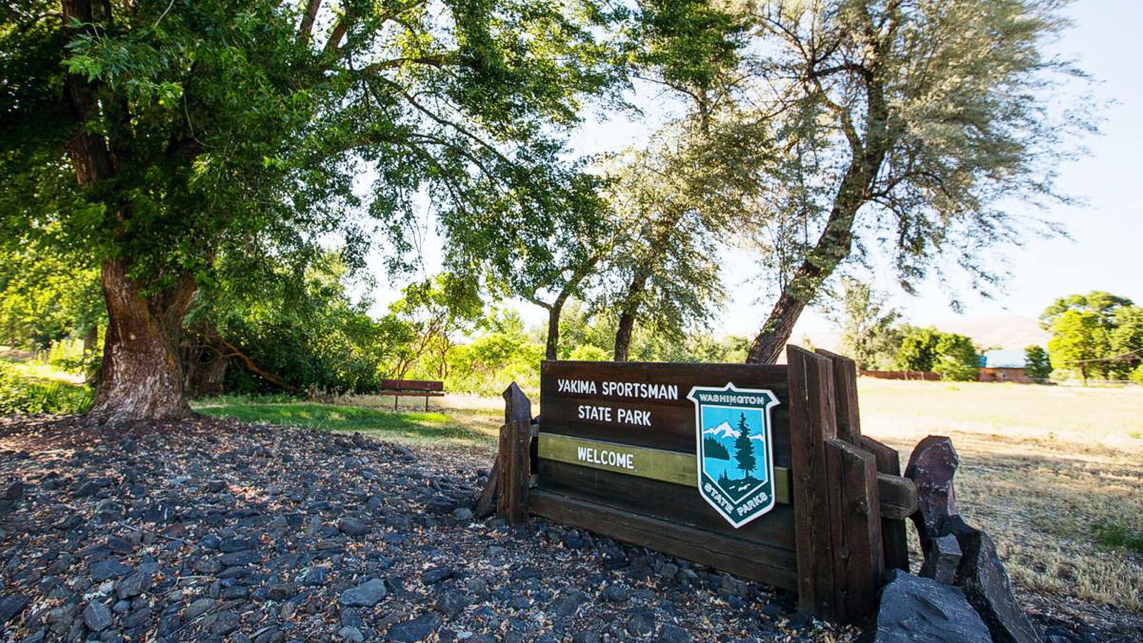
Yakima Sportsman State Park Ice Age Floods National Geologic Trail Yakima Sportsman State Park is, literally, an oasis in the desert. Located near the urban amenities of Yakima in arid eastern Washington, this park attracts local picnickers, out-of-town visitors and road-trippers passing through. Birds flock to Yakima Sportsman, and so do birders, their binoculars and field guides in hand. The Yakima River flood plain sustains a natural wetland of marshes, grasses and ponds, welcoming habitat for 140 bird species. Wood ducks are the stars of the show, but dramatic red-winged blackbirds, herons and hawks make their home near the park’s juvenile fishing pond, which is stocked with rainbow trout and open to young anglers. The gentle trails come alive in season. The trees turn red, orange and yellow in fall, and spring brings a riot of lilies, chokecherry, dogwood and blossoming catalpa trees. Green lawns and tree shade make this a lovely camping or picnic spot in summer. PARK FEATURES Yakima Sportsman State Park is a 266-acre camping park originally created by the Yakima Sportsman’s Association to promote game management and the preservation of natural resources. The park is an irrigated green zone in an otherwise desert area and has a variety of deciduous trees in the camping and picnic areas. More than 130 species of bird make wildlife watching a delight. The campground is a stay-over place for events at the Yakima Sun-Dome and fairgrounds. Discover Pass: A Discover Pass is required for vehicle access to state parks for day use. For more information about the Discover Pass and exemptions, please visit the Discover Pass web page. Quick Facts Location:904 University Parkway Yakima, WA 98901 MANAGED BY:Washington State Parks A Discover Pass is required for vehicle access to state parks for day use. For more information about the Discover Pass and exemptions, please visit the Discover Pass web page.
Tualatin Ice Age Walking Trail
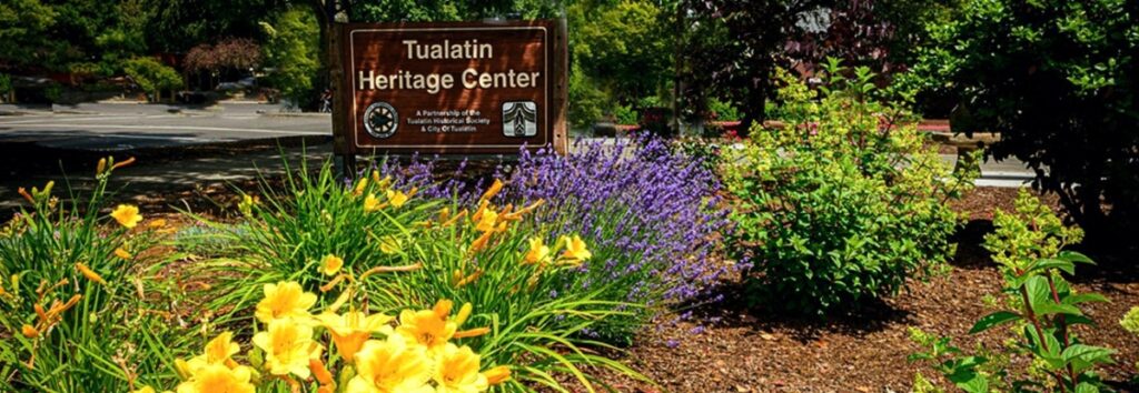
Tualatin Ice Age Walking Trail Ice Age Floods National Geologic Trail The Tualatin Ice Age Trail is a self-guided tour of sites representing the ancient history of our area. Along the trail, you’ll discover evidence of centuries-old ice, rock and bone, including the sites where a mastodon and ground sloth were unearthed. The trail also leads to a portion of the Tualatin ArtWalk, featuring sculptures, engravings and other Ice Age-inspired works of art. There are seven self-guided tours for the Tualatin Ice Age Trail, where you can read and learn more on interpretive signs, as well as on the Tualatin Trails website. The Raging Waters Tour takes you back to the Ice Age floods that carried erratic boulders here and shaped the Tualatin River with landslides and deposits. The water-themed artwork at Tualatin Lake of the Commons is also a nod to that history. Before and After Pictures of the Tualatin Heritage Center. Quick Facts Location:Tualatin Heritage Center8700 SW Sweek Dr. Tualatin, OR 97062
Green Monarch Ridge
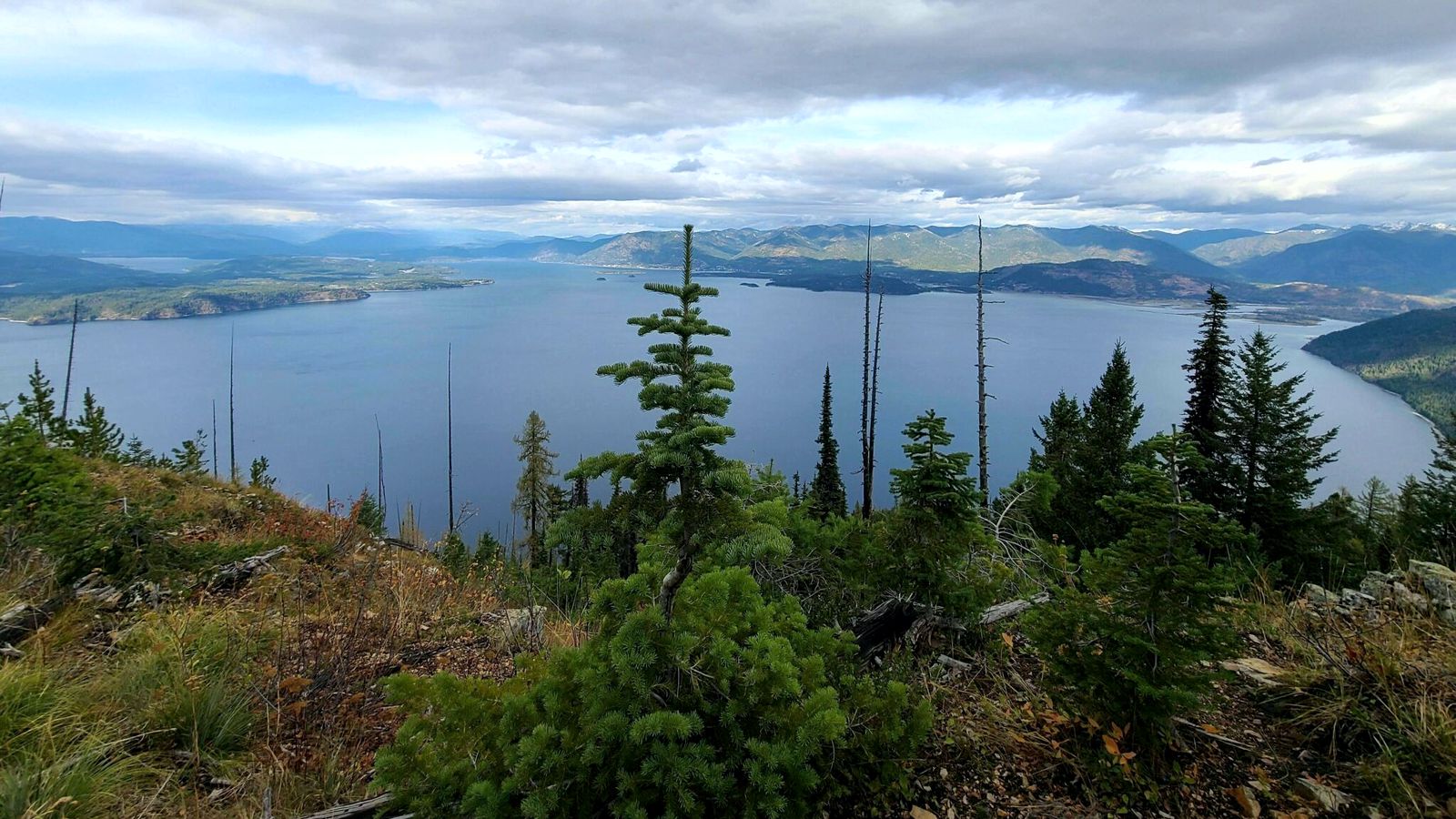
Green Monarch Ridge Ice Age Floods National Geologic Trail THIS IS WHERE IT ALL BEGAN! The Green Monarch Ridge viewpoint, just south of the Hope Fault, is positioned along the edge of the Purcell Trench Ice Lobe. Here it was responsible for damming the mouth of the Clark Fork drainage basin. This damming effect resulted in the formation of Glacial Lake Missoula, the source of the waters for much of the PNW Pleistocene Ice Age Floods. The Purcell Trench Ice Lobe originated in Canada and flowed south into Idaho, guided by the structural control of the Purcell Trench. Following the path of least resistance into the basin now occupied by Lake Pend Oreille, it was impeded by the Green Monarch Ridge, located approximately 10 miles south of this viewpoint. Grinding and scraping, the Purcell Trench Ice Lobe backed up behind the Green Monarch Ridge, eventually building an ice plug up to 4,000 feet thick, and scouring out the deepest parts of Lake Pend Oreille. The Purcell Trench Ice Lobe divided into four sub-lobes: one went approximately west (US Highway 2), two went south (US Highway 95 and Lake Pend Oreille) and one went east (SR 200). All four sub-lobes contributed to blocking the Clark Fork drainageQuick Facts MANAGED BY:US Forest Service – Idaho Panhandle National Forest
Glacial Dam at Green Monarch Ridge View Point

Glacial Lobe Dam at Green Monarch Ridge View Point Ice Age Floods National Geologic Trail As the Purcell Trench ice lobe of the Cordilleran Ice Sheet advanced south from Canada, it was stopped by the Green Monarch Ridge, building an ice dam 4,000 feet (1219 m) tall and nearly 40 miles (64 km) wide that blocked the Clark Fork river, thus filling glacial Lake Missoula. View the Green Monarch Ridge and the Purcell Trench from a large pullout on Idaho State Route 200, about one mile (1.6 km) west of Hope, Idaho and 15 miles (24 km) east of Sandpoint, Idaho. Quick Facts Location: Idaho State Route 200, about one mile west of Hope, Idaho and 15 miles east of Sandpoint, Idaho.
Farragut State Park
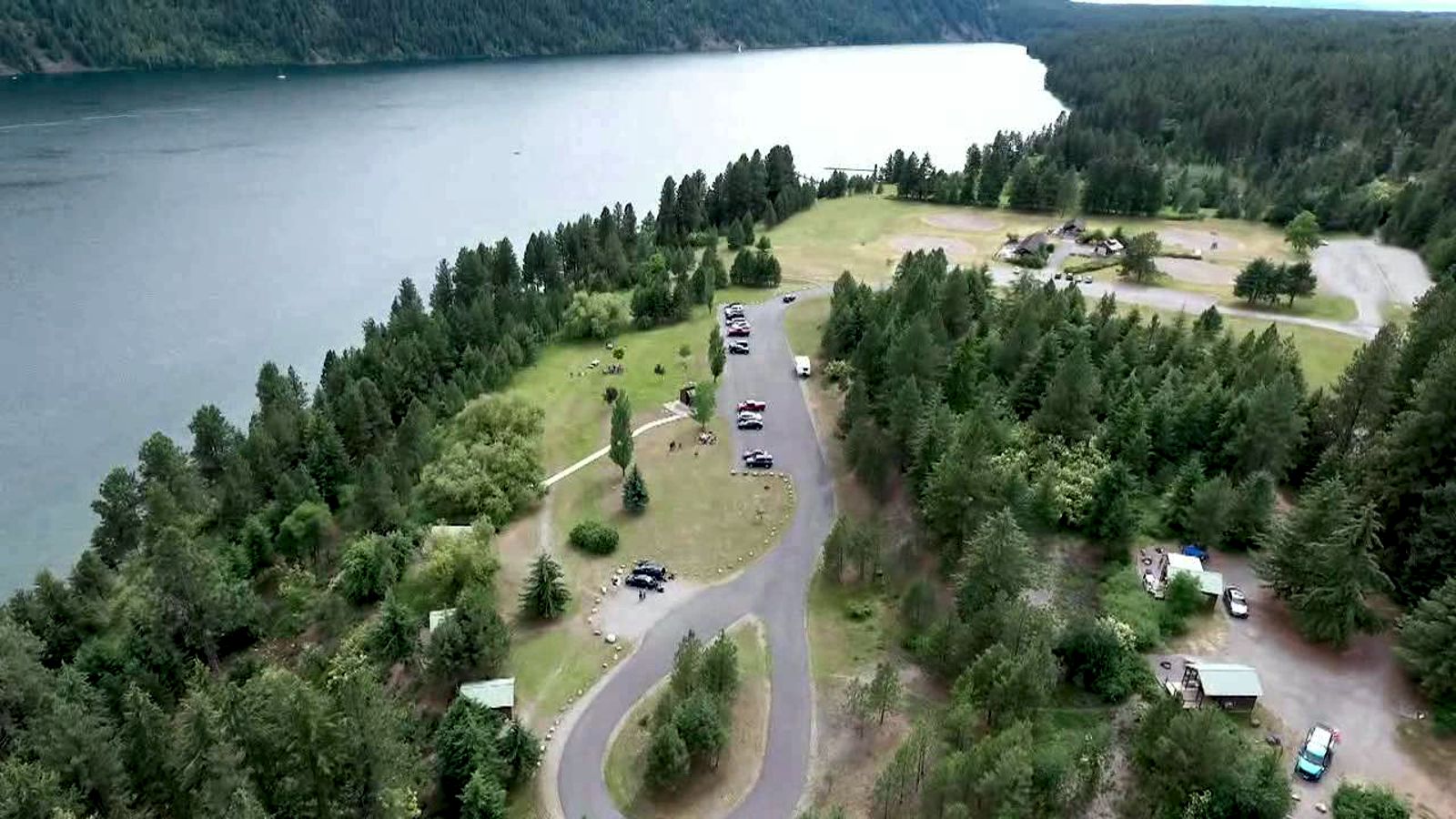
Farragut State Park Ice Age Floods National Geologic Trail Farragut State Park is located at the “breakout” of Glacial Lake Missoula floods, where the ice dam in the Clark Fork valley and the 20-mile-long tongue of ice occupying the Lake Pend Oreille basin failed. From there, a torrent of water and ice burst from the south end of the lake. Farragut State Park is located at the “breakout” of Glacial Lake Missoula floods. Failure of the ice dam in the Clark Fork valley fractured and broke apart the 20-mile-long tongue of ice occupying the Lake Pend Oreille basin, and a torrent of water and ice burst from the south end of the lake. That churning slurry of flood waters, ice, boulders and other debris erupted from the south end of Lake Pend Oreille, flowing 2000 ft deep across Farragut State Park. Nearly all of the water escaping from Glacial Lake Missoula passed through this area. Discharge estimates range from 14 to 21 million cubic meters per second! Vic Baker’s definition of a megaflood is one which has a discharge of at least 1mil cubic m/s, so we are possibly looking at ground zero for the worst Pleistocene flood in the world. Farragut State Park includes many geologic features left by glaciation and megafoods.Hoodoo channel, an abandoned outlet of Lake Pend Oreille provided a pathway for late-glacial meltwater and for the last outbursts from Glacial Lake Missoula. The channel is marked with a number of closed depressions, probably the result of melting icebergs. One of the largest of these features have been proposed, including kettles, potholes, and sub-glacial meltwater. Some of that debris was deposited to form the Rathdrum Prairie Outburst Plain, an extensive, heterogeneous mix of flood deposits. Farragut State Park offers unique scenery, history and an abundance of recreational opportunities. Quick Facts Location:13550 E. Hwy 54 Athol, ID 83801