
Ice Age Floods – Giant Current Ripples
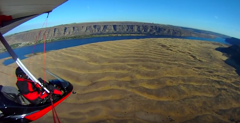
Check out this 2-Minute Geology expedition with Nick Zentner and Tom Foster exploring the Giant Current Ripples at West Bar and Camas Prairie. Ice age floodwater 650 feet deep – moving at 65 miles per hour – left Giant Current Ripples along the Columbia River at West Bar! The ripples at West Bar are 20 feet high, spaced up to 100 yards apart. Giant Current Ripples at Camas Prairie, Montana are also described. The Montana ripples helped Joseph Pardee understand that Glacial Lake Missoula had emptied suddenly. Learn more about Glacial Lake Missoula, Lake Bonneville and the Ice Age Floods at http://hugefloods.com/
Ice Age Floods Facebook Page
You may want to ‘Like‘ the Ice Age Floods Institute Facebook page to stay abreast of all the News and Shares coming out from the Institute. We’re sharing news and articles well beyond the Floods, including geology, natural history, general articles about the area, videoed talks, events, and any number of articles of general interest. Floods of water, floods of lava, rockin’ rocks, 2-Minute Geology, paleontology, and the mystical birth of the universe all get their 15+ seconds of fame. We’ll keep our eyes open to find and share items of interest to you, and of course you can share with us too.
Palagonite Maar Near Hood River
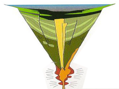
Palagonite Maar Just west of Hood River is a distinctive, short (<500 m) section of stratified orangeish oxidized volcanic tephra and highly fractured lava bombs. This mixture of oxidized volcanic particles ranging down to sub-micrometer sizes mixed with the larger lava bombs is a palagonite tuff. This deposit is the result of a “phreatic” eruption when lava erupted explosively from a volcanic vent through water, like a lake or groundwater. The rapid heating expansion of water to steam blew the rising lava out of the vent as tephra (volcanic rock fragments) ranging from ash-size to volcanic bombs (blobs of lava) up to several inches in diameter. Rapid oxidation of the water-quenched tephra turned the iron content to rust, producing the orangeish color of the tephra. The lava bombs were heavily fractured due to rapid cooling of the blob as it came in contact with the water and as it flew through the air. The tephra deposits dip inward on either side of a central gap toward the gap, with NE dips in the western section and NW dips in the eastern section, forming an inverted cone that converges downward toward the central gap. This feature is a “maar” deposit; an inverted cone of tephra and lava resulting from rapidly rising magma interacting with groundwater causing a steam-driven explosive eruption that builds the surrounding maar. The vent of this maar was in the area of the central gap.
IAFI at Gorge Tourism Studio
The Columbia River Gorge and Lower Columbia Chapters of the Ice Age Floods Institute recently participated in several Gorge Tourism Studio workshops and events intended to bring businesses, organizations, and individuals together to address Columbia River Gorge area tourism issues. The Columbia River Gorge is a unique tourism destination and scenic location. However, this destination is facing increasing challenges including congestion and overstressed infrastructure in many locations and extreme under-utilization and neglect in many others. Given the State and National significance of this destination, the Tourism Studio was designed to provide a unique opportunity for local stakeholders to develop creative solutions to the challenges facing this destination. The Studio was organized by Travel Oregon, and through a unique bi-state arrangement it included representatives from both sides of the Gorge. The Studio comprised 6 full-day workshops and 6 evening get-togethers addressing: Identifying major tourism issues and developing a vision for what Gorge tourism should look like Culinary & Agritourism – addressing farm-to-table issues of local farms, vineyards, orchards, and restaurants Cultural Heritage Tourism – addressing issues affecting the arts, culture, and heritage sectors Adventure Travel & Outdoor Recreation – addressing issues affecting the outdoor recreation and adventure sectors Tourism Marketing & Communications – learning how to create effective tourism marketing and communications Igniting Tourism Action Teams – developing Action Teams to push forward on solutions to the issues The ultimate intent is to establish a long-term sustainable balance in the utilization of the available resources and in the economic development of the area. There are likely to be many lessons and approaches developed out of these Action Teams that can have significance for addressing similar tourism issues throughout the widespread extent of the Ice Age Floods story. COLUMBIA RIVER GORGE What the Columbia River Gorge should look like in 15 Years – a Vision for Sustainable Tourism The Columbia River Gorge region including the nationally recognized Columbia River Gorge National Scenic Area and the majestic Cascades Range of Mt. Adams (12,281 ft.) and Mt. Hood (11,249 ft) within which it’s nestled, offers our target visitor a world-class adventure travel experience. While the mighty Columbia River is its defining feature, nationally designated Wild and Scenic Rivers are the life blood of the region. The Sandy and the Deschutes Rivers flank its east/west boundaries while the White Salmon, Klickitat and the Hood River carve pathways from the Cascades. Free flowing whitewater draws in the adventurous whitewater soul, skilled fishermen and most importantly, salmon. This transition zone from rainforest to desert creates nuclear winds making the Gorge one of the world’s most sought after destinations for windsurfing, kiteboarding and technical sailing. Access to snow sports abounds on the peaks including year-round skiing on the Palmer Glacier. The region’s paved, gravel, and single-track terrain provide bicyclists with a flight-like, captivating experience of the scenic landscape. Signature trails including Gorge Towns to Trails, the Historic Columbia River Highway State Trail and the Pacific Crest Trail are significant draws to the region. These trails that connect waterfalls, world-renowned wildflower meadows, basalt bluffs and the Gorge’s charming towns are frequented by hikers, cyclists and trail runners alike due to the world-class experience that they provide. [TRANSPORTATION] Our seamlessly integrated region-wide transportation system allows visitors to come, travel, explore and connect– all without needing a car. Public and private transit options combined with our bike routes and trail systems have created a multi-modal web knitting together our communities, attractions and outdoor recreation. The region is vibrant with visitation, and traffic congestion is a thing of the past. [CULINARY/AGRICULTRE] The Gorge with its concentration of locally-owned boutique vineyards and small farms boasts an abundant and rich local food scene. Locals and visitors alike can easily eat what’s grown and produced here and visitors are welcomed by growers to have meaningful, quality on-farm experiences. Restauranteurs are well-connected with local growers adding value to locally produced ingredients and offering memorable foodie experiences. The visitor industry has helped contribute to alleviating hunger in the region. [CULTURE] The ‘Gorge Experience’ is unparalleled due to its exposure to history and culture. Locals in the Gorge’s charming communities help travelers gain a deep understanding of peoples who have inhabited the Gorge in the past, of people who reside here now, and of the natural and human forces that have shaped and reshaped the landscape. Stories of this powerful place, both cultural and natural, are infused into every element of the traveler experience. Local guides help travelers personalize and deepen their own connection to the place and an unusual and rich array of classes and events to experience local culture exist. Trails of national historic significance including the Lewis & Clark National Historic Trail, the Ice Age Floods National Geologic Trail, Historic Columbia River Highway State Trail and the Oregon Trail also bring the region’s history to life. [SEASONALITY/CONGESTION] Our intuitive visitor information system has reduced congestion, and spread the benefits to all corners of our region. We have effectively targeted the high-value visitor who appreciates the outdoors and local culture, is sensitive to their surroundings and enjoys people-powered activities. Visitors are coming year-round and staying multiple days. [BALANCE] We have found balance and offer an unforgettable visitor experience while preserving our unique living ecosystem of people, culture and nature. Local residents live in a harmonious and symbiotic relationship with our environment and with the people who travel from around the world to experience a slice of life in the Gorge.
IAFI Gorge(ous) Night Out in Salem & Olympia
Columbia Gorge Chapter of IAFI has joined the party It’s easy to see what makes the Gorge a spectacular experience to visitors, but what makes it special to those who live here, work here, and raise our families here? What parts do we play in the larger economic and political fabrics of the states and nation we’re part of? One Gorge (a young Gorge advocacy group) is trying to share who we are and why we matter at the state and national levels, and to promote the big infrastructure factors to help the Gorge community excel. To help our states of Oregon and Washington to better understand and recognize the who, what, and why of interests in the Gorge, One Gorge has worked with Gorge legislators to organize a 2nd annual Gorge(ous) Night Out for Oregon legislators in Salem, and a first-time event with Washington legislators in Olympia. These casual events bring a selection local businesses and organizations sharing products and information together with legislators just to make them more aware of the vibrancy of the Gorge. We’re bringing Columbia Gorge(ous) Geology and the Ice Age Floods to these parties. Two new 40″ x 60″ displays were finished in time for the Salem event on Feb. 3rd and they were extremely popular. Some suggested we were second in popularity only to Insitu UAVs, but we were also located immediately adjacent to the food table, so factor that into the popularity poll. Now everything is ready and tested for the Olympia event on Feb. 9th for Washington legislators, and we’re hoping to build some support there for the Ice Age Floods National Geologic Trail that is focused to a large extent on Washington. Although the main purpose of the Ice Age Floods Institute usually appears to be for education, outreach, and research, it is important to realize that we also have a strong advocacy role to play. When you support the Institute you are also a player in all our education, outreach, research, and advocacy efforts. Thanks to all for your support.
Pillow Basalt and Palagonite – Lava Flowing into Water

Pillow basalt and palagonite are the result of lava flowing into water. We have a striking example in the Columbia River Gorge at the intersection of Hwy 30 and US 197 at the east end of The Dalles. This video gives a good idea of how these basalt pillows form and what they look like.
Columbia Gorge Geology in 22:22 Minutes

This video by Tom Foster and Nick Zentner about the Columbia River Gorge features an incredible variety of geology and human history as it slices through the Cascade Range of the Pacific Northwest. The Columbia River Basalts, the Missoula Floods, the Bonneville Flood, the Bridge of the Gods, Celilo Falls, Multnomah Falls, Beacon Rock, Lewis and Clark, the Oregon Trail, the Columbia River Highway, and more!
Missoula Flood Rhythmites
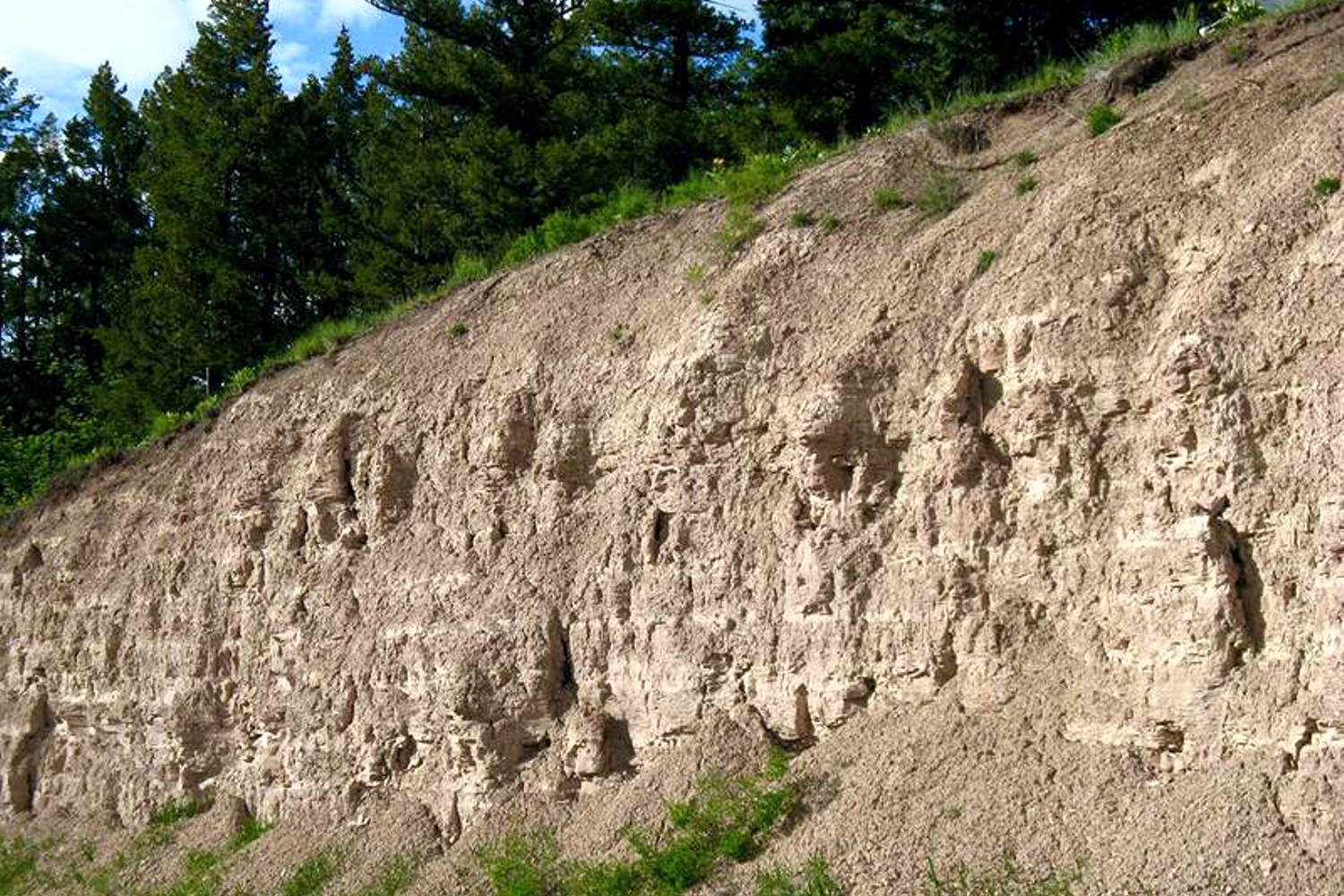
Lake Missoula filled many times and emptied catastrophically in many Missoula Floods. Rhythmite sequences [a series of repeated beds of similar origin] at numerous localities provide this evidence: slack-water rhythmites in backflooded tributary valleys below the dam indicate multiple floods, and varved rhythmites in Lake Missoula attest to multiple fillings of the lake. Below the dam, most slack-water rhythmites are graded beds deposited by flood bores surging up tributary streams. They grade upward from coarse sand and gravel to silt, with occasional ice-rafted erratics. The tops of some rhythmites are marked by thin paleosols, or buried soil horizons, which indicate a period of subaerial exposure. Thus, each rhythmite represents a separate flood event, and each deposit records multiple floods. The most complete record occurs at Sanpoil Valley, an embayment on the north side of Lake Columbia, where varved rhythmites document 89 flood events, with the period of time between floods initially increasing to a maximum of about 50 years and then decreasing to less than 10 years. Thousands of varves were deposited in Lake Missoula. At the best-known Ninemile locality near Missoula, about 40 rhythmites consist of varves overlain by a sand/silt layer. The varves were deposited on the floor of Lake Missoula, and the sand/silt layers represent subaerial exposure and deposition in a stream. The number of varves in each rhythmite varies from 9 to 40, decreasing regularly upward, and the total number of varves is just less than one thousand. An interpretation of these data would suggest: [1] Lake Missoula filled and emptied [in a catastrophic flood] about 40 times, [2] it took 9 to 40 years to fill the lake, each successive lake requiring less time, and [3] the process was repeated over a period of about one thousand years. Because Ninemile is about in the middle of the very long lake, the record here would not provide a complete history of the lake. Correlating Ninemile with the downstream record would suggest these events were in the latter half of the entire flood history.
Missoula Flood Rhythmites

Lake Missoula filled many times and emptied catastrophically in many Missoula Floods. Rhythmite sequences [a series of repeated beds of similar origin] at numerous localities provide this evidence: slack-water rhythmites in backflooded tributary valleys below the dam indicate multiple floods, and varved rhythmites in Lake Missoula attest to multiple fillings of the lake. Below the dam, most slack-water rhythmites are graded beds deposited by flood bores surging up tributary streams. They grade upward from coarse sand and gravel to silt, with occasional ice-rafted erratics. The tops of some rhythmites are marked by thin paleosols, or buried soil horizons, which indicate a period of subaerial exposure. Thus, each rhythmite represents a separate flood event, and each deposit records multiple floods. The most complete record occurs at Sanpoil Valley, an embayment on the north side of Lake Columbia, where varved rhythmites document 89 flood events, with the period of time between floods initially increasing to a maximum of about 50 years and then decreasing to less than 10 years. Thousands of varves were deposited in Lake Missoula. At the best-known Ninemile locality near Missoula, about 40 rhythmites consist of varves overlain by a sand/silt layer. The varves were deposited on the floor of Lake Missoula, and the sand/silt layers represent subaerial exposure and deposition in a stream. The number of varves in each rhythmite varies from 9 to 40, decreasing regularly upward, and the total number of varves is just less than one thousand. An interpretation of these data would suggest: [1] Lake Missoula filled and emptied [in a catastrophic flood] about 40 times, [2] it took 9 to 40 years to fill the lake, each successive lake requiring less time, and [3] the process was repeated over a period of about one thousand years. Because Ninemile is about in the middle of the very long lake, the record here would not provide a complete history of the lake. Correlating Ninemile with the downstream record would suggest these events were in the latter half of the entire flood history.
Glacial Lake Missoula
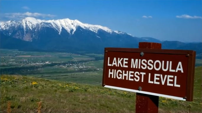
This feature-filled video by Tom Foster and Nick Zentner explores the evidence for Glacial Lake Missoula, and provides a treasure trove of places to visit and sights to see when you plan your field trip to the area.