
Lake Lewis Supports Interpretive Signs on Candy Mountain

The Lake Lewis Chapter has been supporting the Friends of Badger Mountain and the Benton County Parks Department with interpretation kiosks, panels, markers, and signage for the Badger Mountain Centennial Preserve and Candy Mountain Preserve (both Benton County Parks), since their inception in 2005. The latest efforts were to help fund, design and locate three Ice Age floods related interpretive signs along a 1.2-mile interpretive loop trail on Candy Mountain. These signs describe the process and history of Ice Age flooding in this area (Figure 1), and the main line of evidence (erratics) that can be seen along the trail (Figure 2). This was the culmination of a nearly two year effort, that was completed in May 2020. Many thanks to Bruce Bjornstad, George Last and Chris Barnes for their efforts. New interpretive signage is being prepared for installation along Badger Mountain’s Canyon Trail. Efforts are also under way to complete the Little Badger Mountain Preserve, the next stage for a vision of trails connecting four of the Lake Lewis Isles (Little Badger, Badger, Candy, and Red Mountains).
4th Badger Mtn Interpretive Sign Installed

Friends of Badger have completed installing the 4th interpretive sign about Lake Lewis Isles on Candy Mountain – one more to go, plus three more for Badger Mountain. Lake Lewis was a temporary lake that repeatedly formed during the Pleistocene Epoch as Ice Age flood waters (mostly from Glacial Lake Missoula) backed up behind a constriction at Wallula Gap. The Lake Lewis Isles name is given to several basalt hills south and west of Richland, Washington, whose crests stuck up above the maximum flood level (1,200 -1250 feet) of temporary Lake Lewis, making them islands. These temporary islands include Badger Mountain, Candy Mountain, Goose Hill, and Red Mountain. Only the top 380 feet of Badger Mountain poked out above Lake Lewis. Icebergs and other floating debris (such as mammoth carcasses) drifted into quieter waters and ran aground along the shorelines of these islands, leaving behind giant boulders of exotic rock types (erratics) from up to several hundred miles away. The scene of Lake Lewis, with its temporary Isles protruding out of the lake and occasional icebergs carrying erratics, can probably be best be imagined from one of the Badger Mountain or Candy Mountain trails, or along Interstate Highway I-182 as it passes through Goose Gap approximately 3 miles southwest of Richland. We encourage you to explore the trails and imagine the vistas of recurring temporary Lake Lewis. Our interpretive signs will help you peek into the distant past and the incredible Ice Age Floods story.
Nick Zentner – More Geology Videos

Are you looking for new geology videos? Nick Zentner has done a long series live geology lectures from his home in Ellensburg and posted them online to his YouTube channel https://www.youtube.com/user/GeologyNick/videos He is now recording a series of “Nick on the Fly” virtual field trips and posting them on the same YouTube channel https://www.youtube.com/user/GeologyNick/videos Join Nick as he explores the geology of the Pacific NW and many other topics.
Use Social Distancing Time to Explore the Floods with Our Interactive Online Map
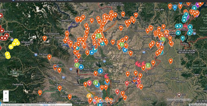
If you’ve ever tried to explore the Ice-Age Floods with a guidebook you’ll know how difficult and frustrating it can be to find and learn about the features in the area you’re visiting. Well, there’s now a solution to that problem; an interactive map that’s available wherever you have internet access. The map features over 300 points of interest throughout our 4-state area, with a description and images that slide out when you click on one of the markers. More features are being added all the time, and we’re planning to expand the map with features related to the Lake Bonneville Flood event that rampaged through the area during the time of the Ice-Age Floods. Since this is an internet-based map, it’s also easy to get driving directions to the site from wherever you are starting from. You can also easily build an informative field trip, exploring and learning about a number of other nearby features with just a few clicks of your mouse. We feel this may be the most useful field guide ever developed to explore ice-age Floods and glacial features throughout our 4-state region. AND it’s absolutely FREE! The only shortcomings we see are 1) the map requires internet access, which isn’t always available in far-flung areas of our region, and 2) we may not have every point-of-interest on the map (YET!). If we’re missing something you think is important we encourage you to submit your suggestion. We also appreciate any comments and/or corrections by email to Webmaster@IAFI.org. We sincerely hope you enjoy using this guide to poke around these fascinating ice-age features.
Explore the Ice Age Floods with 12 New IAFI Brochures

IAFI has compiled 12 brand-new, full-color brochures into a packaged set to help guide you in visiting spectacular ice-age features across all of our 11 Ice Age Floods chapter areas. With these brochures as your guides you can explore the paths of the Ice Age Floods from Montana through Idaho, central Washington and northern Oregon, and even delve into the many glacial features of northwest Washington. Click on any of the brochure covers below to see a full size printable PDF version (note: you’ll need to scale down to print on 8.5×11 letter size paper). Packets of all 12 full-size brochures are NOW available through the IAFI Store and at participating local outlets. Click a cover to open a PDF of any of the brochures below
Oral/Pictorial Video History of the Palouse Area
This 1/2-hour video begins with the Ice Age Floods impact on the Palouse area, then goes on with a fascinating oral and pictorial history of the area. The video was produced by Mortimore Productions for the Whitman County Library with materials and information provided by a bevy of contributors, including several IAFI members. This is a must view if you’re planning to travel to the Palouse Falls Chapter. In this stunning video you’ll learn about the Floods impact, early settlers, mule trains, sheep herders, and so much more that will make the event ever more personal and relevant. Whitman County Library – Ice Age v06 from Mortimore Productions on Vimeo.
Uncovering a Columbian Mammoth
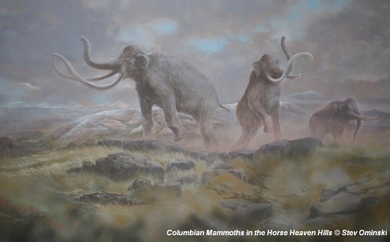
There’s a Columbian Mammoth hiding out in Coyote Canyon down Kennewick way, and MCBONES Research Center Foundation is working to uncover his/her hiding place. For a small contribution you can tour this hide-and-seek site, or you can volunteer to help uncover the hidden mammoth. Sound interesting? Find out more in this short video produced by Mark Harper of “Smart Shoot“, or visit the MCBONES website. The Mid-Columbia Basin Old Natural Education Sciences (MCBONES) Research Center Foundation provides local K-12 teachers and their students, as well as other volunteers, an opportunity to actively participate in laboratory and field-based research in paleontology, geology, paleoecology, and other natural sciences primarily within the Mid-Columbia Region of southeast Washington State.
Bretz and His Floods Story – National Geographic
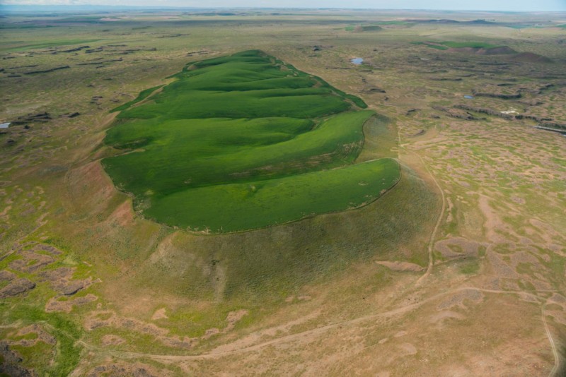
National Geographic has published an outstanding article, “Formed by Megafloods, This Place Fooled Scientists for Decades”, about J Harlan Bretz and his outrageous, fantastical theories of a landscape shaped by huge floods. Most Ice Age Floods aficionados are generally aware of the story, but this one is so detailed and well written it’s worth reading for the story-telling value alone. Please see: This National Geographic site:
Lake Lewis High Water Markers Installed
In April, 2017, Lake Lewis members George Last and Bruce Bjornstad worked with Friends of Badger volunteers Jim Langdon (Trail Master) and David Beach to install Markers showing the Lake Lewis high water marks on Badger and Candy Mountains near Richland, Washington. The Lake Lewis Chapter donated $300 to the Friends of Badger Mountain to purchase the two faux erratics engraved with “Lake Lewis Maximum Elevation 1250 Feet”. One of the markers was installed along the Sagebrush Trail on Badger Mountain, and the other along the Candy Mountain Trail. It was a glorious day!
Washington’s Ice Age Floods – ESRI Story Map
The Washington Geological Survey (formerly the Division of Geology and Earth Resources) has just released an ESRI story map about the Ice Age Floods in Washington. The story map: “tells the story of cataclysmic outburst floods that shaped the landscape of the Pacific Northwest during the last ice age. With imagery, maps and video, this story map follows the devastating deluge of the Missoula floods as it tore across the landscape, from its origins in western Montana to its terminus at the Pacific Ocean. Sites along the Ice Age Floods National Geologic Trail are featured, with an emphasis on flood features in Washington State.” Entitled Washington’s Ice Age Floods, it is best viewed on a desktop or laptop computer. Mobile devices will not show all of the content. It is navigated by scrolling your mouse through the slides. There are a few animated sections that may take a second or two to load. [weaver_iframe src=’https://wadnr.maps.arcgis.com/apps/Cascade/index.html?appid=84ea4016ce124bd9a546c5cbc58f9e29′ height=600 percent=100]