Explore the Ice Age Floods with 12 New IAFI Brochures

IAFI has compiled 12 brand-new, full-color brochures into a packaged set to help guide you in visiting spectacular ice-age features across all of our 11 Ice Age Floods chapter areas. With these brochures as your guides you can explore the paths of the Ice Age Floods from Montana through Idaho, central Washington and northern Oregon, and even delve into the many glacial features of northwest Washington. Click on any of the brochure covers below to see a full size printable PDF version (note: you’ll need to scale down to print on 8.5×11 letter size paper). Packets of all 12 full-size brochures are NOW available through the IAFI Store and at participating local outlets. Click a cover to open a PDF of any of the brochures below
Tualatin Ice Age Foundation Established
A Tualatin, Oregon Ice Age Foundation has been established to provide educational and economic opportunities for area residents, students, businesses and visitors. Local interest in ancient ice-age animals started in the 1970s when a Portland State University college student dug up half of a mastodon skeleton in Tualatin, which now is on display at the Tualatin Library along with several other ancient animal bones from such as mammoths, giant sloth, and bison. In 2018 a Foundation board was created to guide the foundation and raise funds for the center. The board includes Portland State University Geology Professor Emeritus Scott Burns as President; Yvonne Addington, Tualatin Historical Society; Linda Moholt, Executive Director of Tualatin Chamber of Commerce; Paul Hennon, retired Tualatin Parks Director; Jerianne Thompson, Tualatin Librarian; and Rick and Sylvia Thompson of the Ice Age Floods Institute, Lower Columbia chapter. Prior to the Foundation being established, an Ice Age Heritage Tourism Plan, funded by Washington County Visitor’s Association, which contained recommendations for further development by an international consultant, Bill Baker, owner of Total Destination Management. Baker recommended a new Ice Age Interpretive Center to house more of the collections and educate residents and visitors. According to Baker, “the Tualatin area was front and center for one of the greatest natural events of the last ice advance: a series of colossal floods that roared down the Columbia Gorge and pooled in the Tualatin and Willamette Valleys between 18,000 and 15,000 years ago. The entire Tualatin area landscape was shaped by those floods.” Baker saw important economic development, jobs and educational opportunities and recommended a new Tualatin Ice Age Foundation to implement opportunities and raise funds for a Tualatin Ice Age Interpretive Center. Portland State University, the University of Oregon and the Ice Age Floods Institute, Lower Columbia chapter have, for several years, been assisting the Tualatin Historical Society in seeking the prehistory of Tualatin. The National Park Service has identified Tualatin as a key Ice Age Floods National Geologic Trail hub. The City has continued their efforts to display their ice age prehistory by the development of the Tualatin River Greeway Trail and Fred Bruning, chief executive for Center Cal shopping centers, donating to the public, a $220,000 bronze statue of the Tualatin Mastodon. To date, many ancient animal bones and huge multi-ton erratics carried here by roaring floods have been found. Private donations of bones continue to be offered as we seek funding for this unusual historical project of building our interpretive center. Tualatin invites you to come see the displays and exhibits we already have at the library, Tualatin Heritage Center, in our parks and walkways and in the future in our Ice Age Interpretitive Center. For more information on Tualatin’s ice age history go to: https://tualatinchamber.com/visitor/ice-age/.
New – Lower Columbia Chapter Brochure
The Lower Columbia Chapter of IAFI recently produced the third IAFI chapter-specific “Our Cataclysmic Floodscapes” brochure, a guide to several of the key Ice Age Floods sites in the Portland Basin. This multi-panel brochure includes brief descriptions and map locations for five key sites, The Story of the Great Floods, Interesting Flood Facts, information about the Lower Columbia Chapter, and more. Expanded out the brochure measures 18″x23″, but it is folded to a rack card size for distribution to visitor centers. Click here to view a PDF of the brochure, and for more information about where a brochure can be obtained please contact Rick Thompson, President of the Lower Columbia Chapter (Rick@GigaFlood.com).
2018 Annual IAFI Field Trip – Lower Columbia Chapter
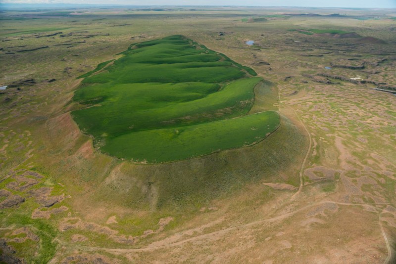
We started our field trip at the Tualatin library where the bones of a number of ice age mega-fauna are on display. Yvonne Addington led us through the displays and explained some of her role in arranging to have the bones in Tualatin where they were found. After the library we took a stroll on the Tualatin River Greenway Trail where we were instructed by several members of the Rivers of Life Youth Tourism Corp. who volunteered to be docents on the trail. We viewed signs, erratic boulders, casts of the mega-fauna and granite insets with maps and timelines. This $3.8 million trail was put in a couple years ago as part of Tualatin’s ice age identity as well as the $230,000 bronze statue of a young mastodon and a stylized image of the boy who dug it up only about a mile from where the bronze is today. Most of the actual skeleton of the mastodon is now on display in the library. After viewing the statue we went to the neighboring town of West Linn. At Fields Bridge Park we walked the nature trail with its three kiosks revealing the story of the ice age floods and the Willamette Meteorite that landed not far from there when the iceberg it was carried in was grounded on the hillside. From Fields Bridge Park we traveled east on Willamette Falls Drive over the gravel bar that the town of Willamette was built on. We then stopped at the I-205 overlook to see Willamette Falls. This Falls is the second largest in the United States by volume after Niagara Falls. Since this has been a fairly dry year it was easy to see the basalt rocks that the river cascades over. After lunch at Tualatin Community Park we took a short drive to the Tualatin Heritage Center; home of the Tualatin History Society. It is here where the molar and tusk from the Tualatin mastodon is housed as well as a collection of ice rafted boulders from the surrounding area. Yvonne Addington, former president of the Tualatin Historical Society, described the display of news articles, photographs and book covers telling the story of the Center and the ice age features. Our next stop, the Tualatin Commons, has a man-made lake with undulating hand-railing representing the wave action of the Ice Age floods and glass drinking fountains representing icebergs in those floods along with several ice rafted boulders; one being an argillite. Partly for fun and partly to see how a community can capitalize on an ice age idea we went to Ibach Park with its symbolic ice age floods play structures. The spongy blue pavement represented the water; some of it including ripples with icebergs. In the sand area children can dig for replica fossils and with the water feature they are able to make their own ice age floods through a collection of ice rafted erratics. We viewed the sign that for the last 20 years has been telling people about the ice age floods, the Willamette Meteorite, the mastodon and the local history. This award-winning park and its structures and signage was years ahead of other areas in adopting the ice age floods theme. Click here to view the full article with many more pictures. Between the towns of Tualatin and Sherwood there is a series of ice age flood channels that funneled the water from the Tualatin Valley into the Willamette Valley. This area is called the Tonquin Scablands. We stopped to view an erosional remnant of two basalt flows separated by a soil horizon and Coffee Lake, a kolk lake, created when two flood channels converged and formed a vortex that removed rock and soil leaving what is now a coffee-colored lake. We then drove along the largest of the 14 Tonquin Flood Channels to an area where we could get out and view that channel both north and south.
Bretz and His Floods Story – National Geographic
National Geographic has published an outstanding article, “Formed by Megafloods, This Place Fooled Scientists for Decades”, about J Harlan Bretz and his outrageous, fantastical theories of a landscape shaped by huge floods. Most Ice Age Floods aficionados are generally aware of the story, but this one is so detailed and well written it’s worth reading for the story-telling value alone. Please see: This National Geographic site:
Washington’s Ice Age Floods – ESRI Story Map
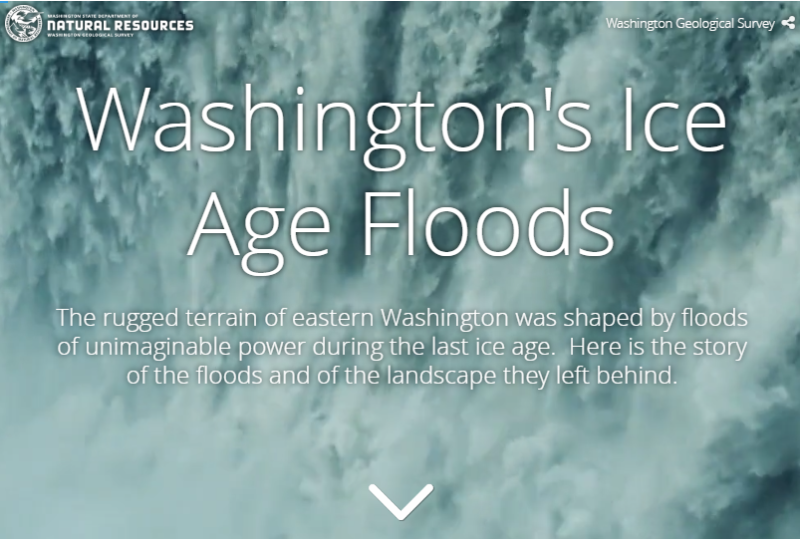
The Washington Geological Survey (formerly the Division of Geology and Earth Resources) has just released an ESRI story map about the Ice Age Floods in Washington. The story map: “tells the story of cataclysmic outburst floods that shaped the landscape of the Pacific Northwest during the last ice age. With imagery, maps and video, this story map follows the devastating deluge of the Missoula floods as it tore across the landscape, from its origins in western Montana to its terminus at the Pacific Ocean. Sites along the Ice Age Floods National Geologic Trail are featured, with an emphasis on flood features in Washington State.” Entitled Washington’s Ice Age Floods, it is best viewed on a desktop or laptop computer. Mobile devices will not show all of the content. It is navigated by scrolling your mouse through the slides. There are a few animated sections that may take a second or two to load. [weaver_iframe src=’https://wadnr.maps.arcgis.com/apps/Cascade/index.html?appid=84ea4016ce124bd9a546c5cbc58f9e29′ height=600 percent=100]
Grant’s Getaways – Oregon’s Erratic Rocks
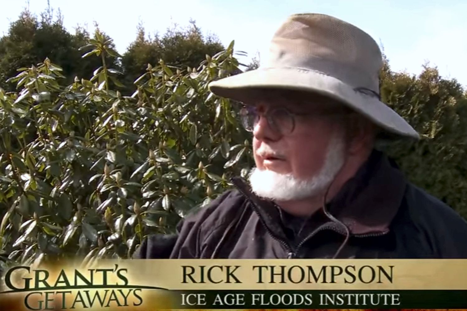
This episode of Grant’s Getaways features Lower Columbia President Rick Thompson and the Floods-borne erratics of the Willamette Valley
Ice Age Floods Facebook Page
You may want to ‘Like‘ the Ice Age Floods Institute Facebook page to stay abreast of all the News and Shares coming out from the Institute. We’re sharing news and articles well beyond the Floods, including geology, natural history, general articles about the area, videoed talks, events, and any number of articles of general interest. Floods of water, floods of lava, rockin’ rocks, 2-Minute Geology, paleontology, and the mystical birth of the universe all get their 15+ seconds of fame. We’ll keep our eyes open to find and share items of interest to you, and of course you can share with us too.
IAFI at Gorge Tourism Studio
The Columbia River Gorge and Lower Columbia Chapters of the Ice Age Floods Institute recently participated in several Gorge Tourism Studio workshops and events intended to bring businesses, organizations, and individuals together to address Columbia River Gorge area tourism issues. The Columbia River Gorge is a unique tourism destination and scenic location. However, this destination is facing increasing challenges including congestion and overstressed infrastructure in many locations and extreme under-utilization and neglect in many others. Given the State and National significance of this destination, the Tourism Studio was designed to provide a unique opportunity for local stakeholders to develop creative solutions to the challenges facing this destination. The Studio was organized by Travel Oregon, and through a unique bi-state arrangement it included representatives from both sides of the Gorge. The Studio comprised 6 full-day workshops and 6 evening get-togethers addressing: Identifying major tourism issues and developing a vision for what Gorge tourism should look like Culinary & Agritourism – addressing farm-to-table issues of local farms, vineyards, orchards, and restaurants Cultural Heritage Tourism – addressing issues affecting the arts, culture, and heritage sectors Adventure Travel & Outdoor Recreation – addressing issues affecting the outdoor recreation and adventure sectors Tourism Marketing & Communications – learning how to create effective tourism marketing and communications Igniting Tourism Action Teams – developing Action Teams to push forward on solutions to the issues The ultimate intent is to establish a long-term sustainable balance in the utilization of the available resources and in the economic development of the area. There are likely to be many lessons and approaches developed out of these Action Teams that can have significance for addressing similar tourism issues throughout the widespread extent of the Ice Age Floods story. COLUMBIA RIVER GORGE What the Columbia River Gorge should look like in 15 Years – a Vision for Sustainable Tourism The Columbia River Gorge region including the nationally recognized Columbia River Gorge National Scenic Area and the majestic Cascades Range of Mt. Adams (12,281 ft.) and Mt. Hood (11,249 ft) within which it’s nestled, offers our target visitor a world-class adventure travel experience. While the mighty Columbia River is its defining feature, nationally designated Wild and Scenic Rivers are the life blood of the region. The Sandy and the Deschutes Rivers flank its east/west boundaries while the White Salmon, Klickitat and the Hood River carve pathways from the Cascades. Free flowing whitewater draws in the adventurous whitewater soul, skilled fishermen and most importantly, salmon. This transition zone from rainforest to desert creates nuclear winds making the Gorge one of the world’s most sought after destinations for windsurfing, kiteboarding and technical sailing. Access to snow sports abounds on the peaks including year-round skiing on the Palmer Glacier. The region’s paved, gravel, and single-track terrain provide bicyclists with a flight-like, captivating experience of the scenic landscape. Signature trails including Gorge Towns to Trails, the Historic Columbia River Highway State Trail and the Pacific Crest Trail are significant draws to the region. These trails that connect waterfalls, world-renowned wildflower meadows, basalt bluffs and the Gorge’s charming towns are frequented by hikers, cyclists and trail runners alike due to the world-class experience that they provide. [TRANSPORTATION] Our seamlessly integrated region-wide transportation system allows visitors to come, travel, explore and connect– all without needing a car. Public and private transit options combined with our bike routes and trail systems have created a multi-modal web knitting together our communities, attractions and outdoor recreation. The region is vibrant with visitation, and traffic congestion is a thing of the past. [CULINARY/AGRICULTRE] The Gorge with its concentration of locally-owned boutique vineyards and small farms boasts an abundant and rich local food scene. Locals and visitors alike can easily eat what’s grown and produced here and visitors are welcomed by growers to have meaningful, quality on-farm experiences. Restauranteurs are well-connected with local growers adding value to locally produced ingredients and offering memorable foodie experiences. The visitor industry has helped contribute to alleviating hunger in the region. [CULTURE] The ‘Gorge Experience’ is unparalleled due to its exposure to history and culture. Locals in the Gorge’s charming communities help travelers gain a deep understanding of peoples who have inhabited the Gorge in the past, of people who reside here now, and of the natural and human forces that have shaped and reshaped the landscape. Stories of this powerful place, both cultural and natural, are infused into every element of the traveler experience. Local guides help travelers personalize and deepen their own connection to the place and an unusual and rich array of classes and events to experience local culture exist. Trails of national historic significance including the Lewis & Clark National Historic Trail, the Ice Age Floods National Geologic Trail, Historic Columbia River Highway State Trail and the Oregon Trail also bring the region’s history to life. [SEASONALITY/CONGESTION] Our intuitive visitor information system has reduced congestion, and spread the benefits to all corners of our region. We have effectively targeted the high-value visitor who appreciates the outdoors and local culture, is sensitive to their surroundings and enjoys people-powered activities. Visitors are coming year-round and staying multiple days. [BALANCE] We have found balance and offer an unforgettable visitor experience while preserving our unique living ecosystem of people, culture and nature. Local residents live in a harmonious and symbiotic relationship with our environment and with the people who travel from around the world to experience a slice of life in the Gorge.