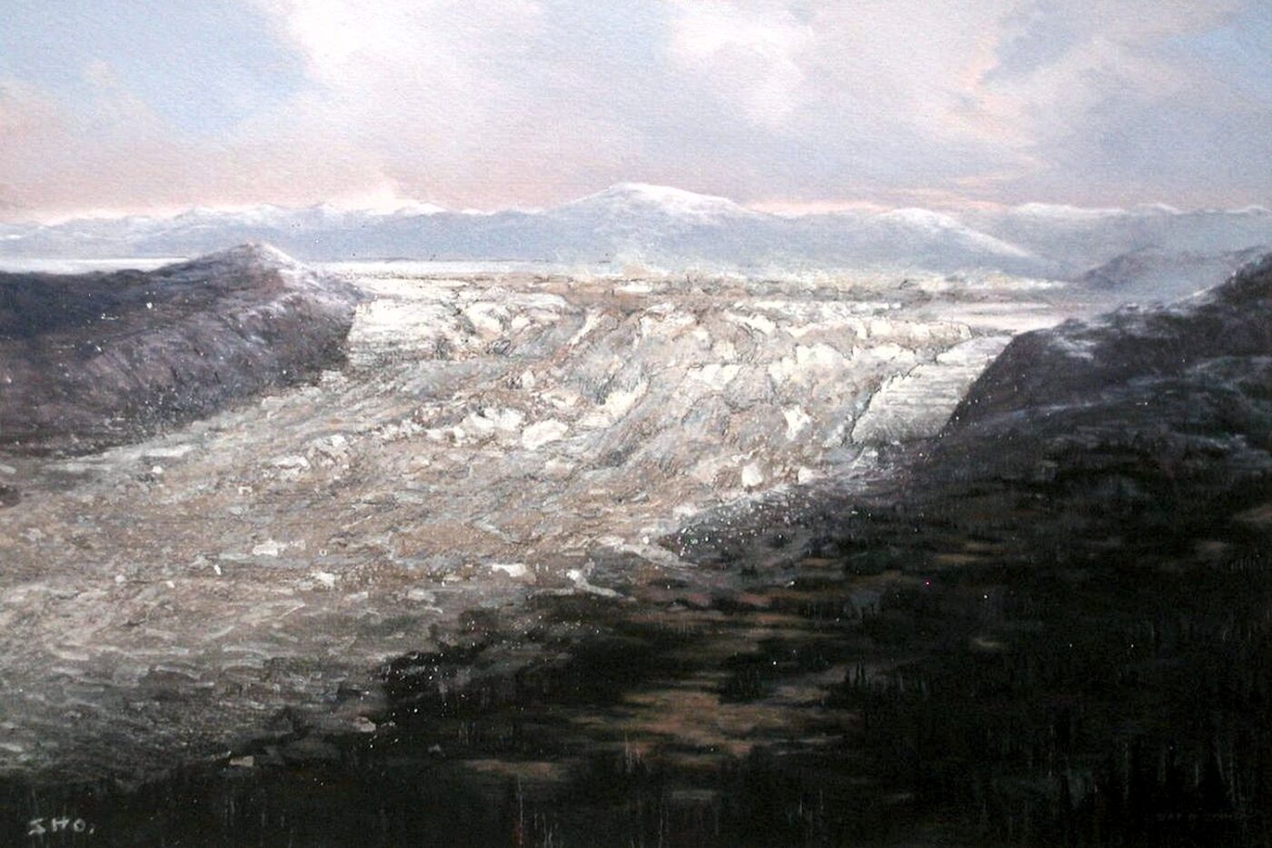
During the most recent Ice Age (18,000 to 13,000 years ago), and probably in previous Ice Ages, cataclysmic floods inundated portions of the Pacific Northwest. Huge Ice Age glacial-outburst floods have occurred in other parts of the world, as well. Even in our own times much smaller outburst floods have occurred in several areas. Could huge floods on this scale happen again? With global warming now a serious concern, there is also concern that failures of the Antarctic Ice Sheet may produce cataclysmic sea level changes. In the far distant future long-term climate cycles may cause large ice sheets to return. then similar cataclysmic outburst floods may happen again, possibly even in this region.
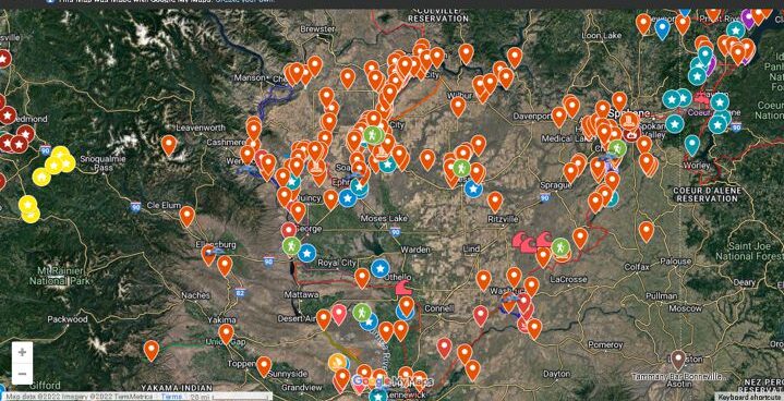
This interactive map includes locations and information about over 400 Ice Age Floods related sites. You can interactively zoom in and out to focus on an area. Clicking a map pin pops up images and detailed information about the site.
This is an invaluable tool for planning trips and exploring any area you’re visiting. You can even suggest additional features for others to enjoy.
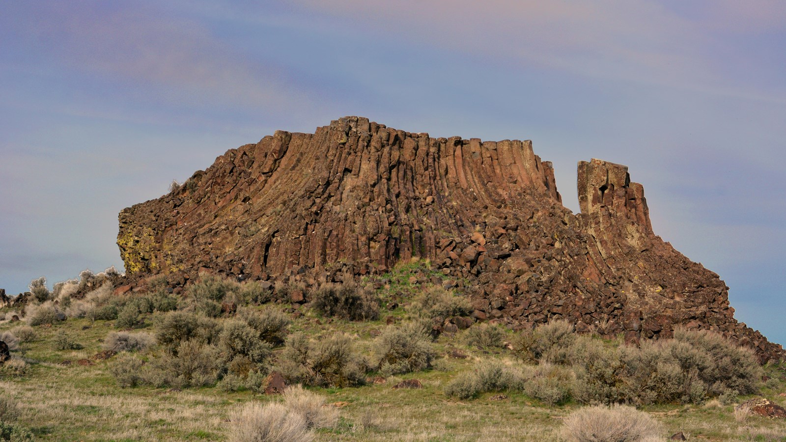
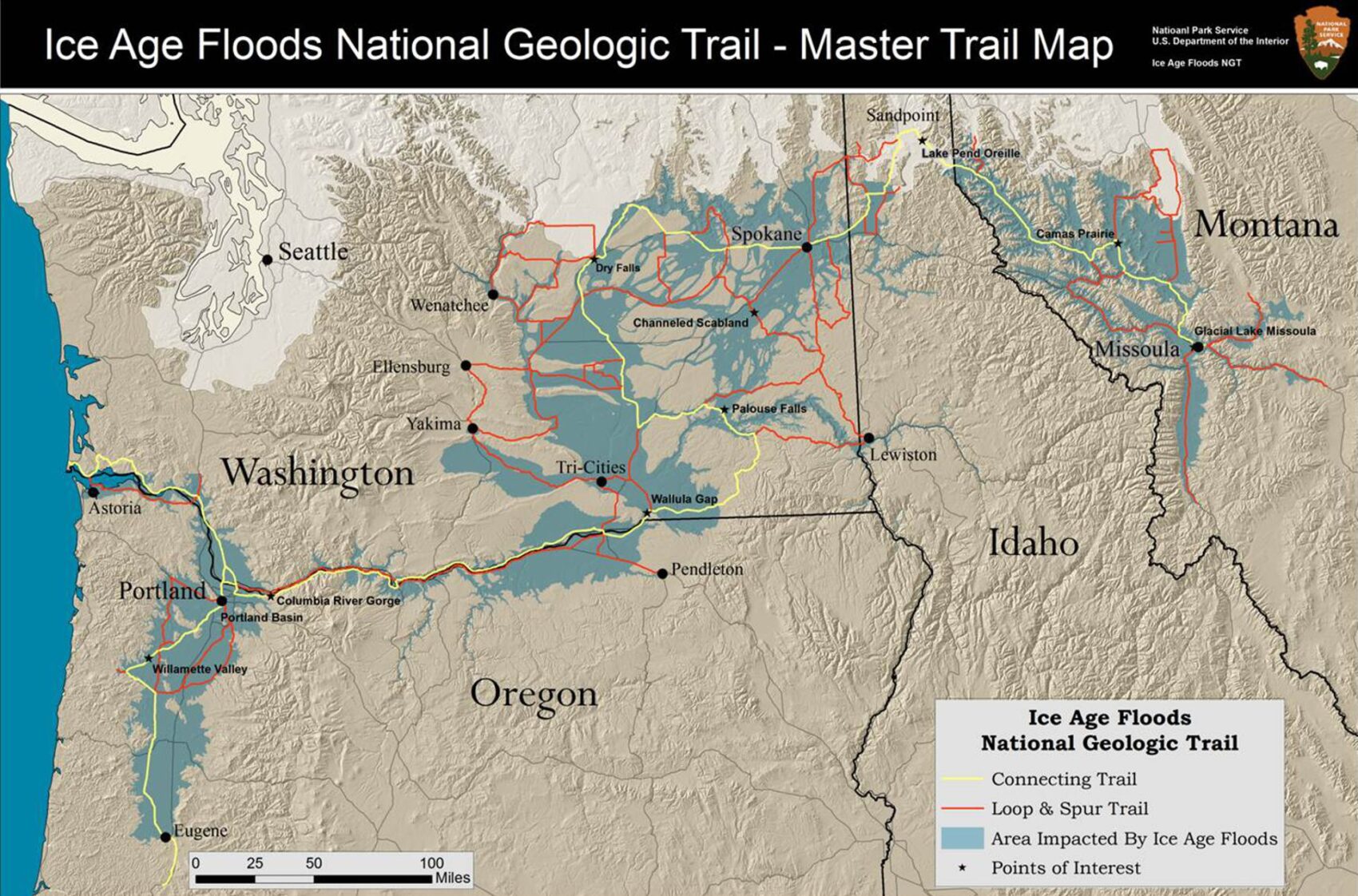
Explore the geologic clues and special landscapes made by the Ice Age Floods at sites all along the Ice Age Floods National Geologic Trail from Clark Fork, Idaho, to Illwaco, Washington, and many points in between!
Use these tools to better assist your Self-Guided Tours in this vast area:
These field guides will help you find and better understand many unique sites and features throughout the Ice Age Floods area. Most guides are written for the general public and include specific information about how to get there and what you’re looking at once you do get there.
Geology Corner is the place to ask questions to our experts, and find answers to questions others have asked. “There are no dumb questions”. We will provide reliable answers.
It’s also a place to find unusual and interesting articles to stimulate your mind.
Other Resources
Our General Resources page provides a wealth of useful and informative links, including:


