GO PLACES! DO THINGS!

Along the ICE AGE FLOODS
NATIONAL GEOLOGIC TRAIL


The Ice Age Floods National Geologic Trail covers some 16,000 square miles (41,440 km2) in present day Montana, Idaho, Washington, and Oregon. We have hand picked some of the best of the best places along the Trail and present them here for you enjoy and explore! Check back often, we will be adding new and wonderful destinations for your entire Family to enjoy!

MONTANA – IDAHO – WASHINGTON – OREGON

SOME PLACES TO GO and THINGS TO DO in MONTANA

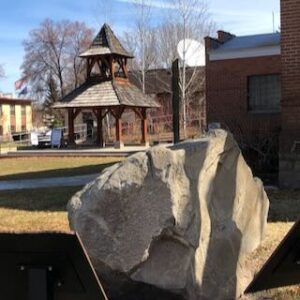
Erratic in the Bitterroot

An 8 ton erratic left behind by Glacial Lake Missoula in the Bitterroot Valley on the property of a local rancher was relocated to serve as the focal point of an outdoor kiosk exhibit at the Ravalli County Museum at the former County Courthouse, 205 Bedford Street in Hamilton.  Unlike their counterparts at other location along the National Geologic Trail, erratics in this part of the Ice Age Floods did not come from Canada nor did they travel as far, but the action of the floodwaters and iceberg rafts is equally evident despite more shallow waters. There are similar erratics found elsewhere in Bitterroot, on the campus of the University of Montana, and at the Bison Range. The outdoor display tells the same story as other locations on the Ice Age Floods National Geologic Trail but also includes information on two other National Park Service trails that pass through this area – the Nez Perce and the Lewis and Clark National Historic Trails.  The museum has other indoor exhibits of historical interest and about Glacial Lake Missoula.    

Read More »

Glacial Lake Missoula National Natural Landmark

Glacial Lake Missoula National Natural Landmark Ice Age Floods National Geologic Trail Glacial Lake Missoula was the largest of several lakes impounded by the Cordilleran Ice Sheet in the Northern Rocky Mountains during the Quaternary period. The lake was approximately 2,900 square miles in size and contained more than 500 cubic miles of water. It occupied the Mission, Jocko and Little Bitterroot valleys, drained by the Flathead River; and the Missoula, Ninemile and Bitterroot valleys, drained by the Clark Fork River. The lake was formed by an ice dam across the mouth of the Clark Fork River at Lake Pend Oreille, Idaho, a result of successive advances of a lobe of the Cordilleran Ice Sheet. The site is located 12 miles north of Perma, Montana. At least three and possibly more than 100 separate collapses of the ice dam, possibly coincident with periods of ice retreat, caused the lake to drain, producing catastrophic floods across the Columbia Plateau and down the Columbia River Basin. It is estimated that the waters of Glacial Lake Missoula, 1,000 feet deep at Eddy Narrows, were withdrawn at a peak discharge rate of 10 cubic miles per hour. Approximately 550 cubic miles of water passed through those narrows during withdrawal. Evidence of this catastrophic withdrawal can be found in scourings, high eddy deposits of flood debris, flood bars of boulders and course gravel, and successions of giant arcuate ripples or ridges of gravel resting on bedrock surfaces. Ripples appear as ridges 15 to 50 feet high, 100 to 250 feet wide, and from 300 feet to a half-mile long. While the form, structure and arrangement of these features are similar to that of ordinary current ripple marks, they are termed giant flood ripples, due to their large size. The giant flood ripples at this site are unusual due to their being on the down-current side of notches in a ridge separating two basins that were both subsidiary to the main course of Lake Missoula in the Clark Fork Valley. The best examples of giant flood ripples are found in Camas Prairie. Quick Facts Designation:National Natural Landmark OPEN TO PUBLIC:Private Land, closed to the public, but features throughout the area are visible from many vantage points.

Read More »

The Paradise Center

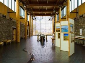
The Paradise Center Ice Age Floods National Geologic Trail Paradise Center, formerly the Paradise Elementary School, is a community, visitors, and arts center in the old railroad community of the same name.  Just below the confluence of the muddy Clark Fork and beautiful blue Flathead Rivers, 70 miles northwest of Missoula, the area was repeatedly inundated by Glacial Lake Missoula, leaving many visible features in the area such as gulch fills, kolks, and lake bottom sediment bluffs. It is on the route between the Camas Prairie Ripples and Eddy Narrows.   Inside the school is a unique interactive 3-D topographical or relief map of the entire area covered by Glacial Lake Missoula and an extensive display of information about the Lake as well as other topics of interest to the area.  Outside on the grounds is a playground and an outdoor walking loop with a dozen or so displays of interest such as the former railroad roundhouse.  A model railroad set-up is also found inside the center. This area can easily be reached directly from the St. Regis exit from I-90 by following the Clark Fork River where flood waters turned sharply to the north, carving out the narrow valley along scenic route 135 to the junction with MT-200. Scour marks and displaced boulders are visible from the road, and it is especially lovely when the larch trees turn bright yellow in the fall. This route also takes you past the historic Quinn’s Hot Springs Resort.  ANNOUNCEMENT: The Paradise Center hours are seasonal, generally Wednesday thru Saturday, 11am-3pm in the summer. Check the website at paradisecentermt.org or call 406-826-0500 Quick Facts Location:2 School House Hill Road Paradise, MT 59856 MANAGED BY:The Paradise Center

Read More »
SOME PLACES TO GO and THINGS TO DO in IDAHO

Farragut State Park

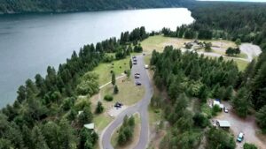
Farragut State Park Ice Age Floods National Geologic Trail Farragut State Park is located at the “breakout” of Glacial Lake Missoula floods, where the ice dam in the Clark Fork valley and the 20-mile-long tongue of ice occupying the Lake Pend Oreille basin failed. From there, a torrent of water and ice burst from the south end of the lake. Farragut State Park is located at the “breakout” of Glacial Lake Missoula floods. Failure of the ice dam in the Clark Fork valley fractured and broke apart the 20-mile-long tongue of ice occupying the Lake Pend Oreille basin, and a torrent of water and ice burst from the south end of the lake. That churning slurry of flood waters, ice, boulders and other debris erupted from the south end of Lake Pend Oreille, flowing 2000 ft deep across Farragut State Park. Nearly all of the water escaping from Glacial Lake Missoula passed through this area. Discharge estimates range from 14 to 21 million cubic meters per second! Vic Baker’s definition of a megaflood is one which has a discharge of at least 1mil cubic m/s, so we are possibly looking at ground zero for the worst Pleistocene flood in the world. Farragut State Park includes many geologic features left by glaciation and megafoods.Hoodoo channel, an abandoned outlet of Lake Pend Oreille provided a pathway for late-glacial meltwater and for the last outbursts from Glacial Lake Missoula. The channel is marked with a number of closed depressions, probably the result of melting icebergs. One of the largest of these features have been proposed, including kettles, potholes, and sub-glacial meltwater. Some of that debris was deposited to form the Rathdrum Prairie Outburst Plain, an extensive, heterogeneous mix of flood deposits. Farragut State Park offers unique scenery, history and an abundance of recreational opportunities. Quick Facts Location:13550 E. Hwy 54 Athol, ID 83801 

Read More »

Glacial Dam at Green Monarch Ridge View Point

Glacial Lobe Dam at Green Monarch Ridge View Point Ice Age Floods National Geologic Trail  As the Purcell Trench ice lobe of the Cordilleran Ice Sheet advanced south from Canada, it was stopped by the Green Monarch Ridge, building an ice dam 4,000 feet (1219 m) tall and nearly 40 miles (64 km) wide that blocked the Clark Fork river, thus filling glacial Lake Missoula. View the Green Monarch Ridge and the Purcell Trench from a large pullout on Idaho State Route 200, about one mile (1.6 km) west of Hope, Idaho and 15 miles (24 km) east of Sandpoint, Idaho. Quick Facts Location: Idaho State Route 200, about one mile west of Hope, Idaho and 15 miles  east of Sandpoint, Idaho.

Read More »

Clark Fork Ice Dam

Ice Age Floods National Geologic Trail 12,000 to 17,000 years ago a 4000′ tall ice dam blocked the path of the Clark Fork River creating glacial Lake Missoula. At the end of the last ice age this ice dam failed, releasing more water than is held in modern day Lake Ontario and Lake Erie combined. 600 cubic miles of water rushed through this area and down Lake Pend Oreille destined for the Pacific Ocrean.One of the most intriguing questions about the catastrophic flooding is how the ice dam failed. Various mechanisms for glacial outburst floods have been proposed: Ice erosion by overflow water, subglacial failure by flotation, deformation of ice by water pressure, and erosion of subglacial tunnels by flowing water. One model suggests a self-dumping phenomenon. In this mechanism, floodwaters are released when the lake level reaches nine-tenths the height of the ice. At this depth the ice becomes buoyant, subglacial tunnels form and enlarge, and drainage occurs until hydrostatic pressure is decreased and the ice again seals the lake. The self-emptying model is used to explain the numerous cycles in the rhythmite deposits and to interpret each cycle as a separate flood. Even so, only the total collapse of the ice dam can explain the largest of the catastrophic foods. Sub-glacial tunneling and enlargement due to thermal erosion progressing to collapse have also been proposed, as well as catastrophic failure due to water pressure. All are dependent on the configuration of the ice dam and structure of the ice. Quick Facts Location:Clark Fork, Idaho

Read More »
SOME PLACES TO GO and THINGS TO DO in WASHINGTON

Scooteney Reservoir

Scooteney Reservoir Ice Age Floods National Geologic Trail Situated about nine miles southeast of Othello, west of Highway SR-17, this body of water has a year-round open fishing season. Smallmouth Bass, Largemouth Bass, Walleye, Bluegill sunfish, crappie, and Yellow Perch produce good action throughout the

Read More »

The Bowl & Pitcher at Riverside State Park

The Bowl and Pitcher is a rock formation along the Spokane River and one of the most scenic sites in the area, with basalt cliffs rising 500 feet above the river and large blocks of basalt in the river causing large rapids. The “Bowl” is

Read More »
SOME PLACES TO GO and THINGS TO DO in OREGON

Columbia Gorge Discovery Center & Museum

Columbia Gorge Discovery Center & Museum Ice Age Floods National Geologic Trail, Lewis & Clark National Historic Trail, Oregon National Historic Trail The Columbia Gorge Discovery Center & Museum is located on a 54-acre point of land adjacent to the Columbia River and is the

Read More »

Multnomah Falls and Lodge

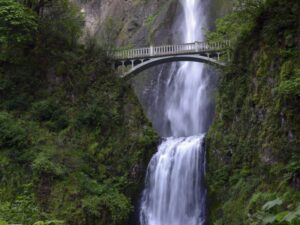
Multnomah Falls and Lodge Ice Age Floods National Geologic Trail, Lewis & Clark National Historic Trail Oregon’s tallest waterfall (620 ft.) is just 30 minutes east of Portland and 30 minutes west of Hood River. Offering scenic splendor and a gateway to the Gorge’s Waterfall Corridor,

Read More »

Museum of Natural History, University of Oregon

Museum of Natural and Cultural History, University of Oregon The museum offers a variety of seasonal and year-round programs for science and culture enthusiasts of every age. Delve into Oregon’s story, from the archaeology of the First Americans to the dynamic cultures of today’s Tribes.

Read More »
Even MORE PLACES TO GO and THINGS TO DO

Click a STATE for MORE PLACES TO GO and THINGS TO DO

MONTANA – IDAHO – WASHINGTON – OREGON

Share this article:

Like this:

Like Loading…