GO PLACES! DO THINGS!

Along the ICE AGE FLOODS
NATIONAL GEOLOGIC TRAIL


The Ice Age Floods National Geologic Trail covers some 16,000 square miles (41,440 km2) in present day Montana, Idaho, Washington, and Oregon. We have hand picked some of the best of the best places along the Trail and present them here for you enjoy and explore! Check back often, we will be adding new and wonderful destinations for your entire Family to enjoy!

MONTANA – IDAHO – WASHINGTON – OREGON

SOME PLACES TO GO and THINGS TO DO in MONTANA

Montana Natural History Center

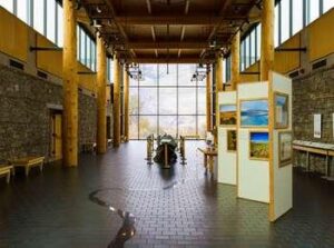
Montana Natural History Center Ice Age Floods National Geologic Trail  The mission of the Montana Natural History Center is to promote and cultivate the appreciation, understanding, and stewardship of nature through education. Founded in 1991, MNHC was the brainchild of a group of educators who were involved in various efforts to educate both kids and adults about the natural history of western Montana, and who decided to unite those efforts into one environmental education organization. MNHC provides nature education programming for people of all ages through summer camps, kids’ activities, Visiting Naturalist in the Schools, Master Naturalist certification courses and Field Days, evening programs, Field Notes on Montana Public Radio, museum tours, and more.  We have a variety of exhibits that focus on the flora, fauna, geology, and ecology of our beautiful state. Please stop by and visit! MNHC often partners with the Ice Age Floods Institute to share fields trips and lectures about the Ice Age Floods.   MNHC has exhibits that help visitors explore the Glacial Lake Missoula and Ice Age Floods. Learn more at:Explore Glacial Lake Missoula | Montana Natural History Center (montananaturalist.org) The Glacial Lake Missoula Chapeter of the Ice Age Floods Institue also produced a short movie about Glacial Lake Missoula. You can find a link here. Quick Facts Location:120 Hickory Street, Suite A, Missoula, Montana
Read More »

Glacial Lake Missoula Strandlines

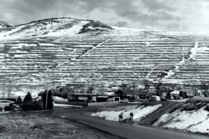
Glacial Lake Missoula Strandlines Ice Age Floods National Geologic Trail Imagine you are standing on the edge of glacial Lake Missoula 15,000 years ago. You can hear lapping waves cutting benches known as “strand-lines” into the shoreline. Today, you can see these huge strand-lines on hills surrounding Missoula, Montana, marking changes in lake level over time. On Mount Sentinel, marked with an “M”, and Mount Jumbo, marked with an “L”, the strand-lines are seen as horizontal lines in the vegetation or highlighted by snow in the winter. Public hiking trails switchback through the strand-lines on Mount Sentinel and Mount Jumbo. Ancient shorelines or strand-lines of Glacial Lake Missoula are visible as perfectly parallel horizontal benches on hillside slopes around Missoula. They are most visible with light snow cover, or in low evening light on the mountains marked with an”M” and an “L” on either side of Hellgate Canyon looking east from the downtown.  These shoreline benches cut by wave action in the lake recorded various lake levels as the ice dam blocking the Clark Fork River far upstream on the Idaho border repeatedly failed and refilled 40 times or more.  It may be that as the ice-age waned each successive ice dam that reformed was smaller and failed under less pressure from a lower lake level than the one before, leaving behind its bench as a record of the successively lower ancient lake shorelines. It’s also possible they record winter still-stands in rising lake levels over time.  Quick Facts Location:The Kim Williams Trail at Van Buren and 5th Street leads from the U Montana campus along the river between the mountains. To reachhigh water markers on the mountains see the Interactive Map or go to GlacialLakeMissoula.org 

Read More »

Little Money Creek Gulch Fill

Mounds of soil, sand, gravel, and other coarse materials covered with light vegetation can be seen in the side gulches all along the Flathead River where tributaries drained into what was Glacial Lake Missoula.  They were deposited by currents eddying into the slower water in these gulches and also by the drop in velocity of the streams carrying deposits from higher elevations on the far side of the river along the path of the escaping floodwaters.  The flow of floodwaters through this narrow valley was estimated by J.T. Pardee at between 8 and 10 cubic miles per hours – more than the combined flow of all modern rivers in the world.  Similar gulch fill can be seen in many locations along this beautiful stretch of the river, which today generally flows smoothly and looks completely flat. There are numerous pull-outs along MT 200 between Perma and Paradise; the view pictured here is at mile marker 91.

Read More »
SOME PLACES TO GO and THINGS TO DO in IDAHO

Clark Fork Ice Dam

Ice Age Floods National Geologic Trail 12,000 to 17,000 years ago a 4000′ tall ice dam blocked the path of the Clark Fork River creating glacial Lake Missoula. At the end of the last ice age this ice dam failed, releasing more water than is held in modern day Lake Ontario and Lake Erie combined. 600 cubic miles of water rushed through this area and down Lake Pend Oreille destined for the Pacific Ocrean.One of the most intriguing questions about the catastrophic flooding is how the ice dam failed. Various mechanisms for glacial outburst floods have been proposed: Ice erosion by overflow water, subglacial failure by flotation, deformation of ice by water pressure, and erosion of subglacial tunnels by flowing water. One model suggests a self-dumping phenomenon. In this mechanism, floodwaters are released when the lake level reaches nine-tenths the height of the ice. At this depth the ice becomes buoyant, subglacial tunnels form and enlarge, and drainage occurs until hydrostatic pressure is decreased and the ice again seals the lake. The self-emptying model is used to explain the numerous cycles in the rhythmite deposits and to interpret each cycle as a separate flood. Even so, only the total collapse of the ice dam can explain the largest of the catastrophic foods. Sub-glacial tunneling and enlargement due to thermal erosion progressing to collapse have also been proposed, as well as catastrophic failure due to water pressure. All are dependent on the configuration of the ice dam and structure of the ice. Quick Facts Location:Clark Fork, Idaho

Read More »

Museum of North Idaho

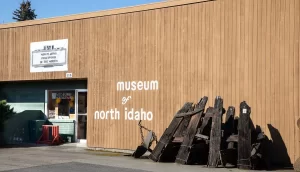
Museum of North Idaho IceAgeFloods National GeologicTrail “The Museum of North Idaho collects, preserves and interprets the history of the Coeur d’Alene Region. to foster appreciation of the area’s heritage.” In the 1960s, the North Idaho Hoo Hoo Club, an organization of loggers, lumbermen and foresters, first entertained the idea of establishing a museum. They incorporated on May 1, 1968 for a museum focusing on the history of the Coeur d’Alene Region (Kootenai, Benewah and part of Shoshone counties). Through the efforts of volunteers and community support, the Museum opened its doors on the North Idaho College campus on July 28, 1973. In 1979, they remodeled a City-owned building and relocated to its current location. Quick Facts Location: 115 Northwest Blvd, Coeur d’Alene, ID 83814Phone: (208) 664-3448 The Museum is open Tuesday to Saturday from 11 am – 5 pm.

Read More »

Celebration Park – Home of Melon Gravel

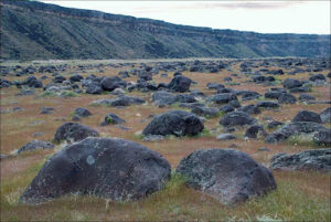
17,000 years ago, a massive Ice Age lake – now called Lake Bonneville – filled a large portion of present-day Utah. As temperatures changed, the influx of ice melt caused the lake level to rise. In addition, the Bear River, once a tributary of the Snake, was diverted by volcanic activity back into Lake Bonneville. These factors ultimately led to the breaching of a sedimentary rock dam at Red Rocks Pass, Idaho. There was only one ice-age Bonneville Flood because Lake Bonneville broke through a rock dam, unlike the Missoula Floods whose glacial ice dam repeatedly dammed Glacial Lake Missoula, then broke and rebuilt.  1,100 cubic miles of Lake Bonneville water rushed through the Snake River Canyon, and it took only six weeks for Lake Bonneville to empty the equivalent volume of modern-day Lake Michigan. The Great Salt Lake we know today is a remnant of Lake Bonneville, but at one tenth the size, it is a mere puddle compared to what the lake used to be.  The power of this catastrophic flood widened canyons as the force of the water pulled huge chunks of basalt off the cliffs and tumbled them around, smoothing their jagged edges along the way. As the canyon width narrowed, the force and velocity of the flood increased. Wherever the canyons widened, the flood lost force and velocity, the waters slowed and began dropping its bedload – in this case, giant tumbled basalt boulders instead of your typical river gravel.  These flood-rounded boulders, named melon gravel due to their distinct shape, are scattered over vast areas of land. The rocks’ unique outlines and smooth surfaces caught the eye of Native American tribes in the area, who have used them as canvases for petroglyphs for thousands of years. Visitors can see the medium sized flood deposits just outside the visitor center, or hike upriver to see gigantic melon gravel the size of heavy-duty trucks.  Celebration Park is located in the Snake River Canyon, approximately 23 miles south of Nampa, Idaho. It is home to an enormous melon gravel field deposited by the Bonneville Flood. 

Read More »
SOME PLACES TO GO and THINGS TO DO in WASHINGTON

Wenatchee Valley Museum & Cultural Center

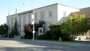
Wenatchee Valley Museum & Cultural Center Ice Age Floods National Geologic Trail The Wenatchee Valley Museum and Cultural Center’s mission is to gather, engage, and educate people to celebrate and preserve the history, arts, sciences, and rich diversity of our region. It is a 501(c)(3)

Read More »

Hanford Reach Interpretive Center and Museum

Hanford Reach Interpretive Center and Museum Ice Age Floods National Geologic Trail – Lewis and Clark National Historic Trail At The REACH Museum in Richland, Washington, you can learn about the natural and human history of the Tri-Cities. It houses rotating and permanent exhibits, including

Read More »
SOME PLACES TO GO and THINGS TO DO in OREGON

Columbia Gorge Discovery Center & Museum

Columbia Gorge Discovery Center & Museum Ice Age Floods National Geologic Trail, Lewis & Clark National Historic Trail, Oregon National Historic Trail The Columbia Gorge Discovery Center & Museum is located on a 54-acre point of land adjacent to the Columbia River and is the

Read More »

Tualatin Ice Age Walking Trail

Tualatin Ice Age Walking Trail Ice Age Floods National Geologic Trail The Tualatin Ice Age Trail is a self-guided tour of sites representing the ancient history of our area. Along the trail, you’ll discover evidence of centuries-old ice, rock and bone, including the sites where a mastodon

Read More »

Tualatin Public Library

Tualatin Public Library Ice Age Floods National Geologic Trail The Tualatin Public Library, located just off Interstate 5 in Tualatin, Oregon, is home to a display of Ice Age Megafauna. The Library features a striking display of an articulated partial mastodon skeleton, which was discovered

Read More »
Even MORE PLACES TO GO and THINGS TO DO

Click a STATE for MORE PLACES TO GO and THINGS TO DO

MONTANA – IDAHO – WASHINGTON – OREGON

Share this article:

Like this:

Like Loading…